Category Archives: Political geography

A Refuge Down Under?: The Unfulfilled Prospect of a Jewish Homeland in the North of Western Australia

image: world atlas.com

Before the creation of Israel as the national home for the Jewish people in 1947 a raft of potential candidates for a permanent homeland for Jewish refugees from the world war cataclysm were canvassed. Comprising all human–inhabited continents, the long list of proposed likely or unlikely sites (aside from Palestine) included several in the US (one being Alaska), Uganda, Madagascar, Russian Far East, Italian East Africa, British Guiana, Manchuria…and Australia!✪

Proposed area in WA for a Jewish homeland (image: Kununurra Historical Society)

A haven for one million people in the WA wilderness?: Yes Australia…a chapter in the country’s history not particularly well known. The proposed homeland in Western Australia’s sparsely–settled Kimberley region evolved out of an Anglo-Australian plan to settle migrants from the UK overseas in the 1920s. The Group Settlement Scheme had the purpose of expanding the population and economy of Australia’s almost boundless western state. Originally it targeted migrants of British and Irish stock only but the results of the scheme were dismally unsuccessful. Nonetheless the scheme captured the interest and imagination of the London–based Freeland League for Jewish Territorial Colonization and gained concrete form when a Western Australian pastoralist, Michael Durack, offered to sell the League a large tract of his family’s land in WA’s East Kimberley. The proposal was investigated by the League with Issac Steinberg (formerly minister of justice in Lenin’s Bolshevik government) despatched to WA to determine the scheme’s feasibility and to get as many VIPs in Australia onside with the League’s objectives as he could. Steinberg’s PR skills and adept arguments for a Jewish homeland in northern WA were persuasive, managing to snare the support of many political and public figures including the WA premier and the Australasian Unions body (ACTU).

Issac Steinberg, emissary for a Jewish homeland

Despite the headway Steinberg was making on his mission, Australian politicians and the public clearly had mixed feelings about a Jewish settlement on Australian soil. The government in Canberra was committed to the objective of populating northern Australia (which the 75,000 and more refugees fleeing from Nazi persecution in Europe would certainly accomplish) but there was opposition to the plan from various sectors. Xenophobia and racism played its part, some in mainstream society were fearful that the Jewish migrants would not stick it out in the harsh conditions of the Kimberleys but would swarm to the cities, take Australian jobs and their “difference” would lead to social dislocation (‘How the Kimberley nearly became the Jewish homeland’, Ryan Fraser, Australian Geographic, 27-Sep-2018, www.australiangeographic.com.au). Newspapers like the Bulletin opposed the plan and of course no one thought to ask the local indigenous custodians of the region, the Miriwoong people, if they were happy with the plan’s ramifications. Some Australian Jews themselves were against it, fearing a backlash of anti-semitism and that the settlement would undermine the Zionist cause of securing a Palestinian homeland𖤘 (Beverley Hooper, ‘Steinberg, Isaac Nachman (1888–1957)’, Australian Dictionary of Biography, National Centre of Biography, Australian National University, https://adb.anu.edu.au/biography/steinberg-isaac-nachman-117…, published first in hardcopy 2002, accessed online 28 January 2025).

Kimberley outback, WA

Preserving the monoculture and keeping diversity under wraps: No progress was made on the project for a few years due in part to the onset of WWII. Meanwhile conservative pressure was mounting on the Curtin Commonwealth Labor government from vested interests like the Graziers’ Association and the Australian Natives’ Association to veto the Kimberley plan. Finally in 1944 PM Curtin informed Dr Steinberg that the Australian government would not be altering its policy barring “alien settlements” in Australia of the “exclusive type contemplated by the Freeland League”. Further appeals to Curtin’s (Labor) successors and to the subsequent Menzies Liberal–Country Party government met with the same negative response, which affirmed Canberra’s refusal to budge from the overarching policy of assimilation. The discouraging experience prompted Dr Steinberg to wryly publish a book entitled Australia – the Unpromised Land (Brian Wimborne, ‘A Land of Milk and Honey? A Jewish Settlement Proposal in the Kimberley’, Australian Dictionary of Biography, National Centre of Biography, Australian National University, https://adb.anu.edu.au/essay/9/text29448, originally published 22 May 2014, accessed 28 January 2025).

SW Tasmania, an unpopulated wilderness (photo: Discovery Tasmania)

Endnote: An island wilderness for the Promised Land? The Kimberley region was not the only part of Australia that got a look-in as a possible home for Jewish refugees from Europe. One obsessively-determined, young Gentile from Melbourne, Critchley Parker, fostered the prospect of the Tasmanian wilderness providing a home for displaced Jews which, he proposed, would sustain itself on discovered mineral wealth in the area𖥠. Inspired by and infatuated with a Jewish–Australian journalist passionately involved in the Steinberg–led campaign for a Jewish homeland in the Antipodes, Parker set out in 1942, underprepared, on a solo expedition to find the ideal location for his own vision of “New Jerusalem”, but perished in the island-state’s southwest wilderness (‘Before Israel was created, Critchley Parker set off to find a Jewish homeland in Tasmania’s wilderness’, Rachel Edward’s, ABC News, 05-Dec-2020, www.amp.abc.net.au).

✪ not all of these were benevolent and altruistic proposals, Madagascar for instance was a Third Reich plan to forcibly remove European Jewry from the continent

𖤘 Steinberg and the Freeland League were opposed to Zionism

𖥠 the scheme with local Jewish backing won the support of the Tasmanian state premier

Conflict at 18,000–Feet in Kargil: Pakistan and India Eyeballing the Nuclear Precipice over Kashmir

The post-independence relationship of India and Pakistan has been characterised by ongoing tensions, mutual suspicions and a sequence of short wars involving the sovereign state successors to the British Raj𖤓. At the forefront of this regional disharmony has been Jammu and Kashmir (J & K), the greater part of the area controversially awarded to Hindu-dominated India in the 1947 Partition of the Subcontinent but populated by a Muslim majority.

Kargil: 8,780-ft above sea level

Advancing by stealth across the disputed boundary: The most recent of these short-lived, episodic wars occurred in 1999 in Kargil in the remote union territory of Ladakh. Faced with the frustration of India holding the dominant hand in the disputed Kashmir region and unwilling to consider any alterations to the Line of Control (LoC)𖦹, Pakistan opted for a bold if brash strategy. “Infiltrators” from the Pakistan side, crossed the LoC and took hold of Indian positions in the inhospitable glaciated terrain of Kargil, initially undetected by the Indian command. Alerted to the incursion, the Indian military unleashed a counteroffensive and over two months of fighting drove the Pakistanis back onto their side. Islamabad first sought to explain the military incursion as the work solely of Mujahideen “freedom fighters”, but this deception was quickly exposed with Pakistan paramilitary involvement discovered to be central to the military operation❖.

Kargil and Kashmir (image: insightsonindia.com)

Islamabad’s motives for the act of aggression taken by what Indian media termed “rogue army” elements, seem to have been severalfold. The strategic plan was to cut India’s communication lines in Kashmir between Srinagar and Leh. Pakistan was probably also motivated by a desire to regain lost honour for earlier military reversals at India’s hands, especially the Indian army’s 1984 seizure of Siachen Glacier and the crushing defeat in the 1971 war (Liberation of East Pakistan). Islamabad hoped that the proactive move might also prove a fillip for the flagging Pakistani insurgency movement in Kashmir [RAGHAVAN, SRINATH. Review of Dissecting the Kargil Conflict, by Peter Lavoy. Economic and Political Weekly 45, no. 44/45 (2010): 29–31. http://www.jstor.org/stable/20787524]. Essentially, Pakistan’s intent was to create a crisis in Kashmir with the aim of forcing New Delhi to sit down to negotiations and finally settle the Kashmir imbroglio.

Pakistani soldiers in snow-capped Kargil (source: au.pinterest.com)

Strategic miscalculation: The upshot for Islamabad was pretty disastrous, the status quo remained in New Delhi’s favour, strategically Pakistan failed to hold its advance position into enemy territory and found itself diplomatically isolated by its action…most of the international powers, including its ally China, criticised Pakistan for what some observers saw as its “reckless”, “adventurist”, “risk–adverse” behaviour. [Tellis, Ashley J., et al. “THE SIGNIFICANCE OF THE KARGIL CRISIS.” Limited Conflicts Under the Nuclear Umbrella: Indian and Pakistani Lessons from the Kargil Crisis, 1st ed., RAND Corporation, 2001, pp. 5–28. JSTOR, http://www.jstor.org/stable/10.7249/mr1450usca.8. Accessed 15 Nov. 2024]. This generally-held perception of Pakistan resorting to intemperate action allowed India to turn the information war in the Kargil conflict into a diplomatic victory for New Delhi.

Pakistan, First Islamic state to join the nuclear club (source: Topcity–1)

Spectre of the nuclear option: While the brief Kargil War was limited to a low intensity conflict, the potential was there for it to escalate into an expanded conventional war, and most alarmingly, into a nuclear confrontation. The possibility of this happening existed because a year prior to Kargil, in 1998, Pakistan joined India as the second South Asian state to attain nuclear weapon capacity. This became more acutely critical to the international community during the war when, in response to India’s massive build-up of military arms in Kargil-Dras sector, Pakistan foreign secretary Ahmed hinted that the country might resort to using nuclear weapons. Islamabad may have only produced the nuclear card as a deterrent to an Indian counter-thrust, nonetheless Pakistan Prime Minister Sharif was clearly engaging in nuclear brinkmanship – by moving nuclear warheads towards the border (for which he was roundly rebuked by US President Clinton) [‘India and Pakistan Fought in 1999. Why Didn’t It Go Nuclear?’, Sébastien Roblin, The National Interest, 14-June-2021, www.nationalinterest.org].

Indian soldiers celebrate victory in the Kargil War (photo: business–standard.com)

No let-up for the troubled Kashmiris: Although there hasn’t been any new wars in Jammu & Kashmir since 1999, tensions and conflicts have continued virtually unabated since then.  In 2019 there were troop clashes across the de facto border following Pakistani Islamist terrorist attacks. With Prime Minister Modi’s BJP Hindu nationalist regime committed to integrating J & K, an administrative rearrangement of the territory saw it lose its autonomy and be downgraded in status. Civil and political rights of the majority Muslim population have been eroded and Indian security forces are frequently accused of human rights violations. Separatist and jihadist militants continue to wage a protracted insurgency against the authorities [‘Indian Kashmir’, Freedom in the World 2024https://freedomhouse.org]. 

Heavy Indian army presence in Kashmir fuelling Pakistani resentment (photo: pakistanpolitico.com)

Postscript: Atlantique Incident After fighting in Kargil ceased in July 1999 there was no easing of Indo–Pakistani tensions. Just one month later the Indian airforce shot down a Pakistan navy plane in the Rann of Kutch (border land between Pakistan’s Sindh province and Western India’s Kutch district), accused of violating the former’s air space. The matter dragged out with both sides blaming each other and a failed international court appeal, leading to a further deterioration in the ruptured relationship.

Rann of Kutch, site of Atlantique Incident (Sir Creek) location of a second long-running Ind–Pak border dispute


𖤓 1947–48, 1965, 1971, 1999

𖦹 the temporary border separating the two countries in the Himalayas region

in so doing it breached the Simla Agreement (1972) between the two neighbours

The Terra Septemtrionalis Incognita of Thule: Greek Mythology, Puzzle Piece for Geographers and Inspiration for Nazis

✱ “unknown northern land”

Hecataeus of Miletus’ world map (ca. 500 BC)

The ancients, the Greeks and Romans, perceived the world of their day as one with the Mediterranean at its centre, surrounded by the conjoined land masses of Europe, Africa and Asia, comprising what the Greeks called oikouménē, the known, inhabited or inhabitable parts of the world. This envisaged world was “a curious place where legends and reality could co-exist” [Vedran Bileta, “3 Legendary Ancient Lands: Atlantis, Thule, and the Isles of the Blessed”, The Collector, 03-Nov-2022, www.thecollector.com]. The Greeks believed that at the northernmost extremity of the existing world lay a fabled island called Thuleⓑ. The originator of this belief was 4th century BC Greek explorer Pytheas of Massalia (now Marseille, Fr.) who claimed to have visited and discovered Thule on a voyage beyond Britain to the northern sea and the Arctic. Pytheas introduced the idea of Thule—far distant and encompassed by drift-ice and possessed of a magical midnight sun—to the geographic imagination. Other ancient writers enthusiastically took up Pytheas’ fantastical notion, notwithstanding that the account of his journey (On the Ocean) had been lost to posterity…Pliny the Elder (1st century AD) described Thule as “the most remote of all those lands recorded”; Virgil (1st century BC) called the island Ultima Thule, (“farthermost Thule”, ie, “the end of the world”).


Thule, as Tile  (1539 map) shown (with surrounding sea-monsters) as located northwest of the Orkney islands

Seeking Thule: The loss of Pytheas’ primary source text, the description of his voyage, led countless generations that followed him to speculate as to where the exact location of Thule might be. Many diverse places have been misidentified as Thule…the Romans thought it was at the very top of Scotland, in the Orkneys; Procopius (6th century AD Byzantine historian), Scandinavia; early medieval clerics located it in Ireland while both the Venerable Bede and Saxon king Alfred the Great asserted that Iceland was really Pytheas’s Thule, as did the famous 16th century cartographer Mercator. Other candidates advanced over the millennias include Greenland, Norway, the Faroe Islands, Shetland, “north of Scythia”, Smøla (Norway) and Saaremaa, an Estonian island.

Smøla island (Norway)

Other conjectures on Thule’s whereabouts have been meaninglessly vague, eg, Petrarch (14th century Italian humanist scholar): Thule lay in “the unknown regions of the far north-west”, supposedly inhabited by blue-painted residents (Roman poets Silius Italicus and Claudian), a probable conflation with the Picts of northern Britain. Thule, from as early as the 1st century AD on, “became more of an idea than an actual place, an abstract concept decoupled from the terrestrial map, simultaneously of the world and otherworldly”…an emblem of mystical isolation, liminal remoteness, a real discovered place and yet unknown” (F. Salazar, “Claiming Ultima Thule”, Hakai Magazine, 08-Sep-2020, www.hakaimagazine.com).

The Thule neighbourhood? (image: worldatlas.com)

Thule has continued to attract the interest of explorers right up to modern times. Continent-hopping scholar-explorer Sir Richard Burton visited Iceland, writing it up as the real “Thule”. Famed Norwegian polar explorer Fridtjof Nansen having explored the Arctic region, produced an account of Pytheas’s ancient Arctic expedition, hypothesising that Thule was in fact a Norwegian off-shore island that the Greek voyager had identified [Nansen F., In Northern Mists, Vols I & II, (1969)]. Greenlandic-Danish explorer and Eskimologist Knud Rasmussen underlined the case for Greenland as the location by naming the trading post he founded in NW Greenland “Thule” or “New Thule” (later renamed in the Inuit language, “Qaanaaq”)ⓒ.

Thule Society, emblem

Thule Society: In the aftermath of World War 1 Thule provided stimulus of a very different kind for extreme-right racist nationalists in Germany. An emerging Munich-based secret occultist and Völkisch group named itself after Pythea’s mythical northern island. The Thule Society (Thule-Gesellschaft) propagated a form of virulent anti-Semitism which fed early Nazism in Bavaria, it also preached Ariosophy (an outgrowth of Theosophy), a bogus ideology preoccupied with visions of Aryan racial superiority, a key component of the later Nazis’ ideological framework. Out of the Thule Society came the ultranationalist Germany Workers’ Party (DAB)which in a short time transformed into the National Socialist Workers Party (Nazi Party). A number of Thulists (eg, Hess, Frank, Rosenberg) became prominent in the Nazi leadership during the Third Reich [David Luhrssen, Hammer of the Gods: The Thule Society and the Birth of Nazism (2012)].

Endnote: Hyperborea’s remote utopia Greek mythology throws up a parallel legend to that of Thule in the Hyperboreans. These were mythical eponymous people living in Hyperborea (hyper = “beyond”, boreas = “north wind”). Their homeland was perpetually sunny and temperate (despite lying within a cold, frigid region), and Hyperboreans were divinely blessed with great longevity, the absense of war and good health…in other words, a utopian society [‘Hyperborea’, Theoi Project Greek Mythology, www.theoi.com]. As with Thule, locating this paradisiacal northern land has proved elusive to pinpoint with the ancient scribes and geographers agreeing only that it lies somewhere on the other side of the Riphean Mountains (which themselves have been variously located). Homer described Hyperborea as being north of Thrace, some other classical geographers had it beyond the Black Sea, vaguely somewhere in Eurasia, perhaps in the Kazakh Steppes. Herodotus (5th century BC) had it in the vicinity of Siberia, while for Pindar (fl. 5th century BC) it was near the Danube. Apollonius of Rhodes (3rd century BC) identified the Hyperboreans with the Celts and Britain, Plutarch (fl. 1st century AD) , with Gaul.

Hyperborea, imagined (image: greek-mythology.org)

which, they believed, itself was surrounded by an unbroken chain or body of water

a belief shared by the Romans who saw Thule as the extreme edge of orbis terrarum

from 1953 to 2023 the northernmost US Air Force base (NW Greenland) was called the Thule Air Base

Thule was symbolically important to the right wing nationalists, a pseudo-spiritual home of Aryanism, further “proof” of the mythic origins of the “Germanic race”

Hyperborean = “inhabitant of the extreme north”

w

Djibouti, the West’s Geostrategic Base in the Horn of Africa and the Gulf: Whither goes?

Djibouti is a moderately populated mini-state in the turbulent Horn of Africa region§, it’s contiguous neighbours, Ethiopia, Eritrea and Somalia (including Somaliland), are all countries which tend to experience ongoing conflict and instability, as is Yemen, less than 30km away by sea across the Bab el-Mandeb Strait. Tiny Djibouti, comparatively, is open for business, and an oasis of stability, or so it seems to many interested foreign onlookers.

République de Djibouti 🇩🇯 Size 23,200 sq km. Pop (est. 2023) 976,000 (image: Pinterest)

Position A, geopolitically speaking: Djibouti’s attraction to the US and other Western powers and more recently, to China, is location. The tiny African republic’s prized geo-strategic location intersects the Red Sea and the Gulf of Aden, plumb in the middle of the vital shipping lane between the Mediterranean Sea and the Indian Ocean, which caters for the transit of 20,000 ships annually and accounts for 30% of world trade [Bereketeab, Redie. “Djibouti: Strategic Location, an Asset or a Curse?” Journal of African Foreign Affairs 3, no. 1/2 (2016): 5–18. https://www.jstor.org/stable/26661713.]🇦

Bab el-Mandeb, oil containers (source: Morocco World News)

Watching the “bad guys”, protecting the West’s interests: Since the 1991 Gulf War and especially since the 9/11 Twin Towers terrorist attack, Djibouti’s importance to the military and security objectives of the US and other world powers has grown exponentially. The imperatives of the “War on Terror” and the upsurge in Somalia-based piracy turned Western eyes to Djibouti, situated ideally at the choke-point on the Suez to Indian waterway as the optimal spot to monitor activity in the Middle East and “the Horn” [‘Port in the Desert: Djibouti as International Lessor’, Jessica Borowicz, Aether: Journal of Strategic Airpower and Spacepower, Vol. 1, No. 3, Fall 2022, www.airuniversity.af.edu]. Today, foreign navies utilise Djibouti’s ports as part of the EU’s anti-piracy operations in the region, the US has a semipermanent base at Camp Lemonnier, with around 4,000 military personnel. France, Germany, Italian, Spain and Japan also maintain bases on Djibouti soil under Djibouti’s “rent-a-space program”. China opened its first base in the country in 2017.

Camp Lemonnier, Djibouti (photo: Facebook)

The rentier state – the Guelleh regime as “big bickies” landlord: Acting as lessor of foreign bases has proved a particularly lucrative earner for the Djibouti government, dominated by authoritarian president Ismaïl Omar Guelleh and his PRP🇧regime. Rents of the bases yield Djibouti an estimated US$119–128m per annum. As noted, “for a country that produces nothing, the income from the military bases has been a lifeline” (Bereketeab), turning round the dire economic prognosis facing the country in the early 1990s.

Ethiopian trade, mutual interest and port leases: An added windfall for the government is the revenues it collects from port leases (Djibouti has seven major ports and terminals). Landlocked Ethiopia is one of its customers, having lost its coastal territory after Eritrea gained independence from Ethiopia in 1993. Ethiopia then became further dependent on Djibouti cooperation following the Eritrea-Ethiopia War (1998-2000). Ethiopia since this time has been required to lease port facilities from Djibouti, with 90% of total Ethiopian trade channelled through this route. With a shared major railroad and a shared water pipeline Djibouti’s relations with Ethiopia have generally been good (cf. those with Eritrea which have been less harmonious).

Doraleh Multi-Purpose Port (photo: Yasuyoshi Chiba/AFP via Getty Images)

Djibouti’s prized non-tangible resources: A third source of revenue for Djibouti is the development aid it receives from donor countries, especially the US, France, other European countries and China. All of this cash inflow (rents + aid + loans) amounts to Djibouti having the largest per capita income in the Horn of Africa region (according to the IMF’s reckonings)🇨and a healthy 6.5% annual economic growth rate (Bereketeab).

French foreign legionnaires in Djibouti (photo: Julien Hubert/Armee de Terre)

Djibouti, a stamping ground for the US, France…and the PRC: US military analysts by and large see Djibouti as the best current option in the region for staging military bases, an “anchor of stability in a volatile region” (Borowicz), with some observers even viewing Djibouti as a “front-line state” of America (Bereketeab), so its clearly happy to pay the high tenancy fees. France, with its “small but mighty force” on-site [‘Inside France’s Small But Mighty Force in Djibouti’, Frédéric Lert, Key.Aero, 01-Aug-2022, www.key.aero] and an involvement with the East African microstate that stretches back over 130 years, no doubt agrees.🇩 And the Guelleh regime is certainly happy with its cut of the deal…with China entering the scene, suggesting a potential new theatre for US v PRC rivalry, Guelleh can play one patron off against another for increasingly higher stakes, he has “agency” in the game, which J-P Cabestan defines simply as “the ability of any country to make independent decisions and strengthen its bargaining power” [CABESTAN, JEAN-PIERRE. “African Agency and Chinese Power: The Case of Djibouti.” South African Institute of International Affairs, 2020. http://www.jstor.org/stable/resrep29586.]

China’s Djibouti military base (source: adr1682305408 Thanh, Flickr)

Djibouti a haven of stability?: But is Djibouti really as stable a state as many in the Pentagon seems to believe? President Guelleh for now keeps a tight rein on things internally in Djibouti, effective opposition to the PRP has been neutralised,🇪but what of the future? Below the surface there are a raft of variables that might threaten the status quo. The great mass of Djiboutians have gained virtually nothing from the massive injection of money into Djibouti’s treasury which remains firmly in the hands of Guelleh and his fellow Somali subclan cronies in the political elite. Ordinary citizens wallow in various stages of poverty with unemployment conservatively estimated at 60% but really higher. Disenfranchised, predominantly illiterate, facing the ever-likely possibility of food shortages and drought, for the young Djiboutians a future with little prospects, the further erosion of basic rights and freedom of expression by an authoritarian regime, a combination of these factors might propel the unprivileged masses to demand a real improvement in their lot and failing that, ultimately regime change [EELCO KESSELS, TRACEY DURNER, and MATTHEW SCHWARTZ. “Front Matter.” Violent Extremism and Instability in the Greater Horn of Africa: An Examination of Drivers and Responses. Global Center on Cooperative Security, 2016. http://www.jstor.org/stable/resrep20264.1.]

Horn of Africa (map source: Nystrom Herff Jones Education Division)

Potential external destabilisers, a war-prone region and radical Islam: External factors could equally impact Djibouti’s stability, prompting a rethink by the lessees of the bases as a long-term option. Conflicts and civil wars emerging in Somalia, Eritrea or Ethiopia could spillover into Djibouti, eg, emanating from a sudden surge in refugee numbers.🇫 The affinity of Djibouti’s Issa Somalis and the Afars with their ethnic brothers and sisters respectively in Somalia and Eritrea could worsen this occurrence (Kessels et al).🇫It should also be remembered that Djibouti’s track record in avoiding conflict and violence is not a clean slate…in its relatively short existence the country has experienced civil war (1991-94) and a brief border conflict with Eritrea (2008), and the cause of the 1990s civil war—uneven power sharing by the Issa powerbrokers with the Afars—is an unresolved issue that continues to fester. A further threat of instability to Djibouti lies in the terrorist agenda of Al-Shabaab,🇬a jihadist fundamentalist organisation based in southern Somalia, which perpetrated a suicide bomber attack in Djibouti City in 2014 and has called on jihadists to target French and U.S. interests in Djibouti [Ahram Online (Egypt), 27-March-2021].

Djibouti women and children (source: aho.org)

A “Trojan Horse” for both sides? Maintaining full sovereignty amongst the mega-powers?: With both the US and China now heavily invested in Djibouti and each using it as a conduit to spread its geo-strategic influence, will an escalation of neo-Cold War rivalry played out here upset the balance in Djibouti? While foreign military forces being based indefinitely on Djibouti territory might provide reassurance to the country, there is a downside to Djibouti being completely dependent on big power external support and large foreign forces within its borders for it’s security and survival: Djibouti’s sovereign status as a free and independent nation is questionable…with a host of foreign patrons holding a significant share of the firmament the regime risks becoming compromised and losing support (Bereketeab). Most worrying (in US eyes) is the danger of Djibouti falling prey to “debt-trap diplomacy” due to it becoming over-dependent on China. Beijing is bankrolling many of Djibouti’s major infrastructure projects (water and gas pipelines, railroads, port upgrades, etc) big time! As a result, China has rapidly become the tiny African country’s major creditor (holding 91% of its external debt)(Borowicz; Cabestan). The upshot in the longer term is that the Guelleh PRP regime may end up being viewed by its own citizens as lacking legitimacy, a further pathway to internal turbulence and instability and enforced change.

Xi Zinping hosting Pres. Guelleh (“let’s do business!”) (photo: chinadaily.com.cn)

§ “Djibouti” in the native Afar language means “boiling pot”, an apt name for the country’s hot and arid, sub-tropical desert climate

🇦 around 6.2 million barrels of crude oil per day passed thru the Bab el-Mandeb Strait in 2018 (Borowicz)

🇧People’s Rally for Progress, which has provided both presidents of Djibouti since independence from France in 1977 – Guelleh, preceded by his elderly uncle, Hassan Gouled Aptidon

🇨in an impoverished “Horn” that is of itself not saying a lot

🇩to the tune of a hefty US$720m injection annually

🇪although opposition parties are now legal, all the political cards are stacked in PRP’s favour, opponents has been ruthlessly suppressed, driven into exile or co-opted into the ruling camp

🇪unfortunately it’s always on the cards that Yemen given its perpetual state of civil war could see upsurges in refugee numbers fleeing across the strait

🇫a revival of the earlier Somali “ethno-nationalism”—an attempt to unite all ethnic Somalis from the different East African countries into one Pan-Somali state—could also have a destabilising outcome

🇬Arabic: “The Youth”

Russia’s Invasion of Ukraine Freezes the Three-quarters of a Century-old Talks over Disputed Cluster of Islands in the North Pacific

Japan is one of many nations who have imposed sanctions on Russia in response to its invasion of Ukraine, but unlike the others Japan has felt an immediate backlash from Moscow in retaliation. The Russian Federation called a halt to peace talks with Japan over the disputed Kuril Island chain[a̼] which has been an ongoing bone of contention between the two countries since the end of WWII.


Japanese residents on Etorofu Is prior to Soviet takeover (Source: ABC News)
On 9 August 1945 in the dying days of the war the USSR invaded Japanese-held territories to its east. Part of the victorious Soviet spoils of war was the Kuril Islands chain§. Since that time successive Japanese governments have tried, without success, to negotiate with Moscow the return of four of the southernmost islands – Kunashir, Iturup, Shikotan and the Habomai islets collectively known to the Japanese as the Northern Territories (Nōzanterotorī). Relations between the two countries have become perpetually strained over the ongoing issue[b̼]. Prospects for resolution of the issue in the three-quarters of a century since the Soviet seizure have been repeatedly stymied…in 1955 Moscow offered to return Shikotan and Habomai to Japan on the proviso that it keeps them demilitarised and not open to foreign vessels, however intervention by Washington effectively torpedoed the arrangement. Secretary of state John Foster Dulles, alarmed at the possible rapprochement of Japan and the USSR warned Japan that if it gave up its claim to any of the southern Kuril Islands, the US might decide to keep Okinawa in perpetuity, squashing the prospect of a peace treaty in 1956. An alternative view from Elleman et al contends that Dulles’ intention was not to sabotage the discussions but to try to give Tokyo a stronger bargaining chip to negotiate with the Russians [Bruce A. Elleman, Michael R. Nichols, & Matthew J. Ouimet. (1998). A Historical Reevaluation of America’s Role in the Kuril Islands Dispute. Pacific Affairs, 71(4), 489–504. https://doi.org/10.2307/2761081].

Kunashir Is (Photo: Reuters)
Why is Russia determined to keep the islands?
° ° °
There are both geostrategic and economic factors driving Moscow’s resolve to retain the islands seized from Japan. Kremlin military thinking sees the continued sovereignty over the South Kuril Islands as vital to the defence of the RFE coastline against potential threats from the US, China or Japan. The Soviet rulers viewed the archipelago and the Kunashir and Etorofu islands in particular as a “protective barrier fencing off the Sea of Okhotsk from the Pacific Ocean” (Rajan Menon and Daniel Abele). The Kuriles’ economic value is considerable, they are thought to be rich in minerals (manganese nodules and crusts, titanium, magnetite and rhenium) and there is good prospects of offshore reserves of oil and gas in its waters. In addition, the islands are adjacent to rich fishing grounds [Chang, Duckjoon. “BREAKING THROUGH A STALEMATE?: A STUDY FOCUSING ON THE KURIL ISLANDS ISSUE IN RUSSO-JAPANESE RELATIONS.” Asian Perspective 22, no. 3 (1998): 169–206. http://www.jstor.org/stable/42704185; ‘Why Russia will not return the Kuril Islands to Japan’, Nikola Mikovic, The Interpreter, 17-Nov-2020, www.lowyinstitute.org].

The Japanese perspective and strategy The Japanese position is that the annexed islands have historically been part of the nation, handed to Japan in 1875 by Tsarist Russia in exchange for Sakhalin Island (Treaty of St Petersburg)[c̼]. In particular the Japanese view the two most southern islands as integrally connected to the adjacent island of Hokkaido. Since the 1980s Tokyo has tended to follow a quid pro quo approach, offering up the carrot of economic assistance, much needed by Russia, but making it conditional upon the resolution of the islands dispute (known in Japan as the seikei fukabun[d̼] policy). A change of approach from recent Japanese prime minister Shinzo Abe eschewing all mention of the hot button subject of the Kuriles and emphasising economic cooperation in a diplomatic offensive aimed at wooing President Putin, again came up short in delivering the desired result for the Japanese.

Abe and Putin (Source: dw.com)


Intractable thorn in bilateral relations
° ° °
Right up to the contemporary era Japanese and Russian politicians have gotten no closer to resolving the Kuriles dispute. With the passage of time public opinion within both countries has hardened on the issue making it more difficult…the Japanese are distrustful of Russia and its current leader, while the rise of nationalism in Russia post-Cold War has sharpened opposition to making any concessions on the islands. President Yeltsin found that out in the 1990s when he had to back down on his commitment to a peace treaty with Japan including a territorial concession, due to domestic opposition (not least of which came from RFE locals). The Kremlin is keenly aware of the politdownside of returning all or any of the Kuril islands which would be seen by Russian nationalists as a sign of weakness on its part (Mikovic).

Image: OSINTdefender
Following Japan’s imposition of sanctions against Russia, prompting the Kremlin to pull the plug on the peace talks, Japanese politicians including current prime minister, Fumio Kishida, have reverted to a hardline position on the dispute, branding Russia as “an illegal occupier” who has militarised sovereign Japanese territories [‘Clash between Japan and Russia looms as Tokyo steps up Kuril Island claims: ‘Russian Army is illegal occupier’, Michael Willems, City A.M., 01-Apr-2022, www.cityam.com]. As a consequence, resolution of the 76-year-old stalemate on the Kuriles’ future now seems further away than ever.

~~~~~~~~~~~~~~~~~~~~~

[a̼] in Japan sometimes called the Chishima Islands or the Northern Islands (Hoppō Ryodo)

[b̼] although relations between Japan and the Soviet Union briefly attained a state of normalisation in the mid-1950s

[c̼] the southern portion of Sakhalin was regained by Japan after victory in the 1904-05 war

[d̼] “the non-separation or politics and economics”

The Pan-American Highway: Part 2, Laying the Foundation for New US Markets and the Darién Gap

Before there was talk in the United States about a highway to span the full length of the American hemispheres, there was talk (as far back as the 1880s and even earlier) of a Pan-American railroad to make a direct connexion with its continental neighbours. This ultimately came to nothing but the idea of a Pan-American highway caught on in the 1920s. With the US pushing the proposal, the 6th International Conference of American States gave its approval in 1928.

ą۷ıʑą (ɧơɬơ: ɛҳɛɬ ۷ąɠąơŋɖ) 

Once work got started in the mid-Thirties on the first section of the highway—3,400 miles, connecting México to Panama1⃞—progress was slow due to multiple factors – disruption of war, the availability of money (the project increasingly depended on the injection of American funding), diplomatic issues, the problem of getting governments to cooperate. While México built and financed its own part of the section (opened 1950), the smaller Central American states required US aid to complete their’s (opened 1963)…and even then the Chepo to Yaviza (the Panama terminus point) stretch, a distance of 139 miles, took 20 years to build [Miller, Shawn W. “Minding the Gap: Pan-Americanism’s Highway, American Environmentalism, and Remembering the Failure to Close the Darién Gap.” Environmental History 19, no. 2 (2014): 189–216. http://www.jstor.org/stable/24690556.].

Road trippers on the PAH who make it as far as Yaviza find that the highway comes abruptly to an end where it meets to the Darién Gap, 66-mile strip of largely impenetrable jungle, rainforest, swamp and marsh land. If motorists want to continue on the PAH they must ship their vehicle by cargo ferry to Turbo (in northern Columbia) where the Highway resumes.

Natural barriers of the Gap
American road builders faced a Herculean task in attempting to construct a road across the Gap. Geography and climate were a constant impediment…swamps and jungles and incessant seasonal rain produced unstable soils, making highway construction in Darién virtually an engineering “mission impossible”. Compounding the extreme topographical landform were the inherent dangers from jaguars, snakes and other poisonous creatures. Topping it off, Darién Gap’s “no man’s land” status, outside of any controlling authority, made it a haven for dangerous anti-government groups (Columbian drug cartels, leftist (FARC) guerrillas, right-wing paramilitaries).

Environmental focus
Later problems upped the degree of difficulty for the road builders. From the early Seventies they started to get a lot of heat from environmental groups. The California-based Sierra Club waged a successful campaign against the highway, raising environmental and health issues. Opponents of the road argued that it would cause irreparable harm to a sensitive area, eco-system damage, deforestation, pose biological threats and spread tropical diseases, and they were aided by the recent passage of US environmental impact laws.

Further thwarting the road builders’ plans was the realisation that the deeper threat of adverse change was not the building of a road through the Darién Gap per se. Establishing road infrastructure in the Gap would bring a raft of unwelcome by-products. Transportation access would facilitate the incursion of loggers, ranchers, farmers, cattle grazers, poachers of wild animals. Moreover, the highway would spawn the construction of many secondary roads throughout the Gap. The Sierra Club also voiced concerns for the culture of the area’s indigenous native communities—the Kuna, Emberá and Wounaan tribes—to safeguard their right to protection of their homeland (Miller).

Once the construction work on the Darién Gap actually commenced, the Atrato River Basin with its swampy wetlands proved a monumental stumbling block, the idea to build a very long bridge over it was eventually jettisoned after the failure to locate a solid earth foundation.

While the nature of the environment and taking into account the effect on local indigenous cultures were impediments to the Darién construction project’s progress, the crucial factor in the anti-highway legal case was the threat of foot-and-mouth disease being transmitted north from South America, sufficient for US federal judges to shut down highway construction for nearly two decades. The Sierra Club’s key argument was that “the Gap served as an essential prophylactic against dangerous microbes” (Miller).

Dariénistas
The absence of a road across the Darién Gap has never stopped adventurers (labelled Dariénistas) from trying to navigate vehicles over its forbidding terrain. A host of adventure junkies have attempted it with only a small number succeeding. The first automobile expedition to make it entirely overland used specialised vehicles and relied on winches, levers and help from indigenous peoples, a journey taking over two years to travel just 125 mi (Miller).

America’s greatest foreign development project”
Today, the PAH is somewhat of a sleeper among American history topics (with a negligible output of books on the subject cf. prolific number of narratives on that other great American enterprise overseas, the Panama Canal). A few historians recently have drawn attention to its largely-overlooked importance – at a time when America was still engaged in its official isolationist stance in foreign affairs, the PAH during the interwar period was the US’s largest global development project…more remarkedly FD Roosevelt allocated the money to kickstart the Central American highway project from New Deal funds during the Great Depression![Maureen Harmon, ‘The Story of the Pan-American Highway’, Pegasus, Summer 2019, www.ucf.edu]. US motives were mixed, PAH (together with the earlier Panama Canal project) is where “the ideals of Pan-Americanism intersected with an expansionist compulsion (by America) to reach new, foreign markets” Eric Rutkov, The Longest Line on the Map: The United States, the Pan-American Highway, and the Quest to Link the Americas, (2019)]. This duality runs through the history of the Highway…promoted as an example of good neighbourly cooperation and mutual advantage by successive American presidents, the blatant self-interest of the US was transparent. Making such a supra-state highway a reality was necessary to expand the lucrative market for American automobiles. The proposal by Washington to build the PAH came at a time (1920s) when the US was the dominant global force in motor vehicle production. The PAH from the American perspective was primarily about the selling of the country’s automobiles…and having the road infrastructure in place was the precondition for US automakers to reap the sales bonanza to come2⃞(Miller).

ɧơɬơ: ۷ıʂıɬƈɛŋɬơáɱɛıƈą.ƈơɱ 

Endnote: “Tricky Dicky” Nixon, fan of the Pan-American Highway
Richard Nixon made the PAH something of a personal project, first as vice-president he talked Eisenhower into boosting American funding for the project. “Cold warrior” Nixon saw its construction as good for regional stability and a way of guarding against the spread of communism in the Americas. As president Nixon got behind efforts to bridge the Darién Gap, even (unrealistically) calling for its completion by 1976.

____________________
1⃞ known locally as the Inter-American Highway
2⃞ in the Seventies the US government cloaked its over-the-top endorsements of the PAH project in the guise of highway safety education programs

The Pan-American Highway: Part 1, the Western Hemisphere’s Long, Long Road Trip

The Pan-American Highway is a Goliath of roads in the Pantheon of world famous highways. The Guinness Book of Records calls it the world’s longest “motorable road”. The Pan-American Highway’s fame is such as to earn it the sobriquet of “Mother of all road trips”. This road running north/south spanning the two hemispheres of the continental Americas, stretches approximately 30,000 km from Prodhoe Bay in Alaska to its extremity at Ushuaia (Argentina) on the tip of Tierra del Fuego①. And yet its much more than a singular, linear road, it is a network of many (in some cases loosely linked) roads.

Nomenclature: although the network of roads that comprises Americas’ iconic highway is known generically as the Pan-American Highway (PAH), particular sections in different countries have their own local designations for the roadway. In Alaska it starts off as the Dalton Highway and extends south as the Alaskan Highway. When the PAH crosses the 49th Parallel you won’t find many signposts saying it but the whole US interstate highway system is designated as the “Pan-American Highway”②. In México and Central America it goes by the moniker “Inter-American Highway” (Carretera Interamericana), as well as by local network names, Federal Highway 45/190, etc. In the South American countries locals use the generic La Panamericana while the Highway is also identified by its domestic descriptor, eg, Columbia: Route 55/66, Peru: Peru Highway 1, Chile: Ruta 5, Argentina: National Route 3/7. As a general rule of thumb, according to UCF assistant professor Eric Rutkow, “the Pan-American Highway is just Highway 1 or 2 of the national system in most of South America” The Longest Line on the Map: The United States, the Pan-American Highway, and the Quest to Link the Americas .

𝐼𝓃𝓉𝑒𝓇𝓈𝓉𝒶𝓉𝑒 𝟤𝟧, 𝒩𝑒𝓌 𝑀𝑒𝓍𝒾𝒸𝑜, 𝑜𝓃𝑒 𝑜𝒻 𝓉𝒽𝑒 𝓊𝓃𝑜𝒻𝒻𝒾𝒸𝒾𝒶𝓁 𝒷𝓇𝒶𝓃𝒸𝒽𝑒𝓈 𝑜𝒻 𝒫𝒜𝐻

°
Unofficial routes
If you look at a map of the Pan-American Highway, one of the first things that stands out is that there is no one route for much of its journey. At Edmonton, Canada, the PAH forks, giving travellers the choice of an eastern route to the US via Winnipeg, bisecting America and entering México via Texas, or following the straighter route south through the Rocky Mountain states to Mexico. In South America also there are various spurs branching off from the PAH, eg, from Bogotá, Columbia to Venezuela; from Montevideo, Uruguay, up the Brazilian coast as far as São Paulo and Rio. When the PAH reaches the Chilean port of Valparaiso, it turns east and joins with Buenos Aires, from where it runs parallel to the Atlantic down through Argentine Patagonia.

𝑅𝑒𝒹𝑒𝑒𝓂𝑒𝓇 𝒯𝓊𝓃𝓃𝑒𝓁 (𝐼𝓂𝒶𝑔𝑒: 𝒲𝒾𝓀𝒾𝓂𝒶𝓅𝒾𝒶)

°
Loftiest points of the PAH
The PAH winds its way through wide diversities of terrain, including many mountainous regions, which prove to be some of the most challenging parts for motorists. The highest points reached by the PAH are in Costa Rica where it rises to a height of 3,335 metres (the so-called “Summit of Death“), in Quito, Eduador’s capital, where the PAH climbs to 2,850 metres, and at the Christ the Redeemer Tunnel, a mountain pass in the Andes (linking Santiago, Chile, to Mendoza, Argentina), 3,200 metres.

Bifurcated highway
Just as the Great Wall of China took millennias to construct, the PAH was far from a rapid build, rather it evolved slowly and haltingly, stage by stage. Laredo/Nuevo Laredo (US/Méxican border) to Mexico City was the first stage completed, followed later by sections connecting Mexico to Panama and Columbia to Argentina. Also like the Great Wall, PAH remains unfinished, the Highway in its “nether regions” is not contiguous. The missing piece in the jigsaw of the road’s infrastructure is a 60-70–mile long “no man’s land” linking the southern part of Panama to the top of Columbia. It’s Spanish name is Tapón del Darién (lit. “Darién Plug”) but is better known as the Darién Gap, a narrow strip of inhospitable terrain, the severity of which has defied all attempts to construct a road through it. The saga of the Darién Gap—the “Achilles Heel” of the Americas’ super-highway—will be taken up in Part 2 of this blog, along with the US’s historic driving (pun intended) role in the development of the PAH.

𝒮𝑜𝓊𝓇𝒸𝑒: 𝓇𝑒𝓈𝑒𝒶𝓇𝒸𝒽𝑔𝒶𝓉𝑒.𝓃𝑒𝓉

𓄲𓄲𓄲𓄲𓄲𓄲𓄲𓄲𓄲𓄲𓄲𓄲𓄲

① traversing 14 countries

② though Interstate 25 at Albuquerque, New Mexico, is signposted the ”Pan-American Freeway”

Manchurian “California” — the Zheltuga “Republic” of Adventurer-Bandit Prospectors

Amur/Heilong River basin (Photo: WWF–Russia/Y Darman)

In 1883 in a remote region of Northeast China gold was discovered near a tributary of a tributary of the great Amur River by hunters from the local Orochen (or Oroqen) tribe➀. Once word got out, aspiring prospectors flocked to the location on the Zheltuga stream from far and near. The bulk came from Russia, peasants and workers from Siberia and beyond. Many chancers came from Blagoveschensk, by boat to the Cossack station at Ignashino, just across the river from the gold strike spot. Many of these were miners who had deserted from the Amur goldmining district (of which Blagoveschensk was the centre). The gold discovery also became a magnet for all sorts of criminal elements including escaped convicts and deportees from the Far East including Sakhalin Island.

A multi-ethnic mix
As more and more miners joined the hunt for gold, a community given the name of Zheltuga grew up, by 1885 there was around 10,000 miners in residence. Russians were the dominant group but the Chinese (mainly Manchus but also some coolies from Shandong province) made up possibly as much as 10% of the population. Others who joined the diggings included Koreans, Orochens, Frenchmen, Germans, Americans, Poles, Jews and Siberians. The population of the mining community was very fluid, the chancers would dig frenetically for the precious nuggets and if favoured by fortune, they wouldn’t hang around, no one stayed long at the goldmining caper in the Zheltuga camp, a couple of months being about the average➁…the mining community was in “a state of constant flux” [Gamsa, Mark. “California on the Amur, or the ‘Zheltuga Republic’ in Manchuria (1883-86).” The Slavonic and East European Review 81, no. 2 (2003): 236–66. http://www.jstor.org/stable/4213684].

Nine of the 10 headmen of Zheltuga (Photo: Earth Science Museum & Moscow State University)

༓ ༓ ༓

Administration and rough-hewn code of civic duties
Despite (or because of) the wildness of the camp and the dubious morality of many of its residents, Zheltuga didn’t function in an ungoverned, anarchical manner. To maintain order and keep Zheltuga’s rampant violence, murder and mayhem in check, a political structure was established with an elected leader and an executive of ten headmen or foremen. A code was promulgated with harsh penalties for breaches of the community’s law – execution for murder, flogging and banishment for lesser crimes. Major decisions affecting the community as a whole were made democratically, meetings of miners (Orlinoe poe) were held in the central field (Orlovo pole/“Eagle Field”) with the entire assembly voting on the matter at hand.

Colours of the Zheltuga republic’s flag

༓ ༓ ༓

Leaders (rather grandly termed “presidents of the republic”) also tended to come and go in regular fashion…the first leader went by the name of Adolf Karlovich Fass, a man with a mysterious background, variously thought to be German, Italian (Karl Fassi?) or Jewish in origin. Fass’ short tenure in charge was terminated when he was arrested by Cossack forces and disappeared. Briefly filling the void apparently was an equally shady figure from the Cossack stations named Sakharov. One of the camp’s last leaders was the better known Russian lawyer Pavel Prokunin who led armed resistance against the Chinese assault on Zheltuga before being deposed as well (Gamsa).

Photo: Earth Science Museum & Moscow State University

༓ ༓ ༓

Commerce in a frontier proto-state
As the camp’s population swelled, a rudimentary township grew rapidly. To service the burgeoning numbers on the goldfield there were 160 shops by 1885 including 18 hotels and taverns, bath houses, a theatre, a church, a hospital, a billiards saloon and even a circus. A sex industry for the miners (Zheltuga was decreed a male-only community) was set up on the Russian side at Ignashino. Also popular on the goldfield were the spiritonosy (“alcohol carriers”) merchants—mainly Jews and and “Old Believers” from Transbaikalia—who sold vodka to the miners. Businesses in the Zheltuga ’republic’ were required to pay tax [‘ Zheltuga Republic’, Wikipedia,
https://en.m.wikipedia.org
].

With the mining of gold Zheltuga’s raison d’être the camp was inevitably tagged with the nickname “California on the Amur” in reference to the more famous, earlier American gold rush. Another name it acquired was Novaia Kalifornia (“New California”). Similarly Ignashino’s proximity to the Manchurian prospecting epicentre earned it the sobriquet Ignashinskaiia Kalifornia.

Source: MAMM / MDF / russiainphoto.ru

༓ ༓ ༓

Heightening political instability on the border
The Zheltuga gold mine was located within the northern frontier of imperial China. The Qing authorities’ slowness to act on this trespass on sovereign Chinese land was due to Peking’s ignorance of the goldmining activity. Russia conversely was well aware of the situation and the local region command tended to usually turn a blind eye to it. When the veil dropped from Chinese eyes, the governor (amban) of Aigun (Dongbei China) protested to the new Russian governor-general of Priamur region Baron AN Korff about the illegal gold mine on Chinese territory. Finally forced to take some action, Korff in 1885 moved to bring the community under rein…supplies were cut off and a Cossack cordon was imposed to block Russians passing to the Chinese side and the miners were compelled to sell their gold to the Cossack commander Prince Wittgenstein at a set price. (Gamsa).

Curtains for the “Amur California”
The Chinese Qing government issued warnings to the Zheltuga community to disband its operations on Chinese soil. Initially the miners retreated to the surrounding taiga (boreal forest), pretending to have vacated the camp, only to return to their diggings afterwards. Peking eventually got jack of the miners‘ refusal to heed its demand they vacate the camp, finally taking decisive military action. In early 1886 a detachment of 1,600 Chinese soldiers attacked the mining camp, dispersing the Russian miners who were allowed to skedaddle back over the Amur➂…the Chinese miners were not so fortunate, those caught while fleeing were summarily massacred by the troops. The camp was subsequently razed to the ground. The following year an officially-run Chinese gold mine was established nearby in the village of Mohe (today China’s northernmost city).


Postscript
: Hóng-húzi, an imagined “Red Beard” republic of proto-communist Chinese brigands

A curious sidelight to the Zheltuga story is the mythical “Hóng-húzi republic”, the invention of two late 19th century French writers (Messieurs Ular and Mury) both of who travelled to the region and wrote separate accounts. Both concocted alternative versions of the Zheltuga episode as Chinese outlaw republics in northern Manchuria (Ular: ”Feltuga republic”| Mury: “Cheltuga republic”). The essentially “Russian enterprise with a proportionally limited, though nonetheless intriguing, Chinese participation” was recast as “an egalitarian republic of Chinese ‘red beards’” based on communist principles. The myth gained some traction at the time and persisted well into the 20th century. Mark Gamsa described the “Red Beard” saga as “a jumble of myth, rumour and unverified bits of factual information…(fuelled by) “an inventive spirit” [Gamsa, Mark. “How a Republic of Chinese Red Beards Was Invented in Paris.” Modern Asian Studies 36, no. 4 (2002): 993–1010. www.jstor.org/stable/3876481].

⌱⌱⌱⌱⌱⌱⌱⌱⌱⌱⌱⌱⌱⌱⌱⌱⌱⌱⌱⌱⌱⌱⌱⌱

a Manchu-Tungus linguistic ethnic minority of forest hunter-dwellers in Heilongjiang and Inner Mongolia

➁ some got no further than the local (Chita) casino, set up to relieve them of their hard-earned moolah (‘How Russians secretly set up their own ‘California’ in China’, Boris Egorov, Russia Beyond, 03-Feb-2021,
www.rbth.com/history/333347-russians-secretly-set-up-california
)

➂ leniency was shown to the Russian miners as Peking didn’t want to antagonise Moscow and worsen relations with the Russian Bear

Heihe and Blagoveshchensk, a “Twin Cities” Odd Couple on the Sino-Russian Border

Image: Moscow Times

The greater part of the boundary separating Russia from China comprises a 2,824-kilometre river – known as the Amur to the Russians on the northern side and Heilongjiang (meaning “Black Dragon River”) to the Chinese on the southern side. At the river’s confluence with the Zeya River is a curious juxtaposition of urban settlements on the border of the two great Asian powers – Heihe and Blagoveshchensk, facing each other across the river, two small cities similar in size and separated physically by less than 600 metres of water.

Image: russiatrek.org

Heihe, a prefecture-level city within the province of Heilongjiang, only came into existence as recently as 1980 (an earlier town called Aihui or Aigun was located in the vicinity, some 30 km south of contemporary Heihe). Blagoveshchensk«𝓪» is the capital of the Amur (Amurskaya) Oblast in Russia’s Far East with a controversial back story. Cossacks built the first Russian outposts here (then called “Ust-Zeysky”) in the 1850s, on land that under the terms of the 1689 Treaty of Nerchinsk between the Russian tsar and the Qing Dynasty that Russians had been evicted from. Blagoveshchensk (or ‘Blago’ as it is often shortened to) came into being after an opportunist Russia forced China to acquiesce to the inequitable Treaty of Aigun in 1858…the Qings lost over 600,000 sq km of territory in Manchuria including the Amur River site of the future city of Blagoveshchensk. The resentment felt by the Chinese at the unjust 1858 Treaty was magnified in 1900 during the Boxer Rebellion when the Russian authorities in Blagoveshchensk forcibly deported the city’s Chinese community resulting in around 5,000 of the fleeing refugees losing their lives in a mass killing. In modern times Heihe/Blagoveshchensk has been the scene of violent confrontation between Soviet and Chinese troops. In 1969 the two countries fought a battle close to the ”twin cities” over a disputed island in the Amur/Heilong river – at the cost of hundreds of casualties.
Amur/Heilong River (Source: worldatlas.com)


By 1989—the year in which the border between the USSR and China reopened after being closed for much of the century—Heihe was still a small village. During the following thirty years Heihe has witnessed the rapid growth and accelerated development associated with many Chinese cities (eg, Shenzhen), a flurry of commercial activity with mercantilist purpose, a flourishing of modern high-rise apartments and even some greening of the city. Conversely Blagoveshchensk, older and more settled, looks “sedate and almost stagnant” by comparison…seemingly resistant to the modernising example of its nearby neighbour. [Franck Billé, ‘Surface Modernities: Open-Air Markets, Containment and Vertilcality in Two Border Towns of Russia and China’, Economic Sociology, 15(2), March 2014, www.repository.cam.au.uk].

Blagoveshchensk tertiary institution
Spatial contrast in architectural styles ༄࿓༄
Heihe and Blagoveshchensk over contemporary times have evolved diametrically different urban landscapes. Blagoveshchensk’s taste in architecture tends toward a kind of “horizontal functionalism” (Franck Billé). It’s structures which includes some classical public buildings as well as surviving grey concrete remnants of the Soviet era adhere mostly to a flat, horizontal form«𝓫». Urban planning is faithful to a rigid grid format and retains a “Roman fort” quality. Heihe, on the other hand, in its modernisation projects the iconic vertical model of the Chinese mega cities to its south (high-rise on overdrive, modern shopping malls, etc). Structures like the large Heihe International Hotel sit jutting out prominently on the riverside promenade (Billé).

Heihe lightshow (Photo: Maxim Shemetov/Reuters)
Light and dark ༄࿓༄
Heihe’s vibrant exterior can be viewed as a pearl set against the beigeness of Blagoveshchensk’s static oyster. At night Heihe’s waterfront becomes a glittery cornucopia, a spectacular colour light show advertising itself to the other side. The stark contrast between the two towns is reminiscent of a similar chiaroscuroesque nocturnal effect observable with the northern Chinese city of Dandong and its barren ill-lit North Korean neighbour 500 metres across the Yalu, Sinuiju. While Heihe’s edge sparkles, Blagoveshchensk’s riverbank remains largely underdeveloped. Notwithstanding the drabness of Blagoveshchensk many of its citizens remain unimpressed by their showy twin’s persona. Blagoveshchensk skeptics describe Heihe as a “Potemkin village”, a flash exterior hiding a poor and dirty reality below the surface, and the evening light show a transparent bait to lure Russian visitors and their roubles from across the Amur [Joshua Kucera, ‘Don’t Call Call Them Twin cities’, Slate, 28-Dec-2009, www.slate.com].

Sculpture of a kiprichi (Source: Indian Defence Forum)
The “suitcase trade”
༄࿓༄ The proximity between the Russian and Chinese towns has led to patterns of interaction, especially after the 1989 border opening when Blagoveshchensk day-trippers began making shopping expeditions to Heihe to buy cheap consumer goods, clothing, the latest electronics, etc. Some Russians segued this into a nice little earner, commuting to the Chinese side, buying in bulk and transporting the goods back to Blagoveshchensk in suitcases to resell at a profit. They were known as kiprichi, also acquiring the less flattering nicknames of “suitcase traders” and ”bricks”. The bottom fell out of this two-way trade however in 2014 when the value of the Russian rouble disintegrated against the yuan. The suitcase trade was no longer profitable for Russians, finding their main source of trade with Heihe had disappeared down the gurgler. The devaluation also had a deleterious effect on many Chinese traders who had set up business in Blagoveshchensk (Kucera).

Russian dolls in Heihe (Photo: Zhang Wenfang/chinadaily.com.cn)
The kiprichi aside, the Russian side of the river has showed marginal if any interest in forming grass-roots connexions with Heihe…most of the running has fallen on the Chinese side to try to create a welcoming “Russian feel” of sorts in Heihe. Street signs in the Chinese city are written in Cyrillic as well as Chinese, but other attempts have been less convincing, eg, the erection of faux-Russian architecture and shop decor; the appearance of matryoshka doll garbage cans on the street (a counter-productive innovation as it caused offence with some Russians).

Mutual development?
༄࿓༄ The potential for larger scale cross-border exchange between the two cities has been slow to take root, not for lack of commitment or effort on the side of Heihe. Blagoveshchensk has repeatedly dragged its feet on initiates for joint commercial and industrial projects proposed by the Chinese, this is despite China being the Amur region’s largest trading partner! A case in point is the highway bridge connecting Heihe and Blagoveshchensk, essential to expand north Asian trade by integrating the two sides’ road networks. First mooted in 1988, the Russians procrastinated and procrastinated regarding committing to the project which it was envisaged would increase the flow of goods and people between the two towns exponentially…work only commenced in 2016 and construction finalised in late 2019 (still not opened in 2022 due to the ongoing pandemic). Heihe city became a free trade zone in 1992 and boosted by funding from Beijing as part of the Belt and Road Initiative (BRI), has strived to forge local (Dongbei/RFE) economic integration with it’s Russian twin town (even tying it to Moscow’s Siberian gas pipeline plans) [Gaye Christoffersen, ‘Sino-Russian Local Relations: Heihe and Blagoveshchensk’, The Asian Forum, 10-Dec-2019, www.theasianforum.org ].

Russian Far East demographic vulnerability ༄࿓༄
Blagoveshchensk’s reluctance to wholly engage with Heihe as partners in joint developments tap into prevailing Russian fears and anxieties about its giant southern neighbour, with whom it shares a porous 4,200-km border. With the Russian Far East being population poor and resource rich, Russian concerns about the possibility of future Chinese future designs on the vast, sparsely-populated territory—including the perceived threat of ‘Sinicisation’«𝓬» (being culturally overwhelmed by the far more numerous Chinese), Chinese expansionism and the balkanisation of the RFE—are never far from the surface. Concerns which are made sharper by awareness of the persisting sense of injustice felt by China at the 1858 Treaty (Billé).

Image: http://gioffe.asp.radford.edu/

Postscript: Siberian exports, casino tourism ༄࿓༄
Over the last several years there have a few optimistic signs that Blagoveshchensk is tentatively opening itself up to more trade with Heihe. In the last decade Amur Oblast’s exports (mainly soy, timber, gold, coal and electricity) to China have risen by 16% , and in the same period Chinese visitors to Blagoveshchensk increased tenfold aided by the hosts putting more effort into creating a more attractive environment for tourists, eg, the introduction of casinos in Blagoveshchensk to cater for Chinese gambling aficiandos. Of course, as with the new cross-border bridge, COVID-19 has stopped all of these positive developments dead in their tracks for now [D Simes Jr & T Simes, ‘Russian gateway to China eyes ‘friendship’ dividends after COVID’, Nikkei Asia, www.asia.nikkei.com ].

ก็็ก็็ก็็ก็็ก็็ก็็ก็็ก็็ก็็ก็็ก็็ก็็

«𝓪» = “Annunciation”, literally meaning in Russian, “city of good news”. The traditional Chinese name for Blagoveshchensk is Hailanbao

«𝓫» with some exceptions such as the 65-metre tall, hyper-modern Asia Hotel

«𝓬» Kitaizatsia in Russian

The Passport in History: Travel Papers to Regulate Mobility, Identity and Control

We live in an age fraught with concerns about security in the wider world, a symptom of which is the ongoing demand for more secure passports enhanced by ever smarter applications of technology – biometric data (eg, photographs, fingerprints and iris patterns), ePassports (embedded microprocessor chips), etc. The international passport today is a much valued and for some a lucrative commodity𝔸, but when did people first start to use passports as we understand the concept?

Passports or their document antecedents were known to exist in ancient civilisations – artwork from the Old Kingdom (ca.1,600 BC) depict Egyptian magistrates issuing identity tablets to guest workers; in the (Hebrew) Bible Judaean governor Nehemiah furnishes a subject permission to travel to the Persian Empire; Ancient Chinese bureaucrats in the Han Dynasty (fl. after 206BC) issued a form of passport (zhuan) for internal travel within the empire, necessary to move through the various counties and points of control.

Henry V

In medieval Europe the prototype travel document emerged from a sort of gentleman’s agreement between rulers to facilitate peaceful cross-border exchanges (‘The Contentious History of the Passport’, Guilia Pines, National Geographic, 16-May-2017, www.api.nationalgeographic.com)…it provided sauf conduit, allowing an enemy safe and unobstructed ”passage in and out of a kingdom for the purpose of his negotiations”. This convention however was ad hoc, haphazard and capricious, the grantor’s ‘authority’ bestowed on the traveller might not be recognised at any point in his or her travels (Martin Lloyd, The Passport: The History of Man’s Most Travelled Document (2005)). The Middle Ages nonetheless did bring advances in the formulation of travel documents for extra-jurisdiction movements. Individual cities in Europe often had reciprocal arrangements where someone granted a passport-type paper in their home city could enter a city in another sovereignty for business without being required to pay its local fees (‘When were passports as we know them today first introduced?’, (Rupert Matthews), History Extra, 29-Sep-2021, www.historyextra.com). King Henry V, he of lasting Agincourt fame, authorised just such a early form of passport/visa as proof of identity for English travellers venturing to foreign lands, leading some to credit him with the introduction of the first true passport. The issuing of travelling papers sanctioned by the English Crown were enacted by parliament in the landmark Safe Conducts Act of 1414.

A ‘passport’ letter furnished by King Charles I to a overseas-bound private citizen of the crown, dating from 1636

Before the rise of the nation-state system in 19th century Europe, large swathes of the populations of the multitudinous political entities—largely comprising serfs, slaves and indentured servants—routinely required “privately created passes or papers to legitimise their movement” (‘Papers, Please: The Invention of the Passport’, (Eric Schewe), JSTOR Daily, 17-Mar-2017, www.daily.jstor.org). Kings, lords and landowners all issued ad hoc laissez-passer of their own definition and design (Baudoin, Patsy. The American Archivist 68, no. 2 (2005): 343–46. http://www.jstor.org/stable/40294299). A systemic, standardised passport would not materialise until the 20th century.

It was only with the arrival of world war in 1914 that governments, motivated by security needs, turned their attention to tightening up entry requirements between the new nation-states, putting immigration quotas on the agenda (US legislators for example were eager to check the flow of immigrants into the country). Spearheaded by the newly created League of Nations (and aided by the availability of cheaper photography) a passport system began to evolve that was recognisably modern. The League in 1920 introduced a passport nicknamed “Old Blue”—specifying the size, layout and design of passports for 42 of its nations—thus establishing the first worldwide passport standards𝔹. Passports “became both standardized, mandatory travel documents and ritual tools reinforcing national identity” (Schewe).

Later the “Old Blue” passport was expanded into a 32-page booklet which included basic data about the holder such as facial characteristics, occupation and address. “Old Blue” had remarkable longevity, remaining the norm for passports until 1988 when it was superseded by a new, burgundy-coloured passport as the international standard (‘The World’s First Official Passport’, Passport Health, www.passporthealthusa.com).

(Source: WSJ Graphics)

Marc Chagall (self-portrait): one of a number of famous Nansen passport holders

End-note: Married women travellers and the ‘stateless’
As the standardised international passport took shape, married women (unlike single women) were not admitted initially into the ranks of passport-holders in their own right, rather they were considered merely “as an anonymous add-on to their husbands’ official document”, eg, ”John Z and wife” (the wife’s public identity at the time still tied very much to that of their spouse‘s). In 1917 newly married American writer Ruth Hale’s request for a passport in her maiden name to cover the war in France was denied (‘The 1920s Women Who Fought For the Right to Travel Under Their Own Names’, (Sandra Knisely), Atlas Obscura, 27-Mar-2017, www.atlasobscura.com). Also bereft of passports in the modern-state system were those refugees who found themselves stateless in the turbulent aftermath of WWI. To address this crisis the League of Nations issued ”Nansen passports” from 1922 to 1938 to approximately 450,000 refugees. Originally intended for White Russians and Armenians (and later for Jews feeing persecution under the Nazis), the “Stateless passports” allowed their holders “to cross borders to find work, and protected them from deportation (‘The Little-Known Passport That Protected 450,000 Refugees’, (Cara Giaimo), Atlas Obscura, 07-Feb-2017, www.atlasobsura.com)𝔻.

⊰⊱⊰⊱⊰⊱⊰⊱⊰⊱⊰⊱⊰⊱⊰⊱⊰⊱⊰⊱⊰⊱⊰⊱⊰⊱⊰⊱⊰⊱⊰⊱⊰⊱⊰⊱⊰⊱⊰⊱⊰⊱⊰⊱⊰⊱⊰⊱

𝔸 like the small island-states Malta and Cyprus who happily sell their citizenship to anyone who can afford it (up to US$1,000,000)

𝔹 “Old Blue” was originally written in French, just like the origin of the word ‘passport’ itself — passeport, from passer (“to pass” or “to go”) and port, meaning ‘gate’ or ‘port’

named after their promoter, Norwegian polar explorer Fridtjof Nansen

𝔻 the Stateless passports didn’t of course stop the numbers of stateless refugees from continuing to escalate alarmingly…the UNHCR estimates that the global number of stateless persons is now more than 10,000,000

Envisaging Canada as “51st State”: A Preoccupation with Invading and Annexing, an American Tradition North of the 49th Parallel

During the time of European settlement of North America there has been at least three attempts to invade Canada by Americans (or by British settlers in what was to become the United States of America). All three ended ignominiously. The first in 1690, part of the Anglo-French conflict known as King William’s War, was a naval expedition by the Massachusetts Bay Colony led by Sir William Phips with the objective of seizing Québec City, the capital of New France. The English bombardment of Québec was an abject failure and Phips’ expedition was forced to return to Boston in smallpox-infested ships on which hundreds perished on the journey [‘King William’s War 1688-1697’, Colonial Society of Massachusetts,  www.colonialsociety.org]<ᵃ>.

1690 assault on Québec City from Massachusetts Bay colonists

The second invasion attempt was in 1775, during the early days of the American Revolutionary War. The idea to invade came from American army colonel (and later defector to the British side) Benedict Arnold, the rationale being to try to induce French Canadians to join the war for independence against their British rulers. The assault on Québec led by Arnold was easily repulsed by a reinforced British garrison and the American patriots reduced to 100 men were forced to retreat with their tails between their legs back to the American side [‘Battle of Québec: When Benedict Arnold Tried to Invade Canada’, Patrick J. Kiger, History, Upd. 29-Sep-2021, www.history.com].

1775 invasion of Québec, brainchild of Benedict Arnold
.

The third occurrence was during the War of 1812, when the Americans invaded Canada, urged on by the “war hawks” in Congress who predicted it would an easy victory (in Thomas Jefferson’s words, “a mere matter of marching”)<ᵇ>.Despite making several invasion attempts, via both Upper and Lower Canada, the Americans again emerged empty-handed from their efforts (due to a combination of factors including inept US military leadership and woeful preparedness, and fierce resistance from the allied forces of British ‘Redcoats’ and First Nation warriors). In early 1813 the  Vermont newspaper Green-Mountain Farmer lamented that the Canadian campaign had produced nothing but “disaster, defeat, disgrace, and ruin and death” [‘How U.S. Forces Failed to Conquer Canada 200 Years Ago’, Jesse Greenspan,  History, Upd. 29-Aug-2018, www.history.com].

Guernsey Is stamp, commemoratingMaj-Gen Brock, War of 1812 (Source: rpsc.org)

.

In addition there have been other unsanctioned invasions from the US, such as the Patriot War of 1837-38, a series of disjointed raids from the US borderlands in support of the Canadian rebels (Rebellions of 1837). The Americans who participated, many from the Hunters’ Lodges, were motivated both by antagonisms against what they saw as British tyranny and by a sense of adventurism (Washington under Van Buren maintained a policy of neutrality during this episode to safeguard its trade interests with Britain).

Map source: New York Almanack

.

After the American Civil War Irish-American Republicans from the Fenian Brotherhood crossed the border, raiding British military strongholds in both the west and east of Canada as part of a stratagem to force the British into negotiation for Irish independence…the most notable of these engagements was the Battle of Ridgeway (1866) in which the Fenians were victorious over inexperienced Canadian volunteers. For the Fenian militia it was a pyrrhic victory, serving only to a spur for the realisation of Canadian confederation rather than to advance the cause of Irish independence<ᶜ> . [‘An Irishman’s Diary on the Battle of Ridgeway, the Fenian Invasion of Canada in 1866’, Brendan Ô Cathaoir, The Irish Times, 01-Jun-2016, www.irishtimes.com].

And when Americans weren’t engaged in the process of actually invading Canada, they were often scheming and planning to annex their northern neighbour. One of the more bizarre instances of this was “War Plan Red”, this 1930 US plan to invade Canada was, unlike earlier ones, supposedly a scheme to get in first! The US military’s predessors to the Pentagon feared that Britain in the years following WWI might launch an invasion of the US from Canada. Canadians in fact had already preempted the US with the military coming up with its own “Defender Scheme No. 1”, a five-pronged attack plan to invade the US (the idea was that Canada would make the initial (surprise) strike on key American cities and then rely on Britain and it’s other dominions to follow up the invasion).  Fortunately, nothing came of either of these plans and they were quietly shelved by the time North Americans managed to crystallise in their minds who the real enemy was (Nazi Germany) [‘The Time the U.S. Almost Went to War With Canada’, Kevin Lippert, Politico Magazine, 21-Jun-2018, www.politico.com].

.

Parliament ablaze in Montreal

Another odd manifestation of the tendency toward annexation came from north of the 49th Parallel in the 1840s. In 1846 Britain repealed the Corn Laws<ᵈ> ending preferential colonial trade which provoked a merchant revolt in Canada. Conservative Anglophone businessmen were fearful that without protection for their produce the Canadian economy might plummet into recession,  some of them rioted, burning down the new parliament building in Montreal. 325 of the Tory businessmen, convinced that republican system of the United States would be more profitable to them, signed a document known as the Montreal Annexation Manifesto (1849), calling for the US to annex Canada. This of course never came to reality but the movement’s primary objective,  reciprocal free trade with the US and access to its market, was ultimately realised with the Elgin-Marcy (Reciprocity) Treaty in 1854…by which Canadian lumber and wheat entered the US duty-free, in exchange the Americans were given fishing rights off Canada’s Atlantic coast.


✠✠✠✠✠✠✠✠✠✠✠✠✠✠✠✠✠✠✠✠✠✠✠✠✠✠✠✠

<ᵃ> an unexpected consequence of Phips’ disastrous Québec adventure was Massachusetts’ introduction of the first government-backed paper currency in the American colonies, necessary to pay the near-mutinous troops, promised a share of the loot from Québec’s capture [Goldberg, Dror. “The Massachusetts Paper Money of 1690.” The Journal of Economic History 69, no. 4 (2009): 1092–1106. http://www.jstororg/stable/25654034.]

<ᵇ> once again the American invaders made the error of thinking they would be received as liberators in Canada

<ᶜ> curiously, in this same year (1866) a bill—designed to appeal to American Fenians—was introduced into the US Congress to formally annex “British North America”, but it never passed the House of Reps

<ᵈ> the ‘corn’ laws in the UK encompassed all cereal grain crops


A Divided Cyprus: Sixty Years and No Resolution on the Horizon, Part II

See also the preceding blog: ‘A Divided Cyprus: Sixty Years and No Resolution on the Horizon, Part I’

After the UN negotiated a cease-fire in Cyprus in 1974, following the Turkish army’s military incursion, the ‘Green Line’ from 1964 was reestablished…a new buffer zone cut right through Nicosia, separating the northern and southern sections of the city.  The divided island was left in a highly militarised state – UN estimates put the Turkey presence in the north at around 30,000 soldiers whereas the Republic of Cyprus maintains a force of 12,000 plus up to 2,000 troops from Greece. The fallout from what the Turkish regime called Kibris Baris Harekâti (“Cyprus Peace Operation”) left 200,000 Greek Cypriots and 50,000 Turkish Cypriots displaced (A Borowiec, Cyprus: A Troubled Island (2000); A Smit, The Property Rights of Refugees and Internally Displaced Persons: Beyond Restitution (2012)).


Source: The Economist

Since the Turkish invasion and the subsequent unilateral declaration of an autonomous Turkish Cypriot entity (in 1983 consolidated into the “Turkish Republic of Northern Cyprus”), there have many attempts to settle the Cyprus impasse, all of which have floundered. Among the would-be fixers have been a succession of UN secretary-generals including Perez de Cueller, Boutros-Boutros Ghali and Kofi Annan, all advancing plans in a vain attempt to end the decades-long stalemate.

Annan Plan
Kofi Annan’s plan proposed a restructure of the island into a federation comprising two states – the “United Republic of Cyprus”. Put to a referendum in 2004 it was supported by 65% of Turkish Cypriots but overwhelmingly rejected by 76% of Greek Cypriots, a disparity which demonstrates how far apart the two sides are and how difficult getting a consensus on the issue will be. The context of the Greek Cypriots’ hardline stance—adopting a view that acceptance of the plan would in fact “legalise the island’s de facto partition”—should be viewed in light of the fact that Cyprus had already been guaranteed membership of the European Union (EU) (‘The Peace Processes: 2004 Annan Plan’, Michael Theodoulou, Cyprus Mail,  29-Dec-2016, www. cyprus-mail.com).


Kofi Annan (Source: The Guardian)

Changing the paradigm: Reunification 
The international community as a whole, the UN, the EU, tend to favour a unification resolution of the island country. Barriers to reunification however are myriad – including where to draw the boundaries between the two communities; the issue of demilitarisation of the island⊗; the question of displaced Cypriots which opens the can of worms of property rights; the repatriation of Turkish settlers from North☮ (Chan).

Putting Cyprus first
An additional underlying factor is the future role of the three guarantor powers, Turkey, Greece and Britain. A future unified Cyprus needs security against new interventions by Turkey and Greece (‘Cyprus Stalemate’, (Fiona Mullen), Late Night Live, ABC Radio National, broadcast 05-May-2021).  Added to the destabilisation, the two hostile Aegean littoral states have continually interfered with Cyprus’ internal politics for their own political advantage. The outside meddling complicates the island’s dilemma, forming a barrier to serious negotiation between the Greek and Turkish communities. When the government in Athens or Ankara is in domestic difficulties they have a habit of reverting to a hardline on the Cyprus issue to deflect attention from their woes at home (Kaloudis, George. “CYPRUS: THE ENDURING CONFLICT.” International Journal on World Peace, vol. 16, no. 1, 1999, pp. 3–18. JSTOR, www.jstor.org/stable/20753188. Accessed 10 May 2021).

A deficit of patriotism
Such is the polarised nature of life in divided Cyprus that both the Turkish and the Greek communities are more loyal to the “mother country” than they are to their own country. This diminished or even absent sense of patriotism by Cypriots works against the misson of securing a solution for Cyprus (Kaloudis).


Image: www.dw.com

Mistrust and baggage 

The simple fact that Greece and Turkey are weighed down by so much historical baggage intensifies the difficulty of finding a viable solution for Cyprus. Ancient rivalries, colonial relationships and wars, have contributed to an atmosphere of mutual distrust which extends to contemporary Cyprus. Greek mistrust of more powerful neighbour Turkey fuels hawkish Greek Cypriot perspectives, seeing in the Turkish Cypriots’ two-state solution a Turkish hidden agenda –  the first step by Ankara in securing control over the entire country (‘Cyprus: Turkey is heading for a two-state solution’, Costas Venizelos, Greek City Times, Dec 2020, www.greekcitytimes.com). Conversely, the Turkish community (18% of population) fear domination by the numerically much greater Greek community (78%), add to this differences in ethnicity, language and religion, doesn’t make finding common ground between the two communities any easier to accomplish (Kaloudis).

If tensions rise between Turkey and Greece, there is the chance of a knock-on effect on the Cyprus situation. When is more likely the reality as new sources of potential Greek-Turkey conflict abound – control of air space in the Aegean Sea, Greece’s desire to fortify its islands in the eastern Mediterranean, claims on each others’ continental shelf, etc.


Photo: www.in-cyprus.philenews.com

Oil catalyst
The dispute over continental shelves is linked to the most worrying Aegean issue, Turkey’s recent oil and natural gas ventures, exploring and drilling in territorial waters contested by Greece and Cyprus§. The UN Convention of the Law of the Sea (UNCLOS) backs Greek territorial claims in the region, however with Turkey not a signatory of UNCLOS, it’s probable that Ankara will not feel itself bound by its law and thus raising the prospect of an escalation of conflict (‘Greece calls on Turkey to stop renewed gas exploration activities in East Med’, Diego Cupolo, Al-Monitor, 10-Aug-2020, www.al-monitor.com).


Deserted Varosha (Photo: www.the-sun.com)

Famagusta ghost town
Another simmering trigger-point for Greek-Turkey tensions over Cyprus is the “no-go” Famagusta province in the island’s north. Deserted by Greek Cypriot residents in 1974, it was seized by the Turkish military and fenced off with barbed wire. Famagusta’s holiday beach resort of Varosha, has come to attention recently because the TRNC are in the process of reopening this “ghost town” to commercial activity and human habitation…this has prompted protests from the republic of Cyprus who declared the move illegal (‘Cyprus asks UN to step in as beach in north is opened after 46 years’, Helena Smith, The Guardian, 09-Oct-2020, www.theguardian.com).

One of the core stumbling blocks to productive negotiation on the Cyprus stalemate is the fundamental question of who owns Cyprus? A large element of the Greek Cypriot community in particular take a partisan view of the question – insisting that its population majority on the island justifies overall ownership, whereas the Turkish community just as avowedly insists on its right to an “equal partnership” (Mullen).

 Failure of political leadership
The Cypriot politicians fronting up to the merry-go-round of fruitless negotiations have abjectly failed in their task to find a resolution…their own entrenched interests and a disinclination to compromise means they come up empty every time. As the progressive-thinking Cyprus Mail summed up the parlous state of Cypriot leadership currently being dished up: “We have returned to the good old days of the Cyprus problem, when every statement issued by one side had to be answered by the other and the blame game was never switched off” (‘Our View: ‘Anastasiades has led the Cyprob to a dead end’ Cyprus Mail 09-May-2021).

With the appointed leaders being part of the problem, some believe it’s time to dump the barren leader-led process and try a markedly new approach to negotiation. One pathway worth pursuing might be to devolve the responsibility to the civic assemblies level, as has been tried with success in Ireland (Mullen).


Greek Cypriot President Anastasiades (www.dailysabah.com)

There’s a perception by some observers that the Greek side doesn’t especially want to reach a settlement. The periodical summits and meetings come round and they go through the motions, paying lip service to the process. This view of a  political lack of will has been articulated even among Greek Cypriots, the person in the street (‘Rationality and the Cyprus Issue’, Hugh Pope, International Crisis Group, 08-Mar-2011, www.internationalcrisisgroup.org). In contrast to the hypocritical politicians on both sides, a December 2010 Interpeace poll revealed that two-thirds of Greek and Turkish Cypriots wanted a resolution (Cyprus Mail).

Behind such cynicism is a complacency on the Greek Cypriot side, many of the politicians may be happy with the status quo…Greek Cypriots in the south are comparatively wealthy cf. the economically weak northern entity. The south has all the privileges of EU membership denied to the north. This diminishes some of the impetus, at least domestically, to seek change. All this doesn’t absolve the motives of Turkish politicians from scrutiny. The North Turkey regime is dependent on Turkey for protection, the situation suits Ankara, also giving it a location to offload surplus population. Turkey is in a position to use Cyprus as a bargaining chip in the Mediterranean (‘Opinion: The never-ending Cyprus conflict’, Spiro Moskovou, DW, 22-Nov-2016, www.dw.com). Ankara seems reasonably comfortable with the state of things too, as long as it has a military presence in control of the north.


TRNC President Tatar (www.dailysabah.com)

TRNC president’s pitch
The Northern Cyprus leader Ersin Tatar used the April summit in Geneva to push his two-state solution (2SS)… its merits in the TRNC president’s eyes were that it represented a fairer proposal than the Greek Cypriot one, allowing for what he calls “political equality” between the two communities, adding that 2SS would make possible an opening up of the economy in the north.

Turkish Cypriots justify the establishment of TRNC as a right of self-determination, but it’s hold on Northern Cyprus has been rejected by the international community as an illegal occupation of an EU member state (the Republic of Cyprus). As a result the body of EU law has been suspended in the northern section of the island (Mullen).

The seemingly insurmountable hurdle remains the yawning gulf between what each communities wants. A 2009 survey found that 78% of Greek Cypriots supported a unitary state solution, while 71% of Turkish Cypriots backed the two-state solution (‘Analyzing the proposed solutions to the Cyprus Dispute’, Oliver Hegglin, Human Security Centre, 13-Mar-2021, www.hscentre.org). While both sides with blinkered vision cling to such an absolute position, its hard to envision any  breakthrough to one of the world’s most Intractable regional conflicts happening in the foreseeable future.


Kípros/Kıbrıs (Image: www.britannia.com)

Footnote: The Enosis question
The Greek Cypriot quest for Enosis (‘Unioned’) with Greece received a boost from the activism of ultra-right paramilitary organisation EOKA-B in the early Seventies. EOKA-B was involved in plots to assassinate Cypriot leader Makarios III (unsuccessful)—when he turned against the goal of Enosis—and in the assassination of US ambassador to Cyprus Rodger Paul Davies (successful), a protest against Washington’s failure to take action on Turkey’s 1974 invasion✼. The Greek Colonels, behind the 1974 coup which unseated Archbishop Makarios, also espoused Union with Greece in its efforts to created a “Hellenic State of Cyprus’. This was perhaps the high-water mark for Enosis in Cyprus. Polls in recent years have indicated that support for union with the ‘motherland’ has dissipated (‘Cyprus: Why One of the World’s Most Intractable Conflicts Continues’, Sewell Chan, New York Times,  07-Nov-2016, www.nytimes.com).


°°°°°°°°°°°°°°°°°°°°°°°°°°°°°°°°°°°°°°°°°°°°°°

✼ notwithstanding the US supported the Greek Colonels’ overthrow of the Greek government and monarchy in 1967

⊗ Turkey and Greece’s heavy military commitment in Cyprus imposes a massive burden on the economies of Greece and Turkey, a resolution would free up finances which are much needed elsewhere in their countries

☮ Ankara embarked on a expansive settlement program after invasion – by 1980 between 35 and 40 thousand Turkish settlers had migrated to Turkish-controlled areas (Helge Jensehaugen (2017) ‘Filling the void’: Turkish settlement in Northern Cyprus, 1974–1980, Settler Colonial Studies, 7:3, 354-371, DOI: 10.1080/2201473X.2016.1196031)

§ over the last decade the (Turkish) ‘Barbaros’ research vessel has repeatedly infiltrated Cyprus’ EEZ, a clear violation of UNCLOS

A Divided Cyprus: Sixty Years and No Resolution on the Horizon, Part I

Image: www.aljezeera.com

Last month in Geneva the UN brokered an informal 5+1 meeting between the representatives of the Greek and Turkish communities of Cyprus in yet another fruitless attempt to find a resolution to the island’s “Intractable, identity-based conflict (RJ Fisher, Journal of Peace Research 2001). Also in attendance were the foreign ministers from Cyprus’s three guarantor powers, Greece, Turkey and Britain. For ordinary citizens of the country and foreign observers alike, this amounted to a “Groundhog Day” experience. The disputing parties came (with their own agendas), they talked (at each other) while remaining firmly anchored to their core list of non-negotiables. The disputants returned to their bunkers.

No compromise, no progress…the stalemate and the status quo continues. Even the usually “glass half-full” UN head is not sanguine about future  prospects…UN secretary-general Guterres emerged from the three-day summit with a ‘realistic’ rather than a hopeful sense of the situation, stating that there was “not enough common ground to resume negotiations” and that new talks were months away (‘Cyprus settlement talks found little common ground: UN chief’, Aljazeera, 29-Apr-2021, www.aljazeera.com).

Photo: www.greekcitytimes.com

The rationales
Both sides restated their entrenched positions…the Greek Cypriots and Greece wouldn’t budge from their Greek Cypriot-majority bi-zonal federation model as the precondition to reunification, a formula ensuring the Greek community would still be dominant in the Federation. Turkish Cypriot leader Ersin Tatar insisted that to go forward the standing UN resolutions that sanction this approach should be sidestepped in favour of the alternate Turkish Cypriot proposal for a two-state solution, a formula backed by the  Turkish government in Ankara and its controversial president Recep Erdogan.

The British connexion and the Cyprus Emergency
The self-interest of Greece and Turkey is transparent, but some may wonder why the UK was one of the participating players in the Cyprus stalemate talks. The British nexus has its genesis in 1878 when expansionist Britain took advantage of the ailing Ottoman Empire to establish a protectorate over Cyprus and add the Eastern Aegean island to its imperial possessions⌖.

EOKA Emergency (Photo: www.iwm.org.uk)

Lead up to the 1960 compromise and beyond
Fast forward to 1955, overseas colonies around the globe were increasingly asserting a postwar yearning for independence from their European masters. Anyone familiar with Britain’s colonial policy in the 20th century (eg, Balfour Declaration on Palestine, Aden, British Raj in India, etc), will be aware of its track record on disengagement with its colonies is far from spotless. The Cyprus situation in the years 1955-60 continued this pattern. British policy towards the colony was shortsighted and misguided. By rigidly denying the Greek and Turkish Cypriots a right to self-determination in an increasingly heavy-handed way, the colonial power inadvertently fostered Greek and Turkish Cypriot nationalist sentiments¤. The struggle of Greek Cypriots to free themselves of British rule was taken up by a guerrilla group called Ethniki Organised Kyprion Agoniston (EOKA). EOKA’s aims were not for independence but for union (Enosis) with Greece. Turkish Cypriots on the other hand, perceiving that the 1960 power share perpetuated  their inferior place in the republic developed the idea of Taksim (‘partition’) in opposition to the Greeks’ Enosis✪. EOKA’s campaign of violence targetted the police (Greek and Turkish Cypriot as well as British) and basically anyone who opposed Enosis. Britain’s tactless use of Turkish police to quell the revolt of Greek Cypriots further inflamed and created new ethnic divisions and hostilities between the communities.

Archbishop Makarios III (Photo: www.pastdaily.com)

Although the British military eventually reined in most of the EOKA activists, the island’s slid towards war prompted Britain and the US to bring some kind of resolution to the conflict. Talks in 1959 led to the establishment of a republic in 1960 with a shared power arrangement—Greek Cypriot president, Turkish Cypriot vice president, etc—leadership of the republic thus fell to Archbishop Makarios (“Cyprus: Why One of the World’s Most Intractable Conflicts Continues’, Sewell Chan, New York Times, 07-Nov-2016, www.nytimes.com).

EOKA guerrillas including leader General Grivas

Cold War considerations
Geostrategic considerations of the Cold War played a part in both Britain’s and the US’ involvement in the Cyprus imbroglio. Cyprus was non-aligned and the western powers were fearful that the USSR could take advantage of the island”s instability with a view to establishing  a base there, giving it a much sought-after influence in the Eastern Mediterranean. The activism and appeal of AKEL, the Cyprus communist party, augmented those fears (‘The Soviet Union, Turkey and the Cyprus Problem, 1967-1974’, John Sakkas & Nataliya Zhukova, Les Cahiers Rice, 2013/1 (n°10), www.cairn.info). Washington’s later support for the Greek colonels’ dictatorship as a buffer against communism proved disastrous for Cyprus’s long-term stability.

Cyprus in crisis
Trouble in the bi-communal unitary state surfaced in 1963 when Makarios proposed constitutional changes to limit Turkish Cypriot political influence. A civil war broke out between the two communities (inter communal violence, casualties on both sides, arson, displacement of villagers, intervention by UN Peacekeeping Force – which became permanent). The Turkish Cypriot-controlled area was reduced to a few enclaves and Nicosia, the capital, was divided by a cease-fire line called the “Green Line”.

Turkish invasion 1974 (Source: www.greekreporter.com)

Greek colonels coup and Turkish counter-strike
1974 was the most momentous year of the Cyprus conflict. Athens’ military junta operating through a  paramilitary group overthrew the Cyprus government of Makarios and installed a ‘marionette’ government headed by an ex-EOKA leader and convicted murderer. The schemers’ purpose of the coup was to bring about the desired union with Greece. For Ankara though, it provided the opportunity (and pretext) it was waiting for…five days after the coup the Turkish military invaded Cyprus (Operation Atilla), the Greek coup collapsed and the Turkish invaders captured nearly 40% of the island. A cease-fire was negotiated but not before thousands of casualties and expulsions, particularly of Greek Cypriots from the north. Turkey set up a de facto Turkish entity in North Cyprus, which in 1983 was proclaimed to be the Turkish Republic of North Cyprus (TRNC). TRNC was recognised as a sovereign state only by the regime in Ankara, not by any other country.

Footnote: Megali idea
Enosis grew out the Megali Idea (“Great Idea”),  an aspirational irredentist concept that posits that all lost Greek territories will be liberated and united with Greece in the future. The Greek colonels launching their 1974 coup d’etat against the Makarios government echoed the concept in their declaration of “the Hellenic State of Cyprus”.

 See also the follow-up blog: ‘A Divided Cyprus: Sixty Years and No Resolution on the Horizon, Part II’

♨♨♨♨♨♨♨♨♨♨♨♨♨♨

⌖ formal annexation didn’t occur to 1914. In 1925 Cyprus was made a British crown colony

¤ an underlying grievance of Greek Cypriots in British Cyprus was what was effectively a system of double taxation. In addition to the standard taxation on many items, the communities had to contribute to Britain’s tribute payments to the Ottoman Empire in return for ‘leasing’ the island

✪ under British rule the two communities had been allowed to self- segregate, this led to an aggregation of “nationalistic fervour”, resulting in the development of Enosis and Taksim (‘Analyzing the proposed solutions to the Cyprus Dispute’, Oliver Hegglin, Human Security Centre, 13-Mar-2021, www.hscentre.org). See also Footnote above.

Hans Island “Whisky War”: Seemingly a Straw Quarrel Conducted with Restraint and Civility

With so many hotspots and tense border stand-offs across the world, the dispute over an obscure island in the Arctic region by two peaceful modern western democracies definitely flies under the international radar. The unlikely spot is Hans Island, a 1.3 square kilometre slab of rock situated in the middle of the Nares Strait separating Greenland from Canada’s Northeast periphery. Barren and uninhabited, devoid of natural resources, the island has been the object of claims on it by both Denmark (of which Greenland is a sovereign part) and Canada since the 1930s¹.

Initially, the League of Nations adjudged the dispute in Denmark’s favour in 1933². But given the ineffectiveness and eventually dissolution of the inaugural world body, the LoN’s ruling carried little weight.

Over the decades Denmark and Canada continued to disagree on who owns Hans Island – without either doing anything about it. Bilateral negotiations in 1973 completely sidestepped the issue of the island’s sovereignty – a maritime border with the vertical line drawn through Nares Strait conveniently left the island itself untouched, and thus still unresolved.

An assertion of sovereignty done with humour and good nature

The 1980s saw an escalation of the competing claims in a tit-for-tat exchange of flag-planting on the island. First there was the hoisting of the Canadian maple leaf (accompanied by an additional item, a trademark bottle of Canadian whisky). The Danes duly responded with their own flag and a bottle of Danish schnapps.

The issue threatened to flare-up again in 2005 when Canadian defense minister Bill Graham earned Copenhagen‘s ire with his unilateral visit of Hans Island. However common sense prevailed and both sides committed to enter into a process to resolve the matter…since then though little headway has been made towards this goal.

A proposal for Inuit authority on the ground

In 2002 academics proposed that Canada and Denmark share control of Tartupaluk (the Greenlandic name for Hans Island), with hands-on management devolving to Inuit control. So far nothing has come of this.

Postscript: A straw prize on the surface but potentially a promising long-term prospect?

Though never getting remotely close to a military confrontation, the periodic posturing and grandstanding by Canada and Denmark reflects the desire of both governments to secure possession of Hans Island. Two material considerations seem to inform the disputantscommitment to the cause – the possibility of oil and gas reserves in the seabed around Hans Island and the potential of the (Nares) strait as a future international shipping route.

End-note: A third claimant to Hans Island has emerged in recent years, Russia, filing its claim through the orthodox UN channels

————————————————

¹ “a bizarre sliver of territory for two countries to fight over” as one observer depicted it (Bender)

² a tricky matter to adjudicate on as the island technically lies in both countries’ waters, falling within the 12 mile-territorial limit under international law

🇩🇰 🇨🇦

Referenced websites and sources:

‘Analysis: Hans Island – and the endless dispute over its sovereignty’, (Martin Breum), High North News, 24-Oct-2018, www.highnorthnews.com

‘2 countries have been fighting over an uninhabited island by leaving each other bottles of alcohol for over 3 decades’, (Jeremy Bender), Business Insider, 10-Jan-2016, www.businessinsider.com

Canada and Denmark Fight Over Island With Whisky and Schnapps’, (Dan Levin), New York Times, 07-Nov-2016, www.nytimes.com

‘Hans Island Case – A territorial dispute in the Arctic’, (Master Thesis), (Nikoleta Maria Hornackova), Aalborg University, May 2018, www.projekter.aau.dk

Australian Anxieties about the Neighbourhood: 19th Century French New Caledonia, an Uncomfortable Presence in a “British Lake”

These days the Australian government it seems welcomes the French presence in New Caledonia. Canberra offered a tacit endorsement of France’s retention of its colonial hold over New Caledonia following the recent referendum which voted for a second time against independence for the French Pacific colony. From a geopolitical standpoint it seems that it is in Canberra’s interest for the French, a Western naval power, to continue to have a stake in the Pacific…as it constitutes the existence of a “significant counterweight” to the uncertain but fluid intentions of China in respect of the western Pacific [‘Australia is part of a Black region; it should recognise Kanaky ambition in New Caledonia’, (Hamish McDonald), The Guardian, 25-Oct-2020, www.theguardian.com].

Noumea, NC

A look back into history reveals that Australia hasn’t always been as sanguine about the French settlement in its near Pacific island neighbour. The French connection with New Caledonia formally began in 1853 when it established a colony, settling a small expat population from Metropolitan France. Prior to this time the British through its colony in New South Wales had assumed a sort of “titular control” of New Caledonia. As well as being within the British-Australian sphere of influence, there was a pre-existing triangular trade between Australia, the New Caledonian islands and China… Australian merchants traded iron and metal utensils and tools and tobacco for sandalwood with the native (Kanak) population, which the merchants then exchanged with China for tea [‘The Perils of Proximity: The Geopolitical Underpinnings of Australia’s View of New Caledonia In The 19th Century’, (Elizabeth Rechniewski), Portal. 2015. Vol 12, No 1. http://doi.org/10.5130/portal.V12i1.4095].

France’s decision to annex New Caledonia (NC)—a further sign to the British of French imperial designs in the south Pacific after its earlier acquisition of Tahiti—prompted a considerable degree of commotion within the Australian colonies. They criticised the colonial office in London for being lax in not having secured the colonisation of NC by Britain to block just such a takeover by the French. Australian newspapers like the Moreton Bay Courier had been warning for some time of NC’s suitability as an ideal location for a naval station from which to attack the Australian coast (Rechiewski).

Pacific pénitentaires Australian concerns and anxieties grew exponentially in 1864 when the French turned NC into a penal colony using Britain’s penal system as a model – prisons were established at two locations, at Île Nou (Noumea Bay) on Grande Terre (NC’s main island), and a second pénitentaire on Île des Pins (Isle of Pines, or Kunié in Melanesian culture). The outcry from the press in Australia and from some politicians against the French presence intensified…a NSW colonial secretary urged Britain take diplomatic action to discourage Paris from continuing the transportation of “these scum of France”.  The intensity of Australian hostility to the NC penal colony, has led one historian to suggest that the fierceness of the opposition may have reflected an element of post-convict shame” within Australian society itself, given that transportation to Australia had only recently been ended [Jill Donohoo, ‘Australian Reactions to the French Penal Colony in New Caledonia’, Explorations: A Journal of French-Australian Connections, 54, 25-45, www.isfar.org.au].

Isle of Pines: vestiges du Bagne (Photo: Marco Ramerini/www.colonialvoyage.com)

19th century “boat people”: Apprehensive eyes looking west In the last quarter of the century the principal external anxiety, especially for Queenslanders and New South Welshmen, was the fear of ‘invasion’ from bagnards or forçats (convicts) in NC. Many east coasters on the mainland were fixated on the threat of convicts—either having escaped from the NC colony or whose sentences had expired or had been pardoned—coming to Australia. Although perhaps exaggerated in actual numbers involved, the incidence of arrivals was more than merely perception, with periodic if isolated boatloads landing mainly on the Queensland coast (also in NSW and some reached New Zealand). With France flagging its intent to increase its transportation of habitual criminals to NC in the 1880s, anxieties further intensified. An additional concern was that in the event of a war erupting between France and Britain, France might unleash boatloads of the most dangereux kind of convicts in menacing numbers onto coastal Australian towns. A French proposal at the time to up the annual transportation numbers of bagnards including lifers to NC and to extend transportation to the adjoining Loyalty Islands as well, did nothing to abate Australian apprehensions [‘The problem of French escapees from New Caledonia’, (Clem Llewellyn Lack), Journal of the Royal Historical Society of Queensland, Vol. 5, No. 3, 1954].

Queensland’s northward anxieties At the same time the Queensland colonial government in particular was equally anxious about imperial German ambitions in the region. Fear of German intentions to annex the eastern half of New Guinea to its immediate north, prompted Queensland first to push the colonial office in London to ratify a British protectorate over the southern portion of  eastern New Guinea, and then to unilaterally and rashly plunge ahead with its own plans for annexation in 1883 [‘Queensland’s Annexation of Papua: A Background to Anglo-German Friction’, (Peter Overlack), Journal of the Royal Historical Society of Queensland, Vol. 10, No. 4, 1979].

Conditions in the Île des Pins were of an extreme nature, the bagnards were subjected to cellular isolation, material deprivation and endemic disease, and worse, they were brutalised, beaten and tortured by the guards. The severity of their treatment was conceivably aggravated by the invidious situation of the wardens who themselves were in a kind of “occupational neverworld” (Toth). Entrapped in a low pay, no future work environment, the  guards were looked on by both administrators and prisoners as merely “loathed turnkeys” [‘The Lords of Discipline. The Penal Colony Guards of New Caledonia and Guyana’, (Stephen A Toth). Crime, Histoire and Sociétés. Vol. 7. No. 2, 2003. Varia. http://doi.org/10.4000/che.544].

Memorial to 1871 political deportes, Île des Pins

By the time France ceased transportation to the Nouvelle Calédonia pénitentaires in 1897—a decision prompted by the economic failure of using bagnard labour to colonise NC rather than by any humanitarian motives—anywhere up to a total of 40,000 convicts had been transported since 1864. This included some 5,000 political prisoners – the Communards, transported for their involvement in the Paris Commune revolt at the end of Napoleon III’s disastrous 1870 war with Prussia (Lack).

Spying for the nation, the first tentative steps Nouvelle Calédonia and other Pacific islands played a role in the formative days of Australia’s espionage history. In 1902 Major William Bridges, acting on orders from the commander of the Australian land forces General Hutton, undertook a military spy mission to NC with the purpose of ascertaining the strength of fortifications in the French Pacific colony. Bridges came to this task already with experience of intelligence work having been on a mission to Samoa in 1896 to suss out German designs for the island [‘The growth of the Australian intelligence community and the Anglo-American connection’, (Christopher Andrew), Intelligence and National Security, Vol. 4, 1989 – Issue 2, 218-256, http://doi.org/10.1080/02684528908431996; Richard Hall, The Secret State: Australia’s Spy Industry, (1978)].

Aside from having French and German ambitions in the region to worry about, the Australian colonies from the 1890s had a new threat to preoccupy them, Japan. Through a series of bold and aggressive moves—annexing Formosa (Taiwan) and Korea , establishing a foothold on the Chinese mainland, and in defeating Tsarist Russia in a Pacific war—Japan signalled it’s arrival as a force in the Asia/Pacific region, and a rival to British-Australian (or Australasian) dominance in the western Pacific. As the 20th century progressed Australian anxieties about the “Japanese menace” would reach a level of hysteria. 

  PostScript: New Hebrides – contested ground By the 1880s the Australian colonies’ concern about the French in NC had extended to elsewhere in Oceania, especially its ambitions for nearby New Hebrides (NH). Some in Australia feared that France might use NC as a base to annex Nouvelles-Hebrides and energies in Australia were directed at ensuring the British government blocked any French attempts to plant the French tricolour on the island group. In 1886 France did just this, establishing military posts with small detachments of troops at two ports, Havannah and Sandwich. The Queensland government, alarmed that this presaged French intentions to also use NH as a convict dump, pressured London into securing assurances from Paris to the contrary (Lack).

Condominium compromise Notwithstanding this, the French maintained a presence in NH and tensions between the British and French on the islands persisted, including some violent exchanges between the two groups. In 1904-06 a curious solution of sorts was reached with an accord in which both sides made concessions, future governance of NH was to comprise an Anglo-French Condominium. This created a dual system with separate administrations (known as residencies) in Port Vila, police forces, prisons and hospitals. The French and British residencies had control over their own ressortissants (‘nationals’) with separate Francophone and Anglophone communities – which led to the inevitable communication difficulties. All of this administrative duplication proved unwieldy and at times unworkable. In the middle of what some cynics tagged “the Pandemonium” rather than the Condominium were the disadvantaged indigenous population of NH, the Ni-Vanuatu who were left stateless (proving difficulties for some of them later trying to travel overseas when they found that they lacked a proper passport) [‘New Hebrides’, Wikipedia, http://en.m.wikipedia.org; Lack]. The unique if bothersome governance arrangement continued until 1980 when the island state finally gained independence as Vanuatu.

↜↝↜↝↜↝↜↝↜↝↜↝↜↝↜↝↜↝↜↝↜↝↜↝↜↝↜↝↜↝↜↝↜↝↜↝↜↝↜↝↜↝↜↝↜

the island chain’s first visit from a European was by Captain Cook in 1774 who gave it its name but didn’t formally claim if for Great Britain

prior to colonising New Caledonia France had shown an interest in the southwestern region of Australia as a possible repository to offload criminals from overcrowded French jails [Bennett, B. (2006). In the Shadows: The Spy in Australian Literary and Cultural History. Antipodes, 20(1), 28-37. Retrieved November 2, 2020, from http://www.jstor.org./stable/41957504]. A few French convicts were despatched to a spot in the Pacific even more remote, Tahiti

France recognised the British occupation of Egypt in return for recognition of its interests in Morocco

though there was a Joint Court established for all residents

The Blacks Between the Reds and the Whites: A Ukrainian Anarchist Entity in a “Stateless Territory”

The Russian Revolution in 1917 fostered a desire for self-determination within the Ukraine (as with other national minorities inside the empire), setting up the impetus for a conflict in Russia’s ‘underbelly’ which would become economically and geopolitically crucial to Soviet ‘imperial’ statehood. The Ukrainian conflict that followed (1917-21) was a complicated affair involving a civil war, foreign interventions by countries from both the Triple Entente and the Triple Alliance, the White Armies (a loose confederation of international anti-communist forces), the Bolsheviks (the Red Army) and from neighbouring countries Poland and Romania with their own territorial ambitions in the Ukraine. The struggle for political control in Ukraine involved the succession (and sometimes the co-existence) of 14 separate governments, before the Bolsheviks finally established the country as a constituent republic of the USSR [The Times Guide to Eastern Europe, (Edited by Keith Sword), (1991); Encyclopedia of the USSR, (Warren Shaw & David Pryce), (1990)].


Reds, Whites and Blacks  
Various social and political groups within Ukrainian society—peasants, Cossacks, nationalists, socialists, communists, anarchists—formed into autonomous partisan detachments and embroiled themselves in the southern front showdown between the Red (Russian) and the White (foreign) armies. Of these groups, the Revolutionary Insurrectionary Army of Ukraine, colloquially known as the Black Army, in particular found itself in the middle of the White versus Red warfare.

Makhnovia AKA ’Makhnochina’
Of the assortment of homegrown players in the conflict in Ukraine, the Black Army was the most intriguing ideologically. Led by a brilliant military commander, Nestor Ivanovitch Makhno, and composed of peasants and workers
, they were an army of revolutionary anarchists (or anarcho-communists). Makhno was engaging in a social revolution experiment by trying to establish a stateless, libertarian society in “free territory”. The Makhnovist Movement was based on the principle of self-government, a “federation of free soviets” without recourse to a dominant central authority – a defiantly anti-statist position that was of course anathema to the Soviets. Aside from anarchists, the movement’s ranks were also swelled by Left Social Revolutionaries, Maximalists and maverick Bolsheviks [Nestor Makhno, Anarchy’s Cossack: The Struggle for Free Soviets in the Ukraine 1917-1921, (Alexandre Skirda), (2004)]. At its high-water point Makhnovia boasted an army some 100,000-strong [‘The forgotten story of the Free Territory’, (John Dennehy), Contributoria, July 2015, www.contributoria.com].

The Bolsheviks in their Ukraine military campaign alternated between forming alliances with the Black Army against the White Army when it suited them, and warring with them at other times. Makhno’s effective use of guerrilla tactics and his own martial innovation, the tachanka, played a decisive role in stopping the advance of Anton Denikin’s White Army on Moscow by cutting its lines of supply. When the Reds eventually got the better of the Whites in the war, Leon Trotsky (Soviet Commissar of War) reneged on the agreement with the Makhnovists, vilified Makhno as a “bandit warlord” and a “counter-revolutionary”, and proceeded to crack down on the Blacks ruthlessly [‘Free Territory of Ukraine’, Libertarian Socialist Wiki, www.libsoc.wiki.fandom.com]. With the Black Army’s strength decimated by the desertion of thousands of soldiers, the Red Army, superior in numbers and better equipped, ultimately defeated and dispersed the Blacks, forcing Makhno to flee Ukraine, eventually taking refuge in France.

Footnote: Makhnovia’s geographical base in eastern Ukraine
Makhno’s powerhouse was on the left bank of the River Dniepr, in the provinces of Ekaterinoslav and Northern Tavrida and in part of neighbouring provinces…an area forming a rectangle measuring 300 km by 250 km and populated by seven-and-a-half million people (Skirda).

A 1919/20 pictorial map of Ukraine (Image source: Christophe Reisser & Sons)

Postscript: Ukraine, ‘Malorossiya’ and historic ‘Great Russia’ assumptions of hegemony
The perception historically of Ukraine as “Little Russia”—held by by both Russians and the outside world—as a geographic entity falling naturally within the realm of “Great Rus” or even as indivisible from it, has acted as a handbrake on Ukraine’s aspirations for independence. In the present Ukraine/Crimea imbroglio, Russia’s military intervention and support for separatism in Ukraine (ie, the 2014 idea of eastern Ukraine as ‘Novorossiya’, (“New Russia”), the encouragement of the separatist “Donetsk People’s Republic”), is the Soviet strategy redux of what happened in 1917 – the setting up of an alternative authority in the country to that of the Ukrainians, namely a pro-Russian regime in Kharkiv. The Europeans in 1917, perhaps with an underlying sense of the vast, sprawling Russian Empire as amorphously heterogeneous, had a poor awareness of the difference between Ukrainians and Russians (the Soviet policy of Russification was designed to further blur those differences) [‘Illusion of a friendly empire: Russia, the West, and Ukraine’s independence a century ago’,  (Ihor Vynokurov), Euromaidan, 02-Sep-2017, www.euromaidan.com].


࿏࿏࿏࿏࿏࿏࿏࿏࿏࿏࿏࿏࿏࿏࿏࿏࿏࿏࿏࿏࿏࿏࿏࿏࿏࿏࿏࿏࿏࿏࿏࿏࿏࿏࿏࿏࿏࿏࿏࿏࿏࿏࿏࿏࿏࿏࿏࿏࿏࿏࿏࿏࿏࿏࿏࿏࿏࿏࿏࿏࿏࿏࿏࿏࿏࿏

because of the causal link the conflict in Ukraine is sometimes characterised as the southern front of the Russian Civil War. Invading White Army leader General Denikin referred to the region as “Southwestern Krai”, a name with Russian imperial overtones

Makhnovia relied on the adherents to an anarchist model to self-organise into peasant communes and worker co-operatives (Dennehy)

horse-drawn machine guns

the Bolsheviks routinely and deliberately underarmed Makhno’s army (the Black Army always had more volunteers than guns) (Skirda)

this is a part of a continuum which had its genesis with Muscovy’s supplanting of Kyiv as the centre of the Russian state

when the Ukrainian war for independence broke out, the western powers, in striking contrast to their ready endorsement of Polish self-determination and independence after WWI, failed to offer the same support to the Ukrainians’ aspirations (Vynokurov)

The Fiume Enterprise and d’Annunzio: A Peculiar but Prophetic Prelude to the Italian Fascist State

In the aftermath of the Great War, among the numerous issues facing the post-world war peacemakers was what to do about the status of Fiume, which had been part of the  (dissolved) Austro-Hungarian Empire. Both the newly established Kingdom of the Serbs, Croats and Slovenes (KSCS), and Italy, laid claims to the city whose population included significant numbers of Italians as well as Croats and Slovenes. While the Paris Peace Conference deliberated over Fiume’s fate, an Italian poet-adventurer named Gabriele d’Annunzio took advantage of the city’s state of flux to invade with a small private force in the name of Italian irredentism.

The “Poet-Warrior”
D’Annunzio was an international celebrity in his time, an unconventional, physically small but larger-than-life, multi-faceted character, an Italian man of letters who also saw himself as un uomo d’azione (‘a man of action’). Having seized the disputed Adriatic port of Fiume, d’Annunzio offered his prize to the Italian government who not wanting to endorse d’Annunzio’s dubious coup, rejected the offer [‘An Irishman’s Diary on Gabriele d’Annunzio — the “John the Baptist of Fascism” and would-be IRA quartermaster’, (Mark Phelan), The Irish Times, 07-Mar-2018, www.irishtimes.com]. Spurned, d’Annunzio reacted by declaring Fiume’s independence as the “Italian Regency of Carnaro”, AKA Impresa di Fiume (‘Endeavour (or Enterprise) of Fiume’).

🔺Photo: d’Annunzio and some of his supporters in Fiume


Progressive reforms and a repudiation of the Versailles Treaty
The constitution (la carta del Carnaro) of d’Annunzio’s unrecognised enclave contained an idiosyncratic “grab-bag” of ideas, including elements from both the Left and Right. The charter included many progressive articles – calling for the full equality of women in society, tolerance for both religion and atheism, a social security system, medical insurance and age pensions[Michael A Leeden, The First Duce: D’Annunzio at Fiume, (1977)]. D’Annunzio’s regime was the first to recognise the Soviet Union and pitched the idea of a kind of “anti-league of nations” for (select) oppressed peoples of the world—which in d’Annunzio’s thinking was those countries which fared badly in the post-WWI territory carve-up and were holding a grudge—including offering assistance in the form of arms to the IRA in its struggle to free itself from British colonialism.


Culture, ‘counterculture’, plus proto-fascism
La carta del Carnaro made music a key principle of the state, the arts flourished with daily public poetry readings and concerts. Impresa di Fiume established a corporatist state along anarcho-syndalicalist lines. The Adriatic city exuded a veritable bohemian buzz, becoming, as Hughes-Halley notes, a “political laboratory” for all manner of political persuasion including anarchists, syndicalists, socialists and ultimately, fascists. It wasn’t all politics either…all manner of perceived ‘subversives’ and outliers, including the socially marginalised, the unorthodox and the disenfranchised, flocked to d’Annunzio’s enclave – fugitives, drug dealers (and takers), prostitutes, discontented idealists, ‘pirates’, dandies, homosexuals, artistic “drop-outs”, runaways, and so on⊞ [Lucy Hughes-Halley, The Pike: Gabriele D’Annunzio, Poet, Seducer and Preacher of War, (2013)].

Although the Fiuman duce wasn’t a fully-fledged fascist himself, his political ideas and his aesthetics in inspired an imitator in Benito Mussolini and informed the blueprint for the future Italian corporatist-fascist state – d’Annunzio’s legacy which prompted many to see him as a kind of “godfather of Italian Fascism” includes the staging of mass rallies, demagogic speechifying, black-shirted vigilantism and Roman salutes (Phelan). Moreover, d’Annunzio’s adventurism in the Regency of Carnaro contributed to a weakening of Italian democracy and paved the way for the Fascist takeover and consolidation of the corporatist state (Hughes-Hallett).

D’Annunzio’s exile and defenestration
Under a deal between Italy and KSCS (Treaty of Rapallo, 1920), the enclave’s name was changed to the Free State of Fiume. D’Annunzio refused to acknowledge the agreement and having failed to reach a modus vivendi with the Italian government, impetuously and unwisely declared war on Italy – with predictable, disastrous results. Fiume was bombarded and d’Annunzio was forced to flee—relocating in exile to Lake Garda in the eastern Lombard region—leaving his Reggenza and his schemes for a new world order in tatters. A later agreement (Treaty of Rome, 1924) sealed Fiume’s full annexation by Italy. Injuries sustained by the still popular d’Annunzio in 1922 when he mysteriously fell from a window (possibly an assassination attempt) worked to Mussolini’s favour, whether he was implicated or not. D’Annunzio withdrew from politics and Mussolini secured his continued inactivity through the payment of inducements. D’Annunzio however characteristically did not remain entirely mute, proffering advice to Mussolini whenever he felt the inclination, such as his warning, unheeded, in the 1930s to Il Duce not to enter into an axis pact with Hitler.

Topnymic end-note: Flume, Fiume, Rijeka
Fiume today is the city of Rijeka (‘River’ in Croatian) within the Republic of Croatia (post-Yugoslavia space)… roughly, a bit over twice the size of Fiume in d’Annunzio’s day, it comprises the most important deep-water port on the Croatian coast.


the Allies’ (and US president, Wilson’s) preference had been to make Fiume into a buffer state, a prime candidate for the headquarters of the soon-to-be created League of Nations

d’Annunzio was many more things as well – decadent artist and musician, aesthete, war-monger and war-hero, necromancer, pioneering aeronautist, serial debt-defaulter, libertine and cad, above all perhaps, an indefatigable self-publicist (Hughes-Halley)

progressive platform aside, Comandante d’Annunzio retained an elitist perception of his own role in national affairs, inspired by Nietzsche, that of the Übermensch or superuomo (the “superior man” who rises above society’s mediocrity)

it would be interesting to know if the Fiume Enterprise had any influence on the creation of contemporary Užupis, the bohemian “independent republic” of artists ensconced within the city of Vilnius, Lithuania 🇱🇹 – see blog Vilnius I, Senamiestis & Užupis: From Old Town to Artistocrazy? (06-November 2015)

Mussolini and d’Annunzio exchange some 578 letters and telegrams until the latter’s death in 1938 [Peterson, Thomas E. “Schismogenesis and national character: the D’Annunzio-Mussolini correspondence.” Italica, vol. 81, no. 1, 2004, p. 44+. Gale Academic OneFile, Accessed 21 Sept. 2020].


An Aegean War of Words: Presaging Strife for the Old Enemies of the Eastern Mediterranean?

Hostilities between the Greeks and the Turks go back to antiquity, at least to the Late Bronze Age if we accept Homer’s classic literary work The Iliad as evidence of an approximate historical actuality – although Homer referred to the mortal combatants in Asia Minor as Achaeans and Trojans. In the modern era the focus of tension between Greece and Turkey has centred on the Aegean Sea and the eastern Mediterranean…the violent division and disputed status of the island of Cyprus in 1974 has been the most dramatic consequence of the ongoing enmity between the two countries.

(Source: OU News)

Tensions rose again in July of this year – Turkish president Recep Erdoğan dispatched the research vessel Oruc Reis along with a formidable military escort into Greek territorial waters to do seismic surveys of the region in search of gas deposits. Greek protests against Ankara’s territorial incursions being in breach of international law was met with “bellicose rhetoric” and threats by Erdoğan, and the tiny Greek island of Kastellorizo became a hotspot for the dispute. Other incidents followed, in August a Greek frigate collided with one of the Turkish military escorts in the vicinity of Crete, and another Turkish vessel started drilling off the coast of Northern (Turkish-controlled) Cyprus [Turkey-Greece Relations: Why are the two countries locked in a dispute over drilling rights?’, (David Walsh), Euronews, 26-Aug-2020, www.euronews.com].

What accounts for all the recent turmoil and agitation in the region is the discovery a decade ago of natural gas in the eastern Mediterranean. Both Turkey and Greece are eager to exploit this lucrative source of energy and revenue. The problem for Turkey is the myriad EEZs (exclusive economic zones) relating to the numerous Greek islands in the Aegean which blocks Turkey’s scope of activity. The problem for Greece (and other onlookers within the EU) is that Turkey does not accept the legality of Greek sovereignty over the islands and their proximity to the Turkish mainland, its perennial bugbear.

Historic grievances
Old sores have been opened for Turkey and its right wing president Erdoğan, who cite the unjust treaties (as they view it) of Sèvres and Lausanne following WWI as retarding Turkeys’s capacity to explore and access natural resources of the eastern Mediterranean. Ankara maintains that the treaties left Turkey “landlocked despite (having) 8,000km of coastline”, that the maritime rights handed the Greek islands in the Aegean by the 1923 treaty box in Turkey from accessing large areas of sea, which it maintains it has a de jure right to. Erdoğan, imbued with the “spirit of the Ottoman sultanate”, has threatened to “tear up the immoral maps and documents” in disregard of the International Court of Justice.  [‘How a rush for Mediterranean gas threatens to push Greece and Turkey into war’, (Patrick Wintour), The Guardian, 11-Sep-2020, www.theguardian.com; ‘Tiny island Kastellorizo at centre of growing confrontation between Greece and Turkey’, (Benjamin Brook), News, 14-Sep-2020, www.new.com.au].

Turkey’s “Blue Homeland adventurism” and ‘maximalist’ v ‘minimalist’ island continental shelves
Railing loudly against the ‘invasion’ of Greece of its ‘sacred’ islands has been a long-standing article of faith for Turkish politicians…Turkish expansionist propaganda has characterised the Greek island-dotted Aegean as its “Blue Homeland” (a doctrine known the Turks as Mavi vatan) in defiance of the Lausanne Treaty [‘Blue Homeland: The Heated Politics Behind Turkey’s New Maritime Strategy’, (Ryan Gingeras), War On The Rocks, 02-Jun-2020, www.warontherocks.com]. Turkey’s counter-argument to Greece’s is that “Greek islands far from the mainland and closer to Turkey cannot have a continental shelf” (continental shelves equate with national mainlands). It also notes that Greek islands such as Meis and Kastellorizo lie a mere two kilometres from the Turkish mainland but many hundreds of kilometres from the Greek coastline— making a nonsense, they argue, of Greece’s “maximalist continental shelf claims” [‘Turkey-Greek tensions escalate over Turkish Mediterranean drilling plans’, BBC News, 25-Aug-2020, www.bbc.com; ‘Turkey ignores Greece’s dispute, moves on with Mediterranean seismic surveys’, (Onur Ant), World Oil, 22-Jul-2020, www.worldoil.com; Walsh]. The question of whether the maritime areas (the continental shelves) of islands should be equal to that of mainlands (Greece’s position) or not is a thorny international one, only resolvable by complex ICJ arbitration – something Ankara would be reluctant to undertake (Wintour).

A ”Pax Mediterranea“ excluding Turkey
Athens responded to Ankara’s aggressive steps predictably by calling it tantamount to “illegal gunboat diplomacy”. Greece has actively pursued cooperation initiatives with other eastern Mediterranean rim countries including Egypt to jointly exploit gas reserves which by-passes Turkey (eg, the Eastern Mediterranean Gas Forum). Athens’ efforts to exclude and isolate Turkey have secured the willing participation of France. The EU, at the urgings of France’s president, Emmanuel Macron, imposed a sanction on Turkey for its aggressive behaviour in the Aegean. Ankara’s response to the attempted snooker has been to broker an agreement with the Libyan Government of National Accord to establish its own EEZ in the Mediterranean between the two countries. The EU have condemned the arrangement as infringing the maritime rights of Greece and Cyprus, and not complying with the Law of the Sea . Turkey’s initiative is “a clear signal to other coastal states in the region that the gas game will not be played without Ankara’s consent” [‘Why did Turkey sign a maritime deal with Libya?’, TRT, 10-Dec-2019, www.trtworld.com].

Kastellorizo 🔻

For the time being tensions over the Kastellorizo hotspot in the Dodecanese islands have eased, President Erdoğan has pulled back its seismic survey vessels to the Turkish mainland. But with Erdoğan defiantly vowing to assert Turkey’s rights in the sea and Greece unwilling to make concessions to its traditional foe, the chance remains that an isolated incident may escalate into something more serious in the foreseeable future [Turkish President Erdogan blinks first in eastern Mediterranean standoff’, (Menekse Tekyak), Arab News, 13-Sep-2020, www.arabnews.com].

🔺 Erdoğan visiting Hagia Sophia in July 2020

(Photo: Turkish Presidential press office via Agence France–Presse — Getty Images)

Postscript: Ankara’s intransigent view of the ‘foreign’ Greek islands within the “Blue Homeland” remains the central stumbling block to security in the region. There are other recent developments in Turkey that have added to the tense trans-Aegean climate. President Erdoğan, always keen to show his Islamist credentials, in July restored Hagia Sophia—until 1453 a symbol of Christian Orthodoxy—to its former status as a functioning mosque, drawing criticism from many quarters including Greece, the Vatican, other international ecclesiastical councils and UNESCO. A second, current source of tension with its neighbour to the west derives from Erdoğan recently deciding to allow large numbers of refugees and migrants to flood into Europe via the Evros River border and Greece (BBC News).

 ⥼⥼⥽⥽⥼      ⥼⥼⥽⥽⥼      ⥼⥼⥽⥽⥼ ⥼⥼⥽⥽⥼

  Erdoğan and the Turks argue that the 1923 Lausanne Treaty allowed Greece and Cyprus to steal Turkey’s continental shelf (Brook). The letter of the law supports Greece, however Turkey’s frustrations are understandable given that such a large swath of its coastline is punctuated with a multitude of Greek EEZs

which Turkey continues to refuse to ratify

  most observers feel that despite Erdoğan’s bellicosity, Turkey is unlikely to declare war any time soon, given it is militarily overextended in Syria and Libya and the current state of the Turkish economy [‘Turkish-Greek relations tense amid fears of military showdown’, Arab News, 13-Jun-2020, www.arabnews.com]

United Fruit, CIA, Do Business with Guatemala, Cold War Style: 2) Democracy to Coup D’état

CCACBF24-9484-466C-AD4D-9150E57E5250With the go-ahead from incoming president Eisenhower in March 1953, Allen Dulles and the CIA continued the covert plot to undermine and destabilise the Árbenz government. The highly-orchestrated assault on the Árbenz regime took place on several fronts. Washington blocked a much needed loan from the World Bank to Guatemala and imposed an arms embargo on the country. The CIA forged an alliance of neighbouring states which were hostile or potentially hostile to Árbenz. The dictators running Nicaragua, Honduras, El Salvador, Dominican Republic and Venezuela didn’t require much persuading. Success by Árbenz in redistributing Guatemalan land could easily inspire the peasantries in their own countries to make similar demands, so the tiranos-caudillos were only too happy to get on-board with the CIA’s mission and pass on valuable intelligence about Guatemala to the US, and in the case of Nicaragua’s Somoza, Dominican Republic’s Trujillo and Venezuela’s Jiménez, help finance and arm the anti-Árbenz rebels.

C59D5011-A600-4BF8-B22A-DC2CAB0D4FD9
⬆️ Dulles Bros Inc

Within the turbulent atmosphere of Guatemala CIA pursued a strategy of divide-and-rule. The US dangled the carrot of future armaments before the country’s military high command –  the arms withheld from them would be made available on the proviso that they were prepared to break with their loyalty to Árbenz. [Bowen, Gordon L. “U.S. Foreign Policy toward Radical Change: Covert Operations in Guatemala, 1950-1954.” Latin American Perspectives 10, no. 1 (1983): 88-102. Accessed July 28, 2020. www.jstor.org/stable/2633365].

Peurifoy and anti-communism in one country
At the same time the US State Department also utilised diplomatic channels to lever pressure on the Guatemalan regime. The State Department purposefully chose John Peurifoy as the new ambassador to Nicaragua. Peurifoy came with the right credentials to ‘help’ in Guatemala. As US ambassador to Greece in 1950 he interfered in post-civil war Greece to consolidate an anti-communist climate in the country. As Washington’s man-on-the-ground in Guatemala Peurifoy played a key role in destabilising the Árbenz government. The ambassador  approached the task of rooting out communists in Guatemalan politics very zealously, describing a meeting with Àrbenz thus, “I came away definitely convinced that if President is not a communist, he will certainly do until one comes along, and that normal approaches will not work in Guatemala” [‘The Ambassador in Guatemala (Peurifoy) to the Department of State, Office of the Historian, www.history.state.com/]. The CIA’s anti-Árbenz propaganda campaign also secured the assistance of the Catholic Church in Guatemala, whose priests infused their sermons with censure of the government.

Washington parachutes ”anti-red troubleshooter” into Guatemala ⬇️
(New York Times)


C286C50A-ADDA-48D6-9B42-1F7A6B23C54B

Self-appointed gatekeeper of the Western Hemisphere
Historians have debated the reasons for Washington’s persistently determined pursuit of the Guatemalan democracy. In the early to mid-Fifties the mania of anti-communism was at its peak in America. Eisenhower had been elected in 1952 pledging to stop the spread of the “communist scourge” both at home and globally. In such a charged climate the US Administration found itself very disposed towards seeing developments in Guatemala under Árbenz as evidence of a Soviet beachhead in the region, as a violation of the Monroe Doctrine, and therefore justification for Washington to intervene in Guatemala’s affairs [‘Upholding the Monroe Doctrine: American Foreign Policy in the 1954 Guatemalan Coup d’Etat’, (Nadjalisse C. Reynolds-Lallement), [Dr. Karen E. Hoppes HST 201: US History June 5, 2013], http://pdxscholar.library.pdx.edu/].

7A32B9BF-D1CA-4AC7-822B-092A594F7586

A symbiosis of political and economic interests?
The consensus among historians is that Cold War politics was the prime mover for the US, and that the economic interests and profitability of United Fruit Company (UFCo) in Guatemala always was secondary in the scheming – although as Gordon has argued, there was a reciprocal relationship between the two at play, the US’ government’s “Cold War and anti-communist hysteria provided public cover for government action on behalf of UFCo, (the company’s) personnel facilitated the CIA’s Cold War task of subverting the Árbenz government” [Gordon, Max. “A Case History of U. S. Subversion: Guatemala, 1954.”Science & Society 35, no. 2 (1971): 129-55. Accessed July 27, 2020. www.jstor.org/stable/40401561].

Notwithstanding the fact that local communists held some sway over the Guatemalan labour movement, their impact on decision-making within the Árbenz government was at best minimal. Árbenz’ objectives on taking control were not doctrinal but pragmatically liberal ones – political liberalisation, creation of a middle class, modernisation of the country, to free the Guatemalan economy from dependency on world coffee prices and from control by foreign corporations𝄪 (Gordon). Try as they may, US apologists arguing that the intervention was saving the country from communism have failed to make any plausible, even indirect, connexion between the Árbenz government and the Soviet Union. Immerman’s view is that the State Department confused communism and nationalism [cited in Bowen).

EFFE9AAC-71FE-42EF-920D-544EC6323B28
⬆️  JF Dulles, Time’s “Man of the Year, 1954”

Isolating the Western Hemisphere’s outlier state 
With former UFCo lawyer John Foster Dulles guiding US foreign policy, the diplomatic isolation of Guatemala was complete when it cajoled the other members of the Organisation of American States (OAS) into accepting its anti-communist resolution in the region at the Caracas meeting early in 1954. The US, with assistance from the UK, also blocked Guatemala’s efforts to secure UN intervention against those seeking to destabilise its democracy.

9B79257F-1F70-4D45-A621-CD71FFE60510

 Rebel troops attacking Guatemala City ⬆️
(Source: www.latinamericanstudies.org)

End-game: The putsch and its denouement
By late 1953 Eisenhower had given the “green light” to the invasion plan that became Operation PBSUCCESS in 1954. The US propaganda campaign intensified a few months later with saturation airdrops of anti-Árbenz leaflets across the country. Concurrently, the US Embassy in Guatemala City employed  blocking equipment to jam the government’s official wireless channels and replace it with misinformation discrediting the Árbenz regime (Bowen). The CIA chose a renegade, expat Guatemalan officer on the outer with Árbenz to lead the coup attempt. From Honduras, Colonel Castillo Armas, with a small force of Guatemalan exiles and mercenaries and financed largely by the CIA, invaded the country. At first repulsed by Árbenz’s troops, the rebels fortunes turned around after Peurifoy persuaded JF Dulles to provided them with air cover. US-piloted planes duly strafed Guatemala City and other towns. American intimidation and terror had a telling psychological effect on the population. Guatemalan army commanders, fearful of a full US military intervention, defected from Árbenz, and refused to allow the president to arm the peasant militia to resist the invaders, this prompted a demoralised Árbenz to resign his office in June 1954 and seek asylum in the Mexican Embassy. After some jockeying for power within the country’s military junta Castillo Armas emerged as the new (US recognised) national leader, hurling Guatemala once again into the void of a crippling military dictatorship [RABE, STEPHEN G. “The U.S. Intervention in Guatemala: The Documentary Record.” Diplomatic History 28, no. 5 (2004): 785-90. Accessed July 30, 2020.www.jstor.org/stable/24914824.]

⬇️ Mexican artist Diego Rivera’s graphic take on the Guatemalan putsch   

7EC3E859-14B4-48D4-88A3-C6E2C42572AD

๑๑๑๑๑๑๑๑๑๑๑๑๑๑๑๑๑๑๑๑๑๑๑๑๑๑๑๑๑๑๑๑๑๑๑๑๑๑๑๑๑๑๑๑

forcing it to seek arms from Czechoslovakia, allowing the US to fling further mud, characterising it as an evidence of Árbenz’s ongoing collusion with communism

 revealingly, the New York Times at the time described Peurifoy as “a man of action rather than a diplomat”, The New York Times, 18-July-1954

as Moye has noted, the Guatemala crisis provided a convenient and fairly easy way for the Eisenhower administration to demonstrate its promised “victory over communism”  [MOYE, LAURA. “The United States Intervention in Guatemala.” International Social Science Review 73, no. 1/2 (1998): 44-52. Accessed July 31, 2020. www.jstor.og/stable/23883544/].

a foreign policy position of the US, first enunciated in 1823, warning off European powers from interfering with the governance of existing countries on the American continent

𝄪  at the time of Guatemala’s to transition to a democratic state, the US accounted for 77% of its exports of 65% of its imports. UFCo functioned in Guatemala (and elsewhere in the region) as a “state within a state”, controlling 42% of the Guatemalan land and benefitting from light tax and import duty burdens [‘Background on the Guatemalan Coup of 1954’, www.umbc.edu/].

Marks offers a contrary view, that the Árbenz government did pose a genuine communist threat, had a tendency towards authoritarianism itself and that the president had lost the confidence of the majority of Guatemalans by 1954 [MARKS, FREDERICK W. “The CIA and Castillo Armas in Guatemala, 1954: New Clues to an Old Puzzle.” Diplomatic History 14, no. 1 (1990): 67-86. Accessed July 30, 2020. www.jstor.org/stable/24912032]. Although Rabe et al have countered that Marks’ conclusions rely on early State Department documents that have been discredited

 Getchell contends that in fact the USSR were “unwilling to prop up what they considered a bourgeois-democratic revolution” [‘Revisiting the 1954 Coup in Guatemala: The Soviet Union, the United Nations, and “Hemispheric Solidarity”’, (Michelle Denise Getchell), Journal of Cold War Studies, 17(2):73-102. April 2015. DOI: 10.1162/JCWS a 00549]

United Fruit, CIA, Do Business with Guatemala, Cold War Style: 1) 1944 Revolution to PBFortune Coup

From the late 19th century to the Second World War Guatemalan politics followed a familiar path to most states in Latin America at the time – dominance by caudillos – military strongmen who were favourably disposed towards foreign investment and economic exploitation, especially from the USA.  Under General Jorge Ubico (president 1931-44), this practice intensified with massive concessions given to Guatemala’s biggest foreign investor, the US United Fruit Company (UFCo), and to the country’s wealthy landowning class.

C484EB04-DFF0-4E02-8AF6-AC7E6AC5E2BD

Belize (to the west of Guatemala) was the colony of British Honduras till 1964

By 1944 the economy in Guatemala was effectively monopolised by a “Big Three” oligopoly of US corporations – UFCo, in commanding control of the banana industry, International Railways of Central America, with its stranglehold (together with UFCo) over the country’s rail and ports facilities, and Electric Bond and Share, which controlled over 80% of Guatemala’s electricity supply. Poverty among the bulk of the rural population was endemic, agricultural workers earned between five and 20 centavos a day. 72% of the country’s land was held by just 2% of the population and there was an over-reliance on food imports because of the under-utilisation of land. Ubico’s oppressive rule was iron-tight and likened by international visitors to a “police state” [Gordon, Max. “A Case History of U. S. Subversion: Guatemala, 1954.” Science & Society, 35, no. 2 (1971): 129-55. Accessed July 27, 2020. www.jstor.org/stable/40402561].

A40-1300530 - © - JosÈ Enrique MolinaGuatemala. Izabal. Banana plantation.

(Source: AFAR)

The spring of democracy 1944-1954
In 1944 a coalition of middle class professionals, teachers and junior army officers, with the backing of trade unions, forced Ubico’s removal [Juan Gonzalez, Harvest of Empire: A History of Latinos in America, (2011)]. This “Guatemalan Revolution” paved the way for free elections and an overwhelming victory for liberal professor Juan José Arévalo. The Arévalo government followed a moderate reformist path, establishing civil rights, a social welfare apparatus and achieved considerable success in improving national literacy levels. Arévalo was succeeded in 1951 by another democratically elected government, this time led by former soldier and defence minister Jacobo Árbenz. The progressive Árbenz moved beyond his predecessor in introducing much-needed, comprehensive agrarian reforms, something Arévalo had carefully avoided for fear of antagonising Guatemala’s landed elite and being branded pro-communist [‘Foreign Relations of the United States, 1952-1954, Guatemala’, Office of the Historian, www.history.state.gov/].

President Árbenz Guzman 
(www.wikia.org)

8F54C539-5A87-4F37-B113-6E44926D9678

Decreto número 900
This put the Árbenz regime on a collision course with UFCo and the US government. The government’s Agrarian Reform Law (Decree 900) allowed for the expropriation of all Guatemalan land more than around 600 acres in size that was not under cultivation (which nonetheless only added up to less than 5% of all private land-holdings). UFCo’s reaction was to complain to Washington that Árbenz’s land reforms threatened its monopolistic position in Guatemala. The Company’s resolve to resist the Guatemalan move was hardened by the government’s offer of about $627,000, a figure derived from UFCo’s own estimate of the land value for tax purposes. The US State Department then demanded compensation from Guatemala of over $15,800,000 for UFCo’s properties in the country  [‘Decree 900’, Wikipedia, http://en.m.wikipedia.org/].

Árbenz’s ‘gift’ to the landless masses
(Source: Life Mag.)

E46CFD36-6ED9-40AC-A670-609CD2DB98DF

Upturning democracy: the build-up to the coup
UFCo turned its energies to lobbying Washington to secure its assets and investments in the small Central American country. The US government however had its own (wider) agenda in mind. With America in the grip of the “Second Red Scare” of McCarthyism in the early 1950s, the US chose to see Árbenz’s anti-colonial land reforms (an attempt by the Third World agrarian country to extricate itself from a backward feudal mode of existence) as prefiguring an encroachment of communism onto the Guatemalan political landscape. The US government, operating through the agency of the CIA, initiated a smear campaign against the Árbenz regime, using misinformation and infiltration to try to undermine its legitimacy within the country and the region. By 1952 the decision had been made to intervene in Guatemala. President Truman authorised the CIA to launch Operation PBFORTUNE, with the complicit involvement of Nicaraguan dictator Somoza García (Snr), but when its cover was prematurely blown the operation was quickly aborted. Plans in Washington for the coup d’état were shelved – for the time being, and the CIA and its co-conspirators resumed the covert task of subverting and destabilising the increasingly isolated Guatemalan government.

7ED0CFD8-0029-4F93-8075-6C228E1FEBA3

 Allen Dulles, CIA director

§§§§§§§§§§§§§§§§§§§§§§§§§§§§§§§§§§§§§§§§§§§

 drawing inspiration from FD Roosevelt’s American “New Deal” and from Mexico’s nationalising Cárdenas regime

 Árbenz has the support of the small Guatemalan Communist Party and some communists filled minor offices in the administration but there were no communist members in the ruling cabinet

 which had connexions with UFCo through those arch-cold warriors, the Dulles brothers, John Foster and Allen 


1898, A Vintage Year for United States Empire Building


“God created war so that Americans would learn geography” ~ Mark Twain (attributed)

57CF2EA0-FA5E-4AA4-AF39-0B57CE29E118

The axiomatic nature of the above much-referenced quotation resounds most strongly in the year 1898. In that year the US expanded its offshore territorial acquisitions in different parts of the Pacific and in the Caribbean. It secured the islands of Cuba, the Philippines, Guam and Puerto Rico as a result of a short, opportunistic, one-sided war with a declining European power. At the same time Washington annexing the Hawaiian Islands, closed the door on four years of ‘independent’ republicanism which followed a successful coup by American businessmen against the indigenous Hawaiian monarchy.

479ABB88-FE53-4FE4-BFD2-E82DADFD3B6A
🔺 Flag of the short-lived Hawaiian Republic


What triggered US involvement in a Cuban conflict against far-off Spain? The immediate pretext was the sinking of the American battleship
Maine in Havana harbour. The explosion is generally believed to have been an accident but leading American newspapers (the Hearst press and to a lesser extent the Pulitzer publications) drove the charge of war jingoism within the country, declaring Spain culpable for the loss of life on the Maine. This and the ongoing reporting of the Cuban insurrection which deliberately exaggerated Spanish atrocities against the Cubans—examples of the “yellow journalism” practiced especially by Hearst—helped to create a groundswell of popular support and agitation for war whilst boosting the newspapers’ sales.

23B2A672-415D-4E8D-A691-C1402B32D2D0

“Remember the Maine! To hell with Spain!” 🔺 (source: www.pri.org

Humanitarian concern for the Cuban people?
In response to the charge that the US engineered the war as a grab for territory (á la Mexico 1846), apologists for the US intervention clothed the action in the garb of a humanitarian attempt to free the Cuban people from the colonial yoke of imperial Spain [Foner, Philip S. “Why the United States Went to War with Spain in 1898.” Science & Society, vol. 32, no. 1, 1968, pp. 39–65. JSTOR, www.jstor.org/stable/404402321. Accessed 21 July 2020]. The McKinley Administration in Washington DC also justified it as an imperative to act given the political instability in Cuba, so close to US soil, and certainly Washington as the hegemonic regional power with a self-appointed role as regional ‘policeman’ had an interest in ridding the Western Hemisphere of the remnants of an old European colonial power [‘The Spanish-American War, 1898’, Office of The Historian, www.history.state.gov/].

Contemporary criticisms of aggressive US foreign policy
Washington’s rapid trajectory towards war in 1898 drew a skeptical response internationally. Keir Hardie, British labour leader, stated that he “cannot believe in the purity of the American motive”, seeing rather the hand of “trusts and Wall Street financiers intent on extending American dominance over Cuba, Latin America, and the Far East”. The French government agreed that the professed humanitarian concerns were “merely a disguise for (US) commercial desires” to conquer the Caribbean and Latin America. Non-mainstream press in the US  like the socialist The People and the New York Tribune argued that the US government ’s real aim was to ”divert attention from economic evils at home” and to protect the US’s extensive interests in Cuba [Foner, Philip S. “Why the United States Went to War with Spain in 1898.” Science & Society, vol. 32, no. 1, 1968, pp. 39–65. JSTOR, www.jstor.org/stable/404402321. Accessed 21 July 2020].

7CC588E4-A630-40CA-A846-FD9CF23AE9C3

An economics-driven war
In fact economics was the principal driver of America’s intervention in Spanish Cuba. First, the US was massively invested in the island in the 1890s, importing sugar (predominantly), plus tobacco and minerals from Cuba…the US’s Cuban business ventures were valued at about $50 million in 1895 [‘American Business in Cuba 1898-1959: A Brief Overview’, (Lisa Reynolds Wolfe), Havana Project, 17-Aug-2011, www.havanaproject.com]. The Maine was in Havana harbour to protect these same American interests when it met with disaster. So, rather than a humanitarian motive to aid the beleaguered Cubans, the intervention can be seen as pure economic self-interest: “halting a nationalistic revolution or social movement that threatened American interests” and the subsequent withholding of sovereignty to Cubans (and to Filipinos) [Paterson, Thomas G. “United States Intervention in Cuba, 1898: Interpretations of the Spanish-American-Cuban-Filipino War.” The History Teacher, vol. 29, no. 3, 1996, pp. 341–361. JSTOR, www.jstor.org/stable/4944551 . Accessed 21 July 2020].

DD26CA9E-382F-4B55-9AD3-6E64D7BAA8EB

🔺 President McKinley

The contemporary state of the American economy was a factor in America’s timing to act. Economic depression and unemployment was plaguing the country. New markets needed to be found for US goods, this meant not only Cuba and the American ’backyard’, but even extending to the Philippines and the lucrative Chinese market (Paterson). Tom Fiddick argues that the real reason President McKinley backed by the American capitalist class opted for war—having seen Spain‘s failure to pacify the Cuban rebels—was to make certain that the insurectos did not succeed in liberating the island and thereby pose a threat to US business interests in Cuba [Fiddick, Tom. “Some Comments on Philip S. Foner’s “Why the United States Went to War with Spain”.” Science & Society 32, no. 3 (1968): 323-27. Accessed July 22, 2020. www.jstor.org/stable/40401358].


9EF5C749-98EE-4106-A3FB-CFCBA860CDB0

🔺 Battle of Guantánamo Bay (Cuba)

US strategy thinking around imperialist objectives was evident prior to the move to war in 1898 – plans were already afoot for the establishment of naval bases in the strategically important Caribbean and in Hawaii, a precondition to expanding economically further into Latin America and into Asian markets. This “game plan” also envisioned US control of the Isthmus of Panama, an objective secured a few years after the victory over Spain (Foner).

Underpinning ideology for upping territorial expansion
The hawkish US foreign policy in 1898 accords with the prevailing 19th century belief of “Manifest Destiny”, a view that settlers in the US were destined to expand inexorably across the continent of North America. Correspondence between key players (T Roosevelt and HC Lodge) disclose that the McKinley Administration was committed—before the outbreak of hostilities—to  “intervention in Cuba as a stepping stone for expansion in the Far East through the acquisition of Spain’s Pacific possessions”. Foner notes that Cuba comprised the ‘fulcrum’ providing the opportunity for US occupancy of the Philippines as “a base at the doorway to China’s markets” for US capitalists. Also shaping this was the influence of Frederick Jackson Turner’s thesis—the idea that American democracy was defined by a moving frontier line—if America’s frontier at home was closing off as was thought by some, then the most viable course may be to seek new frontiers abroad. The increasingly dominant current in international thought, social Darwinism, was also informing American thinking…the national assertiveness shown in 1898 can be seen as a quantum leap in the “deliberate, calculated pursuit of United States’ greatness” (Paterson).

🔻 Battle of Manila Bay (Phil.)

01525635-9648-42D7-BF1B-EF66B29C285E

Hawaii, a foothold on the “American Lake”
The groundwork for the US’s absorption of the Hawaiian islands as part of the Manifesto Destiny credo was laid five years earlier when a group of American sugar planters under Sanford B Dole overthrew Queen Liliuokalani, replacing the monarchy with a provisional government with Dole as president. The coup was tacitly recognised by the US government (with US marines despatched to Hawaii to protect US citizens), although President Cleveland tried unsuccessfully to reinstate the monarchy. His successor William McKinley, recognising the strategic importance of Pearl Harbour as a naval base in the war with Spain, “rubber-stamped” the formal annexation of the islands by the US in August 1898 [‘Americans overthrow Hawaiian monarchy, History, www.history.com/].

B7C50276-E620-4C17-84B8-6C52BC337A3D
US sailors and marines in Honolulu c.1894 🔺

Footnote: A “Spanish-American War”
Thomas G Patterson notes the exclusionist nature of the name given to the 1898 conflict – the omission of reference to Cuba and Philippines in the title—in effect “air-brushing” the native populations out of the conflict—was (Paterson suggests) an attempt by the victors to obscure uncomfortable truths, the denial of full-fledged independence to Cubans and Filipinos once freed from Spanish control, and to try to avoid America’s role in the affair being labelled as ‘imperialist’ (Paterson).

🔻 1900 map (Source: Pinterest)

C55B5EB1-390A-49E2-931E-EED7885D15EB

PostScript: The Filipino insurgency
After the Spanish defeat Filipino nationalists under Emilio Aguinaldo asserted the Philippines’ independence (proclaiming the First Philippine Republic) in 1899. This action was opposed by the US and a conventional-cum-guerrilla war ensued until 1902 when US forces finally subdued Aguinaldo’s army and the Philippines were made an unincorporated territory of the US (although a number of splinter groups of local insurrectos continued to fight the US military occupation for several years) [‘The Philippine-American War, 1899-1902’, Office of The Historian, www.history.state.gov/].

Flag of the República Filipino 🔻


944C1388-069B-4A34-A100-6ED21BB33247

◤◢◤◢◤◢◤◢◤◢◤◢◤◢◤◢◤◢◤◢◤◢◤◢◤◢◤◤◢◤◢

 this famous but elusive quote has also been attributed in slightly modified form to Ambrose Bierce

  the US government paid Spain $20 million, compensation for the loss of infrastructure in the Philippines  

characterised by sensationalism (eg, eye-catching headlines) typically with scant regard for accuracy

US business giant Standard Oil for instance talked about its ”Manifest Destiny being in Asia” (Foner)

  calling themselves the “Committee of Safety”

Remembering the “Forgotten War”: The Korean War, 70 Years On

This week marked the 70th anniversary of the first shots fired in anger of probably the most consequential of the numerous forgotten wars in modern history – the Korean War (25th June 1950).

778C180D-8C4D-4F76-A20C-2319A265D610

Prelude to the conflict
Tensions between the north and south of the Korean Peninsula can be traced back to the 1930s and the Japanese occupation of Korea. Japan’s dominance prompted a resistance movement which included future communist leader and dynasty patriarch of North Korea Kim Il-sung. Some Koreans willingly collaborated with the Japanese invaders including fighting for it against the Korean guerrillas trying to liberate the country (one such agent of the Japanese was a former South Korean president, Park Chung-hee, assassinated in 1979) [‘Collaboration with Japanese hangs over South Korea’, Taipei Times, 08-Mar-2019, www.taipeitimes.com].

BC5B450A-0C12-4D96-BCD3-50B869974301

(Photo: Bettman Archive/Getty Images)

At the end of WWII, Korea was divided into two zones of military occupation, north (with Kim as leader under the tutelage of the Soviet Union) and south (under US control but eventually with right-wing strongman Syngman Rhee installed as president), with the demarcation line quite arbitrarily defined at the 38th Parallel (38° N) by two American officers . The leaders of both Koreas held ambitions for reunification of the peninsula but with very different kinds of political outcomes in mind. The US’ withdrawal of almost all its military forces from the South in the late 1940s decided Kim on putting the communist reunification plan into action. With USSR and China agreeing to support it, North Korean forces attacked the South in June 1950. The ensuing three years saw the opposing forces push each other back and forth along the peninsula (the South’s capital Seoul was captured on four separate occasions) resulting in a stalemate.

25D8FD94-3510-4664-A517-722E358FFB38

Chinese Volunteer Army crossing the Yalu River (Source: www.goodfreephotos.com)

The Korean War was both a Korean civil war and a proxy superpower war militarily pitting the US v Communist China – as well as an early chapter of Cold War confrontation with the Soviet Union and America wrestling for influence over strategically-positioned Korea. The response to North Korea’s invasion was a UN-sanctioned “police action” comprising sixteen nations including Britain and Commonwealth countries but led by the US. After initial defeats and a re-consolidation of its position, the US army drove the North Korean forces back into the northern border with China—at one point the US army captured and held the communists’ capital Pyongyang for eight weeks—this prompted China to enter the conflict with a massive manpower commitment, throwing over 250,000 troops against the Americans and allies and forcing them back deep into South Korea [‘The US Army once ruled Pyongyang and 5 other things you might not know about the Korean War’, (Brad Lendon), CNN, 24-Jun-2020, www.amp.cnn.com].

74F7291A-E111-4BA1-ADD5-6759B34C2594

MiG-15 fighter: the Korean War saw the first appearance of  jet vs jet ‘dogfights’—American F-80s & F-86s fought Russian MiG-15s (manned, first by Russian, and later Chinese and North Korean pilots) with aerial combat taking place in a section of North Korea and the Yalu River that became known as “MiG Alley”

A heavy toll including civilians and MIAs
All together, somewhere between three and four million people died in the conflict. The US army lost nearly 37,000, the South Koreans nearly 138,000. The North Koreans lost up to 400,000 soldiers and the Chinese forces, over 180,000. The MIA tally (missing in action) was very high, over 300,000 from both sides combined. The toll on the civilian population was greatest – the US military unleashed a relentless bombing campaign on North Korea resulting in excess of 280,000 casualties. Virtually all of the modern buildings in North Korea were levelled by the 635,000 tons of US bombs dropped (Lendon).

Picasso’s ‘Massacre in Korea’ (1951)

76C5E694-AA16-4D98-9B21-7307EB865A0D

A Cold Warrior blueprint from the Pentagon
The US’ involvement in Korea was a key plank in the overall strategy of containing communism in Asia – known in the Pentagon as “Forward Defence”. With the postwar map of Eastern Europe encompassed within the Soviet empire and China under communist rule, Washington saw intervention in the peninsula as fundamental and essential to prevent South Korea from becoming another fallen ‘domino’ to communist infiltration of Eurasia…the same logic that held sway a decade later when America stumbled into an infinitely harder regional conflict to disentangle itself from in Vietnam.

A “limited war”
Mindful of the risk that the Korean War might escalate into a wider Asia conflict or even into “World War III”, US president, Harry S Truman, ordered the US military not to extend it’s aircraft raids into Manchuria and Chinese territory, even though the Chinese were using its north-east provinces to amass its forces to enter the Korean war-zone. This also ruled out using atomic weapons in the conflict, Washington’s reticence to do this was sharpened by awareness of the Soviet Union’s recent demonstration of its own nuclear weapons capability [’Never Truly Forgotten: The Lethal Legacy of the Korean War’, (Rebecca Lissner), War on the Rocks, 25-Jun-2020, www.warontherocks.com].

562B1A46-56D5-47E5-AD20-A315EF704757

Korea’s Cold War reverberations for America 
An armistice in 1953 brought an end to the hostilities on the peninsula but left the issue unresolved. A demilitarised zone (DMZ) was set up between the two Koreas – a ‘contained’ hotspot which threatens periodically to spill over and reignite hostilities. The conflict in Korea prompted a radical transformation in US defence thinking. To secure its regional forward defence perimeters the US in the early Fifties forged defence alliances with the Philippines, Australia and New Zealand, South Korea, Japan and Taiwan. And with this came a diverse mushrooming of US overseas military postings and bases in the Asia-Pacific region. Most significantly, the war reversed an earlier contraction of US defence spending, by 1951 it’s spending skyrocketed to $48.2 Bn, setting a pattern for future US military expenditure, including a large standing army in peacetime and an increasingly-funded CIA which expanded its surveillance activities across the globe (Lissner; Cummings).

a US M-24 tank crew, Nakdong River, 1950

0103F584-C22D-4E21-B91A-2FDCB3BB5D52

Out of sight …
Why was the Korean War consigned to history’s back pages so swiftly? Timing is part of the answer. WWII ended less than five years earlier, it was still fresh in people’s minds and they had had enough of war. The Korean War, when it came, was an unpleasant reminder of that world-shattering, traumatic episode [Eric McGeer, quoted in Toronto Sun, 21-Jun-2020]. Korea was “overshadowed by the global conflagration that preceded it and the nation-rending counter-insurgency campaign in Vietnam that followed it” (Lissner). But the Korean War’s unresolved conclusion has “kept it alive as a major influence on Asian affairs” [Shiela Miyoshi Jager, “5 US Wars Rarely Found in History Books’, ( Jessica Pearce Rotondi), History, 11-May-2020, www.history.com]. Since the ceasefire in 1953 the peninsula has remained a potential world hotspot, a state of tension persisting to the present thanks largely to the periodical bellicose threats of North Korea’s communist dictator Kim Jong-un to use nuclear warfare against South Korea and the US.

End-note: Perpetual state of war

Though hostilities ceased on July 27, 1953, technically the Korean War has never ended as no peace treaty between the combatants was ever signed.

PostScript: A reprieve for Taiwan 🇹🇼 
The outbreak of war on the Korean peninsula presaged a change of fate for Taiwan. In 1949, Mao Zedong, having emerged triumphant from the Chinese Civil War against Chiang Kai-shek and the KMT, had amassed a force of troops on the mainland ready to invade and “take back” Taiwan. Korea turned that seeming fait accompli on its head! With fighting starting, Truman, fearful of the war spreading across east Asia, positioned the US 7th Fleet in the Taiwan Strait. Stymied, Peking jettisoned its plans to invade Taiwan and relocated the formation of soldiers to the Korean front (Lendon).

𖣯𖣯𖣯𖣯𖣯𖣯𖣯𖣯𖣯𖣯𖣯𖣯𖣯𖣯𖣯𖣯𖣯𖣯𖣯𖣯𖣯𖣯𖣯𖣯𖣯𖣯𖣯𖣯𖣯𖣯𖣯𖣯

☼ during the three years of direct US military administration of South Korea to 1948, the US injudiciously misread the political situation and employed despised Korean officers of the former Japanese colonial police to impose security – leading to an open revolt in the country (Cumings)

✧ although the conventional view is that Pyongyang was the aggressor and initiated the fighting by invading the South, some observers have noted that in earlier encounters on the border in 1949, South Korea arguably initiated the bulk of the fighting (Cumings)


India v China, the Road to War, 1962: An Early Flexing of Regional Muscle by Two Future Asian Superpower Rivals

Just last month there was a border flare-up on isolated Himalayan territory between northern India and China (Tibet)…one with familiar echoes of the past. A seemingly random clash of troops on the banks of Pangong Tso (eastern Ladakh) apparently initiated by the Chinese, some injuries, accusations of trespassing and of illegal building of defence facilities, a serious face-off between two bodies of troops ’China vs India: Beijing troops take control of border accusing India of trespassing’, (Brian McGleenon), Express, 18-May-2020, www.express.co.uk.

AA9FDC11-8C7E-49C7-9569-9476AD803981

Nathu La border, 2020  (Photo: AFP / Getty Images)

Though the incident is concerning of itself—two Asian military superpowers with nuclear empowerment going head-to-head—this is nothing new, there have been a number of such “minor incidents“ between the two countries over the past six decadesφ. Similar incidents to this occurred in 2017 at the same location and at the Doklam tri-junction (India/Tibet/Bhutan). Small incursions across the contested borderlands by both sides have long been a common occurrence ‘Chinese Troops Have Entered Disputed India Territory Several Times in Recent Days’, (AFP), Business Insider, 19-Aug-2014, www.businessinsider.com.

64870210-A1B8-424A-A21C-B753C7D65563

Asian brotherhood – before the strains
Independent post-colonial India and the People’s Republic of China both emerged in the late 1940s. Initially the relationship between them was cordial, India even fulfilling a role as a diplomatic go-between for communist China to voice the isolated Peking regime’s concerns on world bodies like the UN‘India-China War of 1962: How it started and what happened later’, India Today, 21-Nov-2016, www.indiatoday.in. Indian leader Jawaharlal Nehru pursued a pragmatic approach to the gigantic northern neighbour, entering into the Panchsheel Pact (“Five Principles of Peaceful Coexistence”) with China, eventually even recognising Peking’s right to rule Tibet. Nehru’s expression or slogan for the relationship during these “glass half-full” days was Hindi-Chini bhai-bhai (Indian-Chinese brotherhood) (India Today).

159D5B05-F1F2-437C-91E0-AF8398415391

Deterioration of Sino-Indian relations
In 1959 the relationship started to turn for the worst. The Lhasa Uprising and the Dalai Lama’s subsequent exile into India didn’t endear India to China and its leader Mao Zedong. But much more permanently troubling has been the ongoing spat between China and India over their shared and disputed borders. India inherited one nightmare of a border mess from the British colonials…on two separate fronts – in the northwest of the country it has several contested boundaries with Pakistan and China (ranging over Kashmir, Jammu and Kashmir,  Himachal Pradesh, Uttarakhand), and in the northeast with China (Arunachal Pradesh (“South Tibet”), Assam, Sikkim).

Border clashes and the road to war
In 1959 there were clashes on India’s North-East Frontier Agency (NEFA) – at Kongka Pass, Ladakh (nine Indian and one Chinese soldiers killed) and at Longju, on the disputed McMahon Line (one Indian border guard killed). Both sides argued that the other transgressed into its territory first, a standard refrain in the Indo-Chinese confrontations. Mao was rebuked by Soviet leader Khrushchev at the time for harming the relationship with India
’China’s India War: How the Chinese Saw the Conflict’, (Neville Maxwell), May 2011, www.chinaindiaborderdispute.files.wordpress.com.

From sabre-rattling to open war
Within three years the continuing border fracas developed into a full-blown border war between China and India…in October 1962 the Chinese People’s Liberation Army attacked the concentration of Indian border posts in Ladakh. The brief war itself was an unmitigated disaster for New Delhi and Nehru. The Indian army was badly led, out-manoeuvred and out-fought by the disciplined, efficient Chinese soldiers. Having spectacularly pushed the Indians back, Peking unilaterally called a ceasefire after one month of fighting and withdrew to the Line of Actual Control (a demarcation line separating the territory controlled by each side) leaving China in control of Aksai Chin (the location of Peking’s principal claim).

D9321784-0D33-4E58-9FE2-8A08D9E9B8B7

The Sino-Indian war subsumed within the broader context of the Cold War
As India licked its wounds and tried to compose itself after the shock of the military debacle, Nehru set about portraying China as the belligerent aggressor and India as the aggrieved party merely trying to defend its own territory. Given the prevailing political climate of the time, the US and the UK readily agreed with New Delhi’s assessment of  China‘s actions as “bellicose and expansionist”. Peking was almost universally depicted as the villain in the piece with many Western countries adopting the “knee-jerk” anti-communist response, automatically denouncing Chinese aggression and offering support for the victim India. Both the US and the Soviet Union, who had just emerged from a superpower nuclear stand-off over the Cuban Missile Crisis, funnelled  lavished amounts of aid to India in the war’s wash-upGregory Clark, Book Review of ‘India’s China War’, www.gregoryclark.net/; Neville Maxwell, India’s China War (1971).

“Forward Policy”
The subsequent investigative work of Anglo-Australian journalist Neville Maxwell on the lead-up to the war turned this hitherto-accepted view of the conflict on its head. Maxwell obtained a copy of the top-secret, classified Henderson Brooks-Bhagat Report leaked from an ‘insider’ and published its findings in a book in 1971. Maxwell and the HBB Report exploded the “convenient military mythology” of the 1962 war as being caused by China’s unprovoked aggression ’National Interest: Who’s afraid of Neville Maxwell?’, (Shekhar Gupta), The Indian Express, 22-Mar-2014, www.indianexpress.com.

85D91EB3-8CD9-4263-882B-A998EF21AB3F

Aksai Chin  (Source: www.thediplomat.com)

The documents revealed that India from the end of the Fifties pursued “Forward Policy’, an aggressive strategy of military patrolling of disputed land claimed by China (provocatively and repeatedly setting up military posts ever more forward, so that the Indian post troops found themselves eyeballing the Chinese ones), Also disclosed was the folly of India’s complete unpreparedness for war at the time ’Burying Open Secrets: India’s 1962 War and the Henderson-Brooks Report’, (Shruti Pandalai), The South Asia Channel, 02-Apr-2014, www.archive.org/. The classified report and Maxwell show an ill-conceived plan from go to woe on India’s part…Nehru and members of the government pushed the military into a course of reckless adventurism on the northern borders (with Nehru urging the Indian army to drive the Chinese invaders out of the Dhola Strip)(Clark).

Peking showed itself willing to negotiate border disputes with it’s other southern neighbours, working through obstacles and doing so amicably with Burma, Nepal and Pakistan (the latter only too happy to reach a settlement with the PRC, seeing it as buying an insurance policy against it’s number one enemy, India).

FCF45FE6-42EE-4491-A856-608FCB972A09

(Image: www.differentbetween.info/)


Failure of diplomacy, a negotiating cul-de-sac 
In negotiations with India, China made it clear that it was prepared to exchange it’s claims to NEFA in it’s entirety for New Delhi’s recognition of it’s claim to Aksai Chin (important to China as a route between it’s northwest province Xinjiang and Xizang (Tibet)). Eminently fair and reasonable as that appeared, Nehru was unwaveringly intransigent and refused to budge on an inflexible, previously-stated position that the frontier and boundaries were already delimited. Nehru presented the Chinese with what was tantamount to a
fait accompli, saying effectively, this is what we insist upon, agree to this and then negotiate the rest. Or equally unhelpfully Nehru would insist that the Chinese evacuate Aksai Chin but without making a reciprocal concession on India’s part (Clark).

An alternate view to Nehru’s refusal to countenance any degree of compromise at the negotiating table (Maxwell) has it that at least up until 1959 the Indian PM was favourably disposed to Chou En-Lai’s Aksai Chin/NEFA exchange proposal (Clark).

D60828D7-DB81-4072-A71C-EE9747C5E60C

Chou En-Lai in India  (Source: www.indiandefencereview.com)

A calamitous miscalculation
The approach of Nehru and his defence minister, Menon, was predicated on the assumption that Peking under no circumstances would resort to war¤ — this transpired to be a fatal misreading of the Peking mindset. Equipped with this (false) sense of security the Nehru government felt free to push the envelope as much as it liked, getting closer and closer to the Chinese posts, raising the stakes each time. Premier Chou from the Chinese side tried repeatedly to negotiate a solution with the Indian PM, while all the time fortifying China’s military position on the disputed borders. 

Extra-cabinet Policy-making
Nehru, intent on projecting an unwavering show of strength, insisted that the retention of “India’s territories” were non-negotiable, a question of “national prestige and dignity”. With the domestic opposition egging on the government to take an even more aggressive stance on the border issue, Nehru set the stakes too high, as the situation proceeded relentlessly, he could not back down without risking great loss of face. As India plunged deeper into the diplomatic crisis, Nehru monopolised decision-making in his own hands,  often by-passing cabinet and parliament altogether  (‘India’s China War‘).

Ultimately, a frustrated Peking lost all patience with such bloody-minded stonewalling by the Indian side and took the drastic step that to Nehru and New Delhi had been previously unthinkable ’China Was The Aggrieved; India, Aggressor In ‘62’, Outlook, (Interview with N Maxwell, 22-Oct-2012, www.outlookindia.com; ‘India’s China War’.


579C1766-7131-45CE-BA1C-173A50DBA67D

(Source: www.firstpost.com/)

India’s ”Pollyanna approach” to the military situation
India blundered into a war it was wholly unprepared for. As Maxwell pointed out, India’s championing of a non-aligned position in world politics and the prestige that afforded it, led it to let it’s guard down defence-wise. During the Fifties the strength of the country’s armed forces was allowed to become depleted. The complacency circa 1960 was manifest in Indians’ characterisation of the border confrontations with the PRC as a “police action”, and in Nehru’s comments that the Himalayas represented an “effective barrier“ to stop China. The effortless annexation of Portuguese Goa in 1961, against hardly any opposing forces, further lulled India into an unrealistic assessment of its own military capability. Signs of hubris even! When it came to the actual conflict in October 1962, the contrast was stark. India had maybe a quarter of the strength of China stationed in the conflict zone. India was deficient to the Chinese in many other areas: in weaponry (shortage of tanks and artillery; it’s jawans (soldiers) lacked the warm clothing essential for the weather and were unacclimatised to the altitude; the Chinese had the advantages of location and communications; and the Indians underestimated the difficulty of the terrain ’’Reassessing the Soviet Stand on the Indo-China conflict’, (Arun Mohanty), Russia Beyond, 25-Oct-2012, www.rbth.com; ‘India’s China War’.

Blame for the military fiasco also lands heavily on the generals themselves…Lt-General Kaul in particular comes badly out of the report’s findings. The politicians did not get realistic advice from the military commanders on India’s capacity to handle the border conflict, in part because they themselves had dismissed the unfavourable but accurate advice they were getting from subordinate officers at the front concerning the army’s clear lack of combat readiness (‘India’s China War’).

Drifting away from non-alignment
There had been an Indian eagerness to engage in reckless war rhetoric in the lead-up to the Himalayan war. India was awash with a mood of nationalistic jingoism…following Pandit Nehru’s lead very few were talking about negotiation, inside and outside the government. This, together with it’s swift recourse to warfare to secure Goa just ten months earlier, lost India credibility in the eyes of other countries in the non-aligned camp, and as Nehru was very much the embodiment of non-alignment statesmanship, this diminished him as well. The fracturing of Indian non-alignment was further underscored with the country gravitating towards both Moscow and Washington at the conflict’s end (‘India’s China War’).

CF3C5BE0-A700-481E-B774-409DBDD58CC5

As we have seen since 1962, the posturing and muscle-flexing by India and China on the mountainous border continues to the present. These fracas may on the surface be ‘contained’ shows of bluster, but the geo-strategic importance of the China-Indian border, and its proximity to another unresolved latent border flashpoint in Kashmir (India v Pakistan), remains a very real concern for all three players to avoid the errors of the past ’India’s two-front conundrum’, (Shahzad Chaudhry), The Express Tribune, 31-May-2020, www.tribune.com.pk.

E88C1C43-A401-4FD7-85D9-5C7C60D75533

PostScript: An emerging rift in the “fraternal socialist states”
The Indo-Chinese War had piquant ramifications for the Soviet/PRC relationship. When the conflict took a serious turn, China’s expectation would be that it’d get the support of its fellow socialist state against a capitalist democracy, but the USSR annoyed Peking by adopting a neutral stance (a sign to the PRC of emerging “Soviet revisionism”)◊. Moscow’s position shifted over the course of the conflict, initially tilting slightly toward the PRC then back more openly toward India. The Soviets saw friendship with India and Nehru as useful—in a Russian global strategy that was moving towards a peaceful co-existence with the capitalist world—culminating in the 1971 Indo-Soviet Treaty of Peace, Friendship and Cooperation. The war signalled the emerging ideological gap between the two communist powers which would splinter further apart in 1963 (Mohanty).

Φ the former Indian army chief VK Singh has stated that he is unconcerned by the most recent fracas, attributing Chinese aggression to an attempt to deflect attention away from it’s current problems at home’Amid India-China border stand off, Army Commanders Conference begins’, The Hindu, 27-May-2020, www.thehindu.com

 “(India) inherited frontiers…(but) no boundaries”, as Maxwell pithily put it
the report to this day has not been officially released by any Indian government, it is said, due to its “extremely sensitive” nature and “current operational value” (Pandalal)

in the sensitive Chip Chap Valley almost 40 Indian posts were positioned on territory claimed by China

¤ this was a massive fail on the part of the Indian bureaucrats too. The Congress government was acting on advice from Intelligence Bureau director BN Mullik who assured it China would not react militarily to Indian advance movements

in the trauma and shock of the catastrophic military reversals, a despairing Nehru tried to talk the US and Formosa (Taiwan) into attacking China. As Maxwell noted of India’s curious dualism in this: to Nehru the use of force was “reprehensible in the abstract and in the service of others, but justifiably both politically and morally when employed by India in disputes” (‘India’s China War’)


◊ the USSR had its own protracted boundary disputes with China in the Far East which weren’t resolved until the early Nineties

The 1961 Annexation of Goa: Taking a Decolonising Broom to the Remnants of Estado Portugués da Índia

Having cut itself adrift of British colonial imperialism after WWII, the newly independent Union of India still had a few pieces of the Sub-continent’s geographical jigsaw it wanted to replace. Portugal, a waning colonising power had retained some small fragments of it’s once great empire within the territory of India. Principal among these was Goa on the western coastline of India, held by Portugal since 1510. Together with the tinier exclaves of Daman, Diu, Dadra and Nagar Haveli, they comprised what parent Portugal called the Estado da Índia.

7F9E12A1-C01D-49E1-BAC5-D3927CB8C221

In the early Fifties India tried to negotiate with Portugal to get it to hand over Goa and the other exclaves, but Portugal and its dictatorial leader António de Salazar point-blank refused to relinquish the territories. Lisbon’s position was that Goa, Daman, etc were not Portuguese colonies but provinces and an integral part of metropolitan Portugal, and that furthermore the Republic of India did not exist at the time Portugal acquired them. Indian prime minister, Pandit Nehru, having failed to arrive at a diplomatic solution, soon adopted a more direct approach to bring about decolonisation. In 1954 3,000 unarmed Indian activists captured landlocked Dadra and Nagar Haveli unopposed and it was governed as a de facto state until incorporated into the Indian Union in 1961◘ [‘Dadra and Nagar Haveli: When an IAS officer became the instrument of accession’, (RR Dasgupta), Economic Times, 10-Aug-2019, www.economictimes.com].

🔻 Primeiro Ministro Salazar

3FFBEF20-CBCD-4F2F-94AD-E09C365B01D2

Issue heats up: India ratchets up pressure on Portuguese Goa
The shooting of Indian activists in 1955 by Portuguese police for trying to enter Goa only hardened public opinion against the Portuguese colony, spurring on a Goan resistance movement which had been active for decades. Resistance took the form of Gandhi-esque non-violence as well as armed conflict targeting colonial officials (funded and aided by the Indian government). Groups like the “Free Goa Party” were fighting an intermittent guerrilla war against Portuguese control of  Goa [‘1961 Indian annexation of Goa’, Military Wiki, http://military.wikia.org].

4612F26C-8C57-4201-9714-9CA9526DFC5F

Lisbon dug it’s heels in, rejecting a call for a referendum to decide the colony’s future. The government worked the diplomatic channels to try to drum up international support for its cause, with scant success. Britain, reminded of its 1899 alliance with Portugal by Salazar, choose to stay out of the dispute [‘Goa Falls to Indian Troops’, (Richard Cavendish), History Today, 61(12), Dec 2011, www.historytoday.com].

E6D9B717-B5D7-45D8-A218-7E034963D3C5

Nationalist fervour spills over into full-blown invasion
By late 1961 the Goa situation was at flashpoint, especially after an Indian passenger vessel was fired on by Portuguese shore artillery (killing one passenger and injuring the boat’s chief engineer). In December an out-of-patience Nehru, ignoring calls from the US and the UK not to use force to achieve India’s neo-colonialist aims, launched “Operation Vijay” (Victory). A two-pronged assault, one detachment of forces invaded the enclave Daman and the second, Goa itself. With overwhelming military superiority on land, sea and air, the Indians overran the Portuguese forces within two days…the Portuguese commanders once they assessed the hopelessness of their situation surrendered quickly, disobeying Salazar’s order to fight to the last (a prudent decision which kept the casualty toll on both sides of the conflict low (52))✪ (Military Wiki).

🔻 Portuguese POWs in Goa, 1961

CBA5CC18-B6DE-4FEF-A209-83D659D8A053

(Photo: AP)

Aftermath of “Goa’s Liberation”: Legal perspective
A motion in the UN Security Council to censure India’s unilateral aggression and demand it withdraw it’s troops from Goa was vetoed by the USSR. Delhi attempted to deflect international criticism by justifying the invasion as “self-defence” (Nehru later conceded this line of argument had been a sham) and held to the view that the UN’s commitment to the goal of decolonisation gave it the right to ‘liberate’ what was India’s “sovereign territory” [‘What not to do in Hong Kong: Lessons from Goa, 1961’, (Bruce Gilley), The Article, 02-Sep-2019, www.thearticle.com]. Some legal observers have described the 1961 takeover as a case of legitimacy overriding legality (the yardstick of which Delhi’s act of force didn’t meet) [‘The annexation of Goa’, Australian Magna Carta Institute, www.ruleoflaw.org.au]

🔻 Indian stamp commemorating the 50th anniversary of the  Goa annexationEEFE9EA3-16BA-4C8B-9463-28B0440BC7D8
Lisbon’s reaction: Propaganda, “fifth column” mobilisation and terror
Portugal made no attempt to retaliate militarily  but immediately severed all diplomatic ties with India, refusing to recognise the de facto takeover of Goa by Delhi, and offered the territory’s 650,000 residents Portuguese citizenship. Salazar took the loss of Goa and the other possession very hard, feeling let down by the UK and betrayed by a UN “controlled by communist countries and an African-Asian bloc”. The Portuguese did not let it rest there though, Lisbon devised a scheme to undermine India’s position in Goa. The Plano Gralha was launched at a time when India‘s attention was focused on the worsening confrontation with China (which would erupt into open border war in October 1962). Utilising the Portuguese national radio station, Emissona Nacional, the regime’ propaganda channels reached out to disaffected Goans—many of whom were Catholic and wary of integration into a Hindu-dominated nation—in the hope of fomenting active resistance to Indian rule. The plan also called for a series of terrorist attacks on Indian ports – planting bombs on ships anchored in Bombay and Mormugao (Goa), other targets were identified. In 1964 bombs were planted at two locations in Goa by Portuguese PIDE agents to create havoc and spread terror in the province [‘Records show colonizers were not done with Goa”, Times Of India, 19-Dec-2011,  www.timesofindia.com].

Salazar’s Portugal eventually gave up it’s campaign of subversion but relations between India and Portugal remained estranged until after the Carnation Revolution in 1974 which saw Portugal’s authoritarian Estado Novo regime overthrown and the country set on the path to democracy and full decolonisation. With the new government in Lisbon, finally came recognition of India’s sovereignty over Goa and the exclaves and the restoration of diplomatic relations between the two former enemies.

6B23F9CE-582F-4035-8B79-009D7F5BA8FA

(Source: Flickr)

Footnote: India did not emerge from it’s 1961 act of annexation with its reputation unscathed. The US, the UK, the Netherlands and Pakistan were particularly vehement in their criticisms …charges  of “naked militarism”, “reckless adventurism” and hypocrisy (for having  previously preached the non-use of force to pursue national agendas) abounded. The anachronistic behaviour of Portugal didn’t escape international criticism either, pilloried for hanging on to its colonies way too long [‘Annexation of Portuguese India’, http://infogalactic.com/]. 

𖠿𖠿𖠿𖠿𖠿𖠿𖠿𖠿𖠿𖠿𖠿𖠿𖠿𖠿𖠿𖠿𖠿𖠿𖠿𖠿

originally there were many more enclaves making up the Portuguese State of India, but by the time of India’s independence these were the ones still in Lisbon’s possession

◘ Portugal disputed the takeover in the International Court of Justice, which in its 1960 (mixed message) judgement ruled that Portugal did have sovereign rights over the territories but that India also had the right to deny Portugal passage to Dadra and Nagar Haveli across Indian territory

they also refused to carry out Salazar’s “Scorched Earth” orders to destroy everything of worth in Goa rather than let it fall into Indian hands (upon repatriation to Portugal the senior officers from Goa were punished for their failure to comply with the PM’s directives)

The UPU: Unobtrusively Beavering Away, Working for Cooperation and Democracy in the World of International Postage

24E82D0C-65BC-4951-B268-0EE226ECD057
In
the age of virtual communication and instant electronic transactions, many people see the traditional mail service as less and less relevant in our daily lives, it is fashionable these days to scornfully dismiss it as “snail mail”. It may seem passé to many but the international postal system is still an active and vital service that bridges the gaps between vast distances, and it is one that is governed by a UN world body with a continuous history back to the last quarter of the 19th century.

8DBEA6CD-6CAB-4576-BDCD-3FE3956B6952The Universal Postal Union (UPU), (French: Union Postale Universelle), originally the “General Postal Union”, was established in 1874 with the task of laying down regulations and bringing uniformity to the setting of tariffs (including the transit costs) for mail exchanges between countries. Prior to it’s inception, a complicated, loose bilateral system prevailed where an individual country would have to establish postal treaties separately with each other country it wished to correspond with. Sometimes this involved calculating postage for each leg of the journey and finding mail forwarders in a third country if there was no direct delivery to the country of destination [‘Universal Postal Union’, www.parcelsapp.com/].

66C0DD85-C1B2-4825-817B-662E53BDDFB3The initial mid-19th century impetus to create such a global entity came from American frustrations at postal communication with Europe, especially with France, but the decisive thrust came from Heinrich von Stephan, a senior Prussian postal official from the North German Confederation (and later the Reichspost), whose advocacy prompted the Swiss government to host the inaugural international postal conference leading to the formation of the UPU.

According to it’s own mission statement, the UPU is “the primary forum for co-operation between postal sector players…(helping) to ensure a truly universal network of up-to-date products and services” (www.upu.int). It is also tasked with responsibility for the coordination of member nations in promoting efficient postal services including the monitoring of postal security, stamp design, etc.

8AFD1E81-EE32-4F2A-A51E-931FCFDA4ADCUPU’s role also includes the resolving of any polemical issues that may arise between member nations. The great explosion in E-commerce trade has tended to exacerbate cost anomalies in postage tariffs. In 2018 US companies were paying twice as much to mail an item to a US customer than it cost China (and other subsidised Asian countries) to send items to the same US customer (www.parcelsapp.com/). US president, Donald Trump, threatened to pull the US out of the international body if it failed to make reforms to the system (this provocative move has been part of the outlier American president’s global trade war campaign against China). The US exit was averted in 2019 with the brokering of a deal allowing it to start setting its own postal rates from July 2020, with other high-volume mail member-countries to follow suit from 2021 [‘U.S. Avoids Postal ‘Brexit’ as Universal Postal Union Reaches a Deal’, (Abigail Abrams), Time, (26-Sep-2019), www.time.com].

9034B022-D614-4BA3-8FC1-BDF718103B10This issue aside, the habitually low-profile UPU has been largely free of controversy✶, but one other minor discordant note occurred in 1964 when the Fifteenth Congress of UPU voted by a large majority to expel South Africa from membership. This was controversial because several country delegates raised the objection that the action was unconstitutional, arguing that a member could only be expelled for violating UPU’s regulations. The South African delegate initially refused to budge but did so after other African delegates demanded his expulsion [“Universal Postal Union.” International Organization, vol. 20, no. 4, 1966, pp. 834–842. JSTOR, www.jstor.org/stable/2705750. Accessed 21 May 2020].

6FCB5809-EB84-47BF-9ADA-90EF7F0FC09FThe UPU has gone from a largely Eurocentric organisation in 1874 to a truly universal one today with about 192 countries of the world (plus territories) signed up۞. A number of other non-member states and territories get their mail routed through a third (member) country including Andorra (through France and Spain), Taiwan (through Japan and US), Kosovo (through Serbia), Northern Cyprus (through Turkey), Micronesia (through the US) and Somaliland (through Ethiopia) [‘List of members of the Universal Postal Union’, Wikipedia, http://en.m.wikipedia.org].60D7C770-39D4-47D8-B54E-A77AD8F22E4B

Berne HQ (Source: www.jurist.org/)

Footnote: UPU is said to be the world’s second-oldest intergovernmental organisation, after the International Telecommunication Union (ITU), founded 1865, which, like the UPU, is a specialised agency of the UN.

PostScript: Addressing the problem of the unaddressed
The Postal Union engages in a number of ongoing projects, one of which is the “An Address for Everyone” global initiative – Deirdre Mask has made note of the surprising fact (at least to those in the relatively affluent First World) that even today, the majority of people in the world do not possess a street address!◙ UPU involves itself in making a contribution to remedying this situation, because of the spin-off benefits that such a simple thing as having a prescribed address brings…providing the recipients with “a legal identity, allowing them to participate in the political process, be part of the formal economy” including e-commerce, access credit, receive personal services and engage with the “information and communication age” [Deirdre Mask, The Address Book, (2020); www.upu.int/].

^^^^^^^^^^^^^^^^^^^^^^^^^^^^^^^^^^^^^^^^^^^^^^^^^^^^^^^^^^^^^^^^^^^^^^^^

✶ it’s not surprising if a lot of folk have never heard of the Universal Postal Union, the UPU has traditionally followed the low-profile path of the quiet achiever. As Richard John has noted, it’s preference has been to negotiate policies well out of the limelight, gaining it something of “a reputation as a secretive Postal Illuminati“…by keeping out of politics, John contends, this allows the UPU to be so effective (‘Here’s why Trump threatened to pull out of a 144-year-old postal treaty’, Original World News, 19-Oct-2019, www.originalworldnews.com)

۞ Palestine has special observer status; post-apartheid South Africa was readmitted in 1994

◙ and not just confined exclusively to the slum and shantytown dwellers of the Third World, Mask points to the phenomena existing in parts of rural America such as West Virginia

Manchuria 1910-1911: North-East China’s End of Empire Frontier Plague

In 1910 the 265 year-old Qing Dynasty in China was fasting approaching its denouement. The following year it would be deposed and replaced with a republic. Over the years leading up to this point, Imperial China had been in long drawn-out decline, suffering a series of reversals – a disastrous defeat in the (1st) Sino-Japanese War (1894-95) and ensuing loss of territorial sovereignty in Manchuria; the crushing of the Peking Boxer Rebellion in 1900. In 1907 China had been beset by the latest (and one of the worst) of a series of famines (“Third Plague Pandemic”), losing an estimated 25 million of it’s population. And in late 1910, Manchuria in the midst of a tense political situation—China having to share the region with competing Russian and Japanese aspirations—a plague broke out.

FDA0880F-AA83-4106-9454-5939A414DD1AThe plague was first noticed in the Inner Mongolian town of Manzhouli on the Chinese-Russian border, where Russian doctors began treating patients with fever and haemoptysis symptoms. Thus began the Great Manchurian Plague which eventually took up to 60,000 lives in less than six months – with a mortality rate very close to 100 per cent [William C Summers, The Great Manchurian Plague: The Geopolitics of an Epidemic Disease, (2012)].

92B92C8F-49E1-4C30-B4F0-9667E456FA23

Vector from the rodent family
Because of a past pattern of bubonic plague in China, rats and fleas were initially suspected to be the source of human infection.  50,000 rats were examined but the results proved negative [CHERNIN, ELI. “Richard Pearson Strong and the Manchurian Epidemic of Pneumonic Plague, 1910–1911.” Journal of the History of Medicine and Allied Sciences, vol. 44, no. 3, 1989, pp. 296–319. JSTOR, www.jstor.org/stable/24633015. Accessed 5 May 2020]. The disease was eventually traced to the Siberian marmot (Marmota sibirica) or tarbagan, found in Inner Mongolia, eastern Siberia and Heilongjiang. Later research by Dr Wu (see below) and others established that the plague, like the present coronavirus, was pneumonic, transmitted animal to human by respiratory droplets, and not bubonic.

A roaring trade in fake mink
The European fashion for mink and ermine furs can be ‘fingered’ for being at the bottom of the preconditions leading to the 1910 plague. Mink’s popularity as one of the most prized materials for clothing accessories made it’s cost prohibitive to all but the richest Europeans. Things changed when it was discovered that the fur of the marmot when dyed passed very convincingly for mink fur. After the pelt price for marmot fur soared from 12 cents to 72 cents a hide, hordes of Chinese hunters from the central provinces swarmed into the region to join the lucrative hunt for the now in-demand creature. Mongol and Buryat hunters, long experienced in marmot-hunting knew how to select only tarbagan marmots which were not diseased for culling. The inexperienced Chinese trappers however didn’t practice safe hunting methods, failing to discern the difference, they hunted marmots indiscriminately. Thus, the infection was passed on to humans from the pelts of the disease-ridden rodents (Chernin; ‘Manchurian Plague 1910-11’, (Summers; Iain Meiklejohn), Disasterhistory.org, (April 2020), www.disasterhistory.org].

46E861E4-34EA-48CC-8D6D-00C021D42979

Spreading the plague by rail
Manchuria at the time was equipped with an extensive network of railroads, thanks to the vested interests of the Russians and the Japanese which the Qing Dynasty had, reluctantly, conceded. Russia controlled the Trans-Siberian Railway (TSR) and the China Eastern Railway (CER), Japan controlled the Southern Manchurian Railway (SMR). The time of the year was an important factor. From November/December, as the weather turned arctic-like, the Chinese hunters and agricultural migrant workers started to return to their home regions. The foremost consideration was to get back before the Chinese New Year. The hunters and the labourers, huddled together infecting each other  in the bitter cold of the train carriages, carried the plague along the railway lines. In a short time the plague travelled from its origin point to large cities on the Dongbei line, Harbin, including the central district of Fuchiatien (Fujiandian), Changchun and Mukden (today Shenyang). Compare this to what happened with the coronavirus outbreak which spread from Wuhan to other Chinese cities by airplane.

5EC44B3F-9EA7-477C-8AE9-C2BFEEE17955
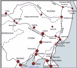
In the disease’s wake mortality proceeded at an alarming rate, Harbin in the far north was the initial epicentre. In November 5,272 died in the city. It then spread along the tracks to cities further south, Mukden recorded a death toll of 2,571 by January 1911, and Changchun was losing over 200 a day to the plague (Meiklejohn). The plague was sustained and promoted by the prevailing conditions it encountered – dense population, high human mobility and poor hygiene environments (Cornelia Knab, cited in Meiklejohn). Eventually the plague reached Peking and as far as central China.

Enter Dr Wu
The authorities, in desperation, turned to a migrant, Penang-born doctor working at the time in Tianjin, Wu Lien-Teh. Cambridge-educated Wu took immediate charge of the medical emergency in Harbin. Enforcing a strict quarantine in the city, Wu put in place a series of comprehensive measures to contain the disease, including:

● converting railway freight cars to makeshift quarantine centres and turning a bathing establishment into a plague hospital

● establishing “sanitary zones” in the city

● closing down the railways in Manchuria, impose blockades, border controls and so stop infected people from travelling (Wu needed to secure the co-operation of the Russian and Japanese rail companies to achieve this)

● burning the lodgings of those infected

● monitoring the population by checking households for new cases

● advocating the wearing of face masks (Wu had more effective masks with extra gauze padding made)

● carrying out mass cremations of the infected dead (considered a sacrilege in Chinese society, Wu had to petition the emperor for permission)

● undertaking post-mortem examinations of the victims (again, a Chinese taboo that Wu had to overcome objections to)✲

Temperature check, Fuchiatien 
(www.Flickr.com)

8EBF0FB5-A594-4A30-ACD7-228BA7A13D7A

With no vaccine for pneumatic plague available, Wu’s quarantine measures involved isolating people for a five to ten day period, if no symptoms present, they are released with a wire band attached to their wrist signifying they have been cleared of the disease [‘In 1911, another epidemic swept through China. That time, the world came together’, (Paul French), CNN, 19-Apr-2020, www.cnn.com; ‘The Chinese Doctor Who Beat the Plague’, (Jeremiah Jenne), China Channel, 20-Dec-2018, www.chinachannel.org].


 Old plague hospital, Harbin. When the epidemic was suppressed, the hospital was burnt down to eliminate any residual risk of contamination  


3ABB804F-1CE8-43AA-B985-B351DA642414

(Photowww.avezink.livejournal.com)

Keeping the ports plague-free
The concerted efforts of Japanese, Russian and Chinese managed to prevent the epidemic from reaching the eastern seaboard. Several towns close to the major port city Dalian reported cases, but Dalian itself (by this time under Japanese control, known as Dairen), initially undertook mass inspections of train and ship passengers, before closing the South Manchurian line altogether. With such strictures in place Dalian was wholly spared from the plague (French).  The Russians were able to similarly stem the outbreak’s movement along the CER rail line and stop it from reaching Russia’s vital Pacific port, Vladivostok.

Racing against catastrophe
What added even more pressure to Wu’s task in trying to control the plague was that he was working against a tight deadline. The plague needed to be contained before 30th January which was Chinese New Year’s Eve. Thousands of migrant workers would be returning home to their families for this most important annual celebrations in China via the Manchurian railway network, which Wu knew would make it almost impossible to rein in the outbreak. The conscientious and thorough measures implemented in northern China made it possible for Wu to be able to declare the epidemic virtually suppressed by the end of January. Decisive action in N.E. China also prevented the plague from spreading to near-by (Outer) Mongolia and Russian Siberia. By March all the region’s shops, factories and schools were reopened and the only lingering infection was confined within the specially established plague hospitals (Meiklejohn).

ECC6C255-C649-4FF3-A494-39F4A9274F3A

Endnote: Dr Wu 
Many Chinese medical personnel including epidemiologists and other physicians contributed to preventing the plague spreading throughout China, and to suppressing it all together within a short period. But if anyone should be called a hero of the Great Manchurian Plague of 1910-11, certainly that mantle should land on Dr Wu Lien-Teh, whose decisive leadership, organisation and enterprise saved China’s North-East provinces from a much higher casualty toll and from the regional plague developing into a nationwide epidemic.

꧙꧙꧙꧙꧙꧙꧙꧙꧙꧙꧙꧙꧙꧙꧙꧙꧙꧙꧙꧙꧙꧙꧙
 China for it’s part controlled the Imperial Railways of North China, which linked Peking with Mukden


 one case was recorded in Shanghai, 2,000 miles away

 thousands of bodies were still above ground in coffins because the relatives were waiting for the spring thaw to bury the dead…ideal incubators for the plague bacillus to magnify the contamination [‘Dr Wu Lien-Teh, plague fighter and father of the Chinese public health system’, (Zhongliang Ma & Yanli Li), www.ncbi.nim.nih.gov; Jenne)

✲ Wu performed the first autopsy in Harbin, identifying the disease as the bacterium Yersinia pestis of the pneumonic variant [‘Wu Lieh-Teh: Malaysia’s little-known plague virus fighter’, Star Online, 11-Feb-2020, www.msn.com]

The Fight against the Coronavirus Pandemic: Reflecting on the Numbers

The war against the coronavirus outbreak is indeed global, infecting to date 199 countries and territories and every continent with the possible exception of (largely and seasonally unpopulated) Antartica. Every day the apps on social media and the news broadcasts inform us of the rising tally of coronavirus cases and of the fatalities, but what we do know is that these totals do not convey a true picture of the populations affected by the virus. They are often an indicator only, a way of charting the trajectory of the elusive curve that every health service and provincial and national government strives to flatten.

Distribution of Covid-19 cases worldwide, 31-Mar-2020 (www.ecdc.europa.eu)

The complexity of the disease partly explains the inexactness. That being infected with coronavirus can be asymptomatic and remains recordable for those never tested, highlights this problem. On a country by country basis the uncertainty over numbers magnifies. Some countries (a lot in Africa for instance) have no or minimal records of testing, which is not the same as saying they have no coronavirus cases! The reason for this might lie in the fact these predominantly impoverished countries have not the wherewithal nor the infrastructure to test even significant numbers of the population, they simply can’t cope. Thus their true numbers are never ascertained. There are other countries in the world who are motivated by reasons other than capacity to report the incidence of infection and mortality, eg, a desire to mask the extent of the calamity for domestic or external purposes.

Geographical distribution of Covid-19 cases worldwide, 31-Mar-2020 (www.ecdc.europa.eu)

The media’s daily servings, the table of virus mortality and morbidity gives us the bare bones of the depth of the human catastrophe — Italy a disaster, Spain a disaster, China a disaster but seemingly over the hump, Iran shockingly bad, France shockingly bad, USA very bad but likely to become even more catastrophic, UK and Netherlands, both worsening, etc. But of equal curiosity is those countries positioned much lower on the ladder of gloom that stand out as demographic anomalies, their numbers almost too good to believe…indeed! Two such are Russia and India. Russia, a vast country with around 145 million people has fessed up to just 17 deaths⋇. On face value a result that would hearten the most pessimistic, but you have to wonder about the level of reportage? India, with 1.3 billion-plus people has so far recorded a mere 32 deaths⋇ (compared to Italy with 60 million people which has lost just shy of 11,600 lives⋇). With India, the lowness of the figure is overshadowed by the inevitability of magnification…the sheer mass of humanity confined within such an acute density of space means that for the substrata of Indians, the poorest classes, no matter how earnestly their prime minister entreats them, they simply cannot physically isolate themselves. The directive from on high to keep a “social distance” from others to ward off the virulent effect of the epidemic remains for the vast masses a pipe dream. That many, many of these unfortunate souls will not escape infection and worse—either recorded or unrecorded—remains inevitable.

At 26-Mar-2020 (Source: Newsweek Statista)

_______________________________________________________________________

as at 1515 hrs, Greenwich Mean-time, 31st March 2020, ‘Confirmed Cases and Deaths by Country, Territory, or Conveyance’, www.worldometers.info/

Republica Moldova, a Not Very Well Known European State in Post-Soviet Space: The Disadvantages of Being Geographically Contiguous with a Latent Russian Hot Spot

Geo-coordinates: 47°0’N 28°55’E. Area: 33,851 sq km. Pop: 3.5 – 4 million (2018 est). Languages: Moldovan (Romanian), Russian; (minority languages) Gagauz, Bulgarian, Ukrainian. Capital: Chișinău (Rus: Kishinev)

Moldova is a small, basically flat, landlocked country situated on the Moldavian plateau, which forms a part of the Sub-Carpathian mountain system, bordered on its west by Romania and on its east by Ukraine. Most of Moldova’s territory lies between the area’s two main rivers, the Nistru and the Prut.

Moldova (or as it is formally titled, the Republic of Moldova) is one of Europe’s least known countries, it is just about the antithesis of turismo centro on the continent’s ratings board! Of the 44 sovereign countries in Europe recognised by the UN, it was the least visited country in 2016 (UN World Tourism Organisation). Historically, small and nondescript Moldova has tended to be a pawn shifted around from one competing imperial power to another over the centuries, valued only by the big power players for its geo-strategic importance in the region.

Moldavia, under the Soviet era

Pre-independence Moldova: a revolving door of designations and destinies
In 1346 Moldova became the Romanian Principality of Moldavia which included the Duchy of Bukovina, eventually the territory was subsumed under the expanding imperial reach of the Ottomans. In 1812 the sultan ceded it to Russia and it became an outer-lying enclave of the tsar’s empire known as the Governorate of Bessarabia. Freed from Russian rule in 1917 as a consequence of the Bolshevik Revolution, it briefly became the Moldavian Democratic Republic before being united with the Kingdom of Romania (as a federated part of Greater Romania). In 1924 the entity’s status and name changed again, becoming the Moldavian Autonomous Soviet Socialist Republic❅. In 1940, in the wash-up of the USSR/Nazi Germany’s Molotov/Ribbentrop Pact, Stalin consolidated the territory after a land grab of parts of Romania, forming the Moldavian Soviet Socialist Republic. During the war Nazi Germany together with its Romanian ally captured Moldova and held it until the Red Army launched a successful counter-offensive in 1944. Once again in Russian (Soviet) hands, the USSR implemented a postwar process of Russification in the Moldavian ‘Republic’ (enforced socio-economic reforms, especially urbanisation and migration). The status quo persisted until 1991 and the dissolution of the Soviet Union. After this seismic political transformation Moldova along with many other Soviet SSRs gained its independence from the Russian empire [The Times Guide to Eastern Europe, (Ed. by Keith Sword), 1991; ‘Moldova between Russia and the West: A Delicate Balance’, (Eugene Rumer), Carnegie Endowment for International Peace, 23-May-2017, www.carnegieendowment.org].

Moldavia – the “Land of Aurochs”
Since 1991 Republica Moldova’s path on the road to a viable and independent democracy has been obstructed by a myriad of challenges. From the start, like other former Soviet SSRs in Central Asia and the Caucasus, its long-term viability was hamstrung by the lack of a tradition of self-government and sovereignty. A major challenge has been trying to find political leaders not tainted by association with the Soviet era. The political inexperience also manifested itself in ongoing constitutional problems for the country. Economics is equally significant a hurdle for the still embryonic democracy…Moldova is a poor, agriculturally-based country, reliance on the former masters, the Russians, has come at a cost. The USSR’s legacy for the new country of a concentration of state and collective farms has made transitioning from a controlled to a free market economy a more rocky passage [‘Moldova’, (KA Hitchins, B Buckmaster, E Latham & F Nikolayevich Sukhopara), Encyclopaedic Britannia, www.britannia.com]. What pre-existing industry there was in Moldova, was concentrated in the Transdniestria corridor (see below).

Multiethnic identities and allegiances
Roughly two-thirds of Moldova’s population is of Romanian descent with the remainder a mix of ethnicities…in the tiny eastern region of Transdniestria there is a block of predominantly Russian and Ukrainian speakers. Moldavia’s experience under the Soviets’ republics policy has included episodes of expulsions of native Moldovans, Gaguaz, Bulgarians and Jews, and the parachuting in of ethnic Russians and Ukrainians. One regional specialist has described it as “a product of ethnopolitical-administrative experimentation” (Rumer).

(Old Orhei monastery, Moldova (source: Calin Stan/Adobe Stock)

The challenge of stable government
Since independence Moldova has managed to establish a reasonably acceptable level of political pluralism…awarded by Freedom House a rating of “partially free” (because of government corruption and deficiencies in the rule of law scoring 58 out of 100) [‘Freedom in the World 2019 – Moldova’, Freedom House, www.freedomhouse.org]. Power has tended to alternate between pro-Russian and pro-European leaders, comprising the (pro-Russian) socialist and communist parties, the centre-left Democratic Party and liberal reformists. At one point the country’s governance functioned for three years without an elected president. Regular changes of government and direction in Moldova reflects public disaffection with the inability of both sides of parliament to address the country’s problems (poor living standards, unemployment, high-level corruption especially involving a national banking scandal✪).

Transdniestria – the crux of conflict within the state
(Image: www.joksankolikot.net)
Transdniestria (officially Pridnestrovskaja Moldavskaja Respublika)
Area: 4,163 sq km.
Pop: 469,000 (2018 est)
Languages: Russian, Moldovan, Ukrainian.
Capital: Tiraspol

The highest profile issue undermining Moldova’s efforts to establish a stable, cohesive national entity has been the lingering problem of a separate Transdniestria. This narrow strip of land within the Moldovan state comprising significant percentages of Russians and Ukrainians broke away from Moldova soon after independence. A brief civil war ensued, Moldovan forces attempted to quash the Transdniestria revolt but was thwarted by the intervention of the Russian 14th Army. A cease-fire in 1992 brought the conflict to a halt and a security zone was established with a peace-keeping force (including Russian troops) in occupation. The Transdniestria enclave has continued to assert its putative sovereign independence, however neither Moldova or any other sovereign state including Russia has recognised its claims. Recently, there having been no resumption of the armed conflict, political onlookers have characterised the situation as a “frozen conflict”…some analysts in the West view it as “de facto settled”. Although the dispute remains unresolved, there is a perception that the combatants have learned over the intervening years “to peacefully co-exist” with one another (Rumer).

This is not to say that the Russian bear has relinquished its political ambitions or interest in the disputed territory, far from it! Transdniestria—and Moldova as a whole—remain geo-politically important to Russia vis-a-vis the Black Sea (more so after the aggressive Russian incursion into the Ukraine in 2014) and in its proximity to the Balkans. Russia supports a “special status” for Transdniestria (announced by then Russian PM Medvedev from Kiev). Meanwhile patterns of intent can be discerned, Moscow continues to maintain a presence in Transdniestria which it sees as a Russian outpost in that region. And there has been a clear effort to forge a new Soviet-Moldovan identity distinct from the Romanian one, eg, by the promotion of the Cyrillic alphabet in preference to the incumbent Latin script (Rumer).

A secondary separatist movement
Transdniestria is not the only irredentist or ethnic breakaway movement that the government in Chișinău has had to contend with. From the late 1980s the Gagauz halki (people), a Turkic-speaking Christian minority in Russian Moldavia, experienced an upsurge in nationalist feeling. In 1990 the Gagauz, apparently concerned about the preservation of its own cultural identity within the new Moldovan state, unilaterally proclaimed itself an autonomous republic (Gaguazia, capital Comrat), followed one year later by a full declaration of independence. Intriguingly, despite this, the Gagauz are inclined to harbour a nostalgia for the old USSR [‘Moldova country profile’, BBC News, (15-Nov-2019), www.bbc.com]. The Moldovan republic has steadfastly refused to countenance independence for the Gagauz but in 1994 it did grant the region a form of autonomy (as a “national-territorial autonomous unit”) and it’s own governor (bașman) [‘Gaguazia’, Wikipedia, http://en.m.wikipedia.org].

Gagauzia

Russia’s role and influence in Moldova
Heavily overlaying Moldova’s attempts to establish good governance and national viability is the gravitational pull exerted on it by both Russia and Romania. Successive Chișinău administrations have—to varying degrees—striven to free themselves from too much reliance on Russia. The relatively undeveloped nation has nonetheless had to acknowledge the economic realities of it’s situation: making a clean break from Russian dependence is something extremely difficult to accomplish. Clearly, the plan of Moldovan reformers was to move closer to the orbit of the EU and this has progressively happened after the country satisfied the EU of its willingness to make democratic and economic reforms. The outcome? Today, the EU is Moldova’s major trading partner (worth US$3.5 bn in 2016), making great strides in turning the country’s international trade matrix around [‘The World Factbook: Moldova’, (Central Intelligence Agency), www.cia.gov]. Nonetheless, economic dependence on Russia—through a complicated set of existing conditions—remains crucial and seemingly unavoidable for the time being.

Remittances, energy and wine
The abysmally low GDP per capital by European standards of Moldovans (US$5,237, 2017) forces large numbers of them into becoming guest workers overseas. Many of these go to Europe especially Italy, but Russia remains the main source of external employment. Remittances by these workers back to their families in Moldova amount to about US$1.2 bn each year (15% of the country’s GDP), the third highest in the world. By far the largest portion of Moldovan Gastarbeiter, about 500,000 guest workers, rely on Russia each year for their income (Rumer; ‘World Factbook’).

Access to energy for Moldova compounds its fragile interdependence. The country is in debt to Russia’s giant Gasprom corporation to the tune of US$6 bn for it’s supply of natural gas (ironically the greater part of this debt to Moscow was incurred by Transdniestria). This energy situation persists because Romania has been able to meet at this time only a small portion of Moldova’s gas needs (‘World Factbook’).

(Photo credit: AP)

Wine-making, on the surface of it, is Moldova’s one bright light. In 2014 the small southeastern European country was the world’s 20th largest producer of wine (mainly reds). Easily it is—together with remittances—Moldova’s most important export. Again however Russia is at the core of the matter. Up to 90% of Moldovan wine goes to Russia. Good for Moldova’s export earnings sure, but the downside of such over-dependence on Russia is fraught with hazards. This places Russia in the position of being able to inflict damage on the Moldovan economy, were it to harbour a whim to do so. And this is not a purely theoretical consideration: twice this century (most recently in 2013), the Russian Republic banned the import of wine from Moldova with predictable effects on the latter’s economy. Russia offered up a pretext, alleging that the Moldovan wine was contaminated with plastic, but it doesn’t require a lot of imagination to see a thinly-veiled warning of disapproval aimed at it’s small regional neighbour [‘Why Russian wine ban is putting pressure on Moldova’, (Tessa Dunlop), BBC News, 21-Nov-2013, www.bbcnews.com; ‘Moldova country profile’].

Closer ties with Romania?
Linguistic homogeneity does bind Moldova closer to Romania but the Moldovans are in no hurry to formalise the nexus through unification with it’s western neighbour. Romania does provide something of a counter-pull for Moldova against the leverage exerted by Russia and a strong Moldovan-Bulgarian nationalist movement has been fostered (Rumer). However, only between seven and fifteen percent of Moldovans have indicated that they are in favour of union with Romania [‘A union between Moldova and Romania: On the cards?’, (Michael Bird), EU Observer, 05-Mar-2015, www.euobserver.com]. Moldovans, it appears, despite the linguistic cord binding them to Romania, don’t tend to possess the sort of irredentist urges that Transdniestrians do for Russia.

The murmurings of unification advocacy have been confined to some sectors on the Romanian side. Even these mostly have tended to be tentative ones. One proposal calls for Romania to reunify with the former geographical entity of ‘Bessarabia’, which is highly problematic – such a union would include parts of present day Ukraine and would exclude Transdniestria! In 2015 a group of Romanian MPs under the banner “Friends of the Union” called for closer economic and cultural ties between the two homophonic countries. Bucharest has, since 2010, started to provided significant amounts of aid to Moldova (€100 M), including for education. For the most part though, Romania’s greatest value to ordinary Moldovan citizens lies in it being a gateway to the EU…since 1991 around half-a-million Moldovans have obtained Romanian passports which allows them entry to the wider Western Europe through the prevailing Schengen arrangements (Bird; Rumer).

PostScript: Sole remaining remnant of the Soviet Union?
Transdniestria is the only political entity in Europe which still bears the “hammer and sickle” on it’s flag—and the only Eastern European entity which still calls it’s secret service the KGB! Tiraspol’s “House of Soviets” proudly honours the tradition of Lenin and Stalin with busts and pictures and the enclave’s various patriotic hommages to the Soviet past lead many outsiders to not take Transdniestria particularly seriously…”a fossilised piece of the former USSR” (Lonely Planet), “a collective hallucination” shaped like a “small worm squashed between two larger creatures” [‘Hopes Rise in Transnistria of a Russian Annexation’, (Alexander Smoltczyk), Spiegel International, 24-Apr-2014, www.spiegel.de/international/]. But dieheart Transdniestrian irredentists were encouraged by Russia’s 2014 annexation of Crimea and cling to a (slim) hope that Russia will some day follow suit with Transdniestria, or at the very least, make it a non-contiguous exclave on the model of Kaliningrad (Smoltczyk).

°°°°°°°°°°°°°°°°°°°°°°°°°°°°°°°°°°°°°°°°°°°°°°°°°°°°

❅ an “autonomous republic” under the jurisdiction of Ukraine – an “artificial political creation” inspired by Moscow’s ideological rhetoric of “world revolution” [‘Moldavian Autonomous Soviet Socialist Republic’, Wikipedia, http://en.m.wikipedia.org]

the failure of successive administrations to prosecute suspects of a US$1 bn bank embezzlement (‘Moldova country profile’). The scandal is known within the country as the “Great Moldovan Bank Robbery”

34% and 26.7% respectively (2015 census)

Romania presents a perception problem for some Moldovans for who, a less than favourable image of a backward country with a scruffy gypsy culture, persists (Bird)

The Russian Far East: Russia’s Far Flung Territory in North-East Asia 2

For most outside observers, the Russian Far East as a geographical region is pretty much indistinguishable from the vast Siberian landscape. This is hardly surprising when you consider that until 2000 the Russian Far East was lacking in officially defined boundaries. Historically, the Russian state in its various forms has tended to ignore the RFE region, commonly seen as a neglected outpost of empire, populated by hardy Cossack settlers, impoverished peasants and those detained there against their will. The population, at its highest point not reaching much beyond eight million, has dwindled since the end of the communist system.

(Map image: www.eurogeologists.eu)

In the early to mid 1990s there was some optimism shown by Russia’s rulers that much needed development could be injected into the country’s Far Eastern region. There was a belief or at least a hope in Moscow that the Russian Far East (RFE) could create a viable niche for itself, that it’s vast repository of natural resources could be utilised to target the growing Asian markets whose own raw materials had a finite life and would soon be running low. Some even touted RFE as potentially the “next Asian Tiger” [‘The Next Asian Tiger? Promoting Prosperity in the RFE’, (Lawrence DiRita), The Heritage Foundation, 18-Aug-1994, www.heritage.org].

Russia’s principal city in the east, Vladivostok, became the Free Port of Vladivostok, the host of a Russian-sponsored event, the Eastern Economic Forum, which it was hoped would provide a platform to attract foreign investment to the region. Rhetoric from Vladimir Putin, assuming the reins of the post-Soviet federation at the end of the Nineties, proclaimed that the development of RFE would be “a national priority for the 21st century”, [‘Accelerated Development of the RFE’, (Igor A Makarov), Russia in Global Affairs, 29-Oct-2018, www.eng.globalaffairs.ru].

Russia’s vulnerable eastern flank ~
Russia, with one eye on the geopolitical implications of an underpopulated eastern flank of the country and its underperforming economy, certainly had the motivation to develop the region. The hitch in the early 21st century has been, as ever, the pitfalls of implementation…a myriad of problems confronted Putin. RFE lacks for infrastructure and labour (#resource rich but people poor). Moreover the country was experiencing an economic slowdown. Russia’s only option if it was achieve any meaningful development was external investment, it needed new partners to propel it. Russia’s 2014 annexation of the Crimea however led to the imposition of economic sanctions by the West, which along with falling oil prices further harmed the nation’s economic situation [Dhananjay Sahai, “Russian Far East and Central Asia: Impediments to Sino-Russian Partnership”, ORF Issue Brief No. 280, February 2019, Observer Research Foundation, http://www.orfonline.org].

The People’s Republic of China, Russia’s new best “enemy-friend” ~ Russia’s unpropitious economic realities have steered its approach to the development of RFE. To get China on board Russia had to provide economic incentives to the Chinese to invest in RFE. Chinese businesses and migrants initially flooded into the region, at its peak in the 1990s there were over 200,000 Chinese living and working in the region. Chinese suppliers and retailers were also thick on the ground in RFE. A Chinese market trader in Vladivostok (Photo: AFP)

Russia’s opening up to China was not without misgivings from Moscow, it had reasons to be wary of opening the door too far to China. The IMF calculates that the Chinese economy is 78 times bigger than Russia’s…Moscow is aware of the risks to its economic sovereignty of becoming over-dependent on its dynamic, powerful neighbour. Accordingly Russia has tried to balance China’s weighty imprint on RFE and Siberia by wooing South Korean and Japanese investment, and from India as well [ibid.; ‘Russia seeks to balance China in Far East; woos Indian investment’, (DR Chaudhury), Economic Times, 24-Jul-2019, www.economictimes.com].

The new Sino-Russian rapprochement has greatly enhanced the trade ties binding the two heavyweight Asian countries – Moscow now sells its natural gas and advanced weaponry to the Chinese and Beijing reciprocates mainly with manufactured goods. With the common enmity/rivalry towards the US a further bond, Russia in the present decade has unequivocally pivoted towards China.

Backlash against the Chinese presence: Fears of Chinese irredentism ~ The presence of the Chinese in RFR has prompted a backlash from local Russian workers and a pushback from local Russian media and politicians. Workers and the communities complained that the burgeoning numbers of Chinese workers deprived locals of job opportunities (Chinese companies tend to employ their own countrymen and women on their Russian projects) [‘Why Russia’s Far East Struggles to Lure Investors (Op-Ed)’, (Richard Cornelius), The Moscow Times, 25-Jan-2018, www.the.moscowtimes.com; Sahai, loc.cit.] . Subsequently, the Russian government decreed that 80% of workers employed on Chinese projects must henceforth be local (ie, Russian) [Chaudhury, loc.cit.].

New ‘besties’ Xi and Putin toast one another (Photo: AP)

Bilateral relations between China and Russia have been talked up recently…this year Chinese premier Xi Jingpin told Russian media that Russo-Chinese relations were “at their best in history”. Notwithstanding this upbeat tone, concerns about the encroachment of the contiguous Chinese in RFE continue to be held by Russians, and such disquiet is fuelled by some Russian media outlets. A suspicion and a fear that lingers here is one of “being demographically (as well as economically) swamped by the giant next door” [‘The Chinese influx into Asian Russia’, (Alexander Kruglov), Asia Times, 13-Jun-2019, www.asiatimes.com]. The existence of unknown numbers of illegal Chinese immigrants in the region adds to the resentment of local Russian settlers in RFE. The influx is often interpreted as “an expression of a China de facto territorial expansion” (invasion fear-mongering) [‘Chinese in the Russian Far East: a geopolitical time bomb’, This Week in Asia, www.amp.scmp.com].

How many Chinese in RFE? ~
The official numbers contradict the basis of this concern. According to the 2010 Russian Census, the number of ethnic Chinese residing in Russia had fallen to just 29,000 (a mere 0.5% of RFE population). However some estimates put the actual total of Chinese at between 300 and 500 thousand [ibid.]. Any figures for the region it should be noted are very fluid and quite speculative. A significant proportion of the population comprises temporary migration and shuttle trade, Chinese merchants who travel back and forth across the border to ply their wares without ever settling permanently in RFE [‘Ethnic Chinese in Russia’, Wikipedia, http://en.m.wikipedia.org]. Conspicuous Chinese visitors now make up the largest sector of Russian tourism, especially to RFE and Irkutsk/Lake Baikal (only two hours from Beijing by plane). Local Russians are perturbed at the behaviour of Chinese tourists to Lake Baikal, patronising Chinese businesses only, their litterbug tendency to leave rubbish strewn around the lake…most worrying to the Russians about the Chinese influx is that it might presage Beijing’s designs on reclaiming the area lost to Tsarist Russia (see “Thorny issue” below). All this contributes to a growing strain of Russian ‘Sinophobia’ in the Far East region [Kruglov, loc.cit.].

Lake Baikal

What probably ‘spooks’ the Russians the most are the stark demographics at play: the Chinese provinces bordering Russia’s Far East contain 110 million people, dwarfing the approximately six million Russians across the border [ibid.]. Dissatisfaction with Putin’s RFE policies are reflected in the 2018 gubernatorial elections in the region – voters rejected the Kremlin’s candidates, sending a clear message of disapproval to their federation president [‘Putin is losing Russia’s Far East’, (Leonid Bershidsky), Bloomberg Opinion, 24-Sep-2018, www.bloomberg.com].

Some scholars have sought to debunk the theory of a Chinese takeover, arguing that the Chinese population in RFE was being checked by several factors current in effect (an upsurge of regulation by the Russian authorities with new controls on Chinese markets; the overall poor economic prospects of the Russian Far East and a resultant shrinking consumer base for Chinese commodities) [‘The Myth of a Chinese Takeover in RFE’, (Xiaochen Su), The Diplomat, 19-Jun-2019, www.thediplomat.com].

Heihe, Chinese boomtown in Dong-Bei region

Thorny issue on the Chinese side ~
The border areas surrounding RFE are a lingering cause for resentment from the Chinese perspective. Under the 1858 Treaty of Aigun Tsarist Russia coerced the Qing Dynasty into ceding more than 600,000 square kilometres of Chinese territory to it. This was followed in 1860 by the Convention of Beijing. The effect of both concessions was that the Russian Empire acquired territory on both sides of the Amur River, giving it control of the Primorye region. Known in China as the “Unequal Treaties”, the 19th century episode still engenders public resentment among the Chinese, sometimes fuelled by dissident groups such as Falun Gong (see also ‘Border clashes’ in FN) [Sahai, loc.cit.; ‘Chinese in the Russian Far East’, op.cit.].

In the prevailing climate Russia and Putin’s commitment to the development of the Russian Far East remains hamstrung by the Russians’ inability to go it alone. Enlisting the help of China, though necessary, is deeply problematic for the Kremlin. It is in fact a delicate balancing game for Moscow, on the one hand it fears becoming economically subordinate to PRC, but it wants Chinese investment because it needs it to go forward. Yet the complexities of the RFE region doesn’t make for a seamless process, it doesn’t deliver the degree of Chinese investment required or desired [‘Russia struggles to attract Chinese capital to its Far East’, (Vita Spivac & Henry Foy), Financial Times, 05-May-2019, www.amp.ft.com]. In the meantime the shortcomings of Russian policy on RFE are a hand-break retarding the region’s development.

Footnote: 1̳9̳6̳9̳ ̳B̳o̳r̳d̳e̳r̳ ̳c̳l̳a̳s̳h̳e̳s̳ ̳– i̳n̳c̳i̳d̳e̳n̳t̳s̳ ̳i̳n̳ ̳t̳h̳e̳ ̳S̳i̳n̳o̳-̳S̳o̳v̳i̳e̳t̳ ̳s̳p̳l̳i̳t̳ Chinese and Soviet troops engaged in a series of isolated military clashes on the eastern border during 1969 (beginning when Chinese platoons attacked Soviet soldiers stationed on Zhenbao Island in the Ussuri River (a reaction to long-standing grievances held by China over Russia’s 19th century acquisition of hitherto Chinese territory). A ceasefire was negotiated by Beijing and Moscow late in 1969, but subsequent bilateral negotiations took until 2008 to settle the matter of who had territorial control of what in the region…as shown above however, the border issue continues to engender lingering grievances up to the present day.

Eastern border conflict (Image: History Forum)

◧◨◩◪◧◨◩◪◧◨◩◪◧◨◩◪◧◨◩◪◧◨◩◪◧◨◩◪◧◨◩◪

 the catch-all descriptor “Siberia and the Far East” (Rus: Сибирь и Дальний Восток) had hitherto been used to refer to Russia’s territories east of the Urals, making no clear distinction between “Siberia” and the “Far East” [‘Russian Far East’, Wikipedia, http://en.m.wikipedia.org]

◘ under Putin’s Russia, Moscow enacted the Russian Homestead Act (2016) which was aimed at encouraging Russian and Ukrainian citizens to settle in the Far East okrugs with the incentive of obtaining 2.5 acres of free land

✧ in the process incurring a substantial loan debt to China

 some of the Russian fears border on the irrational, such as the Siberian speculation that the Chinese want to annex Lake Baikal to monopolise all of its precise fresh water reserves exclusively for Chinese consumption (Kruglov)

✠ the dispute and custom leads some Chinese to continue to refer to the RFE capital Vladivostok by its old Chinese name ‘Hâisenhēnwâi’

✪ reforms affecting RFE have been only partially implemented; there is a paucity of enlightened new strategies to revive the region (eg, a genuine trade liberalisation is sadly lacking); and the planning round it is bereft of a clear, overriding vision for the region [Makarov, op.cit.]

❅ in the same year there was Sino-Soviet military clashes on the western border (Xinjiang/Soviet Central Asia) as well

Mengjiang: The Empire of Japan’s Other East Asian Puppet State in Inner Mongolia

The creation of the puppet state of Manchukuo out of a huge chunk of China’s northeastern territory in 1932 was a springboard for Japan’s nationalists and militarists to expand territorially deep into China and other parts of Eastern Asia [see preceding blog: http://www.7dayadventurer.com/2019/06/27/manchukuo-an-instrument-of-imperial-expansion-for-the-puppet-masters-of-japan/].

(note how close Mengjiang’s eastern boundary came to China’s principal city Peking)

The Japanese military used Manchukuo as a base to gradually move piece by piece into Chinese Mongolia, Outer Mongolia, Siberia and elsewhere in China. Or as one Western observer of the day put it: “Automatically, by the invasion of Manchuria in 1931, Japan became committed to the invasion of Mongolia”, [Lattimore, Owen. “The Phantom of Mengkukuo.” Pacific Affairs, vol. 10, no. 4, 1937, pp. 420–427. JSTOR, www.jstor.org/stable/2750626].

Demchugdongrub and his Japanese advisors

▫️▫️▫️

Demchugdongrub, Pan-Mongolism to vassal state
In Inner Mongolia, a member of the Royal House of Chahar, Prince Demchugdongrub (Te Wang 德王), was agitating in the 1930s for Mongolian autonomy from Chiang Kai-shek’s Kuomintang Republic of China. Demchugdongrub and other Mongolian nationalists harboured irredentist desires for a Pan-Mongolia (the reuniting of Inner and Outer Mongolia) [‘5. Another Manchu-kuo, the dream of the “Inner Mongolian Independence”‘, TAKESHITA, Yoshirō 1997, http://teikoku-denmo.jp/ cited in Global Security, GlobalSecurity.org)].

Mengjiang flag

▫️▫️▫️

Enforced mergers and shifting nomenclature
The opportunity arose with the aggressive expansion of the Japanese military into the country. Chahar and Suiyuan provinces in Inner Mongolia were taken by Japan’s Kwantung Army and its allies. With the muscle of the occupying Japanese military behind him, Demchugdongrub in 1936 was installed as the leader of a new puppet-state regime✳️, the Mongol Military Government (sometimes also called the “Mongolian Border Land”).

In 1939 South Chahar and North Shanxi provinces (both predominately Han Chinese in population✥) were added to the ‘Mongolian’ regime, now renamed the Mengjiang(or Mongol) United Autonomous Government (蒙疆聯合自治政府) (Měngjiāng Liánhé Zìzhì Zhèngfǔ Mōkyō Rengō Jichi Seifu) with its capital in Kalgan (Zhāngjiākǒu) [ibid.]. On paper Prince Demchugdongrub remained Mengjiang head of state (until 1945), his main function seems to have been to give the territorial entity the countenance of legitimacy. One manifestation of Mengjiang’s Mongolian roots was Demchugdongrub’s adoption of the historic Mongolian calendar…1936, Mengjiang’s creation year, became the year 781 to associate the regime with Genghis Khan (below) and the height of power of the Mongol Empire [John Man, The Mongol Empire: Genghis Khan, His Heirs and the Founding of Modern China, (2015)]✧.

▫️▫️▫️

MUAG becomes MAF
In 1941 Mengjiang was rebranded once more, this time as the Mongolian Autonomous Federation (蒙古自治邦). At the same time the Japanese sponsored the elevation of Wang Zhao-ming. Wang, better known by his pen-name of Wang Jingwei, was put in charge of the Reorganised National Government of the Republic of China (中華民國國民政府) (RNGRC)❦. Wang had previously lost out to Chiang Kai-shek in a leadership struggle for control of both the KMT and the Chinese government.

Wang Jingwei, RNGRC president

Wang’s defection to the Japanese was motivated by this and he envisioned his alternate government, RNGRC, would provide him with the power base within China he was seeking▣. With Wang’s appointment as “Chinese president”, Demchugdongrub’s MAF was subsumed under the Wang regime, but in practical terms the MAF was still autonomous of it, if not of the Japanese [‘Mengjiang’, (Military Wiki), www.military.wikia.org].

Mengjiang one yuan note

▫️▫️▫️

RNGRC a ‘toothless’ regime
The RNGRC under Wang was a one-party totalitarian dictatorship, but the reality of Wang Jingwei’s regime was that it was only afforded very limited powers by it’s Japanese masters. Wang, befitting the function of a pliable puppet, was basically no more than a convenient pawn for the Japanese military to negotiate with Chiang’s government [‘Wang Jianwei regime’, Wikipedia, http://en.m.wikipedia.org]. In 1944 Wang died in Japan…his successor as president mayor of Shanghai Chen Gongbo played an equally subservient role for the Kwantung (Chen in 1946 was tried as a war criminal by the Chiang government and executed).

Mongolian flag 1945▫️▫️▫️

At the end of WWII, both the Mengjiang regime of Demchugdongrub and the ‘Reorganised’ Republic of China were effortlessly swept away by the invading Soviet and Mongolian armies. The Inner Mongolian territories were returned to China (along with Chinese Manchuria) and the Soviet satellite Outer Mongolia gained independence after a national plebiscite (100% yes vote!) in late 1945 (which the USSR immediately and China later recognised).

PRTT crest

PostScript: Tannu Tuva, a regional curio Mengjiang (or Mengkukuo) and Manchukuo were not the only contemporary puppet states in that region of Northeastern China/Mongolia. Nestled in between Outer Mongolia and Russian Siberia, is the tiny enclave of Tannu Tuva (1944: 170,500 sq km, Pop. 95,400)…historically this land was part of Mongolia and therefore part of a client state of the Chinese Empire. The People’s Republic of Tannu Tuva (ʙа Arat Respuʙlik) (1921-44) was recognised only by the USSR and Mongolia. Nominally independent but in reality another satellite state of the Soviets, in late 1944 it was absorbed into the Soviet Union as the Tuvan Autonomous Oblast. Today, it is the Tyva Republic, a constituent member of the post-communist Russian Federation.

(map source: www.globalsecurity.org)

➖➖➖➖➖➖➖➖➖➖➖➖

✳️ Demchugdongrub, despite his vaulting ambitions, was only ever nominally in charge of what was always transparently a Japanese-controlled puppet state

✥ exacerbating pre-existing tensions between the Mongolian and Chinese sections of the state (Lattimore, op.cit.)

Mengjiang 蒙 (literally ‘fierce’ or in compound form ‘dream to act’). The entity is sometimes styled Mengkukuo 蒙古國 because of its parallels with Manchukuo

✧ the Mongolian prince’s supposed autonomy was always surface deep at best…”an autonomy administered by the Japanese for the Japanese”, (ibid.)

❦ colloquially known as the “Wang Jingwei regime

▣ Wang’s would-be government was based in the former capital Nánjīng, however the de facto capital was Shanghai

.

Manchukuo: An Instrument of Imperial Expansion for the Puppet-masters of Japan

In 1931 the Manchurian component of the Japanese Imperial Army faked the sabotage of the Southern Manchurian Railroad (which was controlled by the Japanese themselves) near Mukden (present day Shenyang). The Japanese military, playing the victim, alleged it was the work of Chinese dissidents, and used the so-called Mukden Incident to launch a full-scale invasion of Manchuria✴.

Kwantung Garrison troops in Shenyang, 1931

The military onslaught from Japan’s Kwantung Army (formerly Garrison) [関東軍, Kantogun] (AKA the Guandong Army) met with determined if largely ineffective resistance…the Chinese were under-prepared, under-equipped and not as technologically advanced militarily as the Japanese, but their defensive efforts were also undermined by Chinese leader Chiang Kai-shek who ordered the local warlord Zhang Xue-liang to hold back on resisting the Japanese invaders. The reason – Chang had fixed on a strategy that prioritised gaining control over the rest of the China in the civil war against Mao’s Chinese communists [‘Mukden Incident’, Encyclopaedia Britannia, (John Swift), www.britannia.com]. The Japanese military successes were followed by the creation of a Japanese “puppet state”, Manchukuoꆤ, in Manchuria in April 1932 (comprising China’s Northeast and Inner Mongolia).

Background to Manchukuo: Japanese “special interests’

Japan had pursued an aggressively interventionist policy in the region for decades before Manchukuo. Victorious wars against a diminishing Chinese empire (First Sino-Japanese War, 1894-95) and Tsarist Russia (Russo-Japanese War 1904-05) emboldened Japan’s ambitions. Japan’s spoils of war after defeating the Russians included the extension of its economic sphere of influence to southern Manchuria. Moving into ports, mines, hotels and other businesses and its takeover of Russian railroads, brought with it a big influx of Japanese settlers [‘Manchukuo’, Wikipedia, https://en.m.wikipedia.org/].

Even prior to Manchukuo’s creation, Japan had been conceded a portion of Chinese territory in the southern Liaoning Peninsula which included Dalian (renamed Darien by the Japanese). Known as the Kwantung Leased Territory, it remained in Japanese hands until 1945.

Manchukuo’s capital was Hsinking [Xīnjīng: (literally ‘new capital’)] (today reverted to its original name, Chángchūn) in Jilin province. In 1945 at the end of WWII the capital was moved to nearby Tonghua. Hsinking had the status of a “special city” under the Manchurian state, as did Harbin.

Puppet statehood

The Manchukuo state established by the Japanese militarists was initially a republic but in 1934 it was changed to a one-party constitutional monarchy, the so-called Empire of (Greater) Manchuria. The Japanese dredged up the former boy-emperor Pu Yi (last Chinese emperor of the Qing Dynasty) to be the titular figurehead of the ’empire’. Executive power of the Manchukuo government purportedly resided with the prime ministers (Zheng Xiaoxu 1932-35 and Zhang Jinghui 1935-45). The Manchukuo PM held authority under an authoritarianpersonalist dictatorship, but this was more perception than substance as real power lay firmly with the Japanese☯️.

“Emperor of Manchukuo” (Model display of puppet emperor in palace museum)

Kwantung Army, a rogue element

The Kwantung◘ Army, the arm of the Japanese Imperial Army in Manchuria, functioned as something of a rogue element, habitually acting independently of the Japanese government and the Army General Staff in Tokyo which struggled to rein it in. The Mukden Incident (see above) and the Huanggutun Incident (see below) are two such instances of their rogue activities. Service in the Kwantung Garrison, which had its headquarters in the Manchukuo capital Hsinking, was a recognised path for promotion in the Japanese high command…instrumental chiefs of staff Seishirō Itagaki and Hideki Tōjō were both beneficiaries of this [ibid].

Hsinking: Kwantung Army HQs

Highly politicised, the Kwantung Army adopted an extra-military role for itself in Manchuria, eg, the commanding officer of the Kwantung Army was also Manchukuo ambassador to Japan and held an extraordinary power of veto – even over the Emperor of Japan! [ibid.].

‘Race’-based stratification

Japan peopled the sparsely populated parts of Manchuria with Japanese migrants who sat atop a social pyramid with other ethnic groups in the region stratified under the Japanese. Rationing of essential foodstuffs (including rice, wheat and sugar) was administered in accordance with this racial hierarchy. The Japanese-dominated colony of more than 30 million has been characterised as more “an Auschwitz state or a concentration-camp statethan merely a “puppet state” [Yamamuro Shin’ichi, quoted in Smith, Norman. “Disguising Resistance in Manchukuo: Feminism as Anti-Colonialism in the Collected Works of Zhu Ti.” The International History Review, vol. 28, no. 3, 2006, pp. 515–536. JSTOR, www.jstor.org/stable/40111222].

Japanese dominated Manchuria was indeed a police state, one of the most brutal in an (interwar) era of totalitarian excesses. The Manchukuo regime unleashed a systematic campaign of terror and intimidation against the local Russian and Chinese populations (including arrests without trial, “thought crimes”, organised riots and other forms of subjugation) [‘Manchuria’, Wikipedia, http://en.m.wikipedia.org].

Artillery unit of Fengtian Clique

Resistance to Japanese domination

After the establishment of Manchukuo and the ineffective performance of the Fengtian (Liaoning) Army against the Japanese war machine, various Chinese militias were formed to carry on the resistance. The main forces comprised Anti-Japanese Volunteer Armies, backed by the KMT Nationalists and led by famous general Ma Zhanshan. Other resistance to the Japanese in the Northeast came from Communist-organised guerrilla units. The anti-Japanese militias’ campaigns, which included harrying and terrorising the Kwantung Army, lasted ten years until the Japanese Army and Airforce finally pacified Manchuria in 1942.

The brunt of the early Chinese fight-back against Japan’s imperial expansion was borne by these warlord militias and volunteer armies, but after Chiang Kai-shek was talked round to a truce with the communists and a united front against Japan in 1937 (in effect postponing the civil war to the conclusion of WWII), the Republic of China (ROC) army engaged directly with the Kwantung Army (Battles of Shanhai Pass, Rehe, Beiping-Tianjin, 2nd Battle of Héběi, Chahar Campaign, etc).

ROC flag (>1928) 中華民國 Chunghwa Minkuo

1937: Second Sino-Japanese War

After colonising Manchuria, the Japanese military used it as a base to invade the rest of China. In 1937 the eruption of fighting between Chinese and Japanese troops near Peking (Marco Polo Bridge Incident) led to full-scale war. Antony Beevor [The Second World War, (2012)] marks this episode as being effectively the start of the Second World War (some historians date it’s origins earlier, from the Mukden Incident in 1931).

Marco Polo Bridge (Photo: The China Guide)

Siberian sideshow

Eventually the Kwantung Army, unchecked by Tokyo, overreached itself by invading Siberia, provoking the USSR into an undeclared war and several border conflicts and battles in the late 1930s. The clashes culminated in the decimation of Japanese 6th Army at the Battle of Khalkhin Gol in August 1939 [‘The Forgotten Soviet-Japanese War of 1939’, The Diplomat, (Stuart D Coleman), 28-Aug-2012, www.thediplomat.com].

1930s Tokyo ‘spin’

The Japanese came under attack in the West for establishing a harsh, totalitarian regime in Manchuria. Attempts were made to deflect the criticism by portraying the interventions in China’s northeast as a positive contribution to the restoration of regional order. Apologists for Japan, pointing to the pattern of internecine conflicts between warlords, communist insurgency and general chaotic conditions in the rest of China in the first third of the 20th century, argued that Manchuria in the same period had, courtesy of Japanese involvement, enjoyed “peace and order, progress and prosperity, (making) great strides in commercial and industrial development” [Saito, Hirosi. “A Japanese View of the Manchurian Situation.” The Annals of the American Academy of Political and Social Science 165 (1933): 159-66. http://www.jstor.org/stable/1018175].

Manzhouguo passport

Japanese spin imbued the Manchukuo regime with a pseudo-legitimacy that was almost mythic: “the ‘Manchus’ followed the ‘kingly way’ (王道 wangdao) of harmony, prosperity, and peace under the benevolent guidance and protection of imperial Japan” [Review of Sovereignty and Authenticity: Manchukuo and the East Asian Modern, (Prasenjit Duara), by John J. Stephan, The International History Review,Vol. 26, No. 1 (Mar., 2004), pp. 181-182. Published by: Taylor & Francis, Ltd.Stable URL: http://www.jstor.org/stable/40110486]❅.

Myth-busting Manchukuo

Reconnecting with this, Japanese historians in the postwar period, tried to justify the horrors committed by the occupying Japanese army, characterising the incursion in Manchuria and Inner Mongolia as an act of ‘liberation’, prompted by motives which were ‘enlightened’. Recent research by Shin’ichi Yamamuro leads the Japanese academic to posit a view of the Manchukuo occupation that challenges the mainstream Japanese one. Yamamuro debunks the theory that right-wing Japanese military and civilian authorities were supposedly imbued with the idealism of wanting to construct a “paradise in earth” in China’s three northern provinces [Manchuria Under Japanese Dominion, (Shin’ichi Yamamuro, translated by Joshua A. Fogel), 2006; Bill Sewell. “Review of Yamamuro Shin’ichi. Manchuria under Japanese Dominion. Translated by Joshua A. Fogel. Philadelphia: University of Pennsylvania Press, 2006,” H-US-Japan Reviews, March, 2007. URL: http://www.h-net.org/reviews/showrev.cgi?path=265211196449094].

Scope of the membership of the Greater EACP Sphere

“Greater Co-operation” – code for Japanese expansion and economic domination

In 1940 Japan incorporated its Manchurian client-state into the Greater East Asia Co-Prosperity Sphere (GEACS). The purported aim of GEACS was that it would be an economically self-sufficient “bloc of Asian nations led by Japan and free of Western powers”. In reality, this veneer of Pan-Asian idealism (regime motto: “five races under one union”) was a front for the Japanese militarists and nationalists to expand south and west and advance its domination of Asia [‘Manchukuo’, Wiki, loc.cit.].

A prized economic asset

Manchukuo (and the Inner Mongolia territory) was incorporated into both the Japanese war machine and the national economy. Rich in natural resources (especially coal and iron), under the Japanese Manchuria became an industrial powerhouse. Japanese citizens, who had been hard hit by the Great Depression, were enthusiastic in their support for the army’s intervention in Manchurian territory right through the period of Japanese occupancy [ibid.].

August 1945: D-day for the Japanese puppet states

August 9, 1945, the day after the second atomic bomb was dropped on Japan, the Soviet Red Army and the Mongolian Army invaded Manchuria and Inner Mongolia, which was to be the final campaign of the Second World War. In a swift operation (Manchzhurskaya Strategicheskaya Nastupatelnaya Operatsiya), Manchukuo, Mengjiang and Japanese (northern) Korea were all liberated, thus culminating in the break-up of the Japanese empire. Manchuria and Inner Mongolia were returned to China, and the Soviets set about orchestrating a communist takeover of North Korea…meanwhile Korea south of the 38th Parallel was occupied by US forces [‘Soviet invasion of Manchuria’, Wikipedia, http://en.m.wikipedia.org].

Victorious Soviet soldiers in Harbin Photo: https://warfarehistorynetwork.com/

Footnote: ‘Manchuria’ as a geographic descriptor was first used by the Japanese in the 1600s and later adopted by Westerners in China…the Chinese themselves these days are less inclined to use the term ‘Manchuria’, preferring to describe this part of China simply as Dongbei (东北), the Northeast).

Manchurian malfeasance – for the record: these days the once imperial “puppet palace” of Manchukuo is a history museum – a reminder to Chinese and the very occasional 外国人 (foreign) visitor alike of the aberrant and abhorrent regime imposed on North-East China during the interwar period of the 20th century. Manchukuo (State of Manchuria) comprising northeastern China and part of Inner Mongolia Area: approx 1.19 million km Pop (est) 1940: 30-35 million Ethnic Mix: Han Chinese (majority), Manchus, Mongols, Huis, Koreans, Japanese, Belorussians (minorities)

⥰⥰⥰⥰⥰⥰⥰⥰⥰⥰⥰⥰⥰⥰⥰⥰⥰⥰⥰⥰⥰⥰

✴ in 1932 an independent inquiry with US participation, the Lytton Commission (Ritton Hōkokusho), found that both parties were at fault for the incident. In its Report which led to exposure of the Japanese duplicity, it condemned Japan for its aggression (albeit conceding it had “special interests” in the region), while also criticising China for inflaming anti-Japanese sentiments…the League of Nations subsequently demanded that Japan vacate Manchuria, Japan’s response was to give notice to withdraw unilaterally from the League (effective 1935) [‘Lytton Report’, (United States History), www.u-s-history.com]

✪ Zhang’s father, Marshal Zhang Zuolin, also a Manchurian warlord, had been assassinated by the Japanese Kwantung military in 1928, in an episode in Shenyang known as the Huanggutun incident. Zhang senior was one of the most powerful warlords in the Warlord Era, which saw local military cliques carve out territorial strongholds in different parts of China

Manzhouguo in Chinese

the Chinese expression for Manchukuo is 虚假帝国 (the “false empire”)

☯️ Zheng, a royalist and close collaborator of Pu Yi, had hoped that Manchukuo would become a springboard for the restoration of Qing rule in China, aims not shared by the Japanese who pressured him to resign in 1935 [‘Zheng Xiaoxu’, Wikipedia, http://en.m.wikipedia.org]. His successor Zhang Jinghui was even more of a powerless figurehead, content to allow advisors from the Kwantung Army run the state, earning Zhang the unflattering sobriquet of the “Tofu prime minister” [‘Zhang Jinghui’, Wikipedia, http://en.m.wikipedia.org]

◘ Kwantung means “east of Shanhaiguan”, ie, Manchuria

the Kwantung military also maintained a peninsula naval base at Ryojun (Port Arthur)

the charismatic general started fighting against the Japanese, was then induced to swap over to the Japanese side and finally switched back to the cause of Chinese resistance

❅ Stephan summarises Manchukuo as “a producer of beans, bandits and bunk” with the ‘kingly way’ grandiloquence falling under the third of these attributes

💮ᕕ💮ᕕ💮ᕕ💮ᕕ💮ᕕ💮ᕕ💮

Yemen 1970-1994: A Roller-Coaster of Coups, Sporadic Conflicts, Rapprochements, Civil Wars and Uneasy Unions

A tale of two republics After the uprisings and civil wars of the 1960s, Yemen in 1970 was delicately poised between a Saudi Arabian-backed North, the Yemen Arab Republic, and the South, the Soviet Union and Chinese Communist-backed People’s Democratic Republic of Yemen. The South Yemeni PDRY regime, bolstered by large injections of Soviet cash and aid, was taking on an increasingly Marxist complexion…close ties were forged with other left-wing states and organisations – PRC, Castro’s Cuba, East Germany, the PLO (PDRY was the “only avowedly Marxist nation in the Middle East” at this time) [‘South Yemen’, Wikipedia, http://en.m.wikipedia.org].

With the formation and consolidation of power by the Yemeni Socialist Party, South Yemen’s polity moved to a one-party state. The YSP embarked on a nationalisation program which restricted agricultural privatisation to a minimum✽. The economy was restructured along centralised planning lines. An ambitious land reform program was launched, creating 60 collective farms and 50 state forms. Limits were placed on home ownership and the holding of rental properties [ibid.; Halliday, Fred. “Catastrophe in South Yemen: A Preliminary Assessment.” MERIP Middle East Report, no. 139, 1986, pp. 37–39. JSTOR, www.jstor.org/stable/3012044].


Some progressive pluralism
Despite the overall conservative and politically unsophisticated nature of Yemeni society, the regime did not shy away from modernising and progressive reforms. A secular legal code was introduced, replacing Sharia Law, education was also secularised. Reforms addressed at making the position of women in society more equal, were especially bold – polygamy was banned as was child marriage and arranged marriages [‘Sth Yemen’, (Wiki), loc.cit.].

External aid to PDRY 1968-1986
Soviet Union $US270m
PRC (China) $US133m
(Halliday)

The Yemen Arab Republic (YAR) came into being with the ‘Compromise of 1970’…the republican government included some royalists in senior posts but the deposed imam was not allowed to return to North Yemen. In contrast to the leftist PDRY, YAR maintained friendly relations with the West (eg, trade deals with the US and the German Bundesrepublik (West Germany). The new republic embarked on tentative political and economic reforms [‘Yemen – the age of imperialism’, Encyclopaedia Britannia, https://www.britannica.com/]. The YAR civilian government lasted only until 1974 when the military dissolved it and ruled in partnership with some tribal elements.

From 1972, a regular cycle of war/peace/war A unified Yemeni state had long been an abstract idea in the deliberations of Yemeni politicians, but relations between the two adjoining republics became strained in 1972 when conflict between the North and South Yemens erupted over a border disputation. Fighting between the North (backed by Saudi Arabia) and the South (backed by the USSR) was only brief. In October a peace was concluded with the Cairo Agreement where it was agreed that both sides would work towards an eventual unification [‘CIA Study on Yemeni Unification’, www.scribd.com].

Political marginalisation and economic disenfranchisement within North Yemen Under the Saudi-backed Ali Abdullah Saleh, who took over the presidency in 1978, certain elements of society became more favoured – centring round a small mostly northern tribal group (of Zaydi ‘fivers’, a Shi’a sect with it’s base in the northwest highlands) who benefitted from a tax rate of half that imposed on the more numerous lowlands tribes [‘Yemen the 60-Year War’, Gerald M Feierstein, Middle East Institute, (Policy Papers, 2019-2), www.mei.com].

President AA Saleh

(Source: www.aljazeera.com)

The 1979 war: “Groundhog Day” In 1979 this conflict/pause/conflict pattern repeated itself…PDRY funded ‘red’ rebels fighting the northern government in Sana’a provoking YAR into a military response against the South. The spiral into open warfare was triggered by acts of assassination – both the YAR president (al-Ghashmi) and the PDRY president (Rubai Ali) were killed in separate incidents. Outright war followed with South Yemeni on the cusp of inflicting a decisive defeat on North Yemen when the Arab League intervened with a mediation. At the ensuing Kuwait Summit relations between the two states were again patched up, with a now increasingly familiar sounding outcome – unification was once again back on the agenda [‘Yemenite War of 1979’, https://en.m.wikipedia.org/].

YSP shifts from a hardline position From the late 1960s to 1980 PDRY was led by Abdul Fattah Ismail who followed a dogmatic Marxist line and actively interfered in regional politics. In 1980 Ismail resigned the leadership and left Yemen to seek medical treatment in Moscow. Taking his place was Ali Nasir Muhammad, a more pragmatic Arab socialist who pursued a less interventionist approach than Ismail in relation to North Yemen, Oman, etc.

1986, factional showdown within the YSP South Yemen’s peace was broken again in 1986. The South Yemenite Civil War was (at least partly) internecine in nature, spiralling out of an ideological power play between two factions of the ruling Yemeni Socialist Party❂, exacerbated by tribal tensions. The war lasted only eleven days but the fallout was truly catastrophic – somewhere between 4,000 and 10,000 Yemenis died, with 60,000 refugees, the southern capital Aden was sacked. Ismail returned and launched a coup to try to regain the presidency, but was killed in a factional shootout. Nasir Muhammad himself was ousted from power…with both rivals out of the picture a new figure, Ali Salem al-Beidh, emerged as the main power-broker in the YSP and the South [FP Halliday, Revolution and Foreign Policy: The Case of South Yemen, 1967-1987, (2002)].

Salem al-Beidh, South Yemen leader

Forging a fragile union Up to the late 1980s efforts at unification by both states had been at best half-hearted. After 1986 however al-Beidh made a more concerted effort to reconcile with North Yemen than previously. Aden liberalised the authoritarian strain prevailing in the PDRY…releasing prisoners, allowing political parties (in addition to YSP) to form [‘Sth Yemen’, (Wiki), loc.cit.].

Economic straits There were compelling economic reasons for the Beidh regime to reach out to the North at this time…the arid conditions of the country exascerbated by a parlous lack of water made self-sufficiency in food impossible. Accordingly there was an over-reliance on the state’s fishing exports [Halliday, loc.cit.]. Compounding this, between 1986 and 1989 the Soviet Union, itself feeling the pinch, halved its aid to the South Yemeni regime exposing the weakness of it’s economy [Washington Report on Middle East Affairs, July/August 1994, (Special Report), ‘North and South Yemen: Lead-up to the Break-up’, Robert Hurd and Greg Noakes, www.mrmea.org].

By the beginning of 1990 North Yemeni president Saleh and his southern counterpart al-Beidh had reached agreement on a unified Yemen. Political power was intended to be shared evenly. Thus Saleh was made president of the new republic with al-Beidh vice-president and another South Yemeni politician appointed as prime minister [ibid.].

Conundrums of power-sharing Sharing power under the new alliance was always going to be a problematic consideration. Al-Beidh and YSP going into the union would have had an expectation of an equal standing in the government. The reality was that a balance between North and South was unrealistic given the demographics – the North contained some 80% of the republic’s total population. This came home to roost for the South in the 1993 multiparty elections – al-Beidh’s YSP won only 54 seats in parliament out of a total of 301. Saleh’s General People’s Congress won the outright majority, with a new, third force, the northern Islamist-tribal alliance Al-Islah , garnering 62 seats,
pushing the YSP into third place.

Descent into conflict and violence With this power imbalance now starkly visible to all, relations between North and South deteriorated rapidly – especially after the South Yemenis gave support to southern rebels in the North region who were trying to secede from Yemen. In 1994 open fighting erupted and the numerically stronger armed forces of the North invaded the South with the intention of capturing the capital Aden✥.

Saleh’s march on Aden was held up by southern resistance and its superior air power to that of the northern forces. In May the southern leaders seceded and al-Beidh declared the formation of the People’s Republic of Yemen (which did not find international support). By July the North had captured Aden which promptly triggered the disintegration of resistance by the South, driving al-Beidh and other leaders into exile [ibid.]. Reunification was forcibly established with Saleh in charge of the state

General People’s Congress (emblem)

Appendix: Other factors contributing to the failure of unification The chances of the 1990 unification lasting was always at best a long shot. Decades of mutual suspicion and ill-feeling between the two Yemens amounted to considerable baggage to carry into a bold experiment in unification. Some of the stakeholders found themselves pitched against each other in pursuit of their own (sectional) interests, eg, northern elites v southern elites. This also was the case at the leadership level. Both Saleh and al-Beidh came to power and maintained it through ruthless actions (treachery, deceit) and the personal animosity between the two didn’t make for constructive cooperation for the good of the new state.

From al-Beidh’s viewpoint, the economic circumstances making unification an attractive option had altered over time. North Yemen’s economy took a hit after their revenue source from overseas remittances was shut down✫, and the potential oil productivity in the southern Yemen region led al-Beidh to envisage South Yemen becoming an “oil statelet” along the lines of the Gulf states [ibid.].

Contrasting and unharmonious societies Another element contributing to the rupturing of the union was the seeming incompatibility of the two Yemens – socially and ideologically. North Yemeni society was conservative and tribal, resistant to modernising tendencies. The society of the South had a diametrically opposite dynamic, secular, socialist, and an economy driven by central planning. Among the more liberal, progressive elements of South Yemen, there was a fear that the conservatives in the North might roll back some of the progressive gains in DRPY society, such as those made by women (their representation in the judiciary for example was under threat) [ibid.].

External players in the region Following the overthrow of the Shah of Iran, interference in Yemen by the Islamic Republic heightened tensions with Saudi Arabia as the two powers manoeuvred for influence in the region. The gravitation of the North towards Saudi Arabia and the South towards Iran was an underlying factor destabilising the united Yemen state [‘Yemen and the Saudi-Iranian Cold War’, (Peter Salisbury), Chatham House, (Research Paper, Feb 2015), www.chathamhouse.org].

Oman (source: www.geology.com)

Footnote: Proximity to an unstable Yemen It is interesting to briefly consider the situation of the Sultanate of Oman 🇴🇲 on the eastern flank of Yemen. Oman’s history in modern times has not escaped turmoil and instability itself. In 1964 Oman’s unity was confronted by the threat of separatism in Dhofar Province. The separatists, aided by leftist South Yemen et al waged guerrilla war against the sultanate for over ten years before being defeated in 1975. Over the last several decades Muscat under Sultan Qaboos bin Said al-Said, appreciative of its delicate geo-strategic position vis-a-vís radical states (close to both Iran and Iraq) has pursued a steadfast policy of non-interference – in the spiralling out of control conflict in Yemen. Oman has been particularly careful to do what it can to maintain stability on the country’s western flank [‘Oman’s Balancing Act in the Yemen Conflict’, (Roby Barrett), Middle East Institute, 17-Jun-2015, www.mei.edu].

(source: Nafid Mohamed)

◩◪◧◨◩◪◧◨◩◪◧◨◩◪◧◨◩◪◧◨◩◪◧◨
✽less than permitted in the USSR at the same period (Halliday)

❂ one faction led by Ismail pursued a doctrinal hard-left strategy, while the other under Nasir Muhammad took a more pragmatic socialist approach

in this spirit of reconciliation Aden and Sana’a agreed to demilitarise the border, allowing free passage and to conduct joint commercial ventures to tap the oil discovered in Marib Governorate in the mid Eighties (which also unfortunately created opportunities for corruption) [Feierstein, op.cit.]

✥ what accelerated this descent into war was the failure of the two republics’ military forces to integrate in 1990

✫ Saleh’s injudicious backing of Salem Hussein’s invasion of Kuwait earned the displeasure of Saudi Arabia and retaliatory action (an estimated 1M Yemeni workers employed in the Saudi Arabian oil fields were sent home). The returning migrant workers were a double blow to the economy and the Saleh-led regime, swelling the ranks of the unemployed [Colton, Nora Ann. “Yemen: A Collapsed Economy.” Middle East Journal, vol. 64, no. 3, 2010, pp. 410–426. JSTOR, www.jstor.org/stable/40783107.]