China’s other very long and rarely remembered wall
Pastoral France and England of centuries past had their ha–ha walls𖤓𖤓 but China of the Qing Dynasty had its Willow Palisade (or wall). The willow palisade (Chinese: 柳條邊; pinyin: Liǔtiáo Biān) was a system of ditches and earth embankments planted with willow trees acting as a barrier to passage. The wall, stretching a length of 1,000 miles in a northeastern direction, contained gates (men | bianmen)🅰 with wooden towers, 21 in all, at 50–mile intervals. Some sections of the palisades also had moats or dikes.
Shànhâiguan wall (arrowed in red) (image: ltl-beijing.com)
The start-point of the Willow Palisade was the terminus point of the Great Wall, the Shànhâiguan fortress, from there it wound its way up to the Northeast (Dongbei) region (formerly known as Manchuria) into the modern–day provinces of Liaoning and Jilin, terminating at the Korean border (Yalu River). The palisade consisted of three sections and like the Great Wall of China it was built in stages. The first section (Laobian, “Old Border”), together with the second section, formed the inner palisade across the Liaoning Peninsula. The third (northern) section represented the outer palisade whose purpose was to separate the traditional areas of the Manchus from those of the Mongols.
Shànhâiguan Great Wall
Willow tree (Salix Babylonia) (source: Evergreen Trees) in China is a symbol of spring and rebirth, resilience and adaptability (as well as loss and grief)
The Willow Palisade (1883 map)
The palisades as built were intended to be defensive, strategic and restrictive. Most historians and Sinologists see their primary purpose as creating a barrier to keep Chinese immigrants from entering Manchuria. The Manchu Dynasty’s desire to exclude them from the northern territories stems from a fear of its homeland being swamped by the masses of Han Chinese [Elliott, Mark C. “The Limits of Tartary: Manchuria in Imperial and National Geographies.” The Journal of Asian Studies 59, no. 3 (2000): 603–46. https://doi.org/10.2307/2658945.] A restrictive policy was seen as crucial to the preservation of Manchu culture and identity [Bulag, Uradyn E. “Rethinking Borders in Empire and Nation at the Foot of the Willow Palisade.” Frontier Encounters: Knowledge and Practice at the Russian, Chinese and Mongolian Border, edited by Franck Billé et al., 1st ed., Open Book Publishers, 2012, pp. 33–54. JSTOR, http://www.jstor.org/stable/j.ctt5vjss5.6. Accessed 21 Mar. 2025.] Robert Lee and Bulag attribute the installation the wall of willows to a strategy to prevent an alliance forming between the Mongols and the Chinese…keeping the two groups apart would negate a potential threat to the ruling Manchu dynasty [Robert Lee, quoted in Bulag].
(source: Britannica)
There were economic reasons to block Chinese migrating to the Northeast. As well as wanting to relocate in the more productive agrarian lands of Manchuria, many Chinese (and some Tartars) sought to poach the region’s rich harvests of ginseng. Sable was another valuable northern resource that the Manchus wanted to keep secure from southern poachers [Kim, Seonmin. “Managing the Borderland.” Ginseng and Borderland: Territorial Boundaries and Political Relations Between Qing China and Choson Korea, 1636-1912, 1st ed., University of California Press, 2017, pp. 77–103. JSTOR, http://www.jstor.org/stable/10.1525/j.ctt1w8h1p0.11. Accessed 21 Mar. 2025.]
Another intended purpose of the Willow Palisade was to keep trespassers from Korea from venturing west into Qing Dynasty territory. Edmonds however contends that the part of the natural wall in proximity to Korea functioned more as “an internal boundary rather than the demarcation of the China/Korea border” [Richard L. Edmonds, ‘The Willow Palisade’, Annals of the Association of American Geographers, Vol 69, Issue 4, December 1979, pp.599–621].
North China Plain (photo: undp.org)
By the early part of the 18th century the ineffectiveness of the Willow Palisade was apparent. The porous palisade was failing badly in its aim of checking the transgression of Han Chinese immigrants and ginseng poachers into Manchuria which had become by the 1730s a constant flow (Bulag). The prohibition against crossing into the Chinese Pale was in any case not a watertight one, if the circumstance demanded more seasonal labourers for land cultivation or such, it was temporarily rescinded [Michael Meyer, ‘The Lesser Wall’, 06–June–2012, ChinaFile, www.chinafile.com]. Han refugees in the 1780s were imported into Manchuria and Inner Mongolia to farm produce.
Under the Manchus, by the mid–18th century control over the palisades was eroding – soldiers were now only guarding the areas near the gates. Willow Palisade maintenance was being neglected and the tree wall was deteriorating alarmingly with gaps in the willows and trees being cut or pruned for fuel as well, the dikes were wearing away and the palisade had become superfluous as a barrier of any utility. In the 20th century the Willow Palisade disappears from sight and from memory and history altogether. The 1,000–mi long, uncelebrated northern wall does not feature on any modern maps of China or the region. Very little physical evidence is left of the palisade…attempts to retrace the route have tended to rely on drawing the dots between villages in the northern provinces for the nearest approximation of location, the clue being any village name ending in –men (the word for “gate”), eg, Ying’emen (Meyer).
Early (20th Willow Palisade map: Liaoning section to Kaiyuan and points northeast
Willows in Tongli water town, Jiangsu (source: Japonica Plant Nursery)
At eye–level the Willow Palisade’s shape resembles the Chinese character representing a “person striding forward” 人 – described as “a wishbone of soil and trees” (Meyer)
▓▓▓▓▓▓▓▓▓▓▓▓▓▓▓▓▓▓▓▓▓▓▓▓
𖤓𖤓 Ha-ha wall: a recessed landscape design element that creates a vertical barrier to entry (particularly on one side) while preserving an uninterrupted view of the landscape beyond from the other, higher side (also known as a sunk fence, blind fence, ditch and fence, deer wall or foss).
The ha-ha wall
A note on the name “Manchuria”:: The oft-used name “Manchuria” is a controversial one in PRC due to its Japanese imperial associations – it derives from the Japanese exonym Manshū (from the name of the local people, the Manchus). The Northeast region of China has alternately but less commonly been referred to as “Tungpei”.
By about 1200 BC the Late Bronze Age in the Eastern Mediterranean and Aegean world was in turmoil. War and the movement of peoples around the region abounded as international trade ceased, cities crumbling and civilisations collapsed. With a scarcity of hard evidence for a period of history so very distant from our own, the default explanation of many historians until recent times was that the large-scale collapse and destruction was down to one factor, the emergence of vast hordes of nomadic warriors, enigmatic and mysterious pirates and marauders which have been subsumed under the name “Sea Peoples”𝕒. Very little is known of the Sea Peoples outside of what the ancient Egyptians have recorded about these shadowy invaders of the Eastern Mediterranean littoral…which is problematic for historical enquiry in itself – having “the (hefty) disadvantage of being known only by their enemies” [Duke, T. T. The Classical Journal, vol. 65, no. 3, 1969, pp. 134–37. JSTOR, http://www.jstor.org/stable/3296263. Accessed 15 Feb. 2025]
Late Bronze Age (credit: Finn Bjørklid / creativecommons.org)
The assumption that the Sea Peoples were pretty much wholly responsible for the collapse of civilisations in the Eastern Mediterranean in the 12th century BC has been challenged by historians of recent time. This revisionist view maintains that other factors could equally have caused the carnage of that world…drought, grave food shortages leading to a state of famine, the effects of climate change. Research into early agro-economies indicates their vulnerability to drought and long-term temperature change owing to general cooling which truncates their crop-growing season [McCormack et al (2012) cited in Wiener, M. H., FISCHER, P. M., & BÜRGE, T. (2017). Causes of Complex Systems Collapse at the End of the Bronze Age. In “Sea Peoples” Up-to-Date: New Research on Transformation in the Eastern Mediterranean in 13th-11th Centuries BCE (1st ed., pp. 43–74). Austrian Academy of Sciences Press. https://doi.org/10.2307/j.ctt1v2xvsn.7].
Egyptian hieroglyphics
Historian and archaeologist Eric H Cline in particular argues that rather than being the perpetrators of the mega-devastation that befell the region by ca.1177 BC, the Sea Peoples were victims of the collapse as much as anyone else. Cline describes them as refugees fleeing from the drought and famine of cities and civilisations collapsing asunder [‘The Late Bronze Age Collapse and the Aftermath’, Eric H. Cline with Javier Mejia, YouTube interview 2024].
Medinet Habu: Ramesses III’s memorial temple
Primary sources illuminating the identity of the Sea Peoples:The first reference we have to the Sea Peoples is the Amarna Letters of Upper Egypt (ca.1345 BC), clay tablets mentioning, among other things, the existence of and contact with various foreign peoples named as the Sherden, Lukka and Danuna. The richest source of information on the activities of these mysterious seafaring tribes resides in Medinet Habu, Ramesses III’s memorial temple near Luxor. The inscriptions of the scribes tell the Egyptian version of the story of the Sea Peoples who having defeated all other city-states and settlements in their way, launched an armada and land force led by the kingdom of Ekwesh, attacking the Nile Delta with the objective of establishing settlements on its fertile farmlands𝕓. They launched three attempts at invasion of Egypt over a period of 30-odd years and three times they were defeated by the Egyptians. The temple walls reveal the death toll and punishments of the vanquished Sea Peoples and the enslavement of many of them (some of the captured Shardans were incorporated into the Egyptian army to defend the kingdom’s northern frontiers from the Hittites).
Pictorial depictions (above & below) of the Battle of the Nile Delta (ca.1178 BC) (Medinet Habu)
So, who were the Sea Peoples and where did they come from?: In regard to the identity of the Sea Peoples the extant records give us names but little understanding of who they were. There appears to have been at least nine culturally separate tribal groups–including the Sherdan, the Peleset, the Lukka, the Shekelesh, the Tjekker, the Denyen (or Danuna), the Ekwesh, the Teresh, the Meshwesh and the Weshesh—some much better known than others. They formed themselves into a warring confederation (Egyptian records give it the name the “Nine Bows Confederation” whilst under the leadership of King Meryey of Libya). The question of their origins is more problematic to scholars. The Lukka is associated with the region of Lycia (in Anatolia) although they were thought to be highly mobile. Historians have tended to identify the Peleset with the later Philistines (in the Bible also calledPhlishtim (“invaders”) and located vaguely in the region of the Aegean. The Shekelesh have been associated with the island of Sicily although this wasn’t necessarily their original homeland as it’s also speculated that they may have moved there some time during the Bronze Age. The origins of the Sherden (or Shardan) is equally mysterious, with some archaeologists placing them within the Nuragic civilisation of Sardinia. The Tjekker have been variously linked to Canaan, Eastern Crete and the Sicals of Sicily, but without any conclusiveness. The Ekwesh are thought to have been from or based in the land of Libya, as was the Meshwesh. The origins of other groups are even more shadowy, such as the Denyen (or Danuna), the Karkiya and the Weshesh. Balancing these theories, Cline and other noted scholars hypothesise that the Sea Peoples’ migration began from the Western Mediterranean.
The Sea Peoples wearing distinctive feathered headdresses – as depicted on Ramesses II’s temple (source: Texas A&M University)
As Prof. Cline summed up the enigmatic Sea Peoples story: “the simple answer is that there is no simple answer. It remains an archaeological mystery that is the subject of much debate even today, more than 150 years after the discussions first began”.
𝕒 “Sea Peoples” was not a term used by contemporaries—Egyptians called them simply “Northerners”—but arose out of convenience to describe disparate groups of peoples thought to have come from islands and coastal areas of the Mediterranean (in reality, ironically, some came not from the sea at all!). What is established is that the Sea Peoples pursued a systematic pattern of invading and defeating the smaller empires and states of the region (Hittite kingdom, Mycenae (Greece), Syria, the Levant), culminating in a series of invasions of Egyptian Empire between ca.1213 BC and ca.1177 BC. They were repulsed and routed by the Egyptians (according to the Egyptian inscriptions) during the reigns of three succeeding pharaohs. The final Egyptian victory under Pharaoh Ramesses III was a Pyrrhic one. The war weakened the Egyptian economy to the point of bankruptcy, the empire was greatly diminished in size and by ca.1250 BC the Egyptian New Kingdom was finished.
𝕓 the Sea Peoples were atypical invaders, accompanying the fighting men was an entourage that included the families of the raiders and their livestock. The phenomena was a complete package, it’s objective included migration and the settlement of good farming lands…all of this added weight to the theory that the Sea Peoples were refugees in search of a permanent home
The Caspian “Sea”—geographically more correctly an inland saltwater lake, the biggest of its kind in the world—is bordered by five modern nations, Kazakhstan and Russia (to the north), Azerbaijan (west), Turkmenistan (east) and Iran (south). With a melting pot of ethnicities in the region, below we will meet some medieval cities situated on the Caspian littoral that prospered for a time during the Middle Ages before vanishing entirely from history.
Aktobe–Laeti, located south of Atyrau City on the northern shore of the Caspian Sea (image: researchgate.net)
Lost city of Aktobe–Laeti: Archaeologists whose fieldwork focuses on the Caspian Sea and Caucasus regions have had much to occupy themselves with in recent decades. Systematic excavations started in the 1970s and have unearthed hitherto-disappeared sites like Aktobe–Laeti, a buried urban settlement on the Great Silk Road route that thrived in the 14th and 15th centuries. Atkobi–Laeti is located in the Atyrau (western) region of Kazakhstan. Archaeologists discovered that the settlement contains three cultural layers on top of each other (cf. Troy). Furnaces and fragments found among the debris point to the erstwhile city having skilled artisans in metalwork and pottery crafts. Many of the newly unearthed artefacts are now on display at the local history museum [‘Ancient Land of the Caspian Sea Holds Secrets of the Past’, Aruzhan Ualikhanova, The Astana Times, 15-July-2023, www.astanatimes.com].
Excavations of Atkobe–Laeti (photo: assembly.kz)
Reconstructing a Golden Horde settlement: It’s estimated that at its peak Aktobe–Laeti housed around 10,000 inhabitants who traded their goods and wares with travelling foreign merchants. It’s key position on the Silk Road linking Central Asia and the lower Volga and evidence of the minting of coins suggest that the city was a prosperous one during these times. Traces of a substantial urban settlement in Aktobe–Laeti having existed, contradicts the established view that the peoples of the Caspian Sea led exclusively nomadic lives (Ualikhanova).
In the 14th century this important city of commerce could be identified on maps of Italian travellers but by the 16th century Aktobe-Laeti had vanished without a trace. There are two theories put forward that account for it’s sudden disappearance – it was submerged under the rising waters of the Caspian, or the city was destroyed by Timur of Samarkand in his vast empire-extending, take-no-prisoners rampage across central and western Asia (Ualikhanova).
Stone tablets from the sunken Bayil Qala (on display in Baku’s Old City) (source: OrexCA)
Sabayil castle, Atlantis for real: Climate change, the damming of some 100 rivers which flow into the sea including the Volga and the flow-on effects of the Aral Sea disaster, have all resulted in a shrinking of the Caspian and an on-going drop in the sea-level. The singular upside of this ominous ecological change, perhaps for archaeologists alone, is the surfacing of the upper sections of the long-disappeared Sabayil (or Bayil) Castle. The structure, built by Shirvanshah Faribirz III in 1232–1235 as an off-shore watchtower 350m from the shoreline to give the citizens of Baku advanced notice of impending attacks on the city. In 1306 the castle sank under water due to a mega-earthquake. The now visible tops of the towers reveals huge stone tablets engraved in both Arabic and Farsi script and decorations depicting imaginary animals and human faces [‘As the Caspian Sea Disappears, Life Goes on for Those Living by Its Shores’, Felix Light, Moscow Times, 27-Apr-2021, www.themoscowtimes.com; ‘Sabayil Castle, vicinity of Baku’, OrexCA, www.orexca.com].
Shards from the past: no archeological remains of Ithill have been positively identified; the most persuasive theory is that they were washed away by the rising tide of the Caspian Sea
Caspian cities of the Khazar Khanate: Lost cities were also a feature of the medieval Khazaria Kingdom (a large area mainly to the north and northwest of the Caspian Sea). Prominent among these were Ithill (sometimes written “Atil”) and Balanjar. Ithill’s precise location is unknown, however Russian archeologists claim to have discovered the site of Ithill (near Astrakhan in Northern Dagestan), having unearthed a fortress, flamed bricks (a speciality of the Khazars) and yurt-shaped dwellings. The claim has not been substantiated. On the Silk Road route, Ithill, the Khazaria capital at one stage, at its zenith was a major centre of trade, including the Khazaria slave trade. Ithill’s road to ruin and downfall began in the 10th century after the city was sacked by Kievan Rus led by Prince Sviatoslav I. It may have been rebuilt afterwards but it was again decimated in the 11th century and wiped off the map for keeps. Balanjar was also a capital of Khazaria for a time and a city of considerable importance. It suffered the same fate as Ithill, decimated by nomadic conquerors (in the Arab-Khazar wars), rebuilt but went into terminal decline and was no more heard of after ca.1100𖤓.
Khazars were a confederation of Turkic tribes that converted to Judaism in the 8th century (image: Military Review)
Abuskūn: Medieval Persia was the site of a lost city on the southwestern shore of the Caspian Sea, the port of Abuskūn. It’s location is uncertain but most scholars place it in within the Gorgān region. Abuskūn was a prosperous trading hub for its merchants who traded as far away as the land of the Khazars on the Volga trade route. The city’s wealth and vulnerable location made it a sought-after prize for the Rus and their Caspian expeditions. After 1220 Abuskūn is not mentioned in the documents, although in the 14th century a Persian geographer wrote that it had been an island in the Caspian which was submerged due to the sea’s rise in level.
Receding shorelines of the Caspian Sea, Aktaou, Kazakhstan (photo: Alamy Stock Photo)
Abandoned Dekhistan in the desert:Modern Turkmenistan is host to one or two lost cities of its own. The most significant was Dekhistan, aka Dekhistan-Misrian (S.W. Turkmenistan), near the eastern shore of the Caspian Sea…a ruined Silk Road city but at its peak (11th century) a major economic centre and the foremost medieval oasis in the region. It managed to survive the Mongol invasion albeit weakened, limped on till the 15th century but was ultimately undone by large scale deforestation precipitating an ecological disaster (failed irrigation system), turning the city into a ghost town. All that remains are mud-brick foundations, the outlines of a few caravanserais and what’s left of several minarets in varying degrees of decay [‘Ancient settlement of Dekhistan’, Silk Road Adventures, www.silkadv.com].
Dekhistan, deserted former city in Turkmenistan dating back to 3rd century BC (source: advantour.com)
Derbent continuity: Derbent in the Dagestan region of Russia differs from the impermanence of these other medieval Caspian cities in it having achieved a continuity of existence right through to the present day. Archeological diggings reveal that the city has clocked up nearly 2,000 years of continuous urban settlement. The existence of Derbent (romanised as “Derbend”, from a Farsi word meaning “gateway”) as a fortified settlement, was known by Greek and Roman authors as early as the 3rd century BC [‘Citadel, Ancient City and Fortress Buildings of Derbent’, UNESCO, www.whc.unesco.org]. Derbent’s strategic location, nestled tightly between natural barriers—the Caspian Sea and the Caucasus Mountains—has seen control of it pass from empire to empire – Persian, Arab, Mongol, Timurid, Shirvan and finally Russian§. Under the Persians it formed part of the northern lines of the Sasanian Empire.
.
Derbent, citadel/fortress, surrounded on three sides by steep slopes and buttressed by thick, massive stone walls (photo: flickr.com)
𖤓 another Khazar city, Samandar—thought to be situated on the western shore of the Caspian roughly midway between Atil and Derbent—was also lost to history during this period
§ so prized because it allowed rulers of Derbent to control land traffic between the Eurasian Steppe and the Middle East [‘Derbent’, Wikipedia, http://en.m.wikipedia.org]
Some time towards the tail-end of last century China and India changed the standard exonym by which its respective principal city is known to outsiders. Thus, Peking became Beijing and Bombay became Mumbai. Other cities within each country followed suit. At the time this caused some pointed comments and a degree of puzzlement among onlookers and even governments around the world. After being called “Peking” and “Bombay” for what seemed like forever (it wasn’t!), why did the Chinese and Indian governments all of a sudden make such a fundamental switch in nomenclature?
Bombay Mumbai (credit: hayesandjarvis.co.uk)
The reasons why governments up and change the names of their cities and even occasionally the name by which the sovereign state itself is known※※, varies. Quite frequently, it’s about politics or ethnic/cultural identity. Often, it’s a matter of transliteration of writing systems to keep up with the state of contemporary realities – which dovetails neatly into the need for recognition of ethnic identities within the country. In some instances the change of name may be about both the political and the phonetic. Let’s look at a few specific cases from different countries.
Politics of decolonisation: Let’s start with India and Mumbai. “Bombay” was the first to be (officially) cancelled. In 1995 the Shiv Sena—a right-wing Hindu nationalist party—took power in the Maharashtra region (includes Bombay/Mumbai). Shiv Sena changed the city name because it wanted to rid it of a name with the connotation of the British colonial legacy (“Bombay” apparently being a tainted “Raj” name to Hindu nationalists)1⃞. In its place, the regional authority seeking a name which reflected Maratha heritage and identity chose “Mumbai” to honour the Koli goddess Mumbadevi2⃞.
Standardisation of spelling: From 1996 other Indian cities similarly underwent a name change, the most significant of which are Kolkata, replacing the former name “Calcutta”, Chennai, replacing “Madras”, Kozhikode, replacing “Calicut”, and Bengaluru, formally called “Bangalore”. While post-British decolonisation was at the heart of the desire to change names, many of the new names were the result of spelling changes to align with the prevailing local languages/ethnic communities (eg, Kolkata is a Bengali word for a city nearly two-thirds populated by Bengalis)3⃞.
Linguistic map of India
Transliteration:China has quite a track record of changing the name of its cities, during the imperial era it was a regular occurrence. The question most are curious about is how “Peking” got traded in for “Beijing” (which translates as “northern capital”). Well for a start, Beijing is not a new name for the city. Back in 1403, during the Ming Dynasty, it was thus named…hence the wheel has gone full circle. In-between Beijing 1.0 and Beijing 2.0 the city was known variously as Beiping, Peiping and Peking (prior to Beijing 1.0 it was called Dadu when ruled by the Mongols). Which brings us back to the question of why Peking became Beijing. Basically, it was the (delayed) outcome of a change in the Chinese writing system/script, requiring the conversion of text to tally with the new Pinyin romanisation system introduced by the communist authorities. As part of the process the phonetic changes necessitated new spellings of many city names. And as the new system involved replacing Cantonese with Mandarin, this led to “Canton”, the old English name for the great southern Chinese city, being transliterated as “Guangzhou”4⃞. For the same reason “Pusan” in South Korea became “Busan” in 2000.
More politically motivated name swaps: The communist era of the USSR occasioned name changes of some cities to honour Bolshevik supreme leaders – “Tsaritsyn”, the Tsarist era name became “Stalingrad” (after Joseph Stalin), only to change again to “Volgograd”); “St Petersburg” became “Petrograd” before the Bolsheviks renamed it “Leningrad” (after VI Lenin), only for it to revert to St Petersburg after the dissolution of Soviet communism. Turkey’s preeminent city and capital, Istanbul, too has a history of different names, the changes occasioned by the succeeding waves of rulers who in turn conquered the city. Founded as “Byzantium” by the ancient Greeks, later it was renamed “Constantinople” when absorbed into the (eastern) Roman Empire (unofficially also known as “New Rome”), and finally, under the Ottoman conquerors it became and remains “Istanbul”5⃞.
(What) Once was Constantinople is now Istanbul (photo: global-geography.org/)
Endnote: The capital of the Central Asian republic of Kazakhstan is arguably the world record-holder for most changes of its name. While it was part of Russia it was originally called Akmoly, this changed to Akmelinsk and then Tselingrad. Since independence the capital has regularly changed autonyms (and at least one change of location and therefore its name as well) – going from Akmola (= “white tomb”, perhaps not the most uplifting name for a city!), to Astana (which simply means “capital”) to Nursultan (named after Kazakhstan’s autocratic first president) back to Astana.
Transformed and modernised Astana (photo: Jose Fuste Raga/Corbis)
※※ Re country name changes see this site’s August 2024 blog Bharat, Türkiye, etc. What’s in a Name?: The Politics of Country Rebranding
𖣴𖣴𖣴 𖣴 𖣴𖣴𖣴
1⃞ “Bombay” (meaning “good bay”) was the name the English adopted during the British Raj which derived from Bombaim, the name the Portuguese chose for the city during their occupation
2⃞ the new name, Mumbai, didn’t trigger a change in the name of the city’s famous film-making complex which remains “Bollywood”
3⃞ Goa, a Portuguese colony for 450 years interestingly has not changed its name…possibly something to do with “Goa” deriving from a South Asian Sanskrit word Gomantak (= “cow’s horn”)
4⃞ Shànghâi already conformed to the Pinyin system and so didn’t require a change of name
5⃞ if we turn our eyes to Europe other politically-motivated changes in the city name include “Danzig” (when a German city), changed to “Gdańsk” (when it came under Polish jurisdiction), and “Königsberg” (historic Prussian name) ➜ “Kaliningrad” (after the USSR took control of it from Germany). The spoils of war also accounts for the change in name of the Vietnamese city “Saigon” to “Ho Chi Minh City” after the North Vietnamese were victorious in the civil war
Twelve men from the Soviet Union on a scientific expedition to the remotest part of planet Earth, Antarctica, in 1961, found themselves on the horn of an incredible dilemma. One of their number, none other than the expedition doctor, suddenly became acutely stricken with appendicitis. What to do? No one else was medically trained and outside medically help was thousands of kilometres away, the patient couldn’t be transported there and waiting would prove fatal. So the surgeon, Leonid Rogozov, did the only thing he could do to try to save his own life…as mind-numbingly inconceivable as it sounds he operated on himself!
Novolazarevskaya Station, Antarctica, in winter (Photo: Sky News/Getty Images)
Auto-appendectomy was virtually unheard of, let alone performing such an impossibly dangerous procedure in a non-hospital environment, but Dr Rogozov rolled the dice. Firstly, he planned the operation systematically and meticulously (despite being in agonising pain), choosing two members of the expedition to be his surgical assistants, their roles were to hand him surgical instruments and hold a mirror to avail him of a view of his abdomen. The degree to which he prepared the operation exceptionally well can be seen in that he had the foresight to assign a third man to be present in the makeshift operating “theatre” in the event that one of the assistants fainted. As Rogozov needed to stay conscious he submitted only to a local anaesthetic and proceeded slowly in excruciating pain. Finding the inverted view of the mirror more a hinderance than an aid he dispensed with it and operated instead by touch with his bare hands.
The Soviet Union’s pioneering auto-appendectomy (Source: Vladislav Rogozov)
Somehow after nearly two hours the doctor succeeded in removing the offending appendix (while noting that its gangrenous appearance indicated it in all likelihood would burst the following day). Operation successfully completed, Rogozov stitched up his gaping wound and even had the presence of mind to instruct the assistants on how to wash the instruments properly and hygienically clean the room, before finally allowing himself a dose of antibiotics and sleeping tablets to induce sleep. After just two weeks rest the extraordinary doctor was, true to form, back at work. Truly remarkable, real Ripley’s “believe it or not” sort of stuff! [Sara Lentati, “The man who cut out his own appendix”, BBC, 05-May-2015, www.bbc.com].
Dr Rogozov recuperating after the operation (Source: Vladislav Rogozov)
The Antarctic ordeal wasn’t entirely over for Dr Rogozov. Mission completed, the expedition was meant to be picked up by a Soviet vessel about 12 months after the doctor’s self-appendectomy, however exceptionally bad weather and thick sea ice prevented it from getting close enough. Consequently there was a further lengthy delay before all the explorers were eventually evacuated by single-engine aircraft, a distinctly hairy manoeuvre in the treacherous polar conditions. Back in the USSR Leonid Rogozov was hailed as a hero of the Motherland and honoured with the Order of the Red Banner of Labour, although the good doctor did his utmost to shun the huge publicity focused on him, preferring simply to return to his medical clinic work in Leningrad.
Leonid I Rogozov in happier times during his Antarctic stay (Source: Vladislav Rogozov)
ᨎᨐᨏᨃᨑᨎᨐᨏᨃᨑᨎᨐᨏᨃᨑᨎᨐᨏᨃᨑᨎᨐᨏᨃᨑ
Footnote: As a consequence of the 1961 Soviet expedition’s medical quasi-catastrophe, several countries including Australia made appendectomies mandatory for Antarctic explorers about to embark on an expedition to the farthest southern continent.
Exegesis: Relegating the author IN literary and artistic aesthetics the intentional fallacy occurs when readers or viewers use factors outside the text or visual work (such as biographical information) to evaluate its merits, rather than ignoring these “external” factors and relying solely on the textual or visual evidence of the novel, play, poem, painting, etc. to assess the work in question (what’s actually in the text and nothing outside). This key precept of the New Criticism school declares that a poem (or other work of art) does not belong to its author, it is (as stated by the term’s originators WK Wimsatt and MC Beardsley) “detached from the author at birth and goes about the world beyond his power to intend about it or control it”1⃞. Authorial intention is a non-consideration in the assessment of the work. The text or work has an objective status and its meaning belongs solely to the reading or viewing public. The reader’s task in literature, advocates of New Criticism assert, is to eschew subjective or personal aspects such as the lives and psychology of authors and literary history and focus entirely on close reading and explication of the text (A Glossary of Literary Terms (4th edition, 1981), edited by M.H. Abrams).
The intentional fallacy, elaborated in Wimsatt’s 1954 The Verbal Icon
The intentional fallacy doctrine has a corollary in the affective fallacy which adheres to the same principles. Wimsatt and Beardsley affirmed that evaluating a poem by its effects—especially its emotional effects—upon the reader, is an erroneous way of approaching the task. Giving rein to the emotions a work of art evokes in you, negates an appreciation of “the (work’s) inherent qualities and craftsmanship” that an objective analysis permits (Prince Kumar, ‘Understand Affective Fallacy from Example’, LitforIndia, 23-Dec-2023, www.litforindia.com).
(source: cornerstoneduluth.org)
Semantic autonomy, Intentionalism, Anti-intentionalism: The intentional and affective fallacies as prescriptive “rules” of hermeneutics held sway from the 1940s to the 1970s, however this is not to say that there was no pushback from scholarly dissenters. Proponents (primarily American) of what is called “Reader-response theory” reject the claims of New Criticism of this prescribed mode of interpreting and critiquing a work of literature. Some of these objected to the fallacy’s nothing outside the text rigidity for constricting exploration of all possibilities of a work’s meanings. Critic Norman Holland frames it in a psychoanalytical context, the reader, he affirms, will react to a literary text with the same psychological responses he or she brings to events in their daily lives, ie, “the immediate goal of interpretation is to fulfil (one’s) psychological needs and desires” (‘Psychological Reader-response Theory’, Nasrullah Mambrol, Literary Theory and Criticism (2016), www.literariness.org). Theorist ED Hirsch in his “Objective Interpretation” essay also took issue with the expositors of the intentional fallacy thesis, arguing that on the contrary authorial intent (intentionalism) was integral to a full understanding of the work…the only meaning that is permanent and valid is that of the author in question, the reader should confine him or herself to interpreting what the author is trying to say (E.D. Hirsch, Jr, Validity in Interpretation, 1967) .
𖠔 : 𖠔 : 𖠔 : 𖠔 : 𖠔
A quite different kind of fallacious argument is the argument from silence (Latin: argumentum ex silentio). This arises when a conclusion or inference is drawn based on an absence of statements in historical documents and source materials…the argument seeks not to challenge or rebut specific things an author includes in a book or document, but is critical of the author for something they should have said but didn’t! The most common instances of the argument from silence in practice relate to biblical debates and controversies, but a contemporary classic example of a non-theological, historical nature, one generating considerable heated discourse, concerns the 13th century merchant and explorer Marco Polo and the famous book of his travels in the East.
Medieval Venezia at the time of Marco Polo (source: Bodleian Library, Oxford)
Medieval world travelogue guru?: Known by various namesincluding Description of the World (Divisament du monde), Book of the Marvels of the World, Il libro di Marco Polo detto il Milione, The Book of Ser Marco Polo, the Venetian, or simply The Travels of Marco Polo, the book is one of the most celebrated tomes in the annals of literature dealing with the experiences of travellers to distant and unknown lands. The story, told and retold in numerous languages over centuries, presents Marco and his father Niccolò and uncle Maffeo embarking on an epic road trip along the Silk Road to the court of the Great Khan in Khanbaliq (Beijing). The book recounts Marco’s travels in Cathay (North China) and Manji (South China), among other Eastern lands. The consensus among most historians is that Signor Polo, despite a tendency to exaggerate and embellish the tales of his travels2⃞, did nonetheless journey to China as he claimed in the book. The publication of Did Marco Polo Go to China? by Frances Wood in 1995 controversially swam against this tide. Wood infers serious doubts about Polo’s achievements, suggesting that despite his being away from his native Italy for the best part of a quarter-of-a-century, he never reached his intended destination China. According to Wood, he got only as far as Constantinople and the Black Sea where he accumulated all of his information on Chinese society and other Asian lands (his source material for the “Travels”) from picking the brains of visiting Persian merchants.
A page from the Polo travelogue
Doubting “Marco’s millions”: What made Wood so convinced that Marco Polo never visited China? Firstly, there is the book’s puzzling itinerary, it proceeds in a disjointed, incoherent fashion, is not uniformly chronological, has some odd detours and gets some geographical place names in China wrong. Then, while acknowledging The Travels of Marco Polo contains references to porcelain (from Fujian province), coal, rice-wine, paper currency and other items, Wood hones in on the fact that the Venetian traveller failed to mention certain other quintessentially Chinese things—namely the Great Wall of China, tea, chopsticks, cormorant fishing and the practice of foot-binding—in the pages ofhis “Travels’. Wood also picks up on Polo’s failure to learn Chinese during his sojourn in the Middle Kingdom. Allied to these omissions was the absence of Polo’s3⃞ name in any official Chinese document of the period, which Wood believed, further incriminated Marco as the perpetrator of a fraud.
A crumbling section of the not-so-great wall in north China built prior to Polo’s time (photo: John Man, The Great Wall)
Wood herself is perpetrating a pattern of reasoning which is problematic by recourse to an argument from silence. As Sven Bernecker and Duncan Pritchard in The Routledge Companion to Epistemology (2010) (ISBN0-415-96219-6Routledge pp. 64–65) note, “arguments from silence are, as a rule, quite weak; there are many examples where reasoning from silence would lead us astray.” Academic critics have been quick to pinpoint the shortcomings and misconceptions in Wood’s argument. There are, they counter, manifestly valid reasons why Polo would not refer to the Great Wall, for one, it was largely not there in the period of his residency in China! The impressive edifice of the Great Wall as we think of it was primarily a product of the Ming Dynasty (from 1368, three-quarters of a century after the Polos’ stay)…what there was of the not-so-Great Wall prior to that was a much more modest, unprepossessing sight (“a discontinuous series of derelict, pounded earth ramparts”) (‘F. Wood’s Did Marco Polo Go To China?’, A Critical Appraisal byI. de Rachewiltz, http://openresearch–repository.anu.edu.au). With the matter of the Chinese penchant for tea-drinking, perhaps Polo didn’t think the topic simply sufficiently noteworthy to rate a mention4⃞. The question of the omission of foot-binding, chopsticks and Polo’s linguistic ignorance of Chinese in the travelogue can all be accounted for. China and the royal court was under Mongol control (Yuan Dynasty) in Marco’s time, accordingly Polo moved in those circles, tending not to mix with the (Han) Chinese population. and so lacked the motivation (or opportunity) to learn Chinese. Likewise, he wouldn’t have encountered many upper class Chinese women in their homes, this was the strata of society that practiced female foot-binding, not the Mongols. Again, with chopsticks, not a utensil of choice for the Mongols who Polo tended to fraternise with (Morgan, D. O. (1996). Marco Polo in China-Or Not [Review of Did Marco Polo Go to China?, by F. Wood]. Journal of the Royal Asiatic Society, 6(2), 221–225. http://www.jstor.org/stable/25183182). As for “the Travels’” silence on fishing with cormorants, the activity was not a widespread phenomena in China during the Yuan era, confined to the remoter areas of Sichuan Province (‘Cormorant Fishing in China’, Sally Guo, China Travel (Upd. 04-April-2021), www.chinatravel.com).
MP (source: caamadi.com/de/marco-polo-in-venice)
Filtered Marco Polo – Rustichello et al: And there’s another line of thought when considerating the book’s glaring omissions, inconsistencies and inaccuracies that Frances Wood doesn’t seem to have factored into her thesis…The Travels of Marco Polo, the published book we read today, is a different beast in form and content to the original article from the late 1290s. In fact the original manuscript which Polo dictated to his amanuensis, an imaginative romance writer Rustichello de Pisa —who had licence to inject his own theatrical flourishes and flavour into Marco’s original story—was lost early on, so “the Travels” have gone on an untraceable and interminable journey through “dozens of translations of translations, none of which are necessarily accurate” (‘The Travels of Marco Polo: The True Story of a 14th-Century Bestseller’, Anna Bressanin, BBC, 09-Jan-2024, www.bbc.com). Of the 54 extant manuscripts (out of around 150 distinct copies in all languages), no two copies are entirely alike with “improvements” and edits made by each copyist and translator. We should also remember that Marco was in prison, relying on his memory to recount a multitude of events and experiences, some of which stretched back over 20 years, hardly surprising then if readers have to contend with the recollections of a not entirely reliable narrator (‘Marco Polo’s book on China omits tea, chopsticks, bound feet’, Peter Neville-Hadley, South China Morning Post, 04-Oct-2020, www.amp.scmp.com).
The Marco Polo saga has spawned a long history of film and television versions with romantic adventure taking precedence over story accuracy
Heavily redacted archives: The issue of Polo’s claim to have been an official in Kublai Khan’s service—and in particular governor of Yangzhou—was seized on by Dr Wood who pointed out that Marco’s name does not appear in any historical official Chinese archives. Rather than being necessarily proof of Marco fabricating a presence in China as Wood assumes, other factors may explain the discrepancy…no other Italian merchants known to have visited medieval China are mentioned in any Chinese sources, even the Papal envoy to the Great Khan’s court, Giovanni de Marignolli, doesn’t rate a mention (‘Marco Polo was not a swindler. He really did go to China’, Science News, 16-Apr-2012, www.sciencedaily.com). Another factor germane to this is the fact that the Ming (Han) Dynasty that succeeded the Mongol-dominated Yuan Dynasty initiated the practice of erasing the records of earlier non-Han officials (Morgan).
(source: LibriVox)
One particularly vocal critic of Did Marco Polo Go To China?, Sinologist Hans Ulrich Vogel from the University of Tübingen, produced a research paper demonstrating that Marco’s descriptions of currency, salt production and revenues from the salt monopoly in China were of a standard of accuracy and uniqueness of detail5⃞, that produces a very high level of proof that Polo had to have been in China, close to the wheels of power, to be privy to such comprehensive knowledge (www.sciencedaily.com).
Chinese salt production (source: Wellcome Images)
The “logical fallacy of weak induction”: Frances Wood’s iconoclastic book was certainly an attention-grabber, both for medieval scholars and Sinologists and for the general public, causing a furore upon its publication in 1995 and spawning several TV documentaries. China and the world of the Great Khan is a central tenet of the Marco Polo story, making it unthinkable to most scholars, almost a sacrilege, to suggest that the legendary Venetian traveller never set foot in the Middle Kingdom! The weight of the counter-argument unleashed against Wood’s thesis throws a spotlight on the hazards of trying to “treat the absence of evidence as evidence itself”, as Steven Lewis summarises the fallacious nature of the argument from silence (‘The Argument from Silence”, Steven Lewis, SES, www.ses.edu).
(image: silk–road.com)
Frances Wood, Did Marco Polo go to China? (1995, Secker & Warburg, London)
1⃞ Wimsatt and Beardsley’s 1946 ‘Intentional Fallacy’ essay to some extent has its antecedents in the earlier debate between CS Lewis and EMW Tillyard, published as The Personal Heresy: A Controversy (1939), in which Lewis argued that an author’s own personality and biography has negligible to zero impact on the literary text, while Tillyard enunciated the contrary position: that an author’s own imagination and story can have an indelible influence on a work of literature
2⃞ and there had been doubters even in Marco’s time and later about some of his more wilder and fantastic claims, earning him the epithet Il Milione or “the Millions”) (aka “Marchus Paulo Millioni”). Wood’s particular slant on Polo’s book follows the lead of earlier German Mongolists
3⃞ who had claimed to have been an emissary in the emperor’s service
4⃞ Wood herself concedes that Rustichello may have edited out references to tea on the grounds of it being “of no interest to the general public”
The culmination of archaeological excavations on the island state of Bahrain during the 20th century (see endnote) saw the emergence of a fully-formed Bronze Age city that had been buried for 4,000 years. The Saar settlement, as it is known, was found to comprise two sections, a residential zone and some distance away a “honeycomb” cemetery. Archaeologists working at the site described Saar as having all the elements of a modern city including houses, restaurants, commercial outlets and a place of worship [Sylvia Smith, ‘Bahrain digs unveil one of oldest civilisations’, BBC News, 20-May-2013, www.bbc.com].
Excavated sites on Bahrain (image: archaeologydataservice.ac.uk/)
The great Qal’at tell: Saar is the not the only Bahraini site to yield evidence of ancient civilisation. Located at the northern point of the island is Qal’at–al-Bahrain (Fort of Bahrain), a vast tell (artificial mound) 18-hectare in size, which when excavated revealed three early Dilmun cities (dating to 2,800BC) and one later Greek city (200BC), all built on top of one another!(ᗩ) Like Saar, Qal’at–al-Bahrain had multiple human uses, public, residential, religious as well as military, and was in all likelihood the capital of the ancient Dilmun state. There are also approximately 170,000 burial mounds, in Bahrain occupying some 5% of the of the island (Smith)(ᗷ)…including the royal tombs at A’ali which are 15 metres in height.
The Fort , Qal’at al-Bahrain (source: UNESCO World Heritage Centre)
The archaeological finds pieced together testify to the existence of an ancient civilisation known as Dilmun (also rendered as Telmun), which means in the Akkadian language “the place where the sun rises”. The Dilmun region in antiquity—populated by an East Semitic people—stretched over an area comprising Bahrain, the islands of Failaka (today part of Kuwait) and Tarout (now part of Saudi Arabia) and a coastal strip on the East Arabian mainland.
Mesopotamia, the Gulf, Dilmun (image: peterborougharchaeology.org/)
Dilmun as entrepôt for north and south: Dilmuth is mentioned in Near Eastern historical sources, in Sumerian economic texts of the Fourth Millennium BC, written on cuneiform clay tablets, which identify Dilmun as a regional commercial centre [‘Dilmun’, Encyclopedia Britannica, www.britannica.com]. Seen from the early Mesopotamian civilisations’ perspective, the key strategic location of Dilmun was central to trade. Sumer (and Babylon) wanted the luxury commodities produced by the Indus Valley civilisations (Meluha) – spices, precious stones, ivory, etc. But to facilitate trade with the Indian merchants and secure these highly desirable goods, the Sumerians sought to avoid the overland route which took them through a habitually hostile Persia…the sea route via the Gulf and Dilmun allowed Sumer to bypass Persian territory altogether [‘The Sumerian Connection’, (Jon Mandaville), Saudi Aramco World, (1980), www.archives.aramco.org]. By this circumstance Dilmun was able to establish itself as the hub for trade between Mesopotamia and South Asia. Dilmun merchants at one point maintained a monopoly over the supply of copper, a precious commodity produced in the mines of Oman (then called Magan), also much in demand in the cities of Mesopotamia as a metal of improved durability for weapons, utensils and tools(ᑕ). Dilmun also had commercial ties with other cities in the Near East, with Elam in Iran/Iraq, Alba in Syria and Haitian in Turkey (Smith).
“Boats from the land of Dilmun carried the wood”, inscription on a relief of Ur-Nanshe (c.2550–2500 BC)
By some time around 2,050 BC an independent kingdom of Dilmun was at the apex of its powers. Control over the Persian/Arabian Gulf trading routes had made Dilmun a very prosperous state. Agriculture played its part in Dilmun’s commercial ascent as well. The countryside was fertile land both for the farming of livestock and the growing of diverse crops due to the presence of artesian springs.
Early Dilmun burial mounds (photo: Danish Gulf Expedition/Moesgaard Museum)
Decline of Dilmun:From the mid-Second Millennium Dilmun started to enter a decline. Beginning before 1,500 BC the kingdom(ᗪ) is conquered by the first of a series of dominant regional powers – the Sealand Dynasty, followed by the Middle Assyrian Empire, the Neo-Assyrian Empire and the Kessite Dynasty (Neo-Babylonian Empire). Dilmun was further weakened after 1,000 BC by the flourishing of piracy in the Gulf. By 800 BC it is no longer a trading power, having entered a Hellenistic period, it becomes Tylos. By the time of the fall of Babylon, 539 BC, the Dilmun civilisation had been abandoned.
Saar site
Dilmun in the Sumerian creation myth:In Mesopotamian mythology Dilmun held special significance to Sumerians, referred to regularly in texts as a paradisal place to the south…a pure, virginal and pristine land which the (Sumerian) god Enki provides with abundant fresh water, a place where its inhabitants are no longer plagued by the ravages of disease and old age [‘Paradise Found? The Archaeology of Bahrain’ www.peterborougharchaeology.org]. The heavenly characterisation of Dilmun has led some scholars to hypothesise that arguably it may be the location of the Biblical Garden of Eden(ᗴ).
Endnote: The key pioneering work on the location and unearthing of Dilmun civilisation was undertaken by archaeologists Geoffrey Bibby and Prof Peter Glob in the 1950s. Bibby and Glob led a Danish expedition which was the first to excavate the ruins of the ancient civilisation at the Qal’at and Saar sites and date it to the early Dilmun era.
Dilmun excavations (photo: cphpost.dk)
(ᗩ) there is also a Portuguese fort at the Qal’at site built during their occupancy of Bahrain in the 16-17th centuries
(ᗷ) prompting one academic to conjecture that perhaps as many as 20,000 people lived in Dilmun at the ancient civilisation’s peak [C.E. Larson, Life and Land Use on the Bahrain Islands (1983)]
(ᑕ) Dilmun itself exported dates and pearls, the latter especially prized for their quality, thought to be the result of the mixing of salt-water and submarine spring-waters (www.ngwa.org)
(ᗪ) Virtually nothing is known of the Dilmun dynasties or rulers other than the names of some of the kings, garnered from discovered cuneiform inscriptions (eg, Yagli-El, Ilī-ippašra)
(ᗴ) also echoed in the great epic poem of the late Second Millennium, the Gilgamesh Epic
The ancients, the Greeks and Romans, perceived the world of their day as one with the Mediterranean at its centre, surrounded by the conjoined land masses of Europe, Africa and Asia, comprising what the Greeks called oikouménē, the known, inhabited or inhabitable parts of the worldⓐ. This envisaged world was “a curious place where legends and reality could co-exist” [Vedran Bileta, “3 Legendary Ancient Lands: Atlantis, Thule, and the Isles of the Blessed”, The Collector, 03-Nov-2022, www.thecollector.com]. The Greeks believed that at the northernmost extremity of the existing world lay a fabled island called Thuleⓑ. The originator of this belief was 4th century BC Greek explorer Pytheas of Massalia (now Marseille, Fr.) who claimed to have visited and discovered Thule on a voyage beyond Britain to the northern sea and the Arctic. Pytheas introduced the idea of Thule—far distant and encompassed by drift-ice and possessed of a magical midnight sun—to the geographic imagination. Other ancient writers enthusiastically took up Pytheas’ fantastical notion, notwithstanding that the account of his journey (On the Ocean) had been lost to posterity…Pliny the Elder (1st century AD) described Thule as “the most remote of all those lands recorded”; Virgil (1st century BC) called the island Ultima Thule, (“farthermost Thule”, ie, “the end of the world”).
Thule, as Tile (1539 map) shown (with surrounding sea-monsters) as located northwest of the Orkney islands
Seeking Thule: The loss of Pytheas’ primary source text, the description of his voyage, led countless generations that followed him to speculate as to where the exact location of Thule might be. Many diverse places have been misidentified as Thule…the Romans thought it was at the very top of Scotland, in the Orkneys; Procopius (6th century AD Byzantine historian), Scandinavia; early medieval clerics located it in Ireland while both the Venerable Bede and Saxon king Alfred the Great asserted that Iceland was really Pytheas’s Thule, as did the famous 16th century cartographer Mercator. Other candidates advanced over the millennias include Greenland, Norway, the Faroe Islands, Shetland, “north of Scythia”, Smøla (Norway) and Saaremaa, an Estonian island.
Smøla island (Norway)
Other conjectures on Thule’s whereabouts have been meaninglessly vague, eg, Petrarch (14th century Italian humanist scholar): Thule lay in “the unknown regions of the far north-west”, supposedly inhabited by blue-painted residents (Roman poets Silius Italicus and Claudian), a probable conflation with the Picts of northern Britain. Thule, from as early as the 1st century AD on, “became more of an idea than an actual place, an abstract concept decoupled from the terrestrial map, simultaneously of the world and otherworldly”…an emblem of mystical isolation, liminal remoteness, a real discovered place and yet unknown” (F. Salazar, “Claiming Ultima Thule”, Hakai Magazine, 08-Sep-2020, www.hakaimagazine.com).
The Thule neighbourhood? (image: worldatlas.com)
Thule has continued to attract the interest of explorers right up to modern times. Continent-hopping scholar-explorer Sir Richard Burton visited Iceland, writing it up as the real “Thule”. Famed Norwegian polar explorer Fridtjof Nansen having explored the Arctic region, produced an account of Pytheas’s ancient Arctic expedition, hypothesising that Thule was in fact a Norwegian off-shore island that the Greek voyager had identified [Nansen F., In Northern Mists, Vols I & II, (1969)]. Greenlandic-Danish explorer and Eskimologist Knud Rasmussen underlined the case for Greenland as the location by naming the trading post he founded in NW Greenland “Thule” or “New Thule” (later renamed in the Inuit language, “Qaanaaq”)ⓒ.
Thule Society, emblem
Thule Society: In the aftermath of World War 1 Thule provided stimulus of a very different kind for extreme-right racist nationalists in Germany. An emerging Munich-based secret occultist and Völkisch group named itself after Pythea’s mythical northern island. The Thule Society (Thule-Gesellschaft) propagated a form of virulent anti-Semitism which fed early Nazism in Bavaria, it also preached Ariosophy (an outgrowth of Theosophy), a bogus ideology preoccupied with visions of Aryan racial superiority, a key component of the later Nazis’ ideological frameworkⓓ. Out of the Thule Society came the ultranationalist Germany Workers’ Party (DAB)which in a short time transformed into the National Socialist Workers Party (Nazi Party). A number of Thulists (eg, Hess, Frank, Rosenberg) became prominent in the Nazi leadership during the Third Reich [David Luhrssen, Hammer of the Gods: The Thule Society and the Birth of Nazism (2012)].
Endnote: Hyperborea’s remote utopia Greek mythology throws up a parallel legend to that of Thule in the Hyperboreans. These were mythical eponymous people living in Hyperborea (hyper = “beyond”, boreas = “north wind”ⓔ). Their homeland was perpetually sunny and temperate (despite lying within a cold, frigid region), and Hyperboreans were divinely blessed with great longevity, the absense of war and good health…in other words, a utopian society [‘Hyperborea’, Theoi Project – Greek Mythology, www.theoi.com]. As with Thule, locating this paradisiacal northern land has proved elusive to pinpoint with the ancient scribes and geographers agreeing only that it lies somewhere on the other side of the Riphean Mountains (which themselves have been variously located). Homer described Hyperborea as being north of Thrace, some other classical geographers had it beyond the Black Sea, vaguely somewhere in Eurasia, perhaps in the Kazakh Steppes. Herodotus (5th century BC) had it in the vicinity of Siberia, while for Pindar (fl. 5th century BC) it was near the Danube. Apollonius of Rhodes (3rd century BC) identified the Hyperboreans with the Celts and Britain, Plutarch (fl. 1st century AD) , with Gaul.
Hyperborea, imagined (image: greek-mythology.org)
ⓐ which, they believed, itself was surrounded by an unbroken chain or body of water
ⓑ a belief shared by the Romans who saw Thule as the extreme edge of orbis terrarum
ⓒ from 1953 to 2023 the northernmost US Air Force base (NW Greenland) was called the Thule Air Base
ⓓ Thule was symbolically important to the right wing nationalists, a pseudo-spiritual home of Aryanism, further “proof” of the mythic origins of the “Germanic race”
Chinese accounts of antiquity from The Book of the Later Han record the first contact between the Chinese and Roman empires as taking place in AD 166 (an event corroborated by the Roman historian Publius Annius Florus). This initial diplomatic contact of the two empires resulted from a visit of a Roman emissary—authorised by Emperor Marcus Aurelius—to Emperor Huang and the Chinese Western Han Dynasty court. Trade links were subsequently established, Chinese silk for upper class Romans and Roman glassware and high-quality cloth for the Chinese.
Book of the Later Han
Communications blocked by Parthian rivalry:This initial encounter was an initiative on the part of the Romans but earlier than this the Han Chinese had tried, unsuccessfully, to make direct contact with Rome. In AD 97 the Han Chinese general, Ban Chao, despatched ambassador Kan (or Gan) Ying on a journey to Rome(α)…upon reaching Mesopotamia from where he intended to travel by sea to his ultimate destination, Kan Ying was dissuaded from continuing by the Parthians’ exaggerated advice that the sea voyage could take up to two years to complete. Parthia had a vested interest in thwarting the forging of a Sino-Roman mutually-beneficial nexus which might negatively impact Parthian profitability from the lucrative Silk Road [‘The First Contact Between Rome and China, www.silkroad.com].
The Silk Road: (source: MPI/Getty Images)
The Silk Road:The natural route for expansion, Rome eastward and China westward, was along the Silk Road…with Roman eyes obsessively coveting Chinese silk, the premier fabric of the ancient world, and China Han rulers also keen to exchange for Roman goods, the incentives were present, but direct contact between the two great ancient empires did not eventuate(Ⴆ). Standing in the way were a host of obstacles – the distance between them was vast and over inhospitable terrain; another hostile, competing empire, Parthia, occupied the middle space on the Silk Road. Roman-Chinese trade depended therefore on intermediaries, “the people of Central Asia—most notably the Sogdians, as well as the Parthians, and merchants from the Roman client states of Palmyra and Petra—act(ing) as the middlemen” [‘Ancient Rome and Ancient China: Did They Ignore Each Other?’, Vedran Bileta, The Collector, 08-Nov-2022, www.thecollector.com].
Romani indu Sinae? In the 1940s and 50s there emerged one dissenting voice to the scholarly consensus that Romans never made it to ancient China. An American Sinologist Homer H Dubs, lecturing in Chinese at Oxford University, wrote a series of articles on the subject of Roman and Chinese contacts in the Han period, culminating in his controversial 1957 book, A Roman City in Ancient China, which made the startling claim that legionnaires not only reached China but established a Roman settlement on the western fringes of the Han empire.
Battle of Carrhae (source: wikio.org)
Dubs’ “lost Roman legion”:hypothesis: In 53 BC a Roman army under the powerful Marcus Licinius Crassus was on the receiving end of a crushing defeat in the Battle of Carrhae at the hands of Parthian heavy cavalry and archers led by Spahbed (commander) Surena in southern Turkey. The Roman legions lost massive numbers of men, either killed (including its leader Crassus) or captured, in one of the Roman Empire’s worst-ever military disasters. The Roman prisoners-of-war, numbering, according to Plutarch, 10,000, were apparently carted off to Central Asia where reportedly they were married off to local women(ƈ).
Dragon Blade, (2015) 🎥 starring Jackie Chan, a fictionalised movie very loosely based on the Roman legion story
This is where Dubs and his outlier theory comes in…the Oxford professor proposed that 100–145 of the Romans ended up fighting for the Xiongnu(ԃ) against a Chinese Han army in another battle some 17 years later. The Battle of Zhizhi (36 BC), in modern-day Kazakhstan, resulted a victory for the Han Chinese, with the Xiongnu chieftain Zhizhi Chanyu among the dead. Dubs contended that these 100-odd Roman legionnaires fought in the battle, his evidence of this was a Chinese source for the battle, Ban Gu, who referred to 100 or so foot-soldiers of the enemy who employed a strange, fish-scale formation in fighting, interpreted by Dubs as a reference to the Romans’ famous phalanx defence, the testudo (tortoise) formation of interlocking shields. Dubs speculated that the captured Roman soldiers found themselves POWs once again, this time of the Chinese who transported the 100 Roman captives back to the Chinese Empire where they were resettled in Li-jien(ҽ) (later called “Liqian”), located on the edge of the Gobi Desert in modern-day Gansu Province.
Roman testudo formation
Descendants of Roman legionnaires in a Gansu village? Gene testing:Professor Dubs’ controversial theory has drawn the attention of historians, researchers, archeologists, anthropologists and even geneticists over the years, but not widespread support. Detractors have generally debunked the theory, stressing the lack of tangible archeological or historical evidence for a Roman settlement in Liqian, no findings of habitation found, eg, no Roman coins or weapons.
Some residents of contemporary Liqian village (Yongchang), noted for their green or blue eyes, fair-coloured hair and non-Chinese facial features, underwent genetic testing in 2005 which gave some credence to the Roman link theory…a DNA finding of 56% Caucasian. Further DNA testing in 2007 deflated those hopes however, showing that 77% of the villagers’ ‘Y’ chromosomes were limited to east Asia. Researchers from nearby Lanzhou University have pointed out that it was standard practice for the Roman military to employ foreign mercenaries (Europeans and Africans) for their campaigns Moreover, the demonstration that a significant block of the Liqian respondents have foreign origins doesn’t prove that they were necessarily Roman. Professor Yang Dongle (Beijing Normal University) concurred with this view, noting that inter-racial marriage along the Silk Road was far from uncommon. Yang added that research has confirmed that Liqian County was settled a good seventy years earlier than the Roman POWs are supposed to have got there [Matthew Bossons, ‘The Vanished Roman Legion of Ancient China’, That’s, (Nov. 2018), www.thatsmag.com; ‘Finding the lostRoman legion in NW China’, New China TV (video), 2015].
Villager Cai Junnian (aka “Cai Luoma”) with his green eyes and atypical Chinese features has become something of a poster boy for the Liqian Roman ancestry claims (photo: Natalie Behring)
Endnote: Constructing a “Roman world” to exploit the rural legend The dubiousness of the connexion aside, the media attention generated by the DNA tests and the distinctive look of the Liqian Rong has prompted proactive locals to exploit the tourist angle for what it’s worth. There’s been a concerted effort to try to capitalise on the alleged Roman ancestry in Yongchang County – in a kind of “Disneyfication” elements of neoclassical architecture have popped up in the village, a Romanesque pavilion with Doric-style columns, public statues of ancient Romans, etc. Zhelaizhai (or Lou Zhuangzi) village, as Liqian was renamed, is now marketed by Chinese tourist operators as “Liqian Ancient City”.
Statues of Roman legionnaires at the Jinshan Temple visitors’ centre
(α) or as the Chinese called Roman Empire, Da Chi’en, also rendered as Daqin (“Great Qin”)
(Ⴆ) ancient Latin writers regularly referred to Roman travellers journeying east to a country they called Serica (ser = silk in Latin)…its thought that by this that they meant the Central Asian lands, possibly including northwestern China. The name Serica, to some Romans may alternately have been a collective description for a bunch of south and east Asian countries including China and even India
(ƈ ) though, according to Pliny the Elder, the legionnaires were stationed at Margiana on the Silk Road to guard Parthia’s eastern frontier
(ԃ) a nomadic tribal confederation of Hunnic peoples
(ҽ) Dubs postulates that this was the most ancient Chinese name for Rome [H.H.Dubs, ‘A Roman City in Ancient China’, Greece and Rome, Vol. 4, Issue 2, Oct. 1957, pp.139-148]
The letter “U”, 21st letter and ultima vowel of the Latin alphabet, phonemetically one-half of the letter “W” (“double-U”). “U” derives from the Semitic waw, as does F, and later, Y, W, and V. Pictorially its oldest ancestor goes to Egyptian hieroglyphs, and is probably sourced from a hieroglyph of a mace or fowl, representing the sound [v] or the sound [w]. This was borrowed to Phoenician, where it represented the sound [w], and seldom the vowel [u]. The bulk of the U-words that follow reveal the extent of the debt of their Latin roots.
Ubicity: whereabouts [L. ubi (“where”) + -icity] (cf. Ubique: everywhere)
Ucalegon: neighbour whose house is on fire [eponym from ancient Greek. ~ an Elder of Troy, Ucalegon’s house was set afire by the Achaeans during the sack of Troy (the Iliad; the Aeneid]
Ultraist activism: the upsurge in far-right politics (photo: ft.com)
Ultramontane: south of the Alps; other side of the Alps; a Catholic Church belief that supports the pope’s supreme authority [L. ultrā + -mont-, -mons (“mountain”)]
Ultramontane: the Papal cross-keys, symbolising the Papacy
Ultroneous: pertaining to a witness who testifies voluntarily [L. ultroneus, from ultro (“to the further side, on his part, of one’s own accord”)]
Unasinous: equally as stupid as each other [L. ünus (“one”) + -asinus (“ass”) + -ous]
Undecennial: occurring every eleven years [L. undecim (“eleven”) + –ial]
Undinism: the trait of having erotic thoughts when viewing or contemplating water; an awakening of the libido caused by viewing running water or urine [L. unda (“wave”) -ism]
Undinism (image: theseamossharvest.com)
Unicity: the fact of being or consisting of one, or of being united as a whole; the quality of being unique [L. ūnicitās, ūnicus (“uniqueness”) + -ity]
Unigeniture: the state of being the only begotten (ie, fathering a child into existence) [L. unigenitus (“only-begotten”), from unus (“one”) + –genitum (“to beget”)]
Unipara: a woman who gives birth only the once [unus, unius + –parus (“to produce”)]
Unsinew: to take the strength from [un- + from Old Saxon. sinewa]
Untreasure: to despoil [un- + Gk. thēsaurós, (“treasure house”)]
Unwithdrawing: not withdrawing or retreating”; “lavish or liberal” [un- + MidEng. from with from + drawen (“to draw”)]
Upaithric: roofless; open to the sky [Gk. hypaithros, from hypo- + aithēr (“ether”; air”)]
Upas: poisonous or harmful institution or influence [Indon. Malay pohon upas (“poison tree”)] 🌳
Upas: the highly toxic Upas tree (source: naturespoisons.com)
Uraniscus: roof of the mouth; the palate [Gk. ouranískos, (“ceiling”)]
Uranism: male homosexuality [Gk. ouránios, (“heavenly”; “spiritual”)]
Urinator: a diver, especially someone who searches for things underwater [L. ūrīnātor (“diver”), from ūrīnor (“to plunge under water”; “dive”), poss. from ūrīna (“urine”; water(?))]
Urinator (source: Southeast Texas Scuba)
Ursine: of, like or pertaining to bears [from L. ursus (“bear”)] (cf. Ursiform: having the shape or appearance of a bear)
Urticant: (Path.) causing a stinging or itching sensation; irritating [MedLat. urticant-, urticans, from L. urticare (“to sting”)]
Usance: (orig.) habit; custom; firmly established and generally accepted practice or procedure; use, employment; (obs.) interest [L. ūsant-, from ūsāre (“to use”)]
Usitative: signifying a usual act [L. usitari (“to use often”)]
Usufruct: (Civil Law) the right to use and enjoy something; a limited real right which unites the two property interests of usus (usage of or access to) is the right to use or enjoy a thing possessed, directly and without altering it) and fructus (the right to derive profit from a thing possessed: eg, by selling crops (the “fruits” of production), leasing immovables or annexed movables, taxing for entry, and so on [L. uses et fructus (“use and employment”)] 𓍝
Uxorial: of, like or pertaining to a wife [L. uxōrius (“of or pertaining to a wife; overly fond of one’s wife”) from uxor (“wife”) + -al ] (cf. Uxorious: excessively fond of one’s wife) (cf. Uxorodespotic: morbid domineering by one’s wife; wifely tyranny of her husband ➲ (cf. Maritodespotism: tyrannical rulership of a wife by her husband)
Anyone who has heard anything about the Sargasso Sea will have probably learned that it is unique among the planet’s seas in that it is completely bereft of any land boundaries and that it is full of seaweed. The boundaries of the sea are the four directional currents (N-S-E-W) which together create a clockwise-circulating system of ocean currents known as the North Atlantic Subtropical Gyre. This novel geographical oddity results in a clear, deep blue sea which is relatively warm and calm compared to the rest of the cold and often turbulent North Atlantic.
Sargasso Sea (old Dutch map)
The Sargossa’s seaweed is planktonic (ie, floating freely), a genus of seaweed called Sargassum—hence the source of the sea’s name which is thought to be of Portuguese origin (also cf. Sp. sargazzo (“kelp”)—a golden-brown-coloured algae which reproduces vegetatively on the surface and never attaches itself to the sea-bed floor during its lifecycles, which marks it out from the typical behaviour of seaweed on the high seas. The sargassum forms itself into concentrated patchesA⃣ which drift around the sea’s circumference while being ecologically beneficial to the local marine life – providing a habitat, sanctuary and food for turtles, shrimp, fish, porbeagle sharks, eels and the like.
image: National Ocean Service
Sargassum on steroids The Sargasso and its seaweed (more correctly gulfweed) has been much in the news recently due to increasing amounts of it washing up on the shores of beaches in eastern Mexico, Florida and the Caribbean, causing a nuisance to sunbathers, coastal dwellers and even a potential hazard, and happening earlier in the calendar year than in previous yearsB⃣. Marine scientists attribute the recent explosion of gulfweed (the Great Atlantic Sargassum Belt) to human activities such as intensive soya farming in the Congo, the Amazon and the Mississippi, which dumps nitrogen and phosphorus into the ocean (Barberton 2023).
A carpet of pelagic sargassum covering the beach on the Barbados east coast (photo: H Oxenford)
Sargasso loreThe Columbus expedition on route to the East Indies (or so he thought) in 1492 gave us the first recorded sighting of the seaC⃣and navigators and sailors have been long been wary of the suspected dangers thought lurking in the mysterious sea…in fear of their vessel being permanently entrapped in its becalmed, windless waters (known as “the Doldrums”) or inextricably entangled in the ubiquitous brown belts of seaweed. Columbus and later navigators sought to transit through the sea by manoeuvring around the masses of seaweed, fearful as Columbus was that the algae mats concealed coral reefs that would wreck their ships.
Christopher Columbus (source: hoidla.spordimuuseum.ee/)
Eco-hazards: the North Atlantic garbage patch While the imagined threats to sailors and ships have not materialised over time, the real threats, aside from the runaway sargassum blooms, are those that are posed against the long-term health of the sea itself. Passing shipping has had a negative impact on the ecosystem of the Sargasso Sea. Storms and hurricanes transporting massive amounts of human-made pollution, followed by the characteristic stillness of the Sea, has made it susceptible to large-scale garbage accumulation, especially of microplastics (with volumes increasing exponentially the danger of increased plastic ingestion by marine life is a major concern). Other threats to the Sargasso come from climate change and overfishing of its waters. The future harvesting of sargassum seaweed is also a concern for marine biologists.
Sargassum floating on the Sargasso Sea (photo: David Doubilet/National Geographic)
Endnote: Bermuda Triangle intervention in the Sargasso circle? While the Sargasso Sea has no land borders, there is land in the form of the tiny Bermuda islands on the Sea’s western fringe. The intriguing nature of the Sea is further accentuated by association with Bermuda, or more specifically with its Bermuda Triangle reputation – a series of legends and mysteries that have grown up over the last century about a supposed abnormal pattern of aircrafts and ships disappearing without trace in the loosely-defined “Triangle” areaD⃣.
source: Shutterstock
Dimensions: the Sargasso Sea is elliptical in shape and encompasses an area of >1,000 mi in width and 3,000 mi in length; the Bermuda Triangle (aka Devil’s Triangle) is roughly 500,000 sq mi of water in a space bounded by Florida, Puerto Rico and Bermuda.
source: bibliotecapleyades.net
◘◘◘◘◘◘◘◘◘◘◘◘◘◘◘◘◘◘◘◘◘◘◘◘◘◘◘
A⃣ a “golden floating rainforest” (Dr Sylvia Earle)
B⃣ and not confined to the eastern side of the ocean, the media has reported the presence of giant sargassum blooms from West Africa right across to the Gulf of Mexico (‘The Aussie tackling an ocean-spanning seaweed monster’, Angus Dalton, Sydney Morning Herald, 26-April-2023, www.smh.com.au)
C⃣ though 4th century AD Roman writer Avienius referenced an ancient Carthaginian exploration of it that supposedly took place, and there were claims on behalf of Arab mariners from the 11th and 12th centuries
D⃣ critics have generally debunked the idea of the Bermuda Triangle as a nemesis, arguing that there is no evidence that mysterious disappearances occur more frequently there than on other well-frequented oceanic transit route, that the “phenomena” is a manufactured one, sustained by conspiracy theorists and media sensationalism
𓆝 𓆟 𓆞 𓆝 𓆟
Articles and other publications consulted
‘About the Sargasso Sea’, Sargasso Sea Commission, www.sargassoseacommission.org/
Everyone’s heard the story of Marco Polo, his epic journey from Venice via the Silk Road to Cathay (China) and the court of Kublai Khan, and further explorations in Southeast Asia as the Great Khan’s foreign emissary, but much less well known outside the Maghreb and the Middle East are the more impressive peregrinations—in terms of immenseness of scope and distance—of the medieval Moroccan Islamic traveller Ibn Battūta.
Marco Polo’s ‘Travels’
Battūta was born in Tangier, Morocco, into a Berber family of legal scholars about 50 years after Marco Polo’s birth. In 1325 the youthful Battūta set off alone initially with the purpose of undertaking the hajj (pilgrimage) to Mecca, but circumstance and curiosity took the Moroccan scholar on a seemingly never-ending series of extended side trips. Over the next 29 years Battūta’s travels took him on a wide arc to the East, visiting virtually all of the Islamic lands including far-off Sumatra (in modern Indonesia). Battūta’s sense of adventure and desire to learn about distant lands led him to extend his journey far beyond Dar al-Islam (the lands of Islam) to visit Dar al-Kufr (the non-Muslim world). As an Islamic scholar Battūta’s travel to ‘infidel’ lands was legitimised by the Islamic principle of Talab al-‘ilm (“search for knowledge”) (Berman, Nina. “Questions of Context: Ibn Battuta and E. W. Bovill on Africa.” Research in African Literatures, vol. 34, no. 2, Indiana University Press, 2003, pp. 199–205, http://www.jstor.org/stable/4618304).
Battūta’s travels (Image: ORIAS – University of California, Berkeley)
Battūta’s world
Ibn Battūta’s adventure-packed travels—sometimes on foot, sometimes by sea, often for safety in the company of camel caravans—took him to the lands occupied today by 40 modern countries. Divided into two journeys, the first encompassed North Africa, Central Asia and Russia, the Middle East and Anatolia, India and South Asia, the Maldives, East Africa (down as far as modern Tanzania), Southeast Asia and China. A later, shorter journey took him into the Mali Empire and West Africa (crossing the Sahara to Niger, Timbuktu, etc) and later to Moorish-inhabited Spain.
The top three travellers in Pre-modern history – measured by distance
• Ibn Battūta (Islamic scholar and explorer) approx. 117,000 kilometres
• Zheng He (Chinese admiral and explorer) approx. 50,000 kilometres
• Marco Polo (Venetian merchant and explorer) approx. 24,000 kilometres
(‘Ibn Battuta’, Wikipedia entry; John Parker World Book Encyclopedia, 2004)
Image: www.history.com
Unreliable memoirs
Although Battūta clocked up a phenomenal amount of mileage for a traveller in the Medieval age, many modern scholars believe that Battūta did not visit all of the destinations listed on his Rihla✡ itinerary, the narrative of his journeys. Amikam Elad for instance contends that Battūta plagerised large parts of the travel narrative including the description of Battūta’s travels in Palestine from another Muslim traveller Muhammad al-‘Abduri (Elad, Amikam. “The Description of the Travels of Ibn Baṭṭūṭa in Palestine: Is It Original?” The Journal of the Royal Asiatic Society of Great Britain and Ireland, no. 2, [Cambridge University Press, Royal Asiatic Society of Great Britain and Ireland], 1987, pp. 256–72, http://www.jstor.org/stable/25212152). Doubts also exist about his visits to the city of Sana’a in Yemen, Bolghar via the Volga River and Khorasan et al. Some academics contend that in China Baṭṭūṭa only ever got as far as Quanzhou and Canton. Another false claim was that he witnessed the funeral of the Mongol Great Khan (the reality was no emperor died during Battūta‘s sojourn in China). The Moroccan storyteller borrowed liberally from hearsay evidence in the accounts of earlier Muslim explorers, and from his illustrious Venetian predecessor – the Rihla reveals many similarities in themes and commentataries to Marco Polo’s Travels.
Marco Polo, adapting to Tartar dress
Polo/Battūta overlap
Both Marco Polo and Ibn Battūta were in a sense oral historians, neither travellers penned a single word of the books they are famous for, instead dictating their travel stories to a scribe. Battūta’s tendency to rely on hearsay to describe some places he didn’t visit (eg, the Great Wall of China) mirrored the larger-than-life Venetian storyteller’s inclinations – Polo described the small island of Ceylon thus, “for its actual size, is better circumstanced than any island in the world”, despite never having set foot on Ceylonese soil (Marco’s contemporaries were well aware that “il Milione” was given to exaggeration).
Battūta/Juzayy’s ‘Rihla’
Battūta’s ghostwriter
As Ibn Battūta never kept a journal during his nearly three decades of travel, the Marinid sultan of Fez commanded him to collaborate with court poet Ibn Juzayy who wrote the manuscript of what became A Gift to Those Who Contemplate the Wonders of Cities and the Marvels of Travelling☯ based on Baṭṭūṭa‘s recollections. The title was later shortened for convenience to the Rihla☮. The travel book has transparent shortcomings, the format is undercut by extreme chronological inconsistencies. The travelogue relies on Battūta’s memory—Morgan points out that the memory of a traveller understandably may lapse especially if the travels stretch over such a large passage of time (Morgan, D. O. “Ibn Baṭṭūṭa and the Mongols.” Journal of the Royal Asiatic Society, vol. 11, no. 1, Cambridge University Press, 2001, pp. 1–11, http://www.jstor.org/stable/25188080).
Wives, concubines and divorce
A curious side feature of Ibn Baṭṭūṭa’s global footprint is the disclosure in the travelogue of various personal relationships he entered in to. Baṭṭūṭa on arriving at a new town regularly married women and took countless concubines, leaving the (divorced) wives and some of his issue as well behind when he moved on. For an observant Muslim Baṭṭūṭa includes a surprising level of sexual detail pertaining to the local women he encounters on his journeys (Singer, Rachel, ‘Love, Sex, and Marriage in Ibn Battuta’s Travels” (2019). MAD-RUSH Undergraduate Research Conference. 1. http://commons.lib.jmu.edu/madrush/2029/love/1).
Though the Rihla was in essence intended as the devotional work of a pious Islamic scholar, its real value lies in its secular insights into the world of the Middle Ages…providing descriptions of diverse and far-flung countries’ geography, personalities, politics, cultural practices, sexual mores and the natural world (‘The Longest Hajj: The Journeys of Ibn Battuta’, Douglas Bullis, Aramco World, July-August 2000, www.archive.aramco.com).
(Photo: History Extra)
In the 1350s after Ibn Battūta had finally had his fill of wanderlust and hung up his sandals for good, he settled into an altogether sedentary vocation, appointed as a Qadi (Islamic judge) in his hometown of Tangier.
(Source: Blackstone Audio Inc)
Endnote: Polo and Battūta didn’t invent fabrication and embellishment in travel writing. Herodotus of Halicarnassus (5th century BCE)—considered both the “father of history” and the world’s ur-travel writer from—was prone to mixing in ”legends and fanciful accounts” to his Histories (Euben, Roxanne L. “LIARS, TRAVELERS, THEORISTS: HERODOTUS AND IBN BATTUTA.” Journeys to the Other Shore: Muslim and Western Travelers in Search of Knowledge, Princeton University Press, 2006, pp. 46–89, http://www.jstor.org/stable/j.ctt7t5dw.7).
————————————————————————————————————————
✡ literally the ‘Travels’
☯ the travelogue’s proper title
☮ the word Rihla strictly speaking refers to a genre of Arab literature rather than the name of the travel book (Bullis)
There’s only a handful of natural travertine rock formations𝔞 in the entire world, but after 1886 there was was one less. In that year in New Zealand’s Rotorua/Bay of Plenty area, the terraced hot springs wonderland known to Pākehā New Zealanders as the “Pink and White Terraces”𝔟 (Ōtukapuarangi and Te Tarata) were obliterated from sight in a massive eruption from nearby Mt Tarawera (Māori: “burnt spear/peaks”)𝔠.
🌋 Charles Blomfield’s painting of the volcanic occurrence
Fallout from the volcano’s eruption blanketed some 15,000 sq kms of countryside with ash in the air travelling as far away as Christchurch, over 800 km to the south. The explosion of volcanic craters reduced Lake Rotomahana (“warm lake”) to mud and ash. The deafening noise and lightning of the dome volcano exploding caused some in Auckland to think that Russian warships were attacking the city [‘The Night Tarawera awoke’, New Zealand Geo, www.nzgeo.com]. The human casualties were almost all Māori, about 120 people died, as well as 10 Māori settlements destroyed or buried.
Blomfield’s painting of Te Tarata
19th century tourist attraction
Nature’s violent removal of the Rotomahana travertines brought an abrupt end to a lucrative little 19th century tourism earner for the local region. Artist Charles Blomfield who painted the two terraces on multiple occasions was an eye witness to the tourist boom, observing groups of “moneyed people” bathing in the hot springs𝔡 while their lunches of potatoes and koura were cooking in the boiling pools (NZ Geo)𝔢. Village residents benefitted—some Māori guides netted incomes of up to £4,000 a year—but the First Nation community also copped the downside from the economic boost, rising illness and rampant alcoholism [‘Tarawera Te Maunga Tapu’, Rotorua Museum, www.rotoruamuseum.co.nz].
The glistening travertine pools of Lake Rotomahana
Lost and found?
For 120 years New Zealanders thought that all trace of the iconic terraces—the two largest known formations of silica sinter on earth—had vanished. Scientific curiosity in recent decades has speculated whether the terraces has been destroyed altogether or perhaps permanently entombed. Recently, Geologists, drawing on Ferdinand von Hochstetter’s 1859 topographic and geological survey of Lake Rotomahana as a primary source, believe they have found traces of the lost White Terraces in the naturally-restored, crater-enlarged lake [‘A natural wonder lost to a volcano has been rediscovered’, Robin Wylie, BBC, 28-Apr -2016, www.bbc.com]. The terraces are thought submerged under sediment and 50-60 m of lake water.
1860 lithograph of Hochstetter talking to the Māori rangatira of the White Terraces 🔻
New Zealand’s miniature ‘Pompeii’
Right in the firing line of Mt Tarawera when it exploded in 1886 was the tiny village of Te Wairoa and its inhabitants the Tuhourangi people. Engulfed and obliterated by the eruption, it became known as the “Buried Village” of Te Wairoa. These days it has brought back tourism to the area. The excavated village is New Zealand’s most popular archaeological site.
(Source: Flickr.com)
Postscript: the Rotomahana travertines are destroyed but is at least one terraced hydro-thermal springs in the North Island remains. Wairakei Terraces, situated 90 km south of Tarawera in Taupō, is a smaller version of the Pink and White Terraces. This commercial operation is a combination of the synthetic (man-made geyser) and the natural (pink, blue and white silica steps).
🔻Pamukkale, Turkey
🌋 one of the most outstanding examples of travertine formations on the planet is the “Cotton Castle” of Pamukkale in eastern Turkey, with its glistening white-terraced geo-thermal springs sharing the site with the ruins of a Greco-Roman city Hierapolis, making it a world-class tourist magnet. Other extant travertines include Badab-e-Surt in Iran, Mammoth Hot Springs in Wyoming, USA, and Egerszalok in Hungary.
Pink Terraces (Photo: Charles Spencer/ Te Papa)
•••➖•••➖•••➖•••➖•••➖•••➖•••
𝔞 travertines are formations of terrestriallimestone and calcium carbonate deposits around mineral (especially hot) springs, which are often terraced
𝔟 their names in the Māori tongue translate respectively as “fountain of the clouded sky” and “tattooed rock”
𝔠 nicknamed Te Maunga Tapu (“the sacred mountain”), the volcano lies within a caldera (collapse crater) area
𝔡 the actual numbers of Europeans who visited New Zealand’s version of the “8th Wonder of the World” was not as high as might imagine, owing to the terraces not being easily accessible – from the closest settlement Rotorua it was a trek south over hills by horse or buggy followed by a canoe trip and the last section on foot [New Zealand’s Pink and White Terraces’, (Tourism NSW), www.media.newzealand.com]
𝔢 English novelist Anthony Trollope was one of the European ‘celebs’ who fronted up to bathe in the pools and sleep in a whare (Māori hut) next to the terraces (NZ Geo). Trollope found nothing like its waters in the world – “youstrike your chest against it, it is soft to the touch, you press yourself against it and it is smooth” [Australia and New Zealand, (Vol.II, 1873]
With so many hotspots and tense border stand-offs across the world, the dispute over an obscure island in the Arctic region by two peaceful modern western democracies definitely flies under the international radar. The unlikely spot is Hans Island, a 1.3 square kilometre slab of rock situated in the middle of the Nares Strait separating Greenland from Canada’s Northeast periphery. Barren and uninhabited, devoid of natural resources, the island has been the object of claims on it by both Denmark (of which Greenland is a sovereign part) and Canada since the 1930s¹.
Initially, the League of Nations adjudged the dispute in Denmark’s favour in 1933². But given the ineffectiveness and eventually dissolution of the inaugural world body, the LoN’s ruling carried little weight.
Over the decades Denmark and Canada continued to disagree on who owns Hans Island – without either doing anything about it. Bilateral negotiations in 1973 completely sidestepped the issue of the island’s sovereignty – a maritime border with the vertical line drawn through Nares Strait conveniently left the island itself untouched, and thus still unresolved.
An assertion of sovereignty done with humourand good nature
The 1980s saw an escalation of the competing claims in a tit-for-tat exchange of flag-planting on the island. First there was the hoisting of the Canadian maple leaf (accompanied by an additional item, a trademark bottle of Canadian whisky). The Danes duly responded with their own flag and a bottle of Danish schnapps.
The issue threatened to flare-up again in 2005 when Canadian defense minister Bill Graham earned Copenhagen‘s ire with his unilateral visit of Hans Island. However common senseprevailed and both sides committed to enter into a process to resolve the matter…since then though little headway has been made towards this goal.
A proposal for Inuit authority on the ground
In 2002 academics proposed that Canada and Denmark share control of Tartupaluk (the Greenlandic nameforHans Island), with hands-on management devolving to Inuit control. So far nothing has come of this.
Postscript: A straw prize on the surface but potentially a promisinglong-term prospect?
Though never getting remotely close to a militaryconfrontation, the periodic posturing and grandstanding by Canada and Denmark reflects the desire of both governments to secure possession of Hans Island. Two material considerations seem to inform the disputants‘ commitment to the cause – the possibility of oil and gasreserves in the seabed around Hans Island and the potential of the (Nares) strait as a future international shipping route.
End-note: A third claimant to Hans Island has emerged in recent years, Russia, filing its claim throughtheorthodox UN channels
————————————————
¹ “a bizarre sliver of territory for two countries to fight over” as one observer depicted it (Bender)
² a tricky matter to adjudicate on as the island technically lies in both countries’ waters, falling within the 12 mile-territorial limit under international law
❖❖❖🇩🇰🇨🇦
Referenced websites and sources:
‘Analysis: Hans Island – and the endless dispute over its sovereignty’, (Martin Breum), High North News, 24-Oct-2018, www.highnorthnews.com
‘2 countries have been fightingover an uninhabitedisland by leavingeach other bottles of alcohol for over 3 decades’, (Jeremy Bender), Business Insider, 10-Jan-2016, www.businessinsider.com
‘Canada and Denmark Fight Over Island With Whisky and Schnapps’, (Dan Levin), New York Times, 07-Nov-2016, www.nytimes.com
‘Hans Island Case – A territorial dispute in the Arctic’, (Master Thesis), (Nikoleta Maria Hornackova), Aalborg University, May 2018, www.projekter.aau.dk
For scholar and layperson alike, the dawn of story-telling in the West if not the earliest literary text, coincides with Homer and his two epic poems the Iliad and the Odyssey. Dating very roughly from somewhere around 700 BCE, Homer (traditionally thought to be a blind Ionian poet – see PostScript) composed his two (very) long poems in hexameter form to be read aloud at festivals and such public events. The Homeric epics were spread throughout the Greek world and beyond by professional reciters of poetry called rhapsodes (sort of travelling bards) [Beaty Rubens & Oliver Taplin, An Odyssey Round Odysseus: The Man and His Story Traced Through Time and Place, (1989)].
Homer’s works are generally considered the foundation point of what is commonly referred to as the Western canon※, though the Iliad and the Odyssey are predated by other foundation texts emanating from the earlier Sumerian civilisation, particularly the Epic of Gilgamesh (ca 2,100 BCE), comprising poems and tales, the first known work of fiction [‘What is the oldest known piece of literature?’, (Evan Andrews), History, 22-Aug-2018, www.history.com].
The second of the epic poems, the Odyssey, deals with the perilous and action-packed 10-year journey of its eponymous hero Odysseus back to his home in Ithaca after the Trojan War (the Iliad). In 2018 a poll by the BBC of over 100 international authors, academics, journalists and critics chose the Odyssey as the most influential work in Western literature. Some of the reasons given for making the Odysseyprimus inter pares in such a vast array of august literary texts include: it is “one of the great foundation myths of Western culture…asking what it means to be a hero”; it is “properly epic”; it has “great female characters”; it “forces us to question the assumptions we might have about quests, war, and what it means to return home” (repatriation); it endorses a “streak of individualism”, etc [Homer’s Odyssey is Officially the World’s Most Influential Story’, (Tasso Kokkinidis), Greece. Greek Reporter,(2018), www.greece.greekreporter.com✪.
That the Odyssey has been massively influential in the arts ever since it first emerged in the rocky hillsides of Ionian Greece is indisputable. Other ancient Greek playwrights and poets who followed Homer, like Sophocles, produced their own versions of the iconic tale (and their own take on the elusive character of Odysseus). It has been suggested that the character of Jesus in the Gospel of Markspan class=”s2″ style=”font-size: 19.73px”> draws from Odysseus and his adventures, eg, the “feeding of the 500”, Jesus was a carpenter like Odysseus, who was the builder of the “Wooden Horse” [‘The Odyssey : An Overview, No Sweat Shakespeare, www.nosweatshakespeare.com].
It’s widely known that Shakespeare borrowed freely from many sources – plots, devices and imagery from the Bible, Plutarch, Seneca, Chaucer, from Holinshed’s Chronicles, from Boccaccio’s Decameron, etc. [‘Shakespeare’s Source Material’, (J.M. Pressley), Shakespeare’s Resource Center,www.bardnet.net/]. Like any educated Tudor man of the day Shakespeare voraciously absorbed the classics and Homeric influences are discernible in his plays – Odyssean themes like the phenomena of homecoming (Shakespeare’s Romances); the recognition theme from Odysseus’ reappearance in disguise in Ithaca (King Lear); the renewal theme (The Winter’s Tale) (No Sweat Shakespeare)⦿.
The Odysseus-Hamlet connexion
The Odyssey’s imprint on Shakespeare is most noticeable in the Bard’s most famous tragedy Hamlet. Several patterns emerge. Both literary opuses share a preoccupation with a troubled father-son relationship (Odysseus/Telemachus, King Hamlet/Prince Hamlet). Moreover, the Odyssey and Hamlet possess striking thematic similarities. Prince Hamlet and King Odysseus both employ deception to their advantage—the former dissembling madness and the latter physical disguises—to exact retribution against those who have wronged them. Both protagonists reveal a fatal flaw (hamartia)⊞ in the course of their trials and tribulations [‘Hamlet v. Odyssey’, (William Sheng), 12-Apr-2012, http://docs.google.com/].
The influence of the Odyssey on various media has been recurring and pervasive, including on novels (Don Quixote: Quixote, like Odysseus, embarks on a ‘epic’ journey and inflates (or distorts) his tales of heroism and survival) or The Penelopiad (Margaret Atwood’s feminist remaking of the myth as told from the point of view of Penelope, Odysseus’ long-suffering wife); on television animation (The Simpsons “Tales from the Public Domain” episode – a satirical travesty of the Odyssey, Homer (Simpson) as Odysseus on a decidedly unheroic journey [‘8 Novels Inspired by the Odyssey’, (Jessica Ferri), Early Bird Books,www.earlybirdbooks.com ; Economou Green, Mary. “The Odyssey and Its Odyssey in Contemporary Texts: Re-visions in Star Trek, The Time Traveler’s Wife,and The Penelopiad.” Dialogue: The Interdisciplinary Journal of Popular Culture and Pedagogy. 1.1 (2014). Web.]; in poetry (Tennyson’s Ulysses (the Latinised form of ‘Odysseus’) is a kind of pessimistic postscript to the Odyssey with the aged hero unhappily stuck in his island kingdom lamenting the loss of his life of travel and adventure).
Odysseus by the River Liffey
Easily the most famous literary reinterpretation of the Odyssey is James Joyce’s “stream of consciousness✠ novel Ulysses, a work which tore up the handbook for writing novels in the modern age. T S Eliot summarised the revolutionaryimpact of Ulysses’thus: “(Joyce) has made the novel obsolete by replacing the narrative method with the mythical method” [quoted in ‘James Joyce’s Ulysses: Remixing the Homeric Myth’, (James AW Heffernan), The Great Courses Daily, 02-Apr-2017,www.thegreatcoursesdaily.com].Joyce adapts the framework of Homer’s classic to1904 Dublin, condensing the original’s 10-year journey into a single day, in which the protagonist, the “mock-heroic” and cod-ordinary Leopold Bloom, wanders around his various haunts in the city. In every chapter of Ulysses Joyce matches or parallels the actions of his characters with that of the Odyssey but presents them as banal and mundane. The scene in Homer where a lovely princess Nausikaa assists the shipwrecked Odysseus on the island of Scheria is reworked by Joyce to show the married cuckold Bloom as voyeur, spying on an attractive girl at Sandymount Strand while relieving his frustrations by masturbating [David Norris & Carl Flint, Joyce For Beginners, (1994)].
Science-Fictiondepictions on the screen, big and small, have mined an abundant seam of inspiration from the Odyssey. Kubrick’s and Arthur C Clarke’s 2001: A Space Odyssey repositions the story in the Solar System with a supercomputer named HAL-9000 filling the role of the Cyclops imperilling the life of Odysseus/Dave Bowman. Another cult classic that owes inestimably to Homer’s Odyssey is the long-running Star TrekTV series. The Odyssey parallels are more than translucent – Star Trek is replete with alien locations and weird and unworldly characters. Captain Kirk is “an intelligent, strong and charismatic leader, struggling to keep his crew together as they sail through the depths of space” [‘Greek Myth and Science Fiction’, www.greekmythandscifi.wordpress.com]. Kirk & Co leave the known world (Earth) to journey into the unknown (the Galaxy)❂, they “go beyond”, they problem-solve, they vanish aliens and monsters and “re-emerge into the world victorious in quest purpose and with knowledge to better the plight of humankind” (Economou Green).
Odysseus as anti-hero precursor?
Odysseus exhibits qualities that make him seem to our eyes very modern (or even post-modern). He heroically and valiantly combats the monstrous creatures which block his path, but there is another, deeply problematic side to his personality. Odysseus, the personification of guile and cunning (polumetis in the Greek), routinely acts in both the Iliad and the Odyssey without honour or noble intention – a trickster, a dissembler and “con man”, a cheat, a liar, Among his many misdeeds, he sleeps with Circe; he murders innocent maids; he displays arrogance such as in his encounter with Polyphemus (the Cyclops); he misappropriates the armour of the dead Achilles (causing Ajax to take his own life); he fails to protect his crew on the voyage home resulting in them all perishing. You can discern in the ‘complicated’ and ‘ambiguous’◪ character of Odysseus a model for the ascendency of the anti-hero in modern cinema since the 1960s (Clint Eastwood, Al Pacino, Robert DeNiro, etc) [Cook, E. (1999). “Active” and “Passive” Heroics in the “Odyssey”. The Classical World, 93(2), 149-167. doi: 10.2307/4352390].
Footnote: Odyssey, the prototype road movie
Homer’s classic is of course one of if not the principal fount of all subsequent travel/road stories in Western culture. This has proved nowhere more fecund than in modern cinema in films such as Easy Rider, Mad Max and countless others. Other road movies have been even more overt in referencing their debt to Odyssey and Homer – Paris, Texas, where the Odyssean protagonist charts a hazardous course which takes him from ruin and desperation to redemption [‘Wander Forever Between The Wind: A Tribute To PARIS, TEXAS’, (Priscilla Page), Birth, Movies, Death, 23-Sep-2017,www.birthmoviesdeath.com]. The Coen brothers’ O Brother, Where Art Thou is unequivocally transparent in its pilferings from the Odyssey…the movie is variously peopled by a “Ulysses/Everett”, a “Penny”, a figurative “Cyclops”, “Lotus Eaters”, “Trojans/Ku Klux Klan”, a “Cattle of the Sun God”, “Sirens/laundry ladies”, a “Poseidon/county sheriff” and assorted other Homeric entities – all transposed to a 1930s Great Depression, Deep South setting.
PostScript: Authorship issue
Some scholars over the years have sought to debunk the custom of attributing the Iliad and the Odyssey to someone called ‘Homer’, about who there is virtually zero factual information, no biography to recount. Rather than a knowable or identifiable author this view attributes authorship to the whole Hellenic culture, tracing its genesis in fragments created before the supposed dates that ‘Homer’ flourished [‘Author Says a Whole Culture—Not a Single ‘Homer’—Wrote ‘Iliad,’ ‘Odyssey’’, (Simon Worrall), National Geographic, 03-Jan-2015, www.nationalgeographic.com].
ღდღდღ
** the books, films, etc referred to above are only a selection of the total works—literary, the arts, music, cinema—informed and influenced by the Odyssey
𝄪𝄪𝄪𝄪𝄪𝄪𝄪𝄪𝄪𝄪𝄪𝄪𝄪𝄪𝄪𝄪𝄪𝄪𝄪𝄪𝄪𝄪𝄪𝄪𝄪𝄪𝄪𝄪𝄪𝄪𝄪𝄪𝄪𝄪𝄪𝄪𝄪𝄪𝄪𝄪𝄪𝄪𝄪𝄪𝄪𝄪𝄪𝄪
※ ‘classic’ works of literature, philosophy, music and art elevated into a band of select ‘membership’ in the firmament of high culture
✪ the claim of ‘official’ recognition should be tempered by the fact that if a different set of experts were asked, they might not necessarily agree with the choice
⊞ in Hamlet it is prevarication and indecision, failing to act when he should, in Odysseus it is hubris, by which Odysseus offends Poseidon with “god-like” arrogance
⦿ Shakespeare’s borrowings from the Iliad are more overt in Troilus and Cressida, he is indebted to Homer’s tale of Troy for the storyline and the entire Dramatis personae
✠ a method of narration in a literary work that describes happenings in the flow of thoughts in the minds of the characters[www.literarydevices.net/]
As Europe starts to pull itself out of the worst of the coronavirus outbreak, the Americas for the most part are still firmly mired in the devastating crisis of the pandemic…more worryingly, COVID-19 cases continue to rise and even accelerate in some countries as Latin America seems to be turning into “pandemic central”, the ‘new’ Europe❅. This is occurring despite the continent comprising only eight percent of the world’s population and having had the advantage of time to prepare for the virus which reached its shores some six weeks after ravaging Europe.
(Source: www.maps-of-the-world.net)
Smallness helps The picture of Central and South America is not uniformly bleak. Some of the smaller countries, such as Uruguay, Paraguay and El Salvador, have managed to restrict their nation’s outbreaks to low levels of infection and casualties. This last mentioned country was surveyed in an earlier blog entitled Courting Controversy in Coronavirus Country: Belgium and El Salvador– June 2020). Among the Southern Cone countries, Argentina and Uruguay stand in contrast to their neighbours Chile and Brazil. Argentina (population of >45 million)—its commendable performance vs the virus slightly tarnished by a recent upsurge following an easing of the lockdown—has a total of 39,557 COVID-19 cases and only 979 deaths, compared with Brazil (whose leader Jai Bolsonaro has taken a recklessly dismissive attitude towards the pandemic). Even on a per capitabasis Argentina‘s figures are still a fraction of the human disaster befalling Brazil which has racked up 1,038,568 cases and 49,090 deaths (population: 212 million). The Argentine Republic’s results are also way better than Chile’s record of 231,393 cases and 4,093 deaths (from just 19 million) [‘Argentina’s president enters voluntary isolation amid coronavirus surge’, (Uni Goñi) The Guardian, 18-Jun-2018, www.theguardian.com].
Uruguay: Stellar success of an outlier Uruguay has fared as well as anyone in Central/South America in avoiding a pandemic catastrophe on the scale of some of its neighbours. A tiny population (3.5 million) helps immeasurably but the sheer lowness of its corona numbers stands by themselves – just 1,040 confirmed cases and 24 deaths. This has been achieved despite a demographic profile that should have made it highly vulnerable to the disease: the largest regional proportion of elderly citizens and a population which is 96% urban. And an outcome secured not by lockdowns and quarantines (allowing Uruguay to preserve its national economic health cf. the stricken economies of its large neighbours Brazil and Argentina), but by eliciting the voluntary compliance of its citizenry – and through the luxury of having a near-universal, viable health care system✺ [‘Why Is Uruguay Beating Latin America’s Coronavirus Curse?’, (Mac Margolis), Bloomberg, 30-May-2020, www.bloomberg.com].
Uruguay (Photo: Daniel Rodrigues/adhoc/AFP via Getty Images)
Peru: Aside from Brazil the country in the region most in strife due to the pandemic at the moment is probably Peru. Peru’s statistics are stark – over 247,925 confirmed cases and 7,660 deaths in a population of 32 million. What is particularly troubling about Peru is that, unlike Brazil, at onset it seemed to be pulling all the right reins, implementing one of Latin America’s earliest and strictest lockdowns. Months of enforced lockdown have however failed to flatten the curve of infections. Peru finds itself in a demoralising “double whammy”, the public health catastrophe continues unabated❈ while the recourse to a tough national lockdown has further crippled the economy [‘Poverty and Populism put Latin America at the centre of the pandemic’, (Michael Stott & Andres Schipano), Financial Times (UK), 14-Jun-2020, www.amp.ft.com; ‘Peru’s coronavirus response was ‘right on time’ – so why isn’t it working?’, (Dan Collyns), The Guardian, 21-May-2020, www.theguardian.com]✪.
⇑ Andean pabluchas patrol Cuzco streets to enforce social distancing and mandatory mask measures (Photo: Jose Carlos Angulo/AFP/Getty Images)
Indicators of the poverty trap The economic predicament Peru finds itself stems from the country’s high reliance on an informal economy (reaching some 70%). What Peru has in common with Brazil—and has been exacerbated by the pandemic—is very high social inequality. The poorest Peruvians cannot afford to stay home, to isolate as they should. Many are without bank accounts and under the informal economy have to travel to collect their wages, those without home refrigerators also need to shop frequently – all of which makes them more vulnerable to be exposed to the virus [‘Latin America reels as coronavirus gains pace’, (Natalia Alcoba), Aljazeera, 15-Jun-2020, www.aljazeera.com]. Disease and impoverishment have converged in Peru to make the predicament more acute for those of the poor who need life-saving oxygen of which there is now a scandalous critical shortage – the situation being exploited by profiteering hit men (the sicarios) controlling the black market oxygen supplies [‘In Peru, coronavirus patients who need oxygen resort to black market and its 1,000 percent markups’, (Simeon Tegel), Washington Post, 18-Jun-2020, www.washingtonpost.com].
Ecuador and Guayaquil ⇓
Ecuador: In Ecuador the pandemic epicentre is the western city of Guayaquil, the country’s largest city. This is thought to be due to a couple of factors, the city’s sprawling slums where “many residents live hand-to-mouth and routinely violate the government lockdown…in order to work”, and because many Guayaquil exchange students and migrant workers came back to the city from Spain and Italy in March [‘COVID-19 Numbers Are Bad In Ecuador. The President Says The Real Story Is Even Worse’, (John Otis), NPR, 20-Apr-2020, www.npr.org]. The unpreparedness and inability of the authorities to cope with the crisis has affected the woeful degree of testing done, the lack of hospital facilities for patients and even the capacity to bury the dead as the bodies of coronavirus victims were left piling up on the city’s streets. In the wake of the disaster the Guayaquil Council entered into a slinging match with Quito (the national government), asserting that the government has under-represented the city’s death toll by as much as four-fifths, that it failed to provide it with the health care backup demanded of the disaster, as well as calling out the corruption of public utilities which has accentuated the crisis (Alcoba). Ecuador currently has 49,731 confirmed cases and 4,156 fatalities in a population of 17 million.
⋕ ⋕ ⋕ ⋕ ⋕ ⋕
End-note: The hypothesisof virus protection at high altitude Among the multitude of worldwide research projects triggered by the pandemic, a multi-country study looking at Bolivia, Ecuador and Tibet has advanced the theory that populations that live at a height of above 3,000 metres have significantly lower levels of susceptibility to coronavirus than their lowland counterparts. The study attributes the capacity of high altitude to nullify the disease down to the fact that living at high altitude allows people to cope with hypoxia (low levels of oxygen in the blood), and that the altitude provides a favourable natural environment—dry mountain air, high UV radiation and a resulting lowering of barometric pressure—reduces the virus’ ability to linger in the air. The COVID-19 experience of Cuzco in Peru seems to corroborate this hypothesis, being lightly affected compared to the rampage elsewhere in the country – the high Andean city has had only 899 confirmed cases and three deaths. Similarly, La Paz, Bolivia, the world’s highest legislative capital, has recorded only 38 coronavirus-related deaths to date⊠ [‘From the Andes to Tibet, the coronavirus seems to be sparing populations at high altitudes’, (Simeon Tegel), Washington Post, 01-Jun-2020, www.washingtonpost.com].
<Þ> all country coronavirus counts quoted above are as at 20-June-2020
……………………………………………………………………………………………………
❅ for week ending 20th June 2020, confirmed cases for Latin America represented half of all new coronavirus cases (Source: WHO) ✺ a like-for-like comparison to Uruguay might be Paraguay – also a small population (6.9 million), only 1,336 cases and 13 deaths but at the cost of a draconian lockdown with an economy-crippling end-game. ❈ even prior to COVID-19 striking, the Peruvian public health system was struggling due to “decades of chronic underinvestment” (eg, spending <$700 a day on health care) (Tegel, ‘In Peru’) ✪ the strict lockdown has been less rigorous when removed from the urban centres…in outlying areas, in the northern coast and the Amazonas region (particularly bad in the Amazonian city of Iquitos) it was less “honoured in the breach than the observance” leading to the formation of new virus clusters (Collyns) ⊠ other experts discount the study’s findings noting that most coronavirus infections occur indoors, negating the relevance of UV levels (Tegel, ‘From the Andes’)
The war against the coronavirus outbreak is indeed global, infecting to date 199 countries and territories and every continent with the possible exception of (largely and seasonally unpopulated) Antartica. Every day the apps on social media and the news broadcasts inform us of the rising tally of coronavirus cases and of the fatalities, but what we do know is that these totals do not convey a true picture of the populations affected by the virus. They are often an indicator only, a way of charting the trajectory of the elusive curve that every health service and provincial and national government strives to flatten.
Distribution of Covid-19 cases worldwide, 31-Mar-2020 (www.ecdc.europa.eu)
The complexity of the disease partly explains the inexactness. That being infected with coronavirus can be asymptomatic and remains recordable for those never tested, highlights this problem. On a country by country basis the uncertainty over numbers magnifies. Some countries (a lot in Africa for instance) have no or minimal records of testing, which is not the same as saying they have no coronavirus cases! The reason for this might lie in the fact these predominantly impoverished countries have not the wherewithal nor the infrastructure to test even significant numbers of the population, they simply can’t cope. Thus their true numbers are never ascertained. There are other countries in the world who are motivated by reasons other than capacity to report the incidence of infection and mortality, eg, a desire to mask the extent of the calamity for domestic or external purposes.
Geographical distribution of Covid-19 cases worldwide, 31-Mar-2020 (www.ecdc.europa.eu)
The media’s daily servings, the table of virus mortality and morbidity gives us the bare bones of the depth of the human catastrophe — Italy a disaster, Spain a disaster, China a disaster but seemingly over the hump, Iran shockingly bad, France shockingly bad, USA very bad but likely to become even more catastrophic, UK and Netherlands, both worsening, etc. But of equal curiosity is those countries positioned much lower on the ladder of gloom that stand out as demographic anomalies, their numbers almost too good to believe…indeed! Two such are Russia and India. Russia, a vast country with around 145 million people has fessed up to just 17 deaths⋇. On face value a result that would hearten the most pessimistic, but you have to wonder about the level of reportage? India, with 1.3 billion-plus people has so far recorded a mere 32 deaths⋇ (compared to Italy with 60 million people which has lost just shy of 11,600 lives⋇). With India, the lowness of the figure is overshadowed by the inevitability of magnification…the sheer mass of humanity confined within such an acute density of space means that for the substrata of Indians, the poorest classes, no matter how earnestly their prime minister entreats them, they simply cannot physically isolate themselves. The directive from on high to keep a “social distance” from others to ward off the virulent effect of the epidemic remains for the vast masses a pipe dream. That many, many of these unfortunate souls will not escape infection and worse—either recorded or unrecorded—remains inevitable.
The small but strategic island that Britain gave away twice
Heligoland, is a tiny speck of land (a mere 0.67 sq mi) in the North Sea. The main island (Hauptinsel) is a formation of rock and stone cliffs frequently impacted by wind and storm – or as one observer described it, “an outcrop of sandstone and chalk” [Harry Campbell, Whatever Happened to Tanganyika? The place names that history left behind, (2007)]. It’s dominant geographical features are a200-feet high Oberland (upper land) and a Unterland (lower land)✲. Just to the main island’s east is a second, smaller island known as the Düne or Sandy Island for its collection of small beaches❅. Heligoland is 40 miles from the town of Cuxhaven in the Lower Saxony region of Germany (also close to and coming under the provincial administrative jurisdiction of Schleswig-Holstein), and some 290 to 300 miles from the nearest point on the British Isles.
The remoteness and fairly nondescript appearance of Heligoland (in German and Danish: Helgoland, presumably from Heyligeland, “Holy Land”) belies a rather colourful history of fluctuating fortunes, especially over the last two centuries. Up until 1807 the island was the property of Denmark (interrupted by one or two brief periods when it fell under the control of Hamburg). ThIs “No-Man’s Land” has traditionally served as something of a haven for mainlanders – a refuge from the severe climatic conditions of the German Bight, and also occasionally from Danish taxation officials [George Drower, Heligoland: The True Story of German Bight and the Island that Britain Betrayed (2002)].
In 1807, as the Napoleonic Wars raged in Europe, the British Navy under orders from Whitehall seized it from the Danes. Heligoland was of value to the British in the war against Napoleon as a means of circumventing the economic blockade imposed on Great Britain by the French emperor (the Continental system). Having Heligoland provided the British with a handy base to carry on (illegal) trade with Europe in defiance of Napoleon…between 1809 and 1811 alone, some £86 million worth of goods passed through the island and into the hands of German merchants. Heligoland’s economic activity flourished with most of the smuggled merchandise comprising tea, coffee, tobacco, rum and sugar from GB’s commodity-rich colonies around the globe [‘Heligoland’, (The British Empire), www.britishempire,co.uk/].
“The Gibraltar of the North Sea”
A spa was introduced to the island in 1826, luring visitors and holidayers from the nearby German mainland. Some came in search of a haven of a different kind, liberal Germans were attracted because it offered them, they believed, “a political retreat from the nationalistic fervour of their homeland” [‘Heligoland: Germany’s hidden gem in the North Sea’, (James Waterson), The Guardian, 24-Apr-2011, www.theguardian.com]. The new German-British trade ran hand-in-hand with the traditional island vocation of fishing (mainly for lobsters). The permanent population of Heligoland, despite the boost, has over the years remained pretty stable, never rising above 3,000 at any point (predominately the locals have been of German stock, speaking a North Friesian dialect)〥.
A coloniser’s swap: Heligoland for Zanzibar
The status quo on Heligoland remained intact till the late part of the century. In 1890 the change occurred that was to have seismic repercussions in the 20th century. As part of “the scramble for Africa” at the time, the British traded Heligoland to Germany in return for Zanzibar and part of Tanganyika◘, adding to GB’s “patch-quilt pattern” of GB’s ‘pink’ colonies on the world map. But the British were to discover that the true cost was the loss of a significant strategic asset in it’s 20th century foreign policy. Heligoland’s location on a ‘corner’ of the North Sea guarded the entrance to the port of Hamburg and was approximate to the estuary of the Elbe, the Kiel Canal and three other great North European rivers (Drower).
▵ Aerial view of Heligoland, between 1890 and 1900
With the European powers preoccupied with war preparations by the early 1900s, Imperial Germany strengthened the fortifications on Heligoland. When war (WWI) did come, Heligoland did not escape the conflict. It was the site of one of the earliest engagements of the war, the Battle of Heligoland Bight⊕, and involved in one of the first seaplane attacks, the Cuxhaven Raid (Christmas Day 1914)(ibid.). Whatever the fortunes of the British and German forces in Heligoland, the biggest losers were the island’s inhabitants who were summarily ejected from their homes on the island, having been given no say in the matter❂. They were given only six hours to pack and take only what could be transported by hand. The house-holders’s bedding and furniture was left behind. They were ‘reassured’ that they would be able to return after the war was won – in a few weeks! (ibid.). After the war Germany in accordance with the Versailles Treaty was required to demilitarise Heligoland, it was however allowed to retain the island – despite entreaties to Britain from the islanders (returned from their five year-plus exile) that it take back its former colony (ibid.).
▵ An artist’s impression of the Cuxhaven Raid
Island spring-time
The interwar period heralded something of an economic renaissance and the introduction of large-scale tourism for Heligoland. In the 1930s it annually drew 30,000 visitors with enhanced spending power to patronise the new fashionable drinking establishments and expensive gift shops. Adolf Hitler’s Nazi consolidation of power saw a rebuilding of the island’s fortifications. Hitler harboured other grand plans for Heligoland (an anti-aircraft fortress and a gigantic new naval base intended to rival the Royal Navy’s one) but these never came to fruition.
During the Second World War, Heligoland was the site of another early aerial/sea battle between GB and Germany and the onset of the global conflict in 1939. After the Allies gained the upper hand over Germany and it’s Axis partners, the British RAF subjected the fortified island to great devastation (over a two-day period in April 1945 7,000 bombs were dropped on the island, resulting in the flattening of the middle section of Hauptinsel).
Allied victory in the war did not mean a respite from the British destruction for the island. GB having taken interim charge of Heligoland, once again cleared the island of the local population and used it as a bomb-testing range over the next seven years. This assault included a British “Big Bang” (6,700 tonnes of explosives on one single day), thought to be the single largest non-nuclear explosions ever!) [Jan Rüger, Heligoland: Britain, Germany and the Struggle for the North Sea, (2016)].
▵ German Federal Republic stamp commemorating the 1952 hand-back
Cold War sacrifice
After the war, the devastated state of the islandproved good propaganda fodder for the new West German Federal government, allowing it to represent itself as “an emblem of German victimhood and nationalism“. In 1952, the Brits, preoccupied with the wider Western imperatives of the day (the Cold War), gave the tiny archipelago back to the West Germans as an inducement to bind them and their influential chancellor Adenauer firmly to the Western anti-Soviet camp [ibid.].
In peace, once more the rocky island reverted to a pleasant holiday destination for continental (mainly German) day-trippers. In the early 1960s Heligoland rebuilt it’s tourist industry and the island was transformed yet again into a modern holiday resort with attractive duty-free benefits and a new spa complex. The present ambience of the born-again island has been likened to “the understated charm of a classic British seaside resort, a miniature Scarborough transplanted into the middle of the German Bight”. Contemporary Heligoland and it’s harbour has also resumed its earlier role as a venue for yacht races. [Waterson, loc.cit.; Rüger, loc.cit.].
Germany’sonly Hochseeinsel⊞
For all they have suffered materially and emotionally as a consequence of British misrule, in war and in peace—the betrayals, the dismissive lack of consultation, the physical devastation—the Heligolanders seem to have buried that sorry chapter in the past. The German tourist spiel for the island depicts it as Deutschlands einzige meersinsel (“Germany’s only sea island”), projecting images of quaint and colourful fishermen’s harbourside cottages. Phrases such as “offshore oasis of relaxation”, “a unique natural setting…(and)…mild maritime climate” litter the pages of published promos(www.germany.travel/).
Footnote: Promised resort lifestyle aside, contemporary Heligoland eschews many of the trappings of modernity for a more minimalist if not entirely back-to-basics existence—no autos, no bicycles (push-scooters and hiking the prevailing modes of transport), no high-rise, no internet, no invasive smells, noises or sounds of industry—a diet of peace and tranquility and migratory bird-watching, befitting Heligoland’s curative, get-away-from-it-all role over much of it’s history.
▵ Heligoland crest
︻︻︻︻︻︻︻︻︻︻︻︻︻︻︻︻︻︻︻︻︻︻︻︻︻︻︻︻︻︻︻︻︻︻︻︻︻︻︻︻︻
✲these days the island also has a crater-shaped Mittelland (middle land), thanks to the British bomb-testing program of the Forties and early Fifties
❅ severe storm action has massively altered the geology of Heligoland over the centuries…until 1720 the two islands were connected [‘Heligoland’, Wikipedia, http://en.m.wikipedia.org]
〥 today they number around 1,500-2,500
◘ Lord Salisbury, the architect of the exchange, had first had to overcome staunch internal opposition to the relinquishment of Heligoland, not least from Queen Victoria herself
⊕ three German light cruisers and one torpedo-boat was sunk
❂ this has been a recurring motif with Heligoland, GB’s disposal of the island in 1890 was likewise done without consulting the 2,000 inhabitants of Heligoland
The northern coastline of suburban Sydney, with its abundance of picturesque beaches, is a magnet in summer for many visitors from far and near. One of the less frequented of the Northern Beaches, owing to its relative inaccessibility and lack of a rock pool✲, is Bungan Beach.
What drew me to Bungan this summer was not however the pristine waters of its uncrowded beach, but one particular unusual building standing out high up on Bungan Head…Bungan Castle, which this year celebrates 100 years since it was constructed.
Situated as one later observer noted “on a bold headland of the coast, about eighteen miles from Sydney” [1] (Newport, NSW), Bungan’s castle was built at the very pinnacle of a cliff-top by Gustav Adolph Wilhelm Albers, a German-born Australian artists’ agent. Today it is hemmed in and surrounded by a raft of modern, multi-million dollar mansions which share its unparalleled breathtaking views. But when Albers built “Bungan Castle” on what is now Bungan Head Road, the imposing high dwelling was surrounded only by bush and cleared scrub and completely neighbourless!✪
∆photo (ca.1928): National Library of Australia
Albers in 1919 was considered something of a doyen of the Australian art community, he represented local artists like Sidney Long and JJ Hilder, and the castle (his abode at weekends and holidays❇) acted as a kind of 1920s arts hub, an unofficial Sydney artists’ colony. The leather-bound visitors’ book (still surviving) records the names of numerous artistic personalities of the early 20th century including the formidable and influential Norman Lindsay.
photo: NSW Archives & Records∆
Aside from creating a skyline haven for practitioners of the art community, the eccentricity of Albers’ personal taste in decor is worthy of elaboration: he furnished Bungan Castle with an idiosyncratic and vast array of collectibles, a number of which the art connoisseur acquired on his regular jaunts overseas✤. The castle interior was inundated with a phenomenal “hotch-potch” of antiquated weaponry – including Medieval armour, Saracen helmets, Viking shields, sword and daggers including a Malay kris, battle-axes, muskets, flint-lock guns, Zulu rifles; convicts’ leg-irons and Aboriginal breast-plates.
∆ photo: Fairfax Archives
In addition to the assortment of objects of a martial nature, there were numerous other oddities and curios, such as a big bell previously located at Wisemans Ferry and used to signal the carrying out of convict executions in colonial times; a human skull mounted above the hall door (washed up on Bungan Beach below the castle); a sea chest; a variety of ships’ lanterns; “tom-toms” (drums) and various items of taxidermy [2].
This home is a castle – a “Half-Monty” of a castle
From the road below, staring up at the tree-lined Bungan Castle, it does bear the countenance of something from a pre-modern time and not out of place in a rural British landscape. Constructed of rough-hewn stone (quarried from local (Pittwater) sandstone), it contains many of the castellated features associated with such a historic piece of architecture – towers and turrets, a donjon (keep), battlements, vaults, a great hall, a coat-of-arms, etc.
This said, Bungan Castle lacks other standard features – a drawbridge with a portcullis and a barbican ; visible gargoyles; and a moat (although Edinburgh Castle also lacks a moat, being built up high on bedrock it doesn’t require one for defensive purposes); and it is also bereft of a dungeon! And of course, most telling, parts of the southern and eastern facades are clearly more ‘home’ than castle! One could easily dismiss any claim to it being thought of as an authentic facsimile of the “real thing” (some early observers described it, erroneously, as a ‘Norman’ castle), but with a bit of licence we can reasonably ascribe the descriptor (small) ‘castle’ to Bungan, much as New Zealand tourism promotes the lauded Lanarch ‘Castle’ on the Otago Peninsula (also without many of those classic features).
A family concern
GAW Albers’ prominence in the Northern Beaches area and the talking point uniqueness of Bungan Castle led many locals to dub the Sydney art dealer “the Baron of Bungan Castle”. Albers died in 1959 but the ‘baronial’ castle has remained firmly in family hands. The current owners are Albers’ nephew John Webeck and his wife Pauline. John maintains the family’s artistic bent as well, having like Uncle William had a career as an art dealer.
Artists’ Mecca? museum? both?
Webeck has signalled that he would like to reprise the castle’s former mantle as an artists’ Mecca, but I can’t help feeling that with such a wealth of out-of-the-ordinary artifacts within its walls, that its future might be most apt as an historical museum. Such suggestions have been made in the past – the Avalon Beach Historical Society referred to Bungan Castle having been an “unofficial repository for many articles, (sufficient to deem it) Pittwater’s first museum”[3].
—⇴—⇴—⇴—⇴—⇴—⇹—⇹—-⇹—⇹—⇹—⇸—⇸—⇸—⇸—
✲ the close proximity of larger beaches with on-site car parks (absent from Bungan) – Newport, The Basin and Mona Vale – make them a more popular choice for beach-goers
✪ at the time there was only three other homes on the entire headland
❇ Albers’ principal family home was in Gordon, 25 km way on the North Shore of Sydney
✤ although the bulk of the castle’s collection were donated to Albers by others who thought it an appropriate home
[1] WEM Abbott, ‘Castle on a Cliff Edge’, The Scone Advocate, 25-Mar-1949, http://nla.gov.au.news-article162719685
[2] ‘Castle Turrets on Sydney’s Skyline’ (Nobody Wants them…Our Baronial Halls), The Sun (Sydney), 08-May-1927, http://nla.gov.au.news-article223623550. The author of this article goes on to lament the fact that Sydney’s castle homes had fallen out of fashion for the well-heeled “princes of commerce” in search of a suitable ancestoral mansion…in 1927 their preference was apparently for modern Californian villas with all the latest conveniences.
[3] ‘A Visit To Bungan Castle By ABHS’, Pittwater Online News, 14-20 Oct 2018, Issue 379, www.pittwatetonlinenew.com
❝ Rightly to be great
Is not to stir without great argument,
But greatly to find quarrel in a straw
When honour’s at the stake. ❞
~ Hamlet, Act IV, Scene IV.
∝∝∝∝∝∝∝∝∝^∝∝∝∝∝∝∝∝∝
Some time ago I added a post on the capricious nature of international micronations (From Marginalised Malcontents to Micronation Monarchs: The Australian Experience, Nov. 2017) which focused on self-identified micro-states like Lithuania‘s whimsical Republic of Užupis (RoU) and the much-satirised, pseudo-royalty of the Hutt River Principality (HRP) in the state of WA, Australia.
This blog will concentrate on yet another creatively imagined entity, the Conch Republic (CR), a peculiarly American enclave sharing some of the traits of especially RoU (for the latter’s avant-garde artists’ collective substitute “retiree paradise” lifestyle). CR emerged from a speck of US geography to unilaterally declare itself independent of the mainland United States of America.
⇧ Key West AKA the Conch Republic (source: Worldatlas.com)
The island of Key West at the very tip of the Florida Keys archipelago, as pleasant a haven of relaxed beach lifestyle as can be imagined, is perhaps a surprising locale for a defiant act of “go it alone” separatism. Key West (Sp: Cayo Hueso), one time the home of Hemingway on his various peregrinations, is the southernmost city in the contiguous United States, a 15 square kilometre haven of golden sands, verdant palms and a balmy tropical climate with a relaxed Bahamian ambience.
How the Conch Republic was born
A chance occurrence was responsible for Key West assuming the countenance of a ‘micronation’. The seemingly prosaic but far-reaching event took place in 1982…at the time it appeared to be just a fairly hum humdrum, run-of-the-mill, everyday operation of the Federal bureaucracy. The US Border Control (BC) had imposed a roadblock and checkpoint into Key West, it was stated that Border Control’s action was intended to intercept narcotics and illegal immigrants coming into the US.
The problem for the local authority was the ongoing traffic jams and inconvenience it caused for both residents and tourists. The tipping point for the Key West City Council was that their protests went ignored and unanswered by BC and the federal authorities.
“Republic sideshow”
As things transpired, BC lifted the roadblock and removed the inspection station after a few days. For those thinking the matter would end there, the City Council has other ideas. Mayor Dennis Wardlaw took the opportunity to up the ante and under his leadership the protest continued. Key West Council initiated its own (microscopic) version of ‘1776’. The island was now the “Conch Republic” with Wardlaw retitling himself as “prime minister” of the new secessionist state. At this point an air of theatricality took over events and the whole thing turned farcical…CR “declared war” on the United States✲, it then immediately surrendered after 60 seconds and topped off the absurdity of the stunt by requesting $1bn of foreign aid from Washington!⌖
Niche marketing: Milking the ‘novelty’ for all it’s worth
Taking a leaf from the Hutt River Province et al’s book, CR launched a host of paraphernalia promoting it’s supposed autonomous status vis-a-vís the US government, eg, it designed its own flag, ‘national’ motto❂, it issued sovereign passports◘ and renamed the legal tender “Sand dollars” (while still maintaining the everyday usage of USD currency).
The “Republic of Fun”
The jocular, even flippant, nature of pronouncements by CR are reminiscent of the tone adopted by Lithuania’s Republic of Užupis (RoU). Just as RoU’s content-lite ‘constitution’ meanders into the wacky realm of vague, contradictory and meaningless absolutes, CR describes its essence as “exist(ing) as a sovereign state of mind”, a clue to the “tongue-in-cheek” nature of its stance [‘Defending the Conch Republic – From Key to Shining Key’, [www.conchrepublicmilitaryforces.com]. The goodwill ‘vibes’ and the high-spirited jokiness of the Užupis enclave has a soulmate in the Conch Republic. In CR’s info blurbs it lists its values as “Humor, Warmth and Respect”.
Matryoshka dolls syndrome: Emergence of a breakaway group
The minuscule Conch Republic plunged deeper into “comic opera” territory in 2008 when the Northern Keys area (Key Largo) splintered from CR to form the even more minute Independent Northernmost Territories of Conch Republic (INTCR).
PostScript: Benign micronations
The central authorities that CR, HRP and RoU ‘seceded’ from, have taken a pragmatic and largely laissez-faire attitude to the separatist enclaves. Recognising that the self-styled micronations have fashioned a contributory role for themselves as a “tourism booster” for their communities, and that they continue to pay their due taxes and don’t pose a threat to the centre, the provincial and federal authorities have by and large adopted a “softly-softly” approach to them – as in the Latin: Non nocere, relinqui solus (“No harm, leave alone”).
Footnote: 37th anniversary celebrations
Next month (April) CR will hold a celebration of its ‘independence’ from the US – seven days of festivities, food, music and drinking – within a recounting of the 37 years of CR’s history thrown in. Those attending the event include the Republic’s militaristic-sounding ‘High Command’, it’s ‘Founding Fathers’ and other VIPs. On the itinerary are events such as conch shell-blowing and a re-enactment of the fanciful “Great Sea Battle of 1982”, with an emphasis on…you guessed it – fun!
✲ consciously or coincidentally, the Conch Republic’s actions partly mimics the plot of the 1950s movie satire, The Mouse that Roared…a tiny “cream puff” of a country (Duchy of Fenwick) faces bankruptcy when a Californian winery produces a successful “knock-off” of the Duchy’s Pinot wine, the staple of its economy. Fenwick responds by declaring war on the USA, knowing that it’s own Medieval weaponry is no match for the American superpower and it will be totally routed. Fenwick’s rulers thus bank on becoming the beneficiaries of US aid given to a defeated enemy, à la the postwar Marshall Plan 🐁
⌖ the mock state of war scenario was briefly revisited in 1995 when the US Army Reserve held training exercises on Key West simulating the invasion of a foreign island. Unfortunately, the Army didn’t inform CR of its plans beforehand – so the Republic announced that it was engaging in ‘hostilities’ with the US ‘aggressors’
❂ “We seceded where others failed!”
◘ with the risk of unforeseen serious outcomes – the exploitation of the sense held by some that a CR passport was a legitimate travel and ID document. The FBI investigated the possibility that some of the 9/11 terrorists had purchased a CR passport [‘Conch Republic’, Wikipedia, http://en.m.wikipedia.org].
By the 1930s it was apparent to all concerned that Fordlândia, Henry Ford‘s rubber plantation in the Amazon, had been a costly, massive underachiever. Ford however, to the unending frustration of his family, doggedly refused to pull the plug and walk away from the Amazon fiasco counting his losses. In 1934, instead of ditching the failing Fordlândia operation altogether, he retained it and at the same time poured a fresh pile of money and resources into a second Amazonian rubber plantation site.
Learning from failure
The new rubber plantation, at Belterra, was better positioned geographically in relation to the main regional city of Santarém (just 40 km south of it). The plantation site selected this time was a more judicious choice, unlike the uneven ground of Fordlândia, the site comprised a flat topography, much better terrain for moving equipment around and for planting✱. The more favourable physical conditions at Belterra meant that Ford’s agrarian labourers were over a period of several years able to cultivate some 19 square miles of land for the planting of rubber trees (not a gigantic quantity by any reckoning, but a significant advance on the pitiful returns from Fordlândia) [‘Belterra, Pará’, Wikipedia, http://en.m.wikipedia.org].
Improvements in local agronomy
The horticulturalists at Belterra were conscious of the need not to replicate the monoculture prevailing at Fordlândia – which had made the rubber plants vulnerable to infection. By planting hardwoods this time and employing new breeding methods which used local varieties, the planters were able to avoid the scourge of Fordlândia – the Amazon leaf disease. The downside of this method however was that it was very labour-intensive and expensive [ibid.].
Infrastructure, variety and man-management
One of the clear lessons of Fordlândia was that living conditions for migrant workers in the camp were not conducive to creating a happy workforce. Again, as at Fordlândia, the migrant employees (based on the precedent of Ford’s American plant workers) were paid much higher than the going rate elsewhere in Brazil…but the company had learnt from the Fordlândia plantation that this was not enough of itself to get the desired worker performance. This time Ford’s managers delivered an enhanced town infrastructure…the drawing board for Belterra included three well-staffed hospitals (a critical area of shortage at Fordlândia) and three major (and two minor) schools◊. The sanitation system was much improved on the earlier settlement (arguably it was better than anywhere else in rural Brazil at that time). The street layouts were better planned and more uniform (straighter streets, more systematic street grid and more effort put into ‘greening’ the environment). The Belterra management gave workers more options for their leisure time – construction of football fields⍟ and playground equipment, movie and dance nights (exclusively folk dancing, another obsession of Henry Ford!). The upshot was to give the plantation town something akin to a suburban feel [‘Dearborn in the Jungle: Why Belterra Flourished Where Fordlandia Failed’, Past Forward: Activating the Henry Ford Archive of Innovation, (blog), www.thehenryford.com].
Whereas Fordlândia had catered exclusively for single men in its Brazilian work force, the Ford managers (eventually) adopted a more realistic, far-sighted policy, recruiting an increasing number of migrant families to the plantation…showing that Ford (or his management team) were serious about addressing the staff problem that had plagued Fordlândia, a high rate of turnover of the work force [ibid.].
Some relaxation of Ford’s tight reins
Other efforts were made to appease the plantation’s migrant work force to make them more compliant with company target objectives. The imposition of American food on Brazilian work force, which had been the bane of (a large slice of) the dissension in Fordlândia, was lifted. The Brazilian tappers and labourers were allowed to retain their traditional, local eating habits. In addition, in a further relaxation of conditions, musical instruments (an integral part of the Brazilian lifestyle) were allowed in the camp [ibid.].
Ford’s American ‘civilising’ mission for the “undeveloped world”
Despite a relaxing of some of the rules governing the running of Ford’s new industrial town in the Amazon, there were certain things Henry would not compromise on. Ford was always big on “moral education”…part of his rationale for getting into the Brazilian jungle was to fulfill a mission to realise a peculiarly idiosyncratic idea of his concerning “racial progress’. As Elizabeth Esch describes it, driving Ford was a patronising impulse to “proletarianise and civilise” the uneducated rubber tappers of Amazonia, to make them into “something better”※. In the carmaker’s eyes, melding the workforce into an more efficient unit went hand-in-hand with educating them.
Belterra school girls and boys in Ford’s uniforms, ca.1940 | THF56937 | by the Henry Ford (Flickr) 🔽
Midwest “old school” values
School was compulsory at Belterra – for all! Adult workers had to attend night school classes. Schoolchildren were strictly schooled and imbued with discipline along American lines of education…all workers’ children were issued with uniforms (which made the boys look like boy scouts or cadets). Every school day started with the ceremonial raising of the US flag. Some observers have noted how Ford’s installing of rigid educational and moral discipline at Belterra mirrored his own value system…to whit, tantamount to a kind of sociological experiment to “Americanise Belterra youth” along the lines of a “Mid-western small town model” [‘Dearborn in the Jungle’, loc.cit.].
Global war, disruption and end-game
Ford established a tyre manufacturing plant in Dearborn in 1937 which by 1940 had the capacity to build 5,000 tyres, unfortunately for Ford NOT ANY of the raw rubber was sourced by that time from the company’s Brazilian plants [Ford Richardson Bryan, Beyond the Model T: The Other Ventures of Henry Ford, (1997)].
🔽 Henry Ford tinkering (Photo source: The Ford UK Co)
The Amazonian rubber venture by 1941 nevertheless did seem to be making some headway, there was in excess of three-and-a-half million rubber tree planted (mostly at Belterra), which by the following year had yielded 750 tons of latex [ibid.]. The Ford Company was optimistic enough to announce that it expected to produce 30 to 40 million pounds of high quality rubber from the Amazon by 1950 [Esch, op.cit.]. One thing in its favour, as a consequence of the world war extending to the Pacific, was that British, Dutch and French Far Eastern rubber plantations were now in the hands of enemy Japan and no longer commercial entities.
Ultimately though the war rebounded on the Ford Company as on commerce generally with an increasing drain on the US economy for the war effort. The motor company’s finances were not in great shape during the war years…incredibly the increasingly ‘flaky’ Ford Senior had axed the global company’s Accounting Department! [G Grandin, Fordlândia: The Rise and Fall of Henry Ford’s Forgotten Jungle City, (2010)]) . The domestic situation in Brazil was not helping Ford’s rubber plants…although powerful Brazilian President Getúlio Vargas had given approving nods in the public eye to the company’s presence in Brazil, labour law reforms in the country were not advantageous to Ford. The Brazilian government also restricted the export of lumber during the war. To exacerbate matters even more, the rubber plantations were hit with a return bout of the dreaded leaf blight infestation [Bryan, op.cit.].
Synthetic rubber – the future!
Ford’s son Edsel✜ and grandson Henry II had for several years been badgering the bewilderingly stubborn and by now ailing and declining industrialist to bring the wasteful Amazon fiasco to an end. What possibly clinched it in the end was a technological breakthrough, by 1945 synthetic rubber production was a superior and more economical method of getting latex than natural rubber. Moreover, with WWII now over, Britain and the other European powers had regained control of their lucrative Far Eastern rubber estates, and would once again provide the Ford rubber plants with very stiff competition [ibid.]. In December 1945 Ford finally sold the Fordlândia and Belterra plantations back to the Brazilian government, losing over US$20 million in the deal [‘Belterra, Pará’, Wikipedia, http://en.m.wikipedia.org]. The dragged-out, ill-fated Amazon venture of Ford, which perpetually “had teetered between failure and farce” was over [Esch, op.cit.].
PostScript: Fordlândia and Belterra redux
Belterra today is in much better nick than Fordlândia, this is largely because the Brazilian government has kept the Belterra plant operational, although it has never been particularly profitable. Fordlândia on the other hand bears many of the characteristic scars of a ghost town. When Companhia Ford Industrial Do Brasil ceased operations in 1945, the Americans cut and ran, leaving things pretty much as they were…pieces of equipment and machinery abandoned, left lying idle, to rot or to be stolen or to be vandalised (contemporary Fordlândia has been described as a “looters’ paradise”◘), furniture, door knobs and other fittings, whatever that was movable, was taken. Most of the original buildings though have survived✥, as well as the plantation sawmill, the generator and such industrial relics, left rusting in the jungle for the past 73 years.
The most striking physical industrial remnant at Fordlândia today is the Torre de água – the 50m-high Water Tower…it still stands, like a symbol of the lost town, and like most of the fixtures at Fordlândia, built in Ford’s Michigan and shipped to the Amazon. Greg Grandin describes its still erect form as a reminder of what it once personified, “a utilitarian beacon of modernity for Ford’s ‘civilising’ project” [Grandin, op.cit.].
✱ botantist expert James R Weir, brought in to ‘troubleshoot’ the company ‘s dismal performance in trying to grow rubber at Fordlândia, came up with the idea of a second plantation in the Amazon (and then promptly left the project altogether!)
◊ named after Henry Ford’s three grandsons, Edsel, Benson and Henry
⍟ Ford had banned the playing of football (soccer) at Fordlândia
※ there was lots of talk at Dearborn about “taming savages” and more disturbingly, of pseudo-racial categories – creating a “Latin-Saxonian unity” that supersedes the ‘Indian’ and mestizo groupings, E Esch, ‘Whitened and Enlightened’: The Ford Motor Company and Racial Engineering in the Brazilian Amazon’, in OJ Dinius & A Vergara [Eds.], Company Towns in the Americas: Landscape, Power and Working Class Communities, (2011)
✜ Ford heir Edsel predeceased his father, dying in 1943
◘ Simon Romero, ‘Deep in Brazil’s Amazon, Exhibiting the Ruins of Ford’s Fantasyland’, New York Times, 20-Feb-2017, www.nytimes.com]
✥ but not the crumbled mess of the town hospital
Pioneering American industrialist Henry Ford built his first commercial automobile in 1901, and went on in the years following to revolutionise the motor vehicle industry with his eponymous Model T Ford and his innovative assembly line production techniques✲. With the advent of Fordism (a system involving modern technological machinery and standardised production in high volumes) Ford was paying his auto industry employees an (at the time) unprecedented $5 a day! However it came with very consequential strings (a dehumanisation of the workplace and the loss of workers’ individual autonomy).
By the 1920s Ford was pursuing a plan to harness the waters of the Tennessee River to power a proposed 75-mile long mega-city, which the car-maker proclaimed would be a “new Eden” in northwest Alabama.A concerted campaign by political opponents within the US however blocked Ford’s efforts to get the scheme off the ground ‘[‘Valley of Visions’, (Adam Bruns), Site Selection Magazine, May 2010, www.siteselection.com]. Vexated but undaunted, Ford turned to the remote Amazon jungle for his next big project.
The rubber market and “latex gold” Rubber was in high demand by car manufacturers like Ford and his American rivals General Motors and Chrysler. Rubber is the source of latex, which is vulcanised to create car tyres and for a range of other vehicle parts (eg, valves, gaskets, hoses, electrical wiring). The problem for Ford and other manufacturers was that the European colonial powers, France, the Netherlands and (especially) Britain, had an established monopoly on the production of rubber through their profitable South-East Asian colonies (Malaysia, the East Indies, Vietnam, Ceylon). Ford was particularly concerned that the British, spearheaded by its secretary for colonial affairs Winston Churchill, was intent on creating a rubber cartel to further monopolise the valuable product for the Europeans. The industrialist therefore was looking round for a cheaper way of sourcing rubber…he briefly considered planting rubber trees in the Florida Everglades but that didn’t turn out to be promising. His focus eventually fixed on Brazil and its vast Amazon Basin (see also the Footnotes).
Eyes on Brazil From 6,000 km away in Ford’s Dearborn car ‘empire’ headquarters, the Amazon looked a logical location for a rubber plantation. It was after all the original (and therefore seemingly the natural) environment for producing latex, being the home of the plant Hevea brasiliensis, used to make the most elastic and purest form of latex!
Ford’s idealistic and ideological vision Clearly Henry Ford saw the long-term business advantages of securing a consistent supply of latex at the most favourable prices, but in his public pronouncements he let it be known that he viewed the Brazilian project as something grander than an attempt to corner a resource market – “a civilising mission” no less! Ford regularly couched his intervention in Amazonia in terms of it being an act of “benevolence to help that wonderful and fertile land” [‘Lost cities #10: Fordlandia – the failure of Henry Ford’s utopian city in the Amazon’, (Drew Reed), The Guardian, 19-Aug-2016, www.theguardian.com]. While some of the car manufacturer’s overblown utterances may have been an indulgence in PR, the Amazonian venture (and the fact that he persisted with it long, long past its use-by-date) suggests that the idea of Fordlândia represented something in his core that was deeply idealistic. Greg Grandin in his epic study of the Fordlândia experiment, has noted that despite the runaway success of his Detroit-based business empire, Ford had become increasingly disatisfied with modern American society and culture as he saw it, there was a whole catalogue of things that he abhorred…including war, unions, alcohol, cigarettes, cow’s milk(!), modern dance, Wall Street financiers, Jews, the creeping intervention of government into business and into American life as a whole [Fordlândia: The Rise and Fall of Henry Ford’s Forgotten Jungle City, (2010)].
A blinkered idealism Ford saw in the challenge of carving a viable city out of the Brazilian wilderness, a potential antidote to all he disliked about his homeland – a way to recreate “a vision of Americana that was slipping out of his grasp at home” [ibid.]. Another driver in Ford’s Amazonian quest was the unflinching faith in his capacity to replicate the Dearborn business success elsewhere, including the Amazon jungle. This idealism led Ford, even when things went “pear-shaped” in Fordlândia “to deliberately reject the expert advice” and blindly cling to his peculiarly personal notion of trying “to turn the Amazon into the Midwest of his imagination” [ibid.]. Moreover, Grandin notes, that the greater the reverses of Henry’s rubber enterprises in the Amazon, the more the carmaker would describe his ‘mission’ in Brazil in idealistic terms – Fordlândia would, he stressed repeatedly, bring economic stability and increases in the standard of life to the impoverished people of the Brazilian interior; the new city would support 10,000 people, etc [ibid.].
Initially, the government and it seems, the Brazilian people in the main, welcomed Ford’s Amazonian industrial city. Brazilian officials, especially consul José de Lima, went to great pains to woo the American carmaker once his interest in the Amazon became known. Some Brazilian officials even heaped overly-lavish, religiously evocative praise on Ford , calling him the “Jesus Christ of Industry”, the “Moses of the Twentieth Century” and “the salvation of Brazil’s long-moribund rubber industry” [ibid.].
By the terms of the business deal, Ford would pay the Brazilian government about US$125,000 for 5,625 square miles of land and the company was to be exempt from taxes✣. Under the concessions Ford’s city was to be granted an autonomous bank, police force and schools, to many observers it was a violation of Brazilian sovereignty…”it was as if Ford had the right to run Forlândia as a separate state”. The sceptical Santarém (local) press mockingly referred to the Dearborn (Michigan) car manufacturer as “São Ford” (“St Ford”) [ibid.].
The blueprint for Fordlândia Ford poured a massive amount of resources into his (new) utopian ‘dream’ city. The plant was equipped with “state-of-the-art” processing facilities. No expense was spared on constructing the American village (known locally as Vila Americana) which was reserved for American management. It was equipped with a swimming pool, a golf course, tennis courts, a library, schools and a hospital. Not surprisingly, the de luxe conditions of the Americans’ village was in grotesque contrast with that of the Brazilian workers whose rudimentary houses lacked even running water [ibid.].
Setbacks and drawbacks The jungle site picked out for Ford’s prefabricated industry town was Aveiro on the River Tapajós, in the state of Pará. From the get-go in 1928 things did not go well! First off, clearing the dense jungle for the site was really hard (and dangerous) work✪…even with Ford’s promise to pay high wages to the locals, labour was in short supply. The project’slogistics provided another headache, the location’s communications and transportation had serious shortcomings, The location was hilly and there were no roads to Aveiro so movement was by boat up and down the river, and seasonal climatic conditions tended to impede access (also latter on hindering the cargo vessels trying to reach Fordlândia to load up the latex).
“Agri-ignorance” The task of planting rubber trees was thoroughly error-ridden. Ford’s managers used antiquated planting techniques, the team lacked basic knowledge of tropical agriculture. A fundamental flaw that proved critical was the company’s practice (ignoring the advice of Brazilian botanists) of planting the rubber trees too close to each other, this resulted in making the plantings susceptible to disease (enabling the destructive South American leaf blight to move easily from tree to tree) [ibid.].
Illness caused by the harsh tropical location wreaked havoc with the work force (especially the migrant workers but also affecting the American staff). Workers went down with various ailments (malaria, VD, yellow fever, beriberi, parasites, snake bites, etc) placing a strain on the already overwhelmed company health services [ibid.].
Subverting worker morale Ford imposed strict conditions of behaviour on the work force – in keeping with his personal puritanical code. A prohibition ban was imposed (to match the prevailing injunction on alcohol in the US at the time). In light of the severely harsh conditions they were working under, Ford’s “absolutely no tolerance” liquor policy was totally unrealistic⊡. Workers were forced to endure a regime of rigid conformity – regimentation of plantation life, adhering to strict standards of discipline and hygiene. And to make things even more onerous, Ford introduced the same, notorious heavy-handed yolk of enforcement he employed in the River Rouge automobile plant in Detroit. Ford’s “Big Brother” like Service Department men were employed to carry out highly intrusive spot searches on workers’ quarters to ensure compliance with the edicts.
Americanisation overkill Ford insisted that the migrant workers at Fordlândia adhere to Americanised conditions of work and services which ignored the local realities and cultural norms. This meant everyone got American-style housing with metal roofs which were conductors of the already intense tropical heat (in preference to the more sensible natural thatch roofs they were used to in Brazil). Another “First World” error by Ford was to build workers’ houses close to the ground…the locals in the Amazon knew to build high up on stilts so that they didn’t get overrun with animals and insects! Ford was insistent on interfering with the Brazilians’ diets, workers were fed unfamiliar food like hamburgers, whole-wheat bread and unpolished rice, and they were encouraged to plant flowers and vegetables on their plots. The American managers, with scant regard for the workers, forced them to work in the middle of the day in full tropical sun. Inevitably, the migrant workers staged a revolt against the management practices, known as Quebra-Panelas (the “Breaking Pans”). They rioted in late 1930, protesting against Ford’s imposed conditions, and the Brazilian army had to intervene to restore order (with management making some concessions with regard to the food) [ibid.].
Erratic managerial direction Part of the problem with Fordlândia was with the management. They’re was a rapid turnover of managers in the first two years of the settlement. Ford’s often wrong-headed policies were not easy to implement, but some managers were not up to the task and others just couldn’t hack it in the extremely challenging and arduous Amazon and quit. Unsurprisingly, with mismanagement morale plummeted, the American staff increasingly engaged in wild parties and drunken revelry. It wasn’t until Scot Archibald Johnston was put in charge at the end of 1930 that progress started to be made at Fordlândia. Johnston was able to improve the infrastructure, enhance the lifestyles of employees’ – new entertainments and recreations – film and dance nights, gardening, football games (overturning Ford’s earlier ban) and more education options. Grandin feels that under Johnston’s management, the city “came closest to Ford’s original ideal”. But still the yields of latex didn’t come remotely close to the company’s anticipated returns.
With the lack of commercial success, the original Brazilian government enthusiasm for Ford’s project waned badly. Even from the start there had been critics of the done deal that was vague on many details and required Ford to use only 40 % of his land grant for the production of latex♉. Eventually, there was a loss of credibility for Fordlândia – with the situation showing little improvement, the Brazilian middle classes ultimately could not square Ford’s “self-promoted reputation for rectitude and efficiency” with the reality of the plantation’s dismal track record [ibid.]
FN 1: British ‘Bio-piracy’ The European monopoly on rubber had its origins in the unscrupulous actions of British botanist Henry Wickham who clandestinely pilfered Hevea seeds out of the Amazon in the late 19th century. These were propagated successfulyl in Asia✧, putting the three colonial powers in a frontline advantageous economic position in the trade. The sale of latex, especially to the US auto industry which needed rubber for the expansion of the burgeoning industry, helped Great Britain and France pay off its (WWI) war debts [Grandin, op.cit.].
FN 2: The “latex lords” Before the rise of the Asian rubber plantations, Brazil was the dominant world supplier…in the second half of the 19th century, processed rubber accounted for 40% of Brazil’s total exports. The Amazon’s big towns, Manaus and Belem, profited spectacularly from the rubber boom as witnessed by the magnificent BeauxArts palaces and grand neoclassical municipal buildings that sprang up. By the early 1920s however, the country’s rubber industry had bottomed out and Brazil was bankrupt [ibid.]. ••••——••——•••——••——•••——••
✲ so successful that the Ford Motor Company had captured over half the US auto sales market by 1921 ✧ rubber cultivation thrived in South-east Asia due to a combination of factors – the parasites (insects and fungi) that feed off the rubber in Brazil were not present; the cross-breeding of trees led to increased yields of sap. The plantations were close to ports (cf. Brazil), reducing the transportation costs. Lastly, the cost of labour (principally derived from China) was significantly lower [Grandin, op.cit.]
✣ as it transpired, the deal was not as great as the Detroit carmaker thought …”swindled by a Brazilian con artist” Ford paid around three-times the value of the land [G Grandin, Empire’s Workshop: Latin America, The United States and the Rise of the New Imperialism, (2005)]
✪ a hardship compounded by the company providing the clearers with very poor housing conditions ⊡ and impossible to fully enforce…plantation workers got round the prohibitions (Ford’s ‘puritanism’ extended to bans on women in the town, on smoking and on the playing of football as well) by establishing illicit bars, nightclubs and brothels on the so-called “Island of innocence”, [‘Fordlândia’, Wikipedia, http://en.m.wikipedia.org] ♉ leading some Brazilians to speculate that Ford’s real motives for intervening were to seek oil, gold and political leverage [Grandin, op.cit.].
Three hundred years ago this coming April, London merchant-cum-journalist Daniel Defoe published his debut novel anonymously✱ – it was to become one of the most iconic and most imitated literary works ever…it began with a title page descriptor that read in full:
The Life and Strange Surprising Adventures of Robinson Crusoe, Of York, Mariner: Who lived Eight and Twenty Years, all alone in an un-inhabited Island on the Coast of America, near the Mouth of the Great River of Oroonoque; Having been cast on Shore by Shipwreck, wherein all the Men perished but himself. With An Account how he was at last as strangely deliver’d by Pyrates.
Once “cast on Shore by Shipwreck”, Crusoe, isolated and alone, is forced to make the best of a perilous predicament in an alien and challenging environment. His solitary, epic struggle in the face of hardships and the existence of threats from wild animals and the unknown elevates the story to mythic proportions. The myth is complete when Crusoe ultimately succeeds in conquering all impediments and fashions the island into his own “miniature Great Britain”.
A multiplicity and diversity of readings Robinson Crusoe is a multifaceted work of fiction, viewable from a number of different perspectives. On a straightforward level its an adventure novel and a travel book (rather than a guide) tantalising the 18th century Englishman and woman with a sense of faraway “new worlds” which were still undergoing a process of discovery and exploration.
The personality of the protagonist Crusoe himself is an Everyman figure, representing a cross-spectrum of contemporary English societal types – above all he is the archetypical survivor prompting untold numbers of readers to identify with the despair of his plight and “embraced his myth of struggle, survival and triumph against all odds” [Crusoe: Daniel Defoe, Robert Knox and the Creation of a Myth, Frank, K (2011)].
⍐ Of the numerous screen adaptations of the ‘Robinson Crusoe’ tale this is perhaps the most inventive take on the classic fiction (Crusoe and Friday are locked in a constant power struggle with an inversion of the master/servant relationship)
Crusoe as “economic-imperialist” and coloniser
There is the hero of romantic, bourgeois individualism, the Englishman who turns his dire circumstance to his ultimate financial advantage. When others appear on the island (Friday, the boy slave Xury, the ‘savages’, the Spanish sailors and English mutineers), Crusoe reacts with a sensibility typical of the “natural superiority” of a coloniser and uses the others as ‘commodities’✥. James Joyce described Robinson Crusoe as the “true symbol of the British conquest”, embodying “the whole Anglo-Saxon spirit” [quoted in ‘An introduction to Robinson Crusoe’, (Stephen Sharkey), 21-Jun-2018, www.bl.uk].
A spiritual voyage
On another level Robinson Crusoe can be read as a kind of spiritual autobiography (popular in Defoe’s time). Crusoe’s journey from one exotic land to another can be seen as the “spiritual voyage” of Bunyanesque Puritan Christianity. Crusoe’s long, long sojourn on the island is a test of his faith. Being alone with infinite time on his hands he devotes himself to intense self-scrutiny, questioning the Providence that landed him in his predicament (ie, his relationship with God). Some critics have noted that Crusoe’s thought processes on the island entailed a progression from rebellion, acknowledgement of mortal sin, atonement and religious conversion [‘Robinson Crusoe Theme of Religion’, (shmoop), www.shmoop.com].
DIY Robinson Crusoe and the Conduct book
Defoe provides a very detailed description of how his hero goes about making the most of his enforced stay on the island. As Katherine Frank observes, DeFoe’s novel is the “ultimate how to book: a step-by-step guide on how to live in a particular tricky situation”, ie, a method for surviving alone on a desert island◘ [Frank, op.cit.]. On the ship and again on the island Robinson spends copious amounts of time cataloguing items and making lists of everything that comes into his head.
The novel’s preoccupation with DIY touches on something else close to Defoe’s heart, the “Conduct book”✪ (a kind of user’s guide for life in the 18th century). The self-help component in Robinson Crusoe gives a sample of the writer’s broader interest in instructional works…Defoe spilled a lot of ink in writing a series of published texts telling people how they should live their lives – with titles like The Family Instructor, The Compleat English Tradesman and The Compleat English Gentleman.
A Defoe conduct book on the Robinson Crusoe theme
Always look on the bright side of life
Defoe’s faith in the individual’s capacity for self-improvement comes through in his novels as much as in the didactic Conduct books. In Robinson Crusoe Defoe’s central character refuses to give up and submit to his fate no matter how glum his prospects look. With each new challenge he faces on the island, Crusoe time and again evokes the “power of positive thinking”…in his solitude he learns “to look more upon the bright Side of my Condition and less upon the dark Side” (Defoe imbues the protagonists of his later novels like Moll Flanders with this same positive disposition) [ibid.]. Defoe really had to be a glass half-full kind of guy to keep bouncing back from all the reversals life was lobbing on him (viz. a succession of self-inflicted, calamitous business ventures he managed to embroil himself in, doing gaol time for failure to pay his debts, etc).
PostScript: Cashing in on the “golden egg” The Life and Strange Surprising Adventures of Robinson Crusoe was an instant commercial success with four editions printed in 1719. Defoe, always with his mind fixated on how to enrich himself, was quick to follow-up Robinson Crusoe with a sequel. The Farther Adventures of Robinson Crusoe, published in the same year, proved to be almost as much a hit with the public. The Farther Adventures (usually today called the Further Adventures) was intended to be Robinson Crusoe’s swan-song, but Defoe couldn’t resist going to the well one time too many with a third book in 1720 entitled Serious Reflections During the Life and Surprising Adventures of Robinson Crusoe: With his Vision of the Angelick.Serious Reflections ‘bombed’ badly and the less said about it the better⊡.
════════════════════════―════════════════════════
✱ it was commonplace for 18th century texts to be published either anonymously or using a pseudonym…Defoe was especially inclined to obscure textual ownership to try to cover himself when raising polemical questions [‘Anonymity in the Eighteenth Century’, (Gillian Paku), (Literature, Literary Studies – 1701 to 1800: Aug 2015 DOI: 10.1093/oxfordhb/9780199935338.013.37 www.oxfordhandbooks.com]
✥ Crusoe’s mercenary nature (equating with that of the money-obsessed Defoe) is best illustrated with Xury who Crusoe is happy to sell back into slavery when he is no longer required and by so doing fetch a tidy sum for himself
◘ novelist EM Forster once remarked that Robinson Crusoe reminded him of a “Boy Scout manual”
✪ Conduct books, today’s self-help guides, in Defoe’s day took the form of sermons, devotional writings, familiar letters, chapbooks and instruction manuals offering advice on social mores and manners, spiritual guidance and practical information on state and household duties, [Batchelor, Jennie. “Conduct Book”. The Literary Encyclopedia. First published 09 July 2004 https://www.litencyc.com/php/stopics.php?rec=true&UID=216, accessed 29 December 2018.]
⊡ the Farther Adventures had the same trademark derivative framework as the original novel – Defoe borrowed heavily once again from Robert Knox’s autobiography and seems to have modelled the last part of Crusoe’s journey on a 17th century Moscow Embassy secretary’s travel journal (Moscow – Peking), The Farther Adventures of Robinson Crusoe, Wikipedia, http://en.m.wikipedia.org; Frank, op.cit.]
A common retort to people purporting to be in a unique situation of any kind is the phrase, usually emphatically stated, “you’re not Robinson Crusoe!”, ie, not alone. The phrase references probably the best-known solitary and physically isolated character in English literature, a shipwrecked voyager stuck seemingly alone on a deserted island in some unidentified expanse of the great oceans. Daniel Defoe’s classic 18th century novel Robinson Crusoe.
A search for the genesis of The Life and Strange Surprising Adventures of Robinson Crusoe, like the story’s narrative itself, has taken scholars far and wide. Geographically, this has included both the South Pacific and the South Atlantic Oceans, the Caribbean and Ceylon (Sri Lanka). The search has also led, through the work of biographers, to a study of DeFoe’s own life experiences for sources of inspiration for the work of fiction.
Alexander Selkirk’s adventures
For the great bulk of the (almost exactly) 300 years since Robinson Crusoe was first published, the conventional wisdom has been to attribute the book’s origin to the real life experiences of Alexander Selkirk. Selkirk was a Scottish privateer who fell out with his captain and crewmates on a voyage and was voluntarily marooned on an uninhibited island for a bit over four years. When Robinson Crusoe was published less than a decade later, many made a clear link between it and the well-publicised accounts of Selkirk’s episode of being a solitary castaway. Moreover, some people thought that Defoe’s hero must have been a real person and that the book was a travelogue of actual events [‘Robinson Crusoe’, Wikipedia, http://en.m.wikipedia.org].
“Selkirk’s Island” 🔽
Some commentators today still hold that Selkirk was the true inspiration for Defoe’s most famous fictional protagonist [‘The Real Robinson Crusoe’, (Bruce Selcraig), Smithsonian Magazine, July 2005, www.smithsonianmag.com; ‘Scientists Research the Real Robinson Crusoe’, (Marco Evers), Spiegel Online, 02-VI-2009, www.spiegel.de]. A perception that was given some added credence by the Chilean government. With an eye to the tourist potential spin-off, Chile renamed Más-a-Tierra, the small island in the South Pacific which had been Selkirk’s enforced home for over four years, Robinson Crusoe Island.
Defoe’s ‘Crusoe’ cf. Selkirk
Most literary critics these days however accept that Selkirk’s epic misadventure was “just one of many survival narratives that Defoe knew about” (by no means the major one)✲. Becky Little has listed some of the key differences between Defoe’s story and the accounts of Selkirk…Robinson Crusoe was shipwrecked, whereas Selkirk asked to be cast on shore; Crusoe is a plantation owner with a colonising mentality who adapts the island to his own world, while Selkirk was effectively a “glorified pirate” who “goes native”; Crusoe’s Island, as Robinson was to discover in time, was inhabited, whereas Más-a-Tierra was completely uninhabited; Crusoe was stuck on his island for 28 long years compared to a shade over four years that Selkirk had to endure [‘Debunking the Myth of the “Real” Robinson Crusoe’, (Becky Little), National Geographic, (28-Sept-2016), www.nationalgeographic.com].
Aside from Selkirk’s story, Defoe who read widely and voraciously would have drawn on other, existing accounts of shipwreck and survival – this includes a work by 12th century Arab Andalusian writer Ibn Tufail, Hayy ibn Yaqzan, both a philosophical treatise and the first novel to depict a desert island castaway, and the story of Pedro Luis Serrano (Maestre Joan)♉, a 16th century Spanish sailor thought to have been marooned on a small Caribbean Island for seven or eight years [‘RC’, Wikipedia, loc.cit.]❇.
Robert Knox, a prototype for Crusoe?
One of the major influences on Robinson Crusoe is sea captain Robert Knox’s experience of prolonged confinement after his British East India Company ship was forced aground on the island of Ceylon (published in 1681 as An Historical Relation of the Island Ceylon). Katherine Frank in her book Crusoe: Daniel Defoe, Robert Knox and the Creation of a Myth, has pointed to the parallels between Defoe and Knox. Knox’s Island confinement consumes some 20 years, comparable to the 28 years Crusoe is marooned on his remote island. Both Crusoe (in the book) and Knox (in real life) are unable to secure the full patrimony (inheritence) entitled them upon their return. Both are engaged in slave-trading activities at different times [Katherine Frank, Crusoe: Daniel Defoe, Robert Knox and the Creation of a Myth, (2011)].
The derivative Defoe
Frank describes Defoe as a “congenital plagiarist” who freely borrowed material and ideas from numerous sources for Robinson Crusoe. Among the literary works mined by Defoe are Homer’s Odyssey, Shakespeare’s The Tempest, Hakluyt’s Principal Navigations of the English Nation, and Bunyan’s Pilgrim’s Progress. He also relied upon the books of voyages by contemporary explorers such as William Dampier and Woodes Rogers. And of course there was the borrowings from published accounts of real castaways and their ordeals – in addition to Serrano, Selkirk and Knox, Defoe drew upon the accounts of Fernando Lopez on St Helena in the South Atlantic and Henry Pitman’s stranding on Tortuga, et al [ibid.].
‘Robinson Crusoe’, allegory of incarceration
Frank also draws on biographical aspects of Defoe’s life that can be reflected in the famous novel. On two separate occasions Defoe was imprisoned for failure to settle his (very considerable) debts (the first saw him detained in the Fleet and the King’s Bench Prisons and on a subsequent occasion in notorious Newgate). DeFoe’s journal tells us how profoundly affected he was by imprisonment. Frank invokes the symbolism of being “shipwreck’d by land”, analogising the author’s mandatory detention with the catastrophe of being tossed about in a storm and helplessly cast adrift on a desert island, and concludes that “Robinson Crusoe clearly had its autobiographical genesis in Defoe’s bankruptcies and incarceration” [ibid.].
PostScript: a legion of imitators, the Robinsade
As plentiful as were Daniel Defoe’ sources of inspiration for Robinson Crusoe, the novel has continued to this day to capture the imagination of countless writers, film directors and TV producers. Seemingly ubiquitous, it has inspired the creation of a genre of writing, “survivalist fiction”, and even spawned a literary sub-genre known as the Robinsonade. These works include novels as disparate as Swiss Family Robinson, Treasure Island, The Lord of the Flies and JM Coetzee’s Foe, filmic representations of the novel by Luis Buñuel and modernised updates of the story such as Cast Away, plus the television series Lost in Space and Gilligan’s Island. The form of the Robinsonade has also extended to a Science Fiction offshoot with Sci-Fi Robinsonades (movies: Robinson Crusoe on Mars, The Martian; fiction: The Survivors (Tom Godwin), Concrete Island (JG Ballard)). Robinson Crusoe has proved to be particularly fecund in the world of reality television, inspiring a host of “real life”(sic) programs with titles like Lost! and Survivor that say it all! As Katherine Frank commented, “Crusoe hasn’t just survived, he has thrived, flourished and proliferated”.
⋐⁍⋐⁍⋐⁍⋐⁍⋐⁍⋐⁍⋐⁍⋐⁍⋐⁍⋐⁍⋐⁍⋐⁍⋐
✲ eg, the scholarly consensus tends to the view that no single, real life ‘Crusoe’ existed, the character was an amalgam of “all the buccaneer survival stories” [AD Lambert, Robinson Crusoe’s Island, (2016)]
♉ after Robinson Crusoe was published Serrano became known as the “Spanish Crusoe”
❇ Defoe got the idea for Crusoe’s familiar goatskin clothing from reading about another exile, John Segar, on St Helena
Christopher Columbus’s 1492 voyage to the islands of the Caribbean and the opening up of the “New World” provoked a Pan-European search to find an ocean route through the American continent to reach the rich trading ports of the Orient. Within a few years efforts were being focused on locating the North-West Passage, the Arctic archipelago at the top end of Canada. Over the following few centuries various names in exploration – John Cabot, John Davis, Martin Frobisher, Francis Drake, Henry Hudson, William Baffin, James Cook, George Vancouver, William Parry, James Knight and others – tried without success to navigate a route through the elusive passage.
By the 19th century “the Cape” trade route to East Asia was in full swing, but the prospect of finding a shorter route, the Northwest Passage, still beckoned to the explorer nations of the “Old World”. As mid-century approached the British Admiralty under the driving force of Sir John Barrow launched plans for yet another attempt on the Passage, this was to become the most talked-about and most tragic of all of the Arctic expeditions. Forebodings about the 1845 expedition began perhaps with the Admiralty’s choice of leader. Rear Admiral Sir John Franklin, despite a long career as a naval officer and prior experience in Arctic exploration, was not the preferred man✱. With other, more highly thought of candidates like Sir James Clark Ross and William Edward Parry declining, Franklin was perhaps as high as fourth or fifth choice! Moreover, the crews selected, though numerically sufficient for such a mission, had some question marks about them…they were mostly inexperienced in polar regions, only a few of the men had been to the Arctic before [‘Erebus and Terror – John Franklin. In Search of the North-West Passage’, Cool Antarctic, www.coolantarctic.com].
Exploration vessels supplied to the max
Misgivings about the expedition commander aside, the expedition did not lack for preparation – provisions intended to last three years were taken, along with equipment for hunting and fishing. Given the extreme trials and tribulations that the voyageurs were forced to endure when things ultimately went horribly wrong, the practicality of some of the inclusions might raise a query. Room was made on the expedition’s ships (‘Erebus’ and ‘Terror’) for, among other cargo items, 9,000 lbs of chocolate, 3,600 gallons of spirits, nearly 5,000 gallons of ale and porter✦ and 7,088 lbs of tobacco [‘Franklin’s Provisions’, (Arctic Passage), www.pbs.org].
A massive floating library
The expedition members had no shortage of reading material, each ship was laden with well over a thousand hard-bound books plus numerous journals … one estimate puts the total at 2,900 volumes, ‘Terror on the Ice: How Obsession Doomed Franklin’s Arctic Expedition’, (Martyn Conterio), History Answers, 27-Apr-2018, www.historyanswers.co.uk]. Religious volumes of Christian instruction formed much of the library (each of the 128 crewmen⌖were issued with a Book of Common Prayer), but variety was provided with various works of literature popular in the day (novels of Charles Dickens, Goldsmith’s The Vicar of Wakefield, etc), volumes of Punch (a weekly magazine of humour and satire), as well as a host of technical volumes [‘The Library of the Erebus and the Terror’ (Russell A Potter), Visions of the North, 26-Apr-2009, www.visionsnorth.blogspot.com].
Luxury and comfort on a pro-rata class basis
The two ships were equipped and furnished in quite a luxurious fashion. The officers’ quarters (however not the crew’s) were decorated elaborately with the finest curtains and furniture, and kitchens stocked with beautiful ceramic plates and the like. The rear-admiral’s own special fiddle-pattern cutlery lined the drawers. Even more impressively, the Erebus and the Terror had built-in comforts – to counter the Arctic cold the converted bomb-vessels were equipped with hot water and heating systems, something that later proved consequential in how the story ended up. The ships were well-equipped for the task at hand with scientific instruments, navigational tools and daguerreotype cameras.
‘Erebus on Ice’ (FE Musin) NMM Greenwich ⍗ The expedition ships made slow but steady progress over the course of two years, getting as far as King William Island and Victoria Strait, where in deteriorating conditions ice entrapped the ships. After Franklin died (1847), Captain Francis Crozier, skipper of the Terror took over command of the expedition. A year later Crozier abandoned the ships to their icy graves and led the remaining men (recent archaeological findings and forensic testing suggests that four of the crew were in fact women!) on foot south to try to reach the nearest established Canadian outpost…in the process all crew members perished, possibly from starvation or other (unknown) causes.
The hunt for Franklin’s expedition
Back in London, unaware of the expedition’s end-game the Admiralty prevaricated and only really launched a serious attempt at rescue after a media campaign launched by Lady (Jane) Franklin. Over a period of more than 20 years, the lost polar expedition prompted what has been described as “the greatest rescue operation in the history of exploration”[Marsh, J., & Beattie, O., Franklin Search (2018) in The Canadian Encyclopedia. Retrieved from https://www.thecanadianencyclopedia.ca/en/article/franklin-search]…more than 30 missions (most by sea, one from the opposite direction, some by land) were launched to try to locate the vessels’ whereabouts [‘Uncovering the secrets of John Franklin’s doomed voyage’, (Robin McKie), The Guardian, 02-Nov-2014, www.theguardian.com].
The “shock and horror” of white cannibals
By the early 1850s no one bar perhaps Lady Franklin in her most optimistic moments thought the expedition crew still alive. With public interest in Franklin’s fate at a peak the British government eventually offered a reward of £20,000 to anyone who ‘assisted’ the lost expedition. In 1854 Dr John Rae’s mission (under the aegis of the Hudson’s Bay Company) unearthed the key to the mystery while bringing upon himself great controversy and hostility. Rae learned of the missing men’s fate from local (Nunavut) Inuits who told him that members of the expedition had resorted to cannibalism, eating dead crewmen in an attempt to avoid starvation. Such a notion was abhorrent to Lady Franklin and scandalised polite society in England…Charles Dickens endorsed Jane’s view that the word of “Esquimaux savages” should not be trusted and actively propagandised to refute the accursed idea [‘How Lady Franklin led Charles Darwin to disgrace himself’, (14-Sep-2014), www.kenmcgoogan.blogspot.com].
In the fullness of time John Rae’s viewpoint was vindicated. Archaeologists examining the remains of sailors found that they had flesh and even marrow removed from their bones to feed those of the expedition who were still alive. Far from being isolated occurrences, the cannibalism committed was of several stages of the practice [“‘Pot Polish’ On Bones From Franklin’s 1845 Arctic Expedition Is Evidence Of Cannibalism”, (Kristina Killgrove), Forbes, 01-VII-2015, www.forbes.com].
Lady Franklin on the counter-offensive
In the face of the accusations of cannibalism, Franklin’s widow, horrified at its association with the expedition and with Franklin’s name, devoted the rest of her life to salvaging his reputation⊡. Lady Franklin lobbied politicians, enlisted the help of prominent and influential citizens✪, raised funds for a succession of new search parties, even consulted clairvoyants! [‘Finding HMS Terror: the Franklin Expedition and making sense of the past’, (Andrew Lambert), History Extra, 28-Sep-2016, www.historyextra.com].
Discovery – unravelling some of the mystery
The Admiralty officially called a halt to the search for the Terror and Erebus in 1859, though Franklin’s indefatigable widow continued to promote recovery attempts until her death in 1875. In the modern era the Canadian government and other organisations revived the search for Franklin’s vessels. Since the 1980s a raft of relics associated with the ships and crews have been retrieved from the Canadian tundra and subjected to new forensic scrutiny, then finally a Parks Canada mission made the dramatic discovery that had eluded around 90 previous expeditions – the two ships were located using Sonar (Erebus in September 2014/Terror in September 2016). A bonus to the great discoveries was that both vessels, preserved by the ice, were still significantly intact!
What killed the expedition’s crew members?
With a lot more information unearthed now, a lot more is known of what happened. There has much speculation over the years as to how the sailors perished – the extreme climatic conditions, pneumonia, disease (TB), scurvy✣, starvation, have all been put forward to greater or lesser degrees, and all seem to have been contributory factors to the tragedy [‘Cool Antarctic’, loc.cit.]. The reality though is that the exact nature of how the voyageurs died remains a mystery and possibly may never be resolved.
Tinned toxicity?
Other theories have focused on the tins of canned food on board the exploration vessels. Proportionate to the anticipated length of the journey the Terror and the Erebus was loaded with 8,900 lbs of canned vegetables and 33,289 lbs of canned meats, all up comprising an estimated quantity of 8,000 tins [‘Food on board an Arctic expedition – The Franklin Expedition’, Parks Canada, www.pc.gc.ca]. The contribution of the tinned food to the sailors’ diet has led some to speculate that the dead crews were victims of botulism or possibly a form of lead poisoning contracted from the harmful type of lead soldering used on the tins [ibid.]. This explanation gained widespread currency at one time, however others have pointed out deficiencies and inconsistencies in the argument…tinned food consumed in the earlier James Ross Antarctic expedition involving the same two vessels did not have anything remotely like the harmful effect suffered on the Franklin voyage [‘Identification of the Probable Source of the Lead Poisoning Observed in Members of the Franklin Expedition’, (William Battersby), Journal of the Hakluyt Society, Sept 2008, www.hakluyt.com].
Lead poisoning from another source?
A recent counter-argument has suggested that, rather than the soldering on the tins that was the deadly ingredient on the forlorn Franklin expedition, the poisoning of the men (abnormally high levels of lead were detected in forensic examinations) emanated from the specific boat modifications added to make the polar voyage more tolerable. Battersby has argued that the lead infusion came from the “unique distilled water systems fitted to the ships” [ibid.].
Model of HMS Erebus
Footnote: One curious caper that continue to fascinate
Franklin’s polar expedition struck a resounding chord with the popular imagination. Search party after search party trying to unravel the mystery of the explorers’ disappearance, the tragic aftermath and the anthropophagus undertones, have held an enduring fascination for people on both sides of the Atlantic. The peculiar mystique of the Franklin story has provided inspiration for the great writers of fiction such as Verne, Dickens, Wilkie Collins, Twain, Conrad and Atwood, as well as numerous retellings of the narrative in book form, several TV series and popular songs. All captivated by a story which as characterised by Andrew Lambert is “a unique, unquiet compound of mystery, horror and magic” [Franklin: Tragic Hero of Polar Navigation, (2011)].
PostScript: The reason for the mission – “discovery and science”, geographical curiosity, terrestrial magnetism?
The raison d’être of the Franklin Expedition, according to the standard interpretation, was to chart a path through the Arctic archipelago to the Pacific. Franklin’s brief therefore was to find the passage that had eluded at least 60 earlier expeditions going back as far as the 1600s. This emphasis on navigating a feasible route has been challenged by some historians. Andrew Lambert for instance has refocused the mission’s objective on its scientific and geomagnetic observations. He argues that the expedition was part of a big project⋇ that sought to advance oceanic navigation by enhancing science’s understanding of the Earth’s magnetic field. According to Lambert, John Franklin was chosen not for his exploration prowess but as a leading magnetic scientist, his agenda was to get as close to the Magnetic North Pole as possible (if this was his task, judging by where the two expedition vessels were found, he got quite close) [‘Finding HMS Terror’, loc.cit].
⌱⌱⌱⌱⌱⌱⌱⌱⌱⌱⌱⌱⌱⌱⌱⌱⌱⌱⌱⌱⌱⌱⌱⌱
✱ at 59 many considered the portly Franklin too old for such an arduous and hazardous mission. Franklin had recently come off an unhappy tenure as Lt-Governor of Van Diemen’s Land (Tasmania) which had resulted in his being recalled early to England
✦ including extra strong West Indian rum, 35% overproof
⌖ forensic testing of recent discoveries of remains suggests that four of the crew were in fact women!
⊡ remembering also that John Franklin had been keen to accept command of the expedition in 1845 to try to restore his reputation after the events of his Tasmanian governorship left it somewhat tarnished
✪ Victorian Britons seemed to have had a soft spot for Franklin…even prior to the tragic voyage he was viewed as a hero despite being involved in two earlier unsuccessful Arctic expeditions! Much like the later Scott of the Antarctic Franklin appears to have been lionised by the public for undertaking a “noble quest” in the field of exploration albeit being a failure
✣ the sailors definitely suffered from a scorbutic disorder – the vitamin C contained in the supply of lemon juice intended to counter scurvy was rendered ineffective after the liquid became frozen, [Lambert, loc.cit]
⋇ the 1830s and’40s British scientists (with Irish geomagnetic pioneer Edward Sabine in the forefront) were instrumental in promoting a campaign to launch expeditions to establish geomagnetic observatories around the globe (labelled the Magnetic Crusade by historian John Cawood), J Cawood, ISIS, 1979, 70 (No 254), History of Science Society].
On the last day and-a-half of our stay in Oaxaca we had an opportunity to visit some of the region’s best-loved tourist highlights. First on the itinerary was a visit to the state’s mineral springs known as Hierve El Agua. To travel to this spot which draws many tourists we had to take the busy western highway, passing the fabled tree of Santa María del Tule which we had visited the day before.
The valley view – bereft of any blots on the landscape, ie, peacocks imitating musclemen!
We arrived at the famous springs town of San Lorenzo Albarrados after one-and-a-half hours and 62km on the road. Parking in a cliff-top car park above the springs themselves, we first took in an attractive panoramic view of the valley…the view was apparently too inspirational for one of our party, Tansel, a gormless young zennial weightlifter from London who wandered down to the edge. Once there this alpha-male contemporary “Arnold Schwarzenegger” couldn’t resist the chance to shed his shirt and strike up a series of highly stylised topless poses against a backdrop of rolling hills and valleys. As the bearded Tansel (who bore a passing resemblance to Hercules as seen in those atrocious Italian sixties “sword and sandals” movies) enthusiastically flexed his overdeveloped pecs and shoulders, another member of the group who he had demographically aligned himself with on the trip, a tall slim model-proportioned millennial girl named Kimberley obliging snapped away with her iPhone. It made for an amusing albeit almost surreal spectacle on the rock.
With Tansel’s penchant for self-indulgent preening sufficiently satisfied (and most importantly captured on camera) the group got down to business, commencing its descent to Hierve El Agua. We set off down a winding bush trail, at about two-thirds of the journey the trail forked presenting you with two options, left, a short cut to the springs down a sharp, rough track, or straight ahead, a longer, more circuitous trail close to the cliff edge thus offering the prospect of spectacular views of the valley and springs.
In a hurry to get to the springs I took the short cut but regretted it later after sensing some missed vistas from the scenic route especially of the limestone ‘waterfalls’. After emerging from the bush the approach to Hierve El Agua✳ itself is via a 60m-wide rock platform which ends abruptly on the edge of a daunting precipice. The platform comprises several shallow natural infinity pools including two artificial ones provided for visitors to swim in (staff pump water to the tourist-magnet pools from the springs).
Mexico’s calcified kale (‘castle’)
Nearby there’s a visitors’ change room. There were already several Swedish and Japanese tourists in the larger pool and a number of our tour group were keen to join them, not necessarily to immerse themselves in the allegedly healing springs but to cool off on what was an un-wintery warm day in southern Mexico. I had come to the springs with swimmers and towel originally planning on a dip, but immediately I got a close look at the water, I decided that I wouldn’t be joining in on the auto-immersion. The bathing springs were turquoise-green in colour (high mineral concentration? chemicals?)…already obsessed with bugs in the food, I wondered about bugs in the water, what put me off was its unprepossessing appearance, a question of water quality, it was far from pristine, it didn’t look clean to me (evidence of massive overuse?).
Oaxaca’s travertine terraces
Oaxaca’s own, home-grown travertine marvel
The terraced pools were gorgeous but the real natural wonder was below on the cliff face itself, there were waves of white or off-white coloured rock formations which ‘cascaded’ down the face of the cliff, giving this geological phenomenon the thrilling illusion of a waterfall! Known to the locals as cascada chica), in effect it could be described as a “petrified waterfall”, the formations are calcified, the same geological process that produced the world-famous Pamukkale Travertines in south-western Turkey (see also FN below). In both locations the naturally-generated hot springs, with carbonated minerals in the water, are thought to have therapeutic qualities for anyone bathing in the pools✦.
Complex of Mitla’s Columns
Mitlá – centre of Zapotec culture
After exploring Hierve El Agua we moved on to Mitlá which is 44km from Oaxaca de Juárez. The ruins at Mitlá are those of what was once an indigenous religious settlement for the Zapotec people (at one point this site was also under Mixtec control). The core of the buildings, parts of which are surprisingly well-preserved considering their age, is known as the Columns Group and within the Columns is the inner core, El Palacio Conaculta-Inah, which is both the archaeological and the architectural highlight of Mitla.
El Palacio’s intricate fretwork frieze
In pride of place, centrally located, is the Palace…this structure is a stand-out of Pre-Columbian architecture because of the quality of its fretwork (a mosaic of interlaced decorative design). The various tombs, panels, friezes and even whole walls of the Columns are adorned with elaborately carved, distinctive geometric designs in intricate detail. We followed our local guide as he took us on a tour of the Columns’ ruins – which went from the high point of the Palace Courtyard to narrow subterranean tunnels leading to darkly lit, underground tombs (which proved a very tight fit for even the smallest member of our entourage!)
FN: Hierve El Agua and Pamukkale are unique in nature as two instances of the world’s few remaining travertine formations – a consolidation of solidified limestone deposits forming from terraced mineral springs^. Hierve El Agua is admittedly minuscule in scope compared to the breathtaking and mesmerising blue and white appearance of Pamukkale’s vast terraced pools, but this petrified ‘waterfall’ encased in rock is a mightily impressive sight in its own right.
Another non–visible but unmistakable point of difference between the two was distinctly olfactory – visiting the “cotton castle” of Pamukkale, it was nigh-on impossible not to gag…permeating the site was the overpowering smell of sulphur in the air, it was everywhere! El Agua’s sulphur deposits by contrast didn’t exude that same invasive hold over our sense of smell (thankfully!).
✳ Spanish, translated literally as “the water boils”
✦ The pools’ platform ledge is not the prime vantage-point to view the calcified waterfalls, the optimal view is below, further down the valley
^ Interestingly a locale near Rotorua in New Zealand was once a member of Turkey and Mexico’s exclusive “travertines club”, being similarly geologically endowed…NZ’s own travertine rock formation in the geyser-rich North Island was totally destroyed in 1886 by a massive cataclysmic event of nature – the eruption of nearby Mt Tarawera [‘The Lost Pink and White Terraces of Lake Rotomahana’, (by Kaushik), Amusing Planet, (2015/09), www.amusingplanet.com]. For the skinny on the erstwhile New Zealand version of calcified rock formations go to:


 🌋 Charles Blomfield’s painting of the volcanic occurrence
  Blomfield’s painting of Te Tarata


 The remoteness and fairly nondescript appearance of Heligoland (in German and Danish: Helgoland, presumably from Heyligeland, “Holy Land”) belies a rather colourful history of fluctuating fortunes, especially over the last two centuries. Up until 1807 the island was the property of Denmark (interrupted by one or two brief periods when it fell under the control of Hamburg). ThIs “No-Man’s Land” has traditionally served as something of a haven for mainlanders – a refuge from the severe climatic conditions of the German Bight, and also occasionally from Danish taxation officials [George Drower, Heligoland: The True Story of German Bight and the Island that Britain Betrayed (2002)].
  In 1807, as the Napoleonic Wars raged in Europe, the British Navy under orders from Whitehall seized it from the Danes. Heligoland was of value to the British in the war against Napoleon as a means of circumventing the economic blockade imposed on Great Britain by the French emperor (the Continental system). Having Heligoland provided the British with a handy base to carry on (illegal) trade with Europe in defiance of Napoleon…between 1809 and 1811 alone, some £86 million worth of goods passed through the island and into the hands of German merchants. Heligoland’s economic activity flourished with most of the smuggled merchandise comprising tea, coffee, tobacco, rum and sugar from GB’s commodity-rich colonies around the globe [‘Heligoland’, (The British Empire),


 By the 1930s it was apparent to all concerned that Fordlândia, Henry Ford‘s rubber plantation in the Amazon, had been a costly, massive underachiever. Ford however, to the unending frustration of his family, doggedly refused to pull the plug and walk away from the Amazon fiasco counting his losses. In 1934, instead of ditching the failing Fordlândia operation altogether, he retained it and at the same time poured a fresh pile of money and resources into a second Amazonian rubber plantation site.
 Improvements in local agronomy
 The Amazonian rubber venture by 1941 nevertheless did seem to be making some headway, there was in excess of three-and-a-half million rubber tree planted (mostly at Belterra), which by the following year had yielded 750 tons of latex [ibid.]. The Ford Company was optimistic enough to announce that it expected to produce 30 to 40 million pounds of high quality rubber from the Amazon by 1950 [Esch, op.cit.]. One thing in its favour, as a consequence of the world war extending to the Pacific, was that British, Dutch and French Far Eastern rubber plantations were now in the hands of enemy Japan and no longer commercial entities.


 Three hundred years ago this coming April, London merchant-cum-journalist Daniel Defoe published his debut novel anonymously✱ – it was to become one of the most iconic and most imitated literary works ever…it began with a title page descriptor that read in full:
 Once “cast on Shore by Shipwreck”, Crusoe, isolated and alone, is forced to make the best of a perilous predicament in an alien and challenging environment. His solitary, epic struggle in the face of hardships and the existence of threats from wild animals and the unknown elevates the story to mythic proportions. The myth is complete when Crusoe ultimately succeeds in conquering all impediments and fashions the island into his own “miniature Great Britain”.


 A search for the genesis of The Life and Strange Surprising Adventures of Robinson Crusoe, like the story’s narrative itself, has taken scholars far and wide. Geographically, this has included both the South Pacific and the South Atlantic Oceans, the Caribbean and Ceylon (Sri Lanka). The search has also led, through the work of biographers, to a study of DeFoe’s own life experiences for sources of inspiration for the work of fiction.
 Some commentators today still hold that Selkirk was the true inspiration for Defoe’s most famous fictional protagonist [‘The Real Robinson Crusoe’, (Bruce Selcraig), Smithsonian Magazine, July 2005, www.smithsonianmag.com; ‘Scientists Research the Real Robinson Crusoe’, (Marco Evers), Spiegel Online, 02-VI-2009,
  Aside from Selkirk’s story, Defoe who read widely and voraciously would have drawn on other, existing accounts of shipwreck and survival – this includes a work by 12th century Arab Andalusian writer Ibn Tufail, Hayy ibn Yaqzan, both a philosophical treatise and the first novel to depict a desert island castaway, and the story of Pedro Luis Serrano (Maestre Joan)♉, a 16th century Spanish sailor thought to have been marooned on a small Caribbean Island for seven or eight years [‘RC’, Wikipedia, loc.cit.]❇.
 The derivative Defoe


 PostScript: The reason for the mission – “discovery and science”, geographical curiosity, terrestrial magnetism?


 Another non–visible but unmistakable point of difference between the two was distinctly olfactory – visiting the “cotton castle” of Pamukkale, it was nigh-on impossible not to gag…permeating the site was the overpowering smell of sulphur in the air, it was everywhere! El Agua’s sulphur deposits by contrast didn’t exude that same invasive hold over our sense of smell (thankfully!).

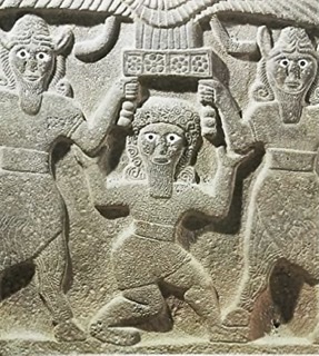