Day 3
As the night went on…and on, I was cursing the rain, not especially because it was making me cold and wet, I was already cold and totally saturated from walking hip-deep in the creek, but because it was not raining enough for me to get some oral benefit from it. I was hoping that a decent rainfall would lessen the effects of dehydration from which I was suffering, but the light, intermittent drizzle over most of the night barely succeeded in making my lips moist.
The swirling winds of the mountains delivered me the strangest of nights on the rocky heights. Every so often my nostrils would detect the inexplicable whiff of glue (quite strong at times), and this combined with the periodical sound of loud machinery in operation, made me believe there was an industrial plant or factory of some sort not far from the rocky outcrop that I had bedded down on. At times the source of the noise seemed to be very close indeed, as did the train, the sound of which I could also clearly distinguish to the north-east of me. These ‘revelations’ did lift my spirits and the prospect of at last escaping the wilderness trap I was in seemed almost tangible. I sensed I was very close to breaking out, although in my more lucid and realistic moments I tempered this optimism with the sobering reminder that noises at high elevation have a tendency to be carried considerable distances by the wind.
As time passed my mind, deprived of sleep, seemed to lapse into a kind of hallucinatory state. I started to rehearse in my head an almost quixotic scenario by which I would make good my escape. At the first sign of a lightening sky I would struggle up the remaining distance to the peak, crossing over it into ‘civilisation’ and secure my own deliverance by finding a workplace plant of some description (it didn’t have to be precisely that, the key element was that I would find people in some sort of roofed structure!). Obsessively through the rest of the night, I would replay this same, imagined sequence of events whereby I would dramatically emerge from the bush and burst in upon the surprised workers, telling them they have no idea how glad I was to see them, the first humans I have sighted in two days, etc, etc. Startled, they would view me as some sort of wondrous spectre bringing lustre and excitement to their deadly-dull, tedious night shift existences (such was the lyrical degree to which my mind was running wildly off the rails!). I would ask my would-be saviours for water and implore them to drive me back to Ross Crescent where my car was, so I could be on my merry way back to a world of modern indoor conveniences!
In hindsight, I can see that this was merely a fanciful, desperate construct of my mind concocted in hope to shore up my resolve to get the hell out of that accursed bush … to find a “get out of jail” to escape my miserable predicament. Or to view my line of thought from a different angle, this was therapy that I was “self-medicating”, psyching myself up to be in, and stay in, survivor mode … at one point I reminded myself that, unhelpfully, I had never ever watched a single episode of that over-publicised Survivor TV show. Drat! All the useless, mindless television I had watched over the years, and I hadn’t included something that would have been at least a little bit of practical use right now!
Even though this intoxicating ‘vision’ of mine was guileless and implausible to say the very least, it affirmed the extent to which I was determined to save myself (or be saved) by whatever means it took. Constantly running through a best result scenario in my head passed the time on this impossible-to-sleep night, as well as being a device to give myself hope, to keep my spirits up in the midst of such a trying experience. Looking at both Google Maps and Gregory’s later, I could not pinpoint the slightest sign of an industrial plant in the vicinity of where I had been, but there was a large man-made structure, possibly an electricity sub-station, in that proximity which I may have mistaken for a factory of some kind … though the mystery of the strong odour of glue remained just that, a mystery!
The part of my coccyx/tailbone which had impacted so dramatically with the stony ground the previous evening had by this time cooled down and I started feeling a discernible pain which came and went. It was a dull pain centred in the lower back, interspersed over the next 24 hours by occasional sharp stabbing pains … a series of momentary spasms in the middle of the back. Fortunately the pain was not severe enough at this time to hamper my mobility. With the light of day came the bitter, demoralising reality that I was not where I had thought I was, not anywhere near it in fact! The top of the mountain peak was still a long way off and a long way up, and between me and the top was a thick ground cover of undergrowth and high trees.
Disappointed, a feeling I was becoming accustomed to, I hastily revised my plans. I figured that I must have gone a long way past the old ladder and was probably on the mountainous range closer to the Warrimo side of the Florabella track. The only alternative to going up was to return to the creek in order to to retrace my steps to the ladder. Starting on my descent down I was keen to avoid those same sheer vertical cliff-faces which had been my unmaking the night before I had already decided to forgo any chance there might have been of recovering the lost hiking boot on the way down (it would have been the most remote of chances indeed). Heading east I steered a haphazard, zig-zagging course trying to skirt around the stony cliffs and gradually ease myself down a steep embankment to the bottom using the hill’s slender but resilient plant stems as hand brakes.
The dense hillside of course had no human-made path and I had to step my way through, over and past an assortment of fallen logs, bush palms, vines, briar patches and countless other native shrubs and trees. Eventually I found or fashioned a way down the steep hill half-running and half-sliding. Thus far, the blundering, accident-filled wilderness adventure I was experiencing had not sparked any inspired perspicacity on my part, let alone anything resembling an epiphany, but suddenly a fragment of bush survival wisdom flickered within me. I realised that the bush foliage everywhere was still wet from the previous night’s intermittent rain, from this I was to obtain a partial antidote to the dehydration that was overtaking me. Not an especially profound revelation but an immensely practical one in the circumstance!
From that point on, every bush or tree that I laboured past on the way down the hill, I would pause in front of it and shake it for all that it was worth. The spray from the leaves and foliage was eagerly received by my mouth. I had move quickly to get to as many trees as I could before the emerging morning sun dried their foliage. I ‘drank’ from dozens of bushes that I came to, and continued this practice when I reached the creek, supping on the wattles, musky-smelling ferns and other tree higher branches overhanging the creek as I made my way up it. In reality, the quantity of fresh water I absorbed through this method wouldn’t have come close to filling a 250ml bottle, but I think it was important (psychologically as well), maybe even vital, in securing for me some temporary respite from a state of being totally dehydrated.
Buoyed by the rainwater I kept to the creek for a good portion of the day, by now I was finding land progress very heavy going. My steps, two days since I had last eaten or drunk anything other than the small quantity of rainwater, were understandably more lethargic than when I started, plus there was the added, significant disadvantage of being reduced to 50% of my footwear! This in itself made it a very hard, laborious slog, both on land and in the creek. Whether on land or in the creek, clambering over obstacles had become a more arduous exercise with one boot only, especially as it was my left boot that was missing. I hadn’t realised prior to this situation that when climbing over boulders or rocks (or going up generally) I naturally and instinctively led or pushed off with my left leg (a habit I guess that comes from being left-handed?). With only a sock on my left leg I become instantly aware of this trait and how it was a handicap in the circumstances. Getting traction on wet or mossy rocks with a shoeless left foot was hard to do, so I had to kind of painstakingly teach myself there in the bush to lead with my (‘unnatural’) right leg … I found the discipline of this surprisingly difficult to master as instinctively I still wanted to start off each time on my left, the consequence of a lifetime habit of relying on it.
 Foot slogging it in the creek brought its own extra burdens courtesy of nature. Walking in the water seemed to attract more pestering insects to myself than when on land. Mosquitos and sandflies of course were ever present but the most persistent annoyances were the large, black bush blowflies. These irritants, which reminded me in appearance of Darth Vader in arthropod form, seemed to be imbued with a large dose of schadenfreude, as they noisily delighted in repeatedly latching on to my open cuts and scratches with blood-sucking precision. Fortunately these insects were slow to react to a counterblow and I managed to squash many a one against my arm or leg whilst trudging upstream.
In my increasingly dire bush predicament, with all the time in the world and nothing or no one to disturb me, I found myself mulling over the oddest notions. Considering my potentially disastrous situation, I marvelled to think that things such as social embarrassment loomed as in any way important to me right at that moment. But extraordinarily they did! As I walked and mused randomly I conjured up images and scenarios that I found distinctly unpalatable, such as the prospect of being identified on the Channel 7 News. I visualised a news item flashing up on the screen along the lines of “Lost bushwalker still not found in Blue Mountains, cold snap predicted for day seven of search”, things like that.
For years I had listened censoriously to reports on the nightly news about rescue trams searching for hopelessly ill prepared and equipped hikers lost in various national parks, and thought how totally inept and irresponsible were these tossers to put themselves in that position! Now the wheel had turned full circle and I reflected that could soon be my fate, nationally outed as the careless and grossly negligent doofus expending valuable resources on an avoidable rescue! Despite the reality of the imminent peril that I was facing, I had the weird presence of mind to push the central issue of my potential non-survival to the back of my mind and concentrate on the galling prospect of being the focus of widespread, social opprobrium. For some inexplicable reason, odd as it seems to me, this was more important at that moment than the very real threat to my life.
It occurred to me that I was hearing or sighting the helicopter above the gorge less frequently than the day before. It had crossed once in the morning relatively close to me, but despite my frantic attempts to attract its attention, in an instant it disappeared from view oblivious of my existence. A new potential news banner sprang into my head: “Emergency rescue services scale back search for missing Blue Mountains solo bushwalker, authorities indicate little chance …..”. My fertile mind turned to reactions of people to the news of my non-rescue, I wondered what people from work would say or whether for instance ex-girlfriends from 20-30 years ago would find out. I thought, they’d be sitting down in front of the nightly news with their families, see the story identifying me as being presumed dead and would say things like “Yes, I remember him! Well what do you know … he always did seem a bit impetuous!” My over-active mind was really giving it a nudge, as they say!
I don’t have a clue why this particular notion came into my head, but such were the bizarre thoughts I was entertaining after three days of exclusively sharing my own company. I can only surmise that maybe I was becoming a bit delirious. I started to speculate in a very left field fashion … rethinking the helicopter situation I reverted fleetingly to a view that they may still be looking for me. I wondered to myself: OK if they were scanning the whole Glenbrook Creek area, surely, I reasoned, they’d realise that I would come down to the creek at regular intervals? Therefore, I thought, why don’t they randomly drop 50 water bottles say all the way along the creek? They could even attach notes to the bottles saying they’re still searching for me! At least, if nothing else, that would solve the acute problem I had of no drinking water. Clearly, my mind was meandering in a wildly erratic way.
An hour or two later (I was watch-less as well so I couldn’t be sure of the time lapse) I started to recognise some of the landform features on the side of the creek (experience was to teach me that this was not a fail-safe approach as many natural features I thought distinctive, I later discovered were replicated elsewhere in the largely homogenous Glenbrook Creek bushscape). I moved closer to the line of trees on the highway side, passing a patch of massive wild, radiantly bright orange mushrooms, I noted a broad area of lanky reeds adjoining a long sandbank which reduced the stream to a trickle, this landform seemed faintly familiar.
Shortly, I spotted an opening in the bush, an area cleared of trees with an elevated mound, and I thought I could actually see the walking track on the ridge on the horizon. This seemed like the point I had gone off-track two days before, but what I couldn’t spot, which would clinch it for me, was the definitive marker, the old corroded white ladder. For this reason I decided to venture on for a bit to locate other markers which would corroborate the location. Unfortunately, the particular markers I had in mind (a log connecting the creek to the bank, a second sandbar with long, dense grasses, a darkly-discoloured rock formation), never came into view. So, I continued on, thinking that I had misjudged the distance between the various markers and the old ladder on day one.
Trudging on in silence up the creek I was reflecting on what had just transpired. Did I misread where I was, did I miss that one elusive window of opportunity for escape? The further I went in the opposite direction I became convinced that the answer was yes … or at least, probably. I was feeling extremely frustrated now. I reached another, vaguely familiar, landmark, which I couldn’t decide whether I had seen it on the first day or not turn back. Indecisive, I tossed up over what to do, concluding that I was now too far west I decided to turn around. Amazingly on the way back, despite looking intently, I couldn’t spot the clearing which I had located as being close to the old ladder. My sense of frustration heightened, I opted to abandon the ladder marker and push on eastwards. Yet again, throwing the dice, I resumed my quest to find those swimming holes, on which I had refocused all of my hopes for self-preservation.
Surely, if I could just locate those accursed pools, it would yield up a way out of the maze. I was annoyed with myself because I was heading east for the third occasion in three days, and for not finding the exit after all this time! I had now gone so long (and so far) without seeing any people, the valley appeared deserted and eerily quiet, bereft of all human existence. Contradicting this thought though was the plentiful evidence of human visitation, numerous bits of litter in the form of discarded soft drink bottles, ice cream and chocolate wrappers. So, the humans have been here, but not just any at the same time as me!
The slow upstream progress allowed me to muse on my mishap, my closely-run ‘escape’ of the night before. Falling from the rock-face was very scary and the outcome had been undoubtedly a very painful one but more worrying was the possibility of something being more serious amiss with me. But the unlimited amount of time I had to my disposal allowed me to mull over just how much more catastrophic the fall might have been. Out there alone in the bush without help, I could easily have pierced a lung or other organ on a rock, or fallen to my death by landing on my head, or by missing the narrow ledge and plunging to the bottom of the canyon – lots of possibilities for achieving mortality. I marvelled at my utter foolhardiness, what was I thinking!!! It was surely crazy, I thought, to have played that desperate card on the mountain, I must have been at that instant gripped by some overpowering instinctive urge to resolve my predicament right then. I guess that I had been in a sort of “crash through or crash” mindset.
The afternoon was hot, by submerging myself in the creek regularly as I travelled up it I managed to get some relief from the sun, refreshing me momentarily but sufficiently to carry on. Eventually I came to a large pool of water, not particularly clear in appearance but deep in parts. This pool was connected by a narrow isthmus of land and rocks to a second pool similar in nature to the first. I realised that this, finally, had to be the elusive, old swimming holes charted on the guidebook map. I looked around the pools and could see that there was a rough-hewn path coming down from the surrounding east-side hill, with a rotted-out old log forming an entry point into the water. This was, finally, the swimming holes, but from the state of them it was clear that they hadn’t been used for a very long time. I scouted round and discovered two potential paths leading away from the waterholes. One was quite steep, going up round a large, rocky hill, and the other followed the elevated bank on the edge of the creek. I tried tracking these routes, but it proved fruitless, as both seemed to lead nowhere, ending either with the path vanishing or coming to a halt at an insurmountable barrier of massive boulders which couldn’t be circumvented. I double-backed to the creek, concluding that if this was an access route to and from the Florabella track, it had long fallen into disuse, another black mark against the guidebook’s accuracy.
Back down in the creek, it was around 3 o’clock and very hot still. My aspirations to escape via this route had been snuffed out, what was I to do now? Going on, further up the creek, was a ‘unknowable unknown’, my map (whatever good it was given it’s dubious performance so far) did not in any case chart the area beyond the swimming holes, so I didn’t have any inkling of where Glenbrook Creek ended. I only knew what I had learned empirically over the preceding two days, that it stretched west for a long way. Backtracking (once again) seemed the only viable course. Yet once more I found myself putting all my faith in finding the old ladder. It was feeling increasingly like ‘Groundhog Day’ without Bill Murray (or any other human company for that matter!) From this point on as I cursed and struggled up the creek, I took every opportunity to metaphorically ‘kick’ myself over the lapse in judgement in not acting earlier in the afternoon when I spotted what I guessed was the trail from the creek bank.
I had by now given up on the helicopter as being my saviour, it wasn’t going to happen. That prospect had become more and more remote as the sightings become less frequent and further away each time. Dehydration was becoming a serious matter of concern for me again. My lips were parched and only cosmetically relieved for a brief time whenever I would cup the unpleasant-smelling creek water in my hands and brush it against my mouth. Even with this, I was aware that if I had to shout for help in the event of the sudden, miraculous appearance of some human sentient being, it was extremely unlikely that I would be able to muster anything more than the most inaudible squeak from my feeble voice.
I found myself adopting a curious stratagem to try to counter the reality of having nothing to drink and its testing physiological (and psychological) effect on me. I kind of psyched myself into this obsessive craving for either Pepsi or Coca-Cola, the inexplicable thing about this is that Coke is a beverage that I’d hardly ever drink or like much (ginger beer is my non-alcoholic drink of choice!)
Nonetheless the idea of it acted as a spur to drive me forwards when fatigue was having a debilitating and demoralising effect on my mind. Revisiting my musings on the mountain of the previous night I visualised a “walk to freedom” (to put it somewhat over-grandly), a sequential process, one step at a time. First, I envisaged myself finally making it to the old ladder, I didn’t ever contemplate the mechanics of how I would get myself, weary and worn, from the ground to the ridge above and then up a straight vertical incline of soft unstable mud and loose dirt to the ladder with nothing much to grab on to. I just knew that once I got there, I would do it – somehow! Willpower I guess.
I imagined myself on the Florabella track to freedom…ragged, filthy, exhausted, half-shoeless and thus doing a mono-shoe shuffle, I would somehow hobble my way back to Ross Crescent Blaxland, and my car. The last step to liberty would take me to the nearest servo. Then, the act of raising the glass of Pepsi or Coca-Cola to my lips heralded that I had returned to civilisation and all its creature comforts! I would indulge myself with the thought of the unbridled pleasure of the coke as it silkily went down my throat. I still can’t fathom why I chose coke of all beverages, alcoholic and non-alcoholic, as the symbol of my resolve to make it out of the bush.
My feet were starting to ache, my left foot in particular was feeling the effects of wear and tear sans footwear, and the nail on my big right toe had turned black and had commenced the process of separating from the toe. I don’t know exactly when or how this additional injury happened, perhaps when I stubbed it one too many of the countless, unseen rocks in the creek, either that or very possibly, it was damaged in the cliff fall when I clipped one or the two ridges on my rapid, spiral descent. After the disappointments of the day, I rallied my spirits and refocusing on the “magical elixir” of Pepsi Cola, I set myself the objective of reaching the old ladder by nightfall. But I didn’t properly reckon on the toll three days of lumbering and stumbling through fierce bush without food or water would take.
By around 5pm, wet and bone-weary, I again switched from the creek bed to the rugged terrain of the bank. I struggled on manfully for as long as I could, going forward where I could, sideways more often than not, around, under, over, through, all the while collecting new abrasions and incisions on my unprotected legs. Later on I paused long enough to do a count of the cuts on my hands (not even bothering to start on my legs!), I stopped when I got to 68 on the top and palm of my left hand and 51 on my right hand. My arms and legs bore witness to the fact that I had come a distant second in taking on a hostile physical environment. And it was not getting any easier after three days, ominously quite to the contrary.
By about quarter past six I was fed up with walking on such a difficult course, and easily succumbed to the fatigue of my tribulations. I simply couldn’t go after further … I stopped and searched out a favourable strip of sand to recover my energies during the night. I flopped down and lay on the cool evening sand, drenched and listless, in need of urgent sleep but unable to sleep in these harsh al fresco surrounds. Exposed like this on the ground, my position felt vulnerable and helpless against any unknown and unseeable threats that may be out there, but I was too drained to do anything about it. I submissively curled up in the cold in an essentially futile attempt to keep warm, all the time listening intently for sounds that may signal some new menace, this hadn’t concerned me before but now, exposed in the open, it had come into my head.
Reflecting on the events of the day, I was all too cognisant of an emerging pattern after three days: on each of the three evenings, after a hard, all-day slog in the bush, I was forced to call a halt to my trek earlier than on the one preceding it! It was becoming clear that understandably the cumulative effects of total exhaustion and lack of nourishment were starting to catch up with me.
As I lay on the cold sand, capable of no more than simulating sleep for the duration of another agonisingly long night in the open, many thoughts rushed through my head. Disparate as some of these were, they all came back to a common theme, I was exhorting myself to stay resolved. Whatever I did the next day, which way I went, which choices I made, this time I had to make them count, I knew that my chances of saving myself or being saved as each day passed, were diminishing rapidly.
 ⏏️ Corporation engineer Robert Bruce (Source: Scottish field) ⨳
 ⏏️ Central Train station, Glasgow (Photo: Network Rail)
  ⏏️ The Planning Committee’s eight-minute film ‘Glasgow Today and Tomorrow’ (1949) was its sales pitch for Bruce’s vision of “New Glasgow”. The rigid functionality and conformity of the estate in this model illustrates why the Bruce Plan was likened to a communist Eastern Bloc city (Screenshot from film, ‘Scotland on Screen’).
  ⏏️ Moss Heights (Source: UK Housing Wiki – Fandom)
 ⏏️ Moss Heights (Source: UK Housing Wiki – Fandom)


 Griffin’s Guy House (Source: Walter Burley Griffin Society) . . .


 Incoherent or indecipherable words in a song can be the source of “great storms in a teacup”. The Kingsmen’s 1963 recording of “Louie Louie”—incomprehensibly vocalised by Jack Ely—prompted an avalanche of complaints from outraged parents of teenagers about a supposed litany of obscene and pornographic lyrics in the single. Knee-jerk misinterpretations abounded from the morally-incensed in mid-century Middle America. One irate father even wrote to US attorney general Bobby Kennedy moaning about the lyrics’ “moral degradation” leading bizarrely to the FBI investigating the song (while wasting public funds the Bureau failed to unearth any such obscenities)! All of which lends credence to the axiom that “people will hear what they want to hear” – which goes to the very heart of Mondegreens※.


 🌋 Charles Blomfield’s painting of the volcanic occurrence
  Blomfield’s painting of Te Tarata


 (Source:


 Despite the pressingly urgent need to canvas expert international input into the dire health catastrophe, China must have had some reservations about what it was doing. Both Russia and Japan with undisguised Manchurian ambitions already held firm footholds in N.E. China (control over railway lines, ports, territorial concessions, etc), plus other Western powers controlled Chinese treaty ports further south. But with no politicians taking part in the conference and all attendees pledging that it’s focus was to be on scientific investigation and not about imposing any further external controls on China, the central government pushed on with it [‘In 1911, another epidemic swept through China. That time, the world came together’, (Paul French), CNN, 19-Apr-2020, www.cnn.com].


 Given the sheer impossibility of compelling all citizens to maintain social distances in public (considering the scale of the enterprise and the limitations of the enforcement agencies), it will probably come down to the will and commitment of governments and bureaucracies to enforce these rules. The stick is already out…the NSW police minister has announced that individuals breaching the social distancing guidelines will be instantly fined $1,000 or even jailed (this second option however is highly implausible in the present health climate which sees the country’s prisons under fire for crowding too many inmates in together!) (‘Breaking social distancing rules will lead to on-the-spot fines of $1,000’, ABC News, 25-Mar-2020,

 Mulholland in the valley (Photo: LA Times)
 Mulholland (pointing), with members of his syndicate (Photo credit:
  Cottonwood Creek diversion conduct and Owens Lake in background (
 Route of the LA aqueduct (Image:
 Detectives investigating the scene (Photo: LA Times)
 Mono Basin, Cal.
 Norway, Sweden and Denmark (
 Norway’s proximity to Sweden was another factor in Germany’s focus on the Scandinavian country, arguably the main consideration in Hitler’s and the Nazis’ calculations. Buried in the north of Sweden—mainly at the Kiruna and Gällivare mines—were vast quantity of high-grade iron-ore. In 1939 Germany imported ten million tons of the mineral from Sweden, all but one million of it from these mines [‘The Nazi Invasion of Norway – Hitler Tests the West’, (Andrew Knighton), War History Online, 01-Oct-2018,
  Kiruna mine 🔼
 In April 1940 Germany, concerned that Britain was trying to engineer Norway into the war, implemented Operation Weserübung, invading both Denmark and Norway at the same time. Neighbouring Denmark for Germany was a staging post and base for its Norway operations. Denmark capitulated virtually immediately but Norway, with some limited and not very effective help from the British, French and Polish, held out against the massively superior might of the Nazi Heer, Kriegsmarine and Luftwaffe for over two months.
 Hitler had another, ideological motive for extending the scope of his Third Reich empire to Norway. The Nazi Führer was an ardent admirer of Viking and Norse culture. Nazi ideology rested on a belief in so-called “Aryan superiority” which elevated Nordic people such as the Norwegians. This ideology was reflected in SS recruitment posters circulated in Norway (and Denmark) during the German occupation…propaganda aimed at an historic appeal to Norwegian manhood, conflating of the Wehrmacht soldier spirit with the valour and exploits of Viking warrior culture [‘Vikings: Warriors of No Nation’, (Eleanor Barraclough, History Today, 68(4), April 2019,
  The Nazis’ program of Lebensborn –intended to create “racially pure” offspring was practiced in Norway, resulting in somewhere between ten and twelve thousand babies being born to Norwegian mothers and German father
 🔼 (L) Quisling, (2nd from L) Himmler, (3rd from L) Terboven
  The Nazis used ancient Viking rune symbols on their uniforms and flags, like the SS’s sig rune insignia (above)
 The ongoing fight to contain the outbreak of COVID-19, the Coranavirus—now entering a new stage of transforming itself into a global epidemic—gives rise to recollection of another virus that swept the world just over one hundred years ago, the so-called Spanish Flu


 2nd wave curve in the US, 1918: note the different mortality peaks during Oct-Dec 1918 for St Louis (imposed a stringent lockdown) vs Philadelphia (much less restrictive approach)

 Business-savvy Harvey sensed there was a gap in the market and in 1876 he clinched a deal with the Atchison, Topeka and Santa Fe Railroad (AT&SF)


 (Photo:


 RAF ‘wanted’ poster (source:
 What most struck the editor about the phenomenon was that “the Weathermen appear(ed) to be largely drawn from the highly intelligent and well-educated strata…well-to-do, academic backgrounds”, something Pears opined to be “sinister and ominous” (a hint toward class betrayal perhaps?). The entry goes on to explore a classic conspiracy theory, the “fantastic speculation, widely held in America” that “the Weathermen are in reality financed and backed by the country’s extreme right—as a means of discrediting in the public eye the slow but steady move toward socialism that seems to be developing there”(?!?). The Pears writer adds a coy reference to one of the leaders of the group (unnamed), “an attractive and dynamic woman university lecturer (who in 1970) was placed on the FBI’s notorious ‘most wanted criminals’ list”
 1970 was the year that domestic terrorism embarked on a rapid upward trajectory in the US. The catalyst for the Weathermen adopting a more extreme line was Nixon’s escalation of the Vietnam War into Laos and Cambodia and the Kent State student murders. The fringe policos went underground and turned ‘outlaws’. “Declaring war on the United States”

 🔺 The character “Mark Slackmeyer” in Garry Trudeau’s ‘Doonesbury’ comic is based on Weatherman Mark Rudd


 A symbol of one’s class


 My appetite whetted, I wanted to delve a bit more of the enigma and mystery of the “Hermit Kingdom”, so long cloaked in authoritarian secrecy to the outside world. A subsequent boat trip up the Yalu left me little more enlightened about what life looked like across the border. Although our hire vessel got pretty close at times to the North Korean mainland, there was a bland homogeneity to what I could see…miles and miles of attractive but uninhabited hills and meadows, pockets of farmed land, the odd isolated building, a few roads, the occasional vehicle, but hardly a human to be sighted!❈
 Touring Changbai County
 The Changbai border towns on the Chinese side are quite remote and relatively lightly populated (most of the internal tourists skip straight past them and make for the much vaunted mountains themselves). All along the Yalu river border between the two countries, there were no Korean border posts or guards in sight. The river itself was the only buffer (no barbed wire fences like I saw north of Dandong). It occurred to me that this un-patrolled, quite narrow and innocuous-looking waterway would not pose much of a challenge to any impoverished North Korean determined enough to escape to the Chinese side in pursuit of a better and more prosperous life. It wasn’t hard for me to imagine Korean refugees clandestinely slipping across the river border and being absorbed into a community with which it already had cultural and linguistic affinities.
 Having hired a Baishan taxi for the day, we visited several of these border villages on route S303. Here I got a chance to see just much Korean culture had permeated the border and river into China. At one point on the river near Maluguo Town, we stopped at a spot where some peasant farmers had laid out their bright harvest of red peppers on the wall to dry (and to sell). This was part of a little trading post peddling various little North Korean trinkets and knicknaks.
 The Korean changgu, integrated into Changbai County public sculpture and municipal utilities ▼▲
 Korean influences on Changbai County

 Continuing on for a few hundred yards we stopped at Guoyuan Village, a tourist an attraction in border country which houses a model Korean village. The village consists of some basic Korean log timber dwellings, a backyard produce garden and a well. The adjoining Korean-style gardens contains a pleasant stream with an agricultural water-wheel with a scattering of sculptures. We stayed here about an hour, wandering the gardens and taking photos. Curiously the place was deserted, we were the only visitors here, no staff around either (though there was a Korean restaurant at the front of the village). Suffice it to say it was a very peaceful and serene setting and a very pleasant diversion.
 Heroic scenes from Chinese history ▲
 Spying on the North Koreans? ▲
 Imitation Great Wall and scenic North Korean peak ▲
 A pagoda-roofed border site for scenic views of the DPRK▼
 The canyon boardwalk takes about 40 to 50 minutes to complete, depending on how fast you want to go, how many times you want to stop and injest the atmosphere and the scenic views, take photos, etc.
 The canyon cuts its way through a dense forest of ancient arboreal specimens. The raised boardwalk allows spectacular views down the 100-metre deep canyon to the river. The walk includes a couple of Indiana Jones-style swaying bridges (not quite as ‘hairy’ a crossing as in the “Lost Raiders” movie). The highlight of the canyon for me was the multitude of intriguing and unusual rock formations to be seen.


 The next day we made for the town tourist centre to buy tickets to Changbaishanxi or Changbai Mountain West⍟. Our overriding objective was to see the famous Changbai Tianchi – the much touted “Heavenly Lake”. When our bus got to the car park at the foot of the Tianchi mountains we were aware from the vast crowds and lines that greeted us, that it was everybody’s overriding objective.
 We had already caught glimpses of the glistering white, snow-like peaks as the bus chugged up the winding road to the tourism site. After availing ourselves of the toilets near the car park (there being no public amenities at the top of the mountain barring a single souvenir stall), we joined the thronging lines of people embarking on the climb.
 From the bottom looking up, there are two walkways, on the left the down staircase and on the right the wooden up staircase. Unfortunately, for walkers going up the right-side steps, some people coming down were blissfully unaware of or simply ignored the clearly posted signs about keeping right on the way down. As a result, walkers going up regularly have to dodge and weave their way round non-conformist walkers on the wrong side. Annoying!
 What was already a challenging walk up the mountain, was made more difficult by the heat of the day. Especially so for me…because of the anticipated cold of the mountains I had worn Long Johns under my jeans. This made the climb up for me very heavy-going indeed. The ascent to Heavenly Lake in high summer is not “a piece of cake”…but of course you can always stop at any point, take a breather and admire the unrelentingly beautiful vista.
 A further off-putting element for a first-time climber at Changbai West is the deceptiveness of the slope. Rather than one (very) long, single “Stairway to Heaven”, the section of stairs you were struggling up would end, only to be continued by a new section. On the ascent, as we paused to take deep gulps of air, we found it difficult to gauge exactly where the top was! It was like the mountain peak was teasing us…just when we were beginning to feel relief having sighted (finally) what we thought was the summit, it would be taken away from us by the appearance of another (and another) extension of the seemingly never-ending stairway.
 The one redeeming feature of this long arduous climb is that the steps are marked at five-metre intervals, so as you breathlessly drag yourself onward and upward, at least you know how far you’ve gone. But we didn’t check on the vertical distance before we embarked on the challenge of the Tianchi stairs. So this proved only of limited comfort to us seeing we had no idea how far there was still to go!
 When we ultimately made it to the summit there was genuine relief to be felt. As well, there’s a congratulatory sign at the top to verify the achievement: SUMMIT! GREAT JOB! it proclaims. The sign informs walkers that they’ve reached a elevation point some 2,470 metres above sea-level, numerical confirmation of how high they’ve climbed.
 For those who can’t physically manage the walk or just don’t feel like doing the ‘hard yakka”, there is the option of ascent by sedan. You can be ferried up the mountain’s infinite number of steps by a brace of hired carriers. You may even experience the momentary pleasure of imagining, just fleetingly, that you are like some distant China emperor! I did however spare a sympathetic thought for a couple of the sedan carriers I passed. There they were about two-thirds of the way up, two fairly slenderly built guys, slumped over, sprawled on the steps, the effort of transporting their rotund and corpulently-proportioned client in this stifling heat was just too much for the poor fellows.
 At the summit there’s a large rectangular-shaped wooden viewing platform to gaze out on the Heavenly Lake. Almost all of the ballast was on one side of the platform, everyone with a camera or a mobile phone was jockeying for the optimal position on the the lake side to take photos and selfies from.
 The utter serenity and stillness of the idyllic landscape, of this gem of nature, contrasted with the jostling and chattering of the human visitors. But it was undeniably a sight worth the trek up the mountain. Seeing Tianchi, with its pristine blue waters at the very top of such a vast mountain peak, was proof that the tag “Heavenly Lake” was not hyperbole. This picture-perfect strato-volcanic crater lake must be one of the most photographed rural lake settings in the world.
 The return walk down was much less taxing on the legs than going up, a leisurely saunter requiring relatively little effort by comparison, notwithstanding the cautionary sign at the start of the downward stairway: “Many Steps / Take Care / Please Go Slowly”.

 What is today a museum was the former home of a family of prominent Dongbei warlords in the first half of the 20th century – the Zhangs, a brace of Zhangs, father and son. During China’s turbulent “warlord era” following the overthrow of the Qing Dynasty, Generalissimo Zhang Zuolin established a power base in the Northeast region. This was his home and after he was assassinated in 1928, his son Zhang Xueliang assumed the mantle as Dongbei warlord and Chinese strongman.
 The mansion-cum-museum’s layout comprises several separate building connected by a series of courtyards. While not as lavish or large an affair as the “Puppet Emperor” Pu Yi’s palace-museum in Changchun, the Marshal Mansion exudes a powerful sense of the power players in control of Chinese’s destiny before the ascent to power of the communist rulers.
 The key architecturally piece, the standout of the museum is the mansion itself. The building is Neo-Gothic in style, not mega-large but substantially large. The curious thing was that in front of the facade was what looked like a random dump of very large rocks, collected together in a large pile. I thought it an odd juxtaposition but I realise it wasn’t merely happenstance and doubtlessly it held some deep cultural and perhaps even religious significance※.
 The other buildings represent a hotch-potch of different architectural styles, ranging from traditional Siheyuan buildings to South China pavilions to habitable structures blending Western and Chinese styles.
 The interior displays have a predictably martial theme (befitting the military power-players the Zhang were) and there’s a section devoted to Zueliang’s exile and migration to Hawaii after his fall from grace – with lots of pictures and material.
 One of the rooms contains an inventive and spectacular war mural which is part painting and part sculpture, depicting a full-on visualised battle scene which is graphically very effective.
 Two of the outdoor exhibits which caught my eye were of a transportation kind. The museum held two of the Zhangs’ vehicles: the Zhang family sedan (a horse-drawn carriage) and a motor truck, the sign for which makes the claim to be if not China’s earliest automobile (I doubted this!), at least one of the very earliest automobiles in the country.
 ⇡Marshal Zhang’s accountant
 Like the nearby Imperial Palace, Marshal Zhang Museum makes much use of waxworks type mannequins to enhance the “historic atmosphere”. So we find different buildings ‘peopled’ by life-size dummies – the warlord’s administrators (accountants and such), his military staff and other functionaries of the mansion✦.
 Next door to the Zhang museum❂ is another tiny (micro-) museum – the Shen Yang Financial Museum. Our tickets got us into this museum as well so I wasn’t sure if there was some formal nexus between the two museums.
 Entry to the Marshal Zhang Mansion Museum (as of September 2019) is ¥60 adult and ¥30 concession (same fee structure as for the Mukden Palace).


 Although Shenyang’s fame resides with the only other Chinese imperial palace outside of Beijing, the old city of Shenhe has other attractions in the neighbourhood worthy of a diversion away from the palace and Shenyang Street. I have already touched on Marshal Zhang Mansion (and museum) and Chaoyang Jie (the subject of separate blog pieces).
 But if you want to explore other places in Shenhe District (Shênhé Qū) celebrating Chinese history and culture, you could start just across the road from Gù Gōng. I happened upon this fairly new monument site to China’s past set in a wide plaza running from Shenyang Jie to Shengjian Lú. The monument, typically Chinese in design, comprises a busy ‘canvas’ of numerous bronze relief sculptures crammed together and mounted on to two long walls which face each other. The monument’s subject matter represents various threads drawn from China’s long and turbulent history of empire and war (no thematic shortage of martial figures on horseback with weapons) .


 Another interesting digression can be had by following Shenyang Jie south for several blocks. There are are some splendid examples of modern buildings borrowing from the traditional styles of Chinese architecture. Eventually you will arrive at a rather magnificent Chinese arch at a major intersection in the road. A pagoda-style structure – dwarfed by comparison – sits atop the massively proportioned arch (this human-made icon is best viewed at night when luminously lit up)

 If you’ve been to Beijing and trekked the city’s tourist trail, you will inevitably see, et al, the Forbidden City (Zǐjìnchéng) 顾功. If you subsequently also find yourself as a visitor in the principal city of Liaoning province, Shenyang, you’re almost equally inevitably going to include the Northeast version of Beijing’s imperial gem on your “to see” list.
 For some, seeing the provincial version of the Forbidden Palace with the image of the monumental original in mind, might prove somewhat of a letdown. Shenyang Imperial Palace (Gù Gōng) 顾功
 Note: The cost of a ticket to enter the Shenyang Imperial Palace and Museum is set at parity with the nearby Marshal Zhang Mansion (60 CN¥ for adults).
 Gù Gōng was built in the 1630s under the directions of
  The architecture of Gù Gōng is interesting in itself. Stylistically, Gù Gōng is a blend of different building styles. The many buildings and structures comprise an architectural amalgam – among these, Han, Manchu, Mongolian and Tibetan styles can be readily discerned within the palace’s four walls.
 The museum component of Gù Gōng includes a raft of Qing imperial art treasures. Among the items on display, direct from the Qing emperor’s pantry are many peerless examples delicate and beautifully glassware, together with enamel vases and gourds, ivory utensils. Not to forget the other such irreplaceable knickknacks from the erstwhile royal household.
  Apart from visiting the palaces’s artworks and artefacts and it’s pavilions, another thing you can do at Gù Gōng, if you really want to get into the decadent spirit and sense of privilege of the Qing lifestyle, is costume hire! For not too many shekels


 Shenyang lu
 Our ultimate day in Harbin, what to do? My own leaning, on surveying the options, nudged me towards a trip to Unit 731 (AKA Detachment 731), a museum established in a multi-building complex which was used by the Japanese military and scientists to carry out heinous biological experiments on the local population during the Thirties and Forties. My travelling companion’s inclination however was for spending a less sombre and more genteel day at Tai Yang Dao (Sun Island). In the end what swayed it for Sun Island was proximity, it being a short boat distance from Central (Z.Y.) Street, compared to Unit 731 which was located in the city’s back blocks, requiring a long train trip from the centre.
 We decided crossing the river by boat would be the optimal way to get to Sun Island. The other but considerably more expensive way to get to Sun Island is by cable car, which certainly provides a bird’s-eye level vantage point during the crossing (you can also get there circuitously by taxi, crossing a series of bridges). There is no charge to visit Sun Island but access to amusements, rides, activities, etc attract a charge.
 The water transport to Sun Island departs from the wharves at Sidalin Park
 As the ageing journeyman ferry chugs across the water we take videos of the approaching island and the cable cars being pulled back and forth. I remind myself that in just a few months time this trip won’t be possible…the clear aqua-turquoise surface of the river will become solid frozen with the onset of Harbin’s winter. Amusingly, we pass a line of swimmers in single file. These, older men mainly, are slowly swimming, or more accurately half swimming, half dog-paddling, their way from an island to the mainland. Each of them is carrying a rucksack of belongings attached to them by rope like an umbilical cord
 As the boat approaches the island wharf, one or two landmarks catch the eye from the river. The first, from a distance looks like a light-hearted sculpture of a very large white swan or is it a goose? When we got to the wharf we realised it wasn’t a pop culture artwork, but the comical masthead on a pleasure vessel for visitors (and especially children) to ride on.
 The second, much more visible landmark getting the attention of the boat passengers looks like a historic European castle rising up out the treetops, something you might find on the Danube – in Budapest for instance. Once ashore, on closer inspection, it’s historical pedigree is found wanting. It is of more origin and seems to be inspired by the logo figurehead castle you see at Disneyland! The ‘castle’ turns out to be the central administrative and amenities building for the island’s commercial operations.
  Getting around the island by foot is possible but it covers a large expanse of land and the attractions are quite spread out. So from the wharf we decided to use the “people mover” or the mini-bus to get-about (¥20 each). This made logistical sense but our experience was that it proved a very poor service provider. I was expecting it to operate as a flexible “hop-on, hop-off” arrangement (a lá the Big Red Bus in capital cities globally), but we were not able to hail down one of the many vehicles continually circling the park (every though we had purchased tickets). Each time we tried the bus driver refused to stop for us even when the vehicle was virtually empty (great PR Sun Island!). Apparently our ticket permitted us to use certain passenger service vehicles only (not explained at point of sale).
  That said, the island park did not lack for attractions and points of interest. The various, quaint bridges around the ponds makes for nice “eye-candy”. A Russian-style village garden added to the theme park feel of Sun Island. The section containing the waterfalls and accompanying rock caves were a real highlight for photography mani
 Many of the island fixtures are well worth a close-up inspection. The mega-scale, modernist monument (a combination of white ovals and arches) near the Greenway is an interesting feature in itself. Another white structure with two storey viewing towers of the water is similar appealing in its design. I was also taken by the supersized “organic sculpture” that we stumbled upon. This creation was another popular point for visitors to mill round and snap endless selfies. The mainly green and red bird (of paradise?)◙ is entirely a floral construction in the familiar style of Jeff Koons (the gigantic floral puppy that once graced Sydney’s Circular Quay, now in Bilbao, Spain).
  And if nature encounters with fauna are your bag, then Sun Island will not disappoint. You can visit a section of the park with fenced off animals of the more gentle kind like deer and caribou. Here for a fee you can pat and feed members of the Cervidae family inside an enclosure. I noticed that with the deer, familiarity brings a singular expectation on their part. Far from being reticent and shy, the creatures can sniff out a food-toting human from 60 feet.
 But the one member of the animal kingdom that seems most at home on Tai Yang Dao are small rodents from the Sciuridae clan. The island abounds with the common acorn-addicted squirrel, plentiful on the ground and in the trees. So numerous they are, they have been designated their own section, “Squirrel Lake”, but you don’t need to go here to find them, they inhabit the entire wooded area of Sun Island. While walking around the island, at the back of the Russian model gardens, I spotted a ginger cat in hot pursuit of a squirrel, desperately but hopelessly trying to diminish the fleet-footed Sciuridae population by one.
 From Harbin’s tourism centro, Zhongyang Jie, you can find your way to Zhaolin Park by heading north one block. This succulently lush green park with its verdant plant life is a great place to retreat to, getting away from all the people, all the hustle and bustle of Zhongyang Street. And it’s very reachable via a short walk down Shangyou Street from Z.Y. Street.
  Zhaolin Park, attractively set on a large block of public land (more than 8 hectares), is roomy yet it is also compact…it fits quite a lot of things into its space while still allowing you the freedom to roam around. What defines the essence of the park is the canal that snakes it’s way through the park and gardens. It is the thread that connects the various parts of green Zhaolin. By walking in concentric circles around the park you can acquaint yourself with the various quaint and charming bridges which cross the canal at different points.
 Zhaolin Park is well resourced, little wonder then that families tend to flock there. It especially caters for the juvenile visitor. Exotic birds in large cages in one part. Several different amusements for children are contained within the park perimeter, plenty of gentle rides for the younger child. For the family as a whole, the most popular element are the paddle boats. You can hire a colourful boat and paddle a course up and down the canal.
 Being on the lookout for traces of the Russian presence that once pervaded Harbin, I particularly noticed the old entrance gates and buildings on my way in and out (in Senlin and in Shangzhi streets). The structures project a distinctly Russian dome character in the design. It is refreshingly and perhap surprising to report that Zhaolin Park is adequately equipped with toilets, but if I had one quibble it is the same one I have with most many public parks. Given the constant and steady stream of visitors Zhaolin receives, it could do with a lot more seats for the punters distributed right across the park.


 Zhongyang
 The commercial hub of the street comprises restaurants, eateries, souvenir shops and hotels. The further you go down the street towards the river, the grander the buildings become. This is where many of the city centre’s older and grander Russian buildings are, including several palatial structures in the Baroque style (alas, some of these grand old mega-buildings have suffered the ignominy of being sub-divided to accommodate KFC and other fast food operators).
 Although Z.Y’s Russianness can be glimpsed everywhere. Place names, shop and restaurant names for the most part are present in both Russian and Chinese. But the Russian imprint on Zhongyang is more profound than this. At many of the street’s corners you can see the Russian architectural influences in the onion domes, minarets and spires sitting atop many buildings.
 With Zhongyang’s cornucopia of niteries and gift shops, the street flows with people ever-so slowly ambling up and down the old cobblestone pavements. They are present from first thing in the morning through to and beyond nightfall. But it is at night that Z.Y. Street really comes alive. The street is a thriving heartbeat, and the night beat is a musical one! The melodic sounds of old-fashioned small bands and trios can be heard all along the central thoroughfare. This recurring feature gives Harbin its nickname of Music City (although Harbinites tend to render it in English as ‘Muisic’ City). The musical highlight for me was a solo guitarist playing with great gusto from an upstairs Z.Y. balcony. This ‘muso’ who wasn’t Chinese (possibly he was Russian) was really going off, strutting his stuff for the gathering of visitors below with Jimi Hendrix-like zeal and vigour!


 Heading westerly up Z.Y. towards the river you will come to a heavy traffic cross-street. The town planners’ solution to this impediment to pedestrian progress was to build an underground pathway which allows those on foot to by-pass the dense vehicular traffic overhead. Known as the “Pedestrian Tunnel under Zhongyang Street”, the tunnel has the additional function of being a secure space for the city’s youth to congregate. Here, the local kids hang-out, skate-board or play ti jianzi (the popular game of foot shuttlecock that many Chinese especially in Beijing are obsessed with). A couple of passageways funnelling off from the tunnel lead to a small U-shaped shopping arcade which caters mainly for tourists.


 If ever you find yourself in Harbin, China, and can manage to tear yourself away from the great northern city’s tourist Mecca Zhongyang Pedestrian Street (aka Central Street), you should head northeast in the direction of the old town district. Our destination, Lao Daowai (literally “Outside the old road”) on the occasion we visited Harbin, was a sprawling area on the northeastern side of Harbin, although its hard to pin down exactly where the district begins (at least it is for a Wàiguó rén passing through).


 With the use of language aids or without them, exploring the physical structures of the former Manchukuo (Manchu State) Imperial Palace provides a fascinating insight into a dark chapter of official life in Dongbei under the Japanese military occupation of the 1930s and 1940s.

 One of the most interesting and sought-out items in the museum’s exhibits is the personal vehicle which belonged to Pu-Yi, a 5.7m long black car✪ housed in its own (garage) section of the complex. The “king-sized” vehicle is quite a rare old 1930s auto, a famous “Bubble Car” – American made by the Park Automobile Co. There’s a little souvenir annex attached to the ‘garage’ for car enthusiasts to secure a momento.
 The palace contains a lot of Pu-Yi paraphernalia and minutiae, personal items like his traditional ceremonial garb, his official uniforms, his BP device and his trademark circular spectacles. Wall photos and information extracts chart the last Chinese monarch’s story from the imperial palace to incarceration to rehabilitation and life as an ordinary private citizen.
 The outside feature of the palace that most captured my imagination though was below it: an air-raid shelter. The increasingly paranoid puppet monarch (no doubt alarmed by the fading fortunes of Japan in the world war) had his own underground bunker constructed. The rooms in the bunkers were grimly threadbare, starkly contrasting with the lavish living quarters of the palace above.
 Elsewhere there apparently used to be a tennis court and a small golf course on the grounds. To leave the palace you need to go through an inner gate which looks like the exit, but it’s not, the actual exit going from the palace to the street is further down a hill. As you walk, to your right look for the palace’s horse racetrack (still operating, there was show-jumping happening while we visited). The entire perimeter of the palace is surrounded by high concrete and brick walls.


 When we lobbed through the doors of a provincial Chinese hot springs hotel which bore the name “The Milky War”, I did momentarily think of the famous 1980s song by The Church. Once inside, any association with inter-galactic imagery quickly vanished. The Milky Way Hot Springs Hotel in Changchun turned out to be an empty metaphor, the hotel’s interior didn’t correspond to anything remotely resembling the stars of any Solar System I’ve seen✥.
  In one sense though I found the “Milky Way” was actually “out of this world”. It was nothing like any other hotel I had encountered before. The reception area was very opulent, very large, lots of gratuitous items of an aspiring luxurious lifestyle.
  But we didn’t get a chance to absorb the Milky Way extravagance because we were whisked through to a changing area where our shoes were ‘confiscated’ and replaced by flip-flops (a variation on the usual practice in China of leaving your shoes at the front door). We were instructed to divest ourselves of our street clothes (which were bagged and deposited somewhere), and given gender colour-coded pyjamas to wear inside at all times. My “Corporate Vasco de Gamas” were a greeny-yellow colour with a circular pattern (all male guests wore the identical outfit), while my partner (and all of her sex) were decked out in a matching pink number with the same pattern. Already I was feeling like I was at an institution more so than in a resort. We were also issued with a plastic wristband (also colour-coded naturally!) with an activation device which we were to use to gain entry to the “mess hall”, to open our assigned lockers in the change rooms and to redeem our shoes.


 From near Changchun’s central train station we waved down a cab to take us to the site of the city ‘s cinematic claim to cultural eminence in China, the Jilin province city’s pioneering film studios. Although it looked fairly close on Google Maps it took an eternity to get to the former movie site of CFS, Changchun Film Studios. Road distance in China is measured in the conventional way by metric length, but also by the number of motor vehicles they’re are between point A (where you are) and point B (where you want to go).
 The setting for the film studios is an impressive one. From the street front you enter a big green park and walk up a grand, sweeping drive. At the top of the drive is the film studio complex, but before you reach the studio entrance, you have to contend with Mao Tse-tung. There he is, “the Chairman” standing erect, as he was in life, larger than the life of any one Chinese person. A gigantic, white statue of Mao, waving benignly at every human figure passing within the shadow of his massive, seemingly immovable image※.
 It was quite late in the day by now but we were still keen after travelling that far, to see inside the CFS Factory/Museum. The callow youth on the turnstiles gate had other ideas…he point-blank refused us entry because it was after 4 o’clock, less than an hour till the museum closed. Unable to dissuade him, we went away disgruntled but decided to explore the outside parts of the site anyway.
 This bore unexpected fruit as we discovered a nice little courtyard adjacent to the factory with an overt military touch (statues of heroic patriotic types and other martial figures, battle-green painted artillery guns, etc). The factory’s military theme is continued in the forecourt which exhibits a fighter plane of 1950s vintage.
 Before leaving altogether we chanced a quick look-through of the CFS gift shop which was still open. This proved a fortuitous diversion on our part…while unenthusiastically perusing the shop’s uninspiring assortment of predictable souvenirs on the shelves we noticed a side door ajar which we took advantage of by slipping through it and into the exhibits area. Thus, through a combination of arse-lucky opportunism and devious initiative we did gain entry to the factory after all and for gratis!
  The public CFS Studios display comprised a long, darkly-lit corridor which threw the lighted exhibits down one side into relief. These exhibits were a miscellany of items reflecting the film company’s past productions, the result undoubtedly of a raid on the props department and the costume wardrobes (old military weapons, uniforms and paraphernalia), old style 35mm film cameras and sound recording machines, etc.
 The military theme of the factory exhibition was further underscored in the choice of film posters to display…war movies galore! The impression that CFS’ most popular movie genre was war was hard to ignore on this evidence.
 Peaking inside a few of the rooms running off the main corridor revealed that the complex was still a hub for contemporary film-making. Production tech staff could be seen working on documentary and TV projects using modern technical equipment (not the antique stuff in the corridor).
 Another room off the corridor held a small viewing theatre…surprisingly to me the projector was running a 1930s British B & W film starring Larry Olivier (not dubbed into Chinese and no one watching!). Elsewhere in the room there were pictures and bios of Chinese film-makers, dubbers and other behind-the-camera personnel who had made a contribution at CFS Films during its halcyon days.
 The props displayed were for the most part interesting and authentic-looking (authentically old too!), but I did find the stuffed tiger mounted and encased in glass right at the end of the passageway rather incongruous and something that didn’t add to the CFS collection.
 Changchun Film Studio Group Corporation (
 Very many cities in China have a Zhongshan Park 中山公园 (perhaps the most famous is Beijing’s Zhongshan Park near the Forbidden City). In honour of the Chinese Republic’s first president, Sun-Yat-sen, it became a standard practice to name public parks after the revered Dr Sun, who within China is better known by the name Sun Zhongshan.
  Dalian’s Zhongshan Park is certainly one of the most chilled-out and slow-paced of the parks named in celebration of “the Father of Modern China”. Entrance to the park is from Huanghe Lu, one of Dalian’s busiest, traffic-heavy roads. Once you come under the canopy of its large trees you only need to penetrate the park’s perimeters by the smallest of distances to put the constant noise and shuffling of traffic on Huanghe behind you.
  The first thing that my eyes lit on as I followed the park’s curving pathway was the rich variety of plant life in the park’s garden. It had lots of different Chinese natives but interspersed with these were some exotics like, of all things, pockets of the unforgiving prickly-pointed Mexican yucca (below). Seats, tables and and the occasional gazebo can be found within the park. I liked some of the (minimalist) sculptures too.
 Of Zhongshan Park’s many patrons using the park, two groups were of most interest to me. The park’s central square bordered by neat hedges, Weeping Willows and Conifers, was the setting for numerous games of cards – people engrossed in playing cards being watched by equally engrossed onlookers. I noticed, here and elsewhere in this city, the penchant for card games by the locals (cf. the preferred pastime for Liaoning’s other principal city, Shenyang, which is checkers). The card players in the park seemed wholly serious about their games, notwithstanding the fact that no money appeared to be waged on the outcomes.
 Meanwhile, diagonally across from the numerous, endless “no stakes” games of poker, or whatever the preferred Chinese card game is in this region (it wasn’t Mah-jong they were playing, I could see that!), an assembly of local seniors were hard at it constructing a commendable Sino-version of “Dad’s Army”, or so it appeared to this unenlightened Júwàirén


 First we had to join a lengthy queue to get in to the museum, a popular site (we spent 10-15 minutes in the hot late summer sun alternately admiring the elegantly attractive edifice of the museum and snapping pictures of the nearby phallic-suggestive Friendship Tower).
  Once inside though, it was worth the temporary discomfort, it was a neat and compact little museum of Lüshun art history and archaeological pre-history. I was drawn to the museum’s collection of regional artefacts, ceramics, figurines, statuettes, vases, Buddhist artworks and its anthropological holdings. But what took my eye in particular were a couple of large, very ancient-looking stone writing tablets. I also took a shine to the large and very dramatic historic battle painting in one of the rooms.
  Outside again, we were given enough time to use the close-by, rusty old Russian-era gun emplacements as a mood-capturing backdrop for half-a-dozen selfies. After that, we barely had time to admire the site’s well-maintained gardens before we were whisked off back to the tour bus to explore other, less historically significant parts of the district.
 After a busman’s lunch (on the bus!), the next time-wasting activity on the agenda at Lǚshùn was a boat ride arranged for its own sake. We filed out of the tour bus and aboard an old boat and handed a slim satchel of sausage (prompting an instant misunderstanding: I thought the paltry offering of protein was for us to consume on the ride). The boat, carrying fifty or sixty Chinese nationals and myself, charted an oblong-shaped course, going out one side of the harbour and then returning the other thirty minutes later.
 I have no notion of, nor was I enlightened as to what the purpose of the boat ride was. We were shown no notable sights or landmarks, saw nothing but empty stretches of water inhabited by other passing vessels some engaged in the same futile, unspecified mission as ourselves. All this leads me to conclude that the purpose was a nihilistic one, an existential muse on nothingness…or perhaps the real reason lay in the small portion of meat we were all given at the start. Everyone else on the boat quickly divested themselves of their piece overboard where it was gratefully snapped up by the swarming flock of seagulls which had been shadowing our boat’s course. With nothing else to do I duly followed suit. Clearly, the the boat trip was part of a supplementary feeding program for the local colony of seagulls in Lǚshùn.
 In a twinkle we shape-shifted from clueless, futile wanderers in the Yellow Sea to gimlet-eyed consumers on a warehouse shopping junket. We were enticed with sparkling opals, beads and precious other gemstones. In a showroom an adolescent Chinese “Joe the Gadget Man” sales dude went through a “show and tell” routine demonstrating how either genuine the precious stones were or how expensive they, I couldn’t be sure which. The Chinese tour party seemed quite engrossed by his highly animated showy spiel, to me it was all a bit ho-humdrum. We moved to the food section of the building where we inspected rows of the dried fish delicacies and all manner of other comestibles that Chinese consumers like to stock up on in large quantities.
  Our final Lǚshùn stop to waste an hour or so was the saddest experience of the day. It involved a trip to a Chinese “drive through” zoo. Not an enlightened zoo like Western Plains Zoo which places the animals’ welfare and happiness at a high premium by allowing them the distance, space and relative freedom to move – as only an open plains environment can do. No, this was more like the bad old western zoos of the 1960s which doubled down on confinement and captivity, corralling the creatures, mainly here Eurasian bears of various kinds and a few tigers, into tiny, unsanitary cages, so they could be stared at through the bars. Bored and immobile, they were pathetic sights.
 The only animals given a bit of space and exercise were the zoo’s Bengal tigers and tigresses. These big cats were allowed to prowl round a dusty strip of turf, albeit a fairly restricted one. We, the humans, were permitted to take photos as we circled round the mainly listless tigers from a good, safe distance. Occasionally an attendant would throw them slabs of meat from a truck.
 The last of the animals on display for the public’s enjoyment were a pair of large brown bears. Ostensibly, they were better off than their caged compatriots because they were sitting in a large pond of water. But I think that was just for the benefit of paying customers, so they can see them frolicking in a riverine environment. When the gates close for the day I suspect they get shuffled back into their 4 x 3 cages. In any case the water quality in the pond didn’t look all that flash, it looked a bit dirty, and this was not helped by visitors in the buses chucking water bottles into the pond to get the Ursus arctos to stand up so they can take better photos.
  Having wasted enough time in Lǚshùn, some enjoyable, some so-so, we started back to Dalian and our digs at the ubiquitous Jinjiang Inn.

 Lǚshùn, Lüshan, Lvshunov (旅顺) – variations of nomenclature for a settlement with a long, multinational history as highly prized first-rate port and a key strategic location on the Northeast coast of Asia. For some tourists, Lǚshùn is merely a peninsula appendage to a trip to Dalian, Liaoning’s second city. Popular for visitors from China, Russia and Japan – at the crossroads of the three differing cultures – and for anyone, anywhere, interested in the modern history of the region.
 But for those less interested in the story of the North Asian powers’ struggle for supremacy in Port Arthur (Lǚshùn’s former name under the Russians), there are plenty of other diversions and attractions to fill in a day in the Lǚshùn area. Crossing that spectacular, breathtaking bridge that separates Dalian from Lǚshùn, passing some impressive modern residential monoliths (obviously a lot of new estates cropping up recently), we made not for Lǚshùn’s history-soaked prison or museum…our first stop was at a submarine base at the ports with a large aged submarine in pride of place. On first sighting the displayed veteran U-boat I was initially under the misapprehension that it was a Japanese World War 2 sub left behind by the Japanese Navy or perhaps captured by the Chinese at the war’s end (a sort of spoils of war on show won from the vanquished foe)※
  On taking the tour through the permanently moored submarine (opened for inspection at both ends of the craft), I soon realised I was wide of the mark. This was in fact a Chinese naval submarine, a Type-033 submarine actually (which is probably quite significant detail to your average, obsessed submarine aficionado)※. And the whole enterprise, known as the Lushun Submarine Museum (established 2015), is a new feature for China (the country’s first museum to exhibit naval military culture).
  The other attraction at the museum vying with the ex-service sub is a submarine simulation exhibit, a room devoted to recreating a realistic'(sic) submarine cruise. Severe looking naval servicemen man the entrance, herding waves of visitors in and out in regimented fashion. The tightly packed paying punters in the room jockey for the best posy to take pictures of the ‘demo’: comprising the virtual submarine, with its commander barking orders to his crew, steering a safe sea-course between a host of pop-up enemy frigates while notching up the odd warship ‘kill’ itself…in effect a large scale video game on a super-wide screen with all the bells and whistles, not to mention the “real-life” sound and lighting effects to conjure up the appropriate atmosphere.
 After the Submarine Centre we were ready for a more hands-on 3D animation (or at least that was the view of the tour organisers). We piled out of the bus and into what ostensibly was a commercial building. Inside we were led to a room to indulge our inner-nine-year-old in a video game. We were equipped with sonic “ray guns” (or whatever the equivalent current millennial term is) and invited to pretend that we were riders on an out of control roller coaster. Our seats rocked and rolled violently tossing us to and fro…we sat there immovable, gaining what vicarious pleasure we could muster by ‘zapping’ 10,000 demons each, only to find ourselves desperately trying to dodge the infinite number of remaining malevolent dragons, zombies and other miscellaneous monsters hurtling towards us without respite. Most of the adult Chinese tourists seemed to be totally captivated by the virtual “make-believe” alternate universe, whereas for me it was, at the least, a novel, “one-off” experience, considering I am someone with no interest in ‘civilised’ computer games, let alone ever contemplated visiting a fantasy arcade venue to play games of a unrelentingly violent nature.
 Russian Street (Russian Lu), or as it is sometimes rendered, Russian Style Street or Russian Custom Street, is a lingering reminder of the days the city of Dalian was an outpost of Moscow. Today the connexion to an erstwhile Russia is most visually embodied in this single street to the north of Shengli Qiào (Shengli Bridge), near Dalian’s Xigang district.
 The start of the street is marked by (what I imagine was once a very grand but what is these days) a large, aged Russian mansion. A sign in front of it proclaims the Russian heritage, русский. Russian Street is a longish, commercial street (with a short side lane appended to it) near the city ports. Rows of stalls line up on the inside of the street in front of the bricks and mortar shop buildings. It’s a street restricted to pedestrian traffic, although this in no way hinders the bike and scooter riders and the odd delivery van with its Russian goods.
  Virtually all of Russian Street’s gift shops sell more or less identical merchandise – moon cakes in highly decorative boxes, inexpensive bars of Russian chocolate (going at 10CN¥)
 Half-way down there’s a authentic Russian pectopaH (restaurant)…a lot of visitors don’t venture much further than this point and it’s a good deal less busy than than the Shengli bridge end. Russian Custom Street ends at a roundabout with a large official-looking building of state, there are a couple of small coffee shops and a number of food outlets spread out along the thoroughfare.


 From the advanced publicity I had envisaged a Chinese version of some kind of swanky, luxurious modern resort complex surrounded by flowing meadows, undulating hills, wooded forest* and a pleasant babbling brook. Imagine my disappointment when we arrived to discover nothing resembling a health farm or even an ashram exuding the enlightenment of the Bhagavistawama.
  The ‘resort’ was in the middle of the township…a dusty side-street off the main drag, it was a series of rundown, crumbling, grimy buildings not suggesting the hot springs country recuperator I was picturing on the way there.
  The rooms were equipped with a brace of hot tubs (large, deep bathtubs really) and apparently there were hot springs below the ground pumping up thermal water. I couldn’t personally verify the bona fides of the springs’ healing powers but I took it at face value. In any case, even if the medicinal therapeutic benefits lacked evidence, it was very welcome just to relax and unwind for an hour or so each day in the heated tub. On my travels in China I haven’t encountered many baths in the hotels and appartments I have stayed in.
 Even if it didn’t measure up to my (Western) understanding of a de luxe country hot springs resort, I have to admit that it was certainly a bargain deal and tariff: three meals a day (with the owner family experiencing authentic local tucker at varying odd times), two rooms plus the hot tub facilities for ¥150 per night. Although when the plumbing burst at 3am one night and we ended up almost up to our ankles in water that may or not been from the springs, I did have some fleeting, momentary doubts about our choice. But this can happen anywhere at any time, so I passed it off as part of the experience.
 Don’t get me wrong, while the resort’s surface appearance and location may not have not been exactly the ticket, and about as far from a top-of-the-range rural resort you can get, the town and surrounding countryside of Fengcheng did have a certain attraction. A sleepy little Chinese backwater hamlet during the day, takes on a lively night-time ambience with the constant blare of street music reverberating up and down the main street of the town.
 Fengcheng’s natural environs (just a leisurely stroll from the built-up area) have a lot to offer in the way of walks through wilderness, viewing pleasant rivers and streams and some dazzling local fauna. All in all our brief sojourn in Fengcheng was a chill-out, low-key diversion from the urban tourist trail.
 Fengcheng, Liaoning province, is about 35 miles or so north-west of the city of Dandong
 Before coming to Dandong, my only exposure to China’s greatest human-made wonder was a day visit years ago to the Mutianyu section of the Great Wall near Beijing. So I was interested while in Dandong in taking the opportunity to see a very different and quite remote section of this greatest of walls. I also relished the chance to experience a section of 长城 that would not be maxed out with zillions of formicating tourists. Visitors often complain that seeing the Wall at the more popular sections like Mutianyu, Juyong Pass or Jiankou entails having to manoeuvre round countless numbers of slow-moving or immobile walkers, thus taking the gloss off the unique Chángchéng experience.
 We toured the Hushan section (about 15km north-east of Dandong) on a warm midsummer’s day. At the entrance gates to the site (a pseudo-ancient wall edifice created to create the ambience of a historic wall structure), the process of entry was fairly seamless, our tickets, pre-arranged, were purchased on the spot and we moved through the turnstiles and were funnelled into waiting transporters. From there we were whisked off to the start-point (about 700m distance from the gate), passing ambling visitors and a large heroic sculpture positioned about half-way to the Wall’s first part. The tourist start-point contains an impressively restored main tower (the two-storey gate tower).
 On the structure itself there was a steady stream of inquisitive visitors eager to climb and explore the Tiger Mountain Great Wall. Well patronised but nothing like the “Boxing Day” crowds and queues in the Beijing district Walls. The only part of the Wall where a slight bottleneck eventuated was two-thirds of the way up to the summit where we had to line up (in a fairly orderly and polite fashion for a Chinese queue) to climb a set of very steep and narrow stairs. Once past there, there wasn’t any further encumbrances impinged on a very smooth climb to the Wall’s highest point.
 The authorities don’t want anyone to ‘kindle’ the Great Wall
 As I expected, some of the Wall’s floor surfaces were in better condition than others, but it was all still perfectly walkable. From the highest lookout point there are commanding views across the border into the uniformly wide, unpopulated fields of North Korea. The descent down from the summit is mostly very steep and winding. At the foot of the stairs on the eastern (border) side is a raised battlement area containing the relics of a couple of mounted guns that are several centuries past their use-by date.
 By Great Wall standards Tiger Mountain isn’t a particular long section compared to others—distinctly short to be precise—but it still provided a reasonably testing walk in the hot summer of August even for those of reasonable solid fitness. On the descents especially, there was some steep, narrow and tricky steps requiring a careful and steady step. At the end of the walk, at the car park right on the PDRK border, there is a statue of some significance and nearby two strategically positioned refreshment outlets competing for your business. After a energy sapping morning’s climb there were many takers for a cool beverage. For those of us on an organised tour, a pick-up bus arrived within ten minutes to take us back the start-point, from where we were relayed back to the main gates by a “people mover”.
 There is a row of souvenir stalls adjacent to the entrance wall building but unfortunately we were denied a chance to peruse the Wall-related merchandise as we were whisked off again back to the tour bus. If you continue past the Hushan site for a couple of kilometres on the winding Provincial Road north, there are several good vantage points on the side of the road from which to take good, unobscured long shots of the highest watchtowers on the Wall peering out from the mountain’s canopy.

 From our mid-city hotel in Dandong we took a tour upcountry following the river road (S319) into Hushanzhen and beyond. At the northern outskirts of the city we stopped for our first glimpse at the Korean side of Yalu Hé. The spot we stopped at contained a memorial to the Korean War sacrifices (two statues of heroic Chinese servicemen) and a stall hawking the usual military-themed momentos and souvenirs. The crossing point here to North Korea was fairly narrow and was marked by the barely existing remnants of an old wooden bridge (the bridge itself was long gone with a few rotting planks visible where the posts of the bridge once stood). Little could be seen on the other side, a wasteland of grasses and vast meadows.
 After a mandatory stop at Tiger Mountain to see the Hushan Great Wall (see separate blog), we ventured on to lunch at a pleasant roadside restaurant, one that specialises in the tourist trade, shuffling bus loads of lunching tourists in and out swiftly to capitalise on high turnover profitability.
 Further up the river we stopped again at another bridge, this one with stronger historical overtones of the Korean conflict. This bridge bore some similarities with the famous Dandong Broken Bridge in that it was also a disconnected structure. From the Chinese shoreline it looked like a normal bridge, but once on it you soon realised that it jutted out only about two-thirds of the way to the opposite mainland, ending suddenly and abruptly in the middle of the Yalu river! Many, many Chinese tourists took the stroll along the length of the abridged bridge reading the Korean War information boards on the side as they went. Having reached the point where the bridge ended, it was obligatory for all to pull out phone cameras and take photos of themselves with the North Korean remote countryside as a backdrop.
 In what seemed almost conspiratorial, the North Koreans on the other side had truncated their bridge in a similar manner (although what there was of it was not as long as the Chinese one). I have no notion as to why these two sides of the bridge don’t connect or why they were at some stage severed, but I’m sure there’s a back story to it, if I could avail myself of the necessary Mandarin.
  The site has plenty of tourists stalls, as well as an amicable fellow dressed in Korean War era uniform with a blackened face and a rifle who provided ‘atmosphere’ for the historic site, making himself available to tourists for ‘authentic’ looking photos. Next to the bridge there was a wharf from where we took a long boat trip out into the river. The boat charted a course around the waters veering into North Korean territorial waters…we got close enough to the Korean mainland to make out farms, the occasional building, a handful of motor vehicles, but saw precious few actual North Koreans.
  Our boat passed a desolate fishing boat reeling in its net in the windy waters and eventually disembarked at an another point down the river where we were entertained by an all-female music concert which included both Chinese singers in traditional costumes and a girl pop band with members dressed in a kind of retro-Sixties’ outfit. Back at the wharf we returned to the bus for the long drive back down the S319 through Kuandian County, reaching the outskirts of Dandong just in time to join the afternoon gridlock on Binjiang East Road.
 Dandong in China’s North-eastern Liaoning province is 541 miles from Beijing, but only some 105 miles from Pyongyang, North Korea’s seldom seen capital. But Dandong is much, much closer to North Korean soil as a visit to the most eastern city in China’s Dong-Bei will confirm. From Dandong’s shoreline on the Yalu River, the Peoples’ Democratic Republic of Korea (PDRK) is just the distance of one short bridge away.
  We, like millions of Chinese visitors from other parts of the vast country, paid the admission fee (¥30 per head) to tour the bridge open to the public
 At night the Broken Bridge is at its most visually striking as the bridge cascading into a revolving spectrum of colours. Climbing on to the bridge itself (draped in Chinese flags) during the day allows visitors, some in guide-led tour groups, more opportunity to study the bridge’s intricacies in detail. The swing bridge signage contains detailed information explaining its unusual engineering specifics, a “Unique Horizontal-Opening Beam Bridge” (a special thrill for civil engineering tragics and graduating Lego enthusiasts alike).
  The bridge was very well attended on the afternoon/evening we visited, everyone making their way to the famously truncated section of the bridge to survey the damage close-up. The end-point, with people jostling for prime position, is also the best spot to peer into the “Hermit Kingdom” of North Korea, home of the colourfully unstable President Kim. Just across from here is the “ghost town” like city of Sinuiji…at night bereft of lights, and during the day scarcely little to be seen, a scattering of seeming abandoned grey old buildings, a strange orange dome-shaped structure that catches the eye and a dilapidated Ferris wheel, and precious little else. Eerily it is seemingly also bereft of observable human life. An added nationalistic touch for very many of the Chinese visitors was to snap a selfie with both the red Chinese flag and the Sinuiji “still-life” backdrop.
 Of course back in Chinese Dandong you can find a North Korean presence right here. Several of the restaurants in riverside Binjang Middle Road are North Korean (run perhaps by economic refugees who had once taken the chance to hop over the Yalu at some point to find more profitable trade and opportunity on the Chinese side).
  Manley as chief minister of the colony of Jamaica and founder of the Jamaican People’s National Party (PNP) at the onset of the Caribbean Federation was in a position to exert a centrally prominent role and even a guiding influence over the shaping of the new multi-island federation. Manley however chose not to put himself forward as candidate for the WIF’s prime ministership✲, or even to stand for election to the new parliament as an MP. And given that Manley was revered within Jamaica as a national hero/father figure, his non-participation in the fledgling WIF, certainly would have dissuaded other Jamaicans from embracing the cause of union [Kwame Nantambu, ‘W. I. Federation: Failure From the Start’, (art. updated 26-Oct-2014), www.tricenter.com].
 Federalism as an essential stage to independence
 ⇡ Eric Williams, 1st PM of independent Trinidad & Tobago

 All of the eastern Caribbean islands advocated a strong role for the central authority, but T & T chief minister Williams was the WIF’s strongest voice. Seeking dominion status for the British Caribbean islands Williams in 1956 laid out the predicament for its small countries: “The units of government are getting larger and larger…federation is inescapable if the British Caribbean territories are to cease to parade themselves to the twentieth-century world as eighteenth-century anachronisms” [Vasciannie, op.cit.]. This echoed the UK’s position at the time of the 1947 Montego Bay Conference: union was the only way the “small and isolated, separate communities could achieve and maintain full self-government” [Narkine, loc.cit.].
 ⇡ Kingston 🇯🇲 (1960s)


 ⇡ WIF crest – motto refuted: a federation without unity

 Enduring West Indian unity – the WI cricket flag
 In the 19th century there were various attempts at “governor-sharing” of different British West Indian possessions, eg, the Windward and Leeward Islands had a sort of federated arrangement from the 1870s to the 1950s✲. The Crown also appointed a governor to take joint control of Jamaica and British Honduras…the same thing happened at one point with Barbados and the Windwards. These constructed entities did not necessarily have satisfactory or happy outcomes, the last of these imposed ‘unions’ was followed by the Confederation Riots of 1876 in Barbados (a protest by local black labour against the sub-par wages paid by the white planter class) [Kwame Nantambu, ‘W. I. Federation: Failure From the Start’, (art. updated 26-Oct-2014), www.tricenter.com].
 Photo: Bustamante Industrial Trade Union (bitujamaica.org)

 ⦽ Red arrow = de jure federal capital
  ⌂ 1890s map of the Samoan Islands 🇼🇸


 After RLS’s death of a stroke in December 1894 after decades of ill-health, his widow sold up and returned to California. Since then, Villa Vailima initially housed the German colonial administrators followed by the New Zealand ones. After decolonisation it became the residence of the Western Samoan head of state. Finally, restored to its impecable state, it was transformed into its present incarnation as the Robert Louis Stevenson Museum on the anniversary of the novelist’s death.
 RSL’s study and the smoking room are probably the highlights of the tour for several reasons…on display in the former is a bookcase full of original translations of RL Stevenson works. Even more impressive, it contains the novelist ’s original, solid wood writing desk (on which he wrote his last four novels). The pièce de résistance for me though was in the downstairs smoking room – a double fireplace had been installed (and never used!) It seems that the Scot wanted the “feel-good” reassurance of having a quintessential feature of his former Northern hemisphere life – irrespective of how incongruously impractical it seemed (and how puzzling to Stevenson’s Samoan attendants!), located in the steamy tropical climes of the South Pacific. RL’s wife Fanny had her own familiar reminder of home at the Vailima house, she had the walls of her bedroom lined with polished Californian redwood [Lonely Planet Samoan Islands, (M Bennett et al) (2003)].


 A journey to Trinidad (that’s the one in Cuba, not the one also in the Caribbean Sea which is nearly always spoken of in the same sentence as ‘Tobago’) takes you right into the heart of azúcar country. The nearby Valle de Los Ingenios (‘Valley of the Sugar Mills’) housed the vast sugar estates of the 18th-19th centuries (three score and ten sugar cane mills remain in the three-fold Sancti Spíritus valley system). Sugar, one of the staples of the Cuban economy, and enforced slavery (facilitating its economical production) was the foundation upon which Trinidad’s great colonial wealth rested.
 Plaza Mayor
 Plaza Mayor is also a place where you’re likely to see some of Trinidad’s impromptu artists and musicians performing in the square…on one extremely hot day I saw a “living statue” in (lack of) motion, the guy was dressed in heavy, bulky religious garb, looking like he’d was doubling for Brother Cadfael or perhaps an extra in the Da Vinci Code! Everybody else was in shorts and T-shirts, I don’t know how he could stand the searing humidity, his back was a mat of perspiration through his tunic. No sign though of any relief from divine intervention coming his way in the sweltering heat, notwithstanding his appropriate ecclesiastical attire! While in the vicinity, also worth a gander, just off a side street to the square, are a few specialist museums – notably the Museo Histórico Municipal, one exhibiting colonial furnishings and another colonial architecture.


 Egyptian president and Arab unity strongman Gamal Abdel Nasser died in 1970 and gradually the government in Cairo started to soften its hard-line stance on the blockade (plus there was the worrying consideration of the ongoing lost revenue from the canal tolls that Egypt was suffering). For the last couple of years of the closure a Norwegian company took over the management of the fleet. By 1974 work had begun on the extremely onerous task of clearing the scuttled ships and sea mines before shipping in the canal could resume. American naval units and British and French minesweepers assisted the operation, with the salvage job finished by Californian company Murphy Pacific Marine Salvage. With the Suez Canal finally opened again, eleven of the remaining thirteen vessels⊟ were unable to continue their journey unaided, only the two German container ships were capable of making it back to their destination (Hamburg) under its own power.
 ▔▔▔▔▔▔▔▔▔▔▔▔▔▔▔▔▔▔▔▔▔▔▔▔▔▔▔▔▔▔▔▔▔▔▔▔▔▔


 The long promenade’s other attractions include the historically and strategically important Castle Morro and views across the bay to the historic San Carlos de la Cabaña fortifications on the eastern peninsula (Habana del este). Dotted all along the foreshore are bunches of fishermen trying to land a catch with their lines and nets – usually with a botella de ron (rum bottle) close at hand. When the Malecón reaches the district of Vedado you’ll likely catch sight of the odd, remaining architectural ‘eyesore’ – ugly, monolithic apartment buildings, leftover examples of the brutalist Soviet architecture that imprinted themselves on the Havana landscape from the 1960s to the 90s. The most notorious of these Malecón monstrosities is the high-rise Edificio Girón, dubbed by many Habaneros “the ugliest building in Cuba”!


 Obispo connects Parque Central (near Havana’s main street Paseo de Martí, AKA Paseo del Prado) at one end with Plaza de Armas and the waterfront at the other. A big chunk of the activity, the vibe, happens on or around this street. A real assortment of shops, giftwares and numerous eateries to choose from. There are cafés and several banks/ATMs for your dinero necessities on Obispo. Obispo is the easiest spot to pick up a bargain souvenir or memento, the “el cheapo” place to buy artesano regalo items is the small undercover handicrafts market half-way up Obispo.


 Inside the temples


 Footnote: elsewhere at El Alamein, located separately, there are two other, tiny military cemeteries commemorating combatants on different sides who lost their lives in World War II – a Greek war memorial (its portal taking the form of an ancient Greek temple) and cemetery containing the remains of that nation’s soldiers who died in the two battles of El Alamein. There is another ossuary memorial to Libyan troops who fought for Fascist Italy in the campaign. Bakr didn’t mention either of these war cemeteries and I certainly didn’t spot them on our travels.


 The Masbat ▲


 Beaconsfield, NSW

 Dacey Garden Suburb
 A profusion of blueprints
  A quantitative shortfall!
 A win for the working class?


 Curiously there are some variances in the kinds of type-face used in different maps, some use a Gothic font in contrast to the classic style. ◀ The Redfern-Darlington map at left differs from the type used in most maps. On a few seldom occasions maps make reference to the traditional, nineteenth century British land concept of parishes (eg, the Parish of Gordon)…this seems extraneous as the maps and the book largely follow a division by municipalities.


 Aquanauts of an ancient cénote!


 ▆▅▄▃▂▂▂▂▂▂▂▂▂▃▄▅▆▆▆▆▆▆▅▄▃▂▂▂▂▂▂▂▂▃▄▅▆


 First-hand encounter with the ‘Conflicto de Chiapas’


 Another non–visible but unmistakable point of difference between the two was distinctly olfactory – visiting the “cotton castle” of Pamukkale, it was nigh-on impossible not to gag…permeating the site was the overpowering smell of sulphur in the air, it was everywhere! El Agua’s sulphur deposits by contrast didn’t exude that same invasive hold over our sense of smell (thankfully!).


 We headed back to the Zócalo to find a place with a decent lunch selection…reflecting on what had transpired at the cafe, it was clear to me that we had turned up during the afternoon siesta, the locals obviously knew that, that’s why it was empty (unlike the last two times we were there!). But because we were there, they obviously didn’t want to turn away the tourist dollar, so their scheme was to cobble together anything, maybe leftovers (who knows what!) and fob us off with that. Another valuable lesson learnt: don’t enter a Mexican eatery during siesta time! I stored it up alongside strictly avoiding any salad in prepared meals at Mexican restaurants!


 We made a slightly premature exit from Arena Mexico – nothing was spoiled, we weren’t psychic but somehow we sensed the “good guys” would triumph in the deciding third fall (tres caídas) – to avoid the end-of-night rush. Back at Colonial Doctores station, clutching our cheap souvenir luchador mask, we boarded one of CDMX’s strange box-shaped carriages for another zig-zagging journey on the Metro to Centro. When we alighted at our nearest Metro station, the obliging and ever affable Milton walked us back to our hotel near the Almeida Park.


 _____________________________________________________________


 The grounded WWII sub at Fairlight


 (Photo: Mansfield News Journal)
 With her reputation unfairly besmirched (tantamount to no more than implicit guilt by association!), Hunt was punished by being inexorably squeezed out of the Hollywood film mainstream. Potential parts in A-movies disappeared and the public saw her relegated to B-pictures and eventually to television and theatre (few good roles in theatrical movies came her way after 1947, the 1948 film noir Raw Deal and the much later Johnny Got His Gun (1971) were rare exceptions for the Chicago-born actress).
 (Source: Alt Film Art)


 Small vineyards grew up in the early 1800s, such as in nearby Fullers Park, with many orchards scattered along the river bank. Further south on the river sat the Fairyland Tea Gardens (later Pleasure Grounds), known for its picnics, swings, slides, Ferris wheel and a dance hall [‘A Brief History of Lane Cove National Park’,
  With the bulk of the river’s tall timber hacked down by the 1850s, quantities of citrus plants were planted in their place with the yields transported from the wharf to the city for sale. The wharf’s commercial role as a goods transport hub diminished by the 1880s after Lane Cove Road was established as the “main highway” and route for delivering goods to the ferry at Blues Point (North Sydney).

 The Kroger business ethic
 Kroger innovations
 A&P Tea endgame
 A&P Tea at its zenith


 Unfortunately Saunders (left) died in 1953 before he could open the first Foodelectric store. The track records of Piggly Wiggly, Sole Owner Stores and especially Keedoozle were not stellar success stories in the world of retail grocery, the notion of triple-bankruptcy does not connote good business practice or acumen. But Saunders was a visionary thinker outside-the-box, his concepts and novelties in the field were decades ahead of their time…the Memphis grocer is remembered today for pioneering a nascent sales model of self-service which paved the way for the development of the modern supermarket.
 e
e


 The ‘sound’ of silent stars


 Faro de Ceuta
 Map of Melilla (note neutral zone encircling city)


 IQ tests continued to be fashionable in the 1950s & beyond: giving ‘scientific’ credence to the stigmatising of those in society labelled as “less intelligent” (Source: The Creativity Post)
 Dr Gamble
 Nils Roll-Hansen has pointed out that Scandinavian society was quick to reject the excesses and unscientific attitudes of eugenics (eg, in Nazi Germany), whilst not rejecting the basic ideas and beliefs of eugenics. The political structure inherent in the Nordic countries was considered conducive to the success achieved by proponents of eugenics. The dominant labour parties (especially the Swedish Social Democratic Party) elicited effectively co-operation from the labour organisations in implementing social policy (as part of the country’s “social contract”). Roll-Hansen has contended that the region’s liberal-democratic tradition with its stress on the rights of the individual ensured that the eugenic practices that were put in place were moderate only[14]. The unearthing of Roll-Hansen and Broberg’s ‘bombshell’ had a big effect on Scandinavians, especially the Swedes … in 1999 Sweden agreed to compensate victims of forced sterilisations, offering each individual affected up to 175,000 kronors[15].

 (source: www.telegraph.co.uk)
 PostScript: D H Lawrence and Australia


 °
°


 The E tree


 Close to the Coast Hospital site the University of NSW maintained a campus for many years. Originally intended for a medical school which was never built, it was used instead for biological sciences research and for solar energy research (Solarch, first building in NSW to generate green power). In 2008 UNSW sold the land to developers and it now contains high-rise apartments [‘Development of ex-UNSW site Little Bay’, LAPEROUSE – Social Change not Climate Change, www.laperouse.info].

 The Aboriginal connection

 Bare Island: The Russians are coming? … maybe not


 In the aftermath of the events in Crimea in 2014, the bitterly learnt lessons of history (the 50 year Soviet occupation of the Baltic States) gave the Lithuanians and the other Balts cause to fear that a new invasion might be on the cards. Since then there has been immediate and tangible evidence of the perceived threat from Russia. Moscow has undertaken a renewed military build-up in Kaliningrad, adding an Air Force detachment and early warning system (Voronezh radar) to the land forces already on the ground[3].
 (Source: www.dailymail.co.uk)
 (Photo: www.washingtonpost.com)
 президент Putin inspects the oblast’s troops (Photo: www.neweasterneurope.eu)

 (Photo: www.britannia.com)


 Those visitors that didn’t want to do the camel ride (speaking personally, I had sated my taste for camel rides striding high atop a collection of even-toed ungulates in Egypt on an earlier occasion), went for a combined dinner and show. The eating conditions were pretty rudimentary (one tick for authenticity at least!) – we were seated on large sand-filled cushions which were resting on ancient-looking strips of carpet bleached dry of colour by endless exposure to the harsh sun … however I would concede that the meal was quite good (falafel & kebab roll) except for the rather tasteless penne.
 The dancer twirled around in circles – in one direction – ever more frenetically. He did this for so long I thought he would surely have to unwind in the opposite direction for the equivalent amount of time before he would be able to regain his balance! … but he was OK. Halfway through his twirling performance his whole outfit lit up like New Year’s Eve … at this point for some reason, randomly, the idea of suicide bombers came into my mind – maybe it was the way he was self-activating the light show (ie, himself) by repeatedly flicking a switch on and off! Fortunately for all the show ended peacefully and we eventually returned to our more comfortable beds in the hotel.


 All manner of piscean life can be viewed from the transparent wall – sharks, hammer-heads, stingrays and multifarious smaller fish. We saw scuba divers swimming among the sea creatures, cleaning the gigantic pool with long blue hoses. The neoprene-clad divers were getting unnerving dead-eye stares from the sharks. Hopefully for their sake the human “Creepy-crawleys” do their work AFTER the members of the lamniade family have been fed!
 We did the standard thing, paid to go up to the Observation Deck, Level 124. If you want a higher view you can go up to the top viewing deck at Level 148 (out of 163 levels all up) – which will cost you about AED350.
 But level 124 was high enough for us, the view from there was like looking at a space age city – vast modern buildings and vast intersecting arterial freeways, surrounded by an ocean of sand – made to look all the more Sci-Fi by a constant haze circling around the periphery. The waterworks of the Dubai Fountain was a spectacular hydro-sight from above. Back on ground level the Burj has an interesting info display on the history of the building’s construction, charting it stage-by-stage and metre-by-metre.
 The fort is square-shaped & towered, in the open courtyard are some aged cannons and a summer hut composed of palm fronds (known as an Arish). On display both outside and inside the walls are dhows (traditional boats). The museum provides a good grab of local history amidst all the newness of Dubai.


 𝔥𝔱𝔱𝔭://𝔴𝔴𝔴.7𝔡𝔞𝔶𝔞𝔡𝔳𝔢𝔫𝔱𝔲𝔯𝔢𝔯.𝔠𝔬𝔪/𝔴𝔭-𝔠𝔬𝔫𝔱𝔢𝔫𝔱/𝔲𝔭𝔩𝔬𝔞𝔡𝔰/2016/04/𝔦𝔪𝔞𝔤𝔢-11.𝔧𝔭𝔤” 𝔯𝔢𝔩=”𝔞𝔱𝔱𝔞𝔠𝔥𝔪𝔢𝔫𝔱 𝔴𝔭-𝔞𝔱𝔱-5049″&𝔤𝔱; 𝔖𝔥𝔦𝔭𝔴𝔯𝔢𝔠𝔨𝔰 𝔭𝔩𝔞𝔮𝔲𝔢[/𝔠𝔞𝔭𝔱𝔦𝔬[/𝔠𝔞𝔭𝔱𝔦𝔬𝔫]
 Approaching Bicentennial Park a turnoff on the right takes you on to a zig-zagging boardwalk through the Badu Mangroves, a dense patchwork of grey and olive-coloured mangrove growth which leads to the Bennelong Ponds and the western side of Bicentennial Park. If you choose not to do this diversion continue south to the next crossway and go left opposite the tinny looking Field Studies Centre building. After passing a small bridge and another of those observation towers in the mangroves you soon reach the far-eastern edge of the park and a path which heads north along the water, parallel to Homebush Bay Drive.


 The path (usually muddy here) skirts round the back of the Concord Repatriation Hospital, which itself continues the WWII theme. It was built in 1940 as the 113th Australian Army General Hospital, taking in wounded and convalescing servicemen from the War. The ground on which the hospital dominated by the huge “Multi Building” stands passed to the Crown after the death of Dame Eadith Walker, daughter of the second Thomas Walker associated with the area. This Thomas Walker was a Scottish migrant in the 19th century who made it (very) big from property and stock investment and finance in Australia (in his later years he was president of the Bank of NSW). At the time of his death his personal worth was estimated at up to £2,000,000, a staggering amount for 1886!
 At its height the adjoining structures included an admin block, separate dining rooms and pavilions for men and women, concert hall and servants’ quarters, with a tennis court for convalescing patients. Staying on the foreshore path we reach the distinctive Dutch bell tower (above) on the water, from where a long stepped pathway leads impressively up to the hospital entrance. In the time it was a working hospital the bell tower was the landing-point for ferries conveying patients from Circular Quay, and it also served in a secondary function as a smoking room – for male patients only!


 Uncertainty about the Government’s future plans for Callan Park led concerned citizens to form the Friends of Callan Park (FOCP) in 1998. Their concerns were well-founded as the Carr Labor Government in 2001-2002 produced a draft Master Plan for the land which included the sale of significant chunks of the site for residential development and the shift of psychiatric services to Concord – all formulated without having consulted local residents (this followed an earlier clandestine arrangement made by Carr to provide land in the Park gratis for a Catholic retirement village). FOCP and Leichhardt Council mobilised community support against the Government’s plan, resulting in a huge backlash from residents of the municipality.
 [http://callanparkyourplan.com.au/]


 The Food and Beer tour was probably my favourite (kind of a fast food pub crawl of the Soviet high-water mark of working class proletarian cuisine), going to various interesting little out-of-the-way cafés, fast food parlours and back lane bars. For a small charge (about 20 PLN) we sampled so many different types of piva – lagers, porters, pilsners, kozlaks, ales, American-style, Pekin-style, etc. plus culinary oddities such as the “John-Paul II” pączki (a donut of Papal proportions which I passed on!). One of the non-alcoholic beverage ‘highlights’ was the “wonderfully insipid” Oranzada (this sugary ‘treat’ was the soft drink of choice of the old Communist Party apparently). I enjoyed the visit to Soviet Warsaw’s first American-style milkbar (next door to the home of Poland’s double Noble laureate in Science, Madame Curie). We also got an informative commentary on the story behind the construction of the dynamic Warsaw Uprising monument.


 Gedimus, Grand Duke of Lithuania (ca1275–1341). According to the “Iron Wolf” legend, founder of Vilnius


 Another factor in the Argonauts Show passing pretty much right under the radar for me was that it was a late afternoon children’s radio program (we spelt it ‘programme’ in those more formal, longhand days) and post-school afternoon and nights during my youth were incontestably reserved for television, then still a relatively novel phenomena. When it came to the wireless I was an avid morning listener to commercial networks like 2UE and 2UW. Gary O’Callaghan and “Sammy Sparrow” was more my style in the sixties. I can’t be sure if there had been a Sammy Sparrow radio club but as I’ve still got a Sammy Sparrow badge kicking round the house somewhere which probably confirms it.


 Inevitably, the popularity of the Argonauts program waned. In the late sixties the segment was cut to just one hour a week at 5pm on Sunday. In 1972 ABC Radio pulled the plug entirely on the show, apparently because a survey found that most of those still listening were over the age of 40! The inexorable encroachment of television into the lives of children also would have been a massively-significant factor in its ultimate demise [Urania,


 In the early 1970s one of the pioneering manifestations of this light-hearted form of imitation was an American book called Shrink Lits: Seventy of the world’s towering classics cut down to size, by Maurice Sagoff. This work took on the task of economising many of the best known classics of fiction such as Don Quixote, Gulliver’s Travels, Dante’s Inferno, Shakespeare and The Hobbit. The gruesome and brutal Old English epic poem Beowulf is rendered thus:
 I seem to recall that Anthony Burgess in the Eighties published a list of the best (ie, “AB’s best”) Anglophone novels written since 1939. ‘Clockwork’ Burg provides an appraisal of each selection infused with his characteristic English snobbery and acerbity….the works are by authors of a certain homogeneous nature – a collection not surprisingly top-heavily British and overwhelmingly masculine.
 The book comes in a handy, appropriately reduced size, 148mm x 90mm – just right for slipping through recession-shaped holes in coat pockets, losing on the bus, etc. Each verse is decorated with charming illustrations by that effervescent trans-cis Pacific cartoonist, Victoria Roberts. Victoria is really good at giving the countenances of her creations that look of crumbled anxiety, perturbed faces conveying a sense of harassed humanity in the onslaught of a perplexing post-technological age. Not only that, she is extra good at drawing kangaroos and dogs!


 ▐▀▄▐▀▄▐▀▄▐▀▄▐▀
 More conventional prison clobber…1st class of course!


 So, how plausible is the link between “Middle Earth” of Lord of the Rings and the sleepy, little village of Hogsback? Clearly, as stated above, JRR Holkien had no direct association with Hogsback, having left South Africa at age three. Information on Tolkien’s life however, suggest the existence of an indirect link. One of Tolkien’s sons, whilst in the Royal Air Force during WWII, was stationed at Hogsback and did correspond regular with the author with his reflections on the locale. These correspondences from Tolkien Junior included sketches and descriptions of the Hogsback ambience [Ibid.].


 Lawrence grappling with the menacing Kangaroo on the veranda of “Wyewurk”. ⍙ The Struggle’ by Garry Shead (Wollongong Art Gallery)


 Griffin’s inventive use of windows and fireplaces in Castlecrag won praise from admirers and provided inspiration for later Australian architectural practitioners. Not everyone however had a favourable view of the WBG concept of the model house. Many home-buyers were not attracted to the utilitarian plainness and the restrictive compactness of the standard Griffin house with its flat, odd cubic shape. In addition, the quite puritanical covenants concerning individual property use, whilst implemented to protect the natural environment and for egalitarian purposes, served to turn many would-be Castlecrag residents off.


 The sales brochure of the Greater Sydney company (the Griffin’s firm) reads: “Castlecrag architecture has struck a distinct bold note in Australia. In place of the high peaked tile roofs … the handsome landscape style, with the stone walls and flat roofs, has been introduced in harmony with the great amphi-theatre of stone and forest”.


 Early Griffin project {Carter House Evanston, Illinois}


 We drive out of Puno, I grab my last glimpse of Lago Titikaka and we wind our way up the hills north towards Juliaca. The same recurring features on the sides of the road that I had seen during the last 100km of the journey to Puno reappear. At random intervals, there is the presence of stray dogs on the side of the highway, kilometres from anything or anyone else, as if they had been mysteriously dropped there by some secret canine transit service. The driver tells me that people do occasionally stop and dump scraps of food for the highway for them, that’s why they hang around in the middle of nowhere with the semblance of an expectant look on their faces.


 Commune leader Förster, in heavy debt, facing the spectre of bankruptcy and in despair at the utopian disaster, committed suicide in 1889. Nueva Germania struggled on without its main spearhead, now led by Elizabeth Nietzsche who made an attempt to recruit more members from the Fatherland – with little return for her efforts. However in 1893 Frau Förster-Nietzsche abandoned the Aryan Paraíso and it’s settlers, returning to Germany to take charge of her famous brother’s affairs and care for him (Nietzsche had fallen into a state of insanity probably as a result of contracting syphilis). In the years after the philosopher’s death in 1900 the warped Elizabeth proceeded to convert him into a kind of intellectual “pin-up boy” on behalf of the emerging Fascist and Nazi movements of Italy and Germany. Significant to note that Nietzsche, when still in full control of his faculties, had been on record as expressing his complete disapproval of anti-Semitism and of the Försters’ plans for establishing an Aryan colony. Elizabeth, who later became a wholehearted supporter of Hitler, criminally and comprehensively traduced her brother’s reputation by falsely resurrecting Nietzsche as a prophet of the German “master race” to come. [J. Golumb & RS Wistrich (Eds), Nietzsche, Godfather of Nazism? On the Uses & Abuses of a Philosophy.]
 The Association looked initially in Argentina for land to settle, but when this proved fruitless, Lane turned to neighbouring Paraguay where they found a government much more amenable. Lane’s scheme to export Australian workers suited the Paraguayan Government which was desperate to replenish the loss of manpower in the 1860s suffered in a disastrous war against Brazil, Argentina and Uruguay. Paraguay, hopelessly outmatched, by war’s end, lost its territorial access to the sea and somewhere between 60 and 70 per cent of its male population during the war, leaving the country with an estimated total of only 28,000 adult males [Thomas Whigham, “The Paraguayan Rosetta Stone”, Latin American Research Review (1999)].


 I was collected at the Casa Andina at 7am by yet another braces-wearing Peruvian guide to drive to the (inland) port. The port was quite close by, but as usual we had to go via umpteen other hotels to pick up the other passengers. When we eventually got to the Titicaca dock we were swarmed upon by a small battalion of lakeside Indian women trying to entice us to buy a bargain-priced hat or two from a broad assortment they were either carrying or wearing.


 Left the Sorgente hotel in Puerto Iguazú to get an early start for the bus ride to the falls area. When we arrived there were already a great number of visitors lining up at the entrance – international visitors, nationals (Buenos Aireans and from elsewhere in the country), school groups, and so on.


 As 80 per cent of the waterfalls are on the Argentinian side of the river, the best panoramic views tend to be from the Brazilian side or from the river itself. So, I decided on the optional speedboat ride (Macuco Safari Boat Ride) under the waterfalls itself, which was a great thrill. Be forewarned though that YOU WILL get drenched by the falls and from the motion of the boat rapidly swerving from side to side (make note to bring or wear swimmers on the falls tour).


 Cusco is of course a tourist mega-magnet, and has much by itself to recommend it, quite apart from its function as a launchpad for embarking on the ritualistic ‘mecca’ to Machu Picchu. It has heaps of interesting things to see, including San Pedro Mercado (where you can buy all manner of exotic and sometimes bizarre produce), the imposing El Catedral, the Inka Museo, and countless restaurants where you can try llama, ceviche and roasted guinea pig, or if you prefer, something slightly less adventurous. There are faux museums too, it must be said. The Chocomuseo and the Pisco (Sour) Museum are respectively, a shop and a bar. Totally transparent, they don’t even attempt to thinly disguise this fact, notwithstanding their names.


 Our guide showed us some of the more notable features, such as the Sun Temple and the sculpture known as the “Eyes of Pachamama” (two carved circles in the ground) and the Inyiwatana, a rock pillar with profound astronomical significance for the Incas. He also pointed out the line formed in the mountains that represents the hiking trail that leads to Machu Picchu. I observed countless modern-day Hiram Binghams embarking on two or four day hikes in the footsteps of that famous first trek to this archaeological magnet.


 This morning I was scheduled to go on the first part of the Sacred Inca Trail tour. I was collected early at my hostela by someone I would come to call Braces Guide # 1, she took me to my coach for the Inca Trail trip. We stopped on the way out of Cusco and took on more passengers. I had been noticing that all of the passengers on the coach seemed to be Spanish or Spanish speakers, but without actually realising that something was awry.


 The road along the Inca Trail was shockingly bad considering that this was a primary tourist route, and there was an amazing amount of rubbish strewn all over it. There were reminders of Australia in the countryside as early 20th century Peruvians had planted countless eucalyptus trees, known for their fast growing quality, on the sides of the Trail. So far my stay in the Cusco area I hadn’t experienced any side effects of the altitude but on the Sacred Trail journey I started to get a touch of the dreaded Cusco belly. I wasn’t dizzy or light-hearted or suffering from a headache but I was feeling drained and weak from a bout of diarrhoea. The Spanish on the tour kept to themselves and didn’t seem to have any English to speak off, fortunately the guide was quite competent in the language.


 Given that Cusco is 3,300 metres above sea level I had been forewarned about the risk of soroche (altitude sickness) and was advised to take the coca plant as an antidote, either by chewing the leaves or in tea. At the hotel I decided on the coca de mate (the coca tea method) and started drinking it night and morning. It was not immensely palatable but tolerable none the less because it had a fairly neutral taste. Once you got used to it, it tasted a bit like very weak green tea.


 When I got to the airport to catch my flight to the next destination, Puerto Maldonado, I found there were huge queues at the domestic airline check-in, and LAN had one line only open. After 15 minutes in the queue, the line had hardly moved, so I switched to the next line (also LAN) which had only a handful of passengers in it. After some time in this line, a LAN staff person came up and ejected me from the line, because apparently this was for ‘special’ check-ins. I remonstrated loudly with the staff, saying that LAN should have more than one lane open to cope with the overflow of passengers, but they would not budge, so I found myself relegated to the end of a now much longer queue. After three-quarters of an hour and little progress, it was pretty apparent that I would miss my flight. And I would have done so, had not a savvy American traveller I was talking with alerted LAN to my plight. The LAN staff person OK’d me to go straight to the departures gate carting my luggage with me. The sudden spike in passenger numbers at the airport was down to the school holidayers starting their trips, which underlined just how inept LAN was in planning for this annual occurrence. The plane flew first to Cusco for a stopover before going on to the Amazonia region. The Cusco trip turned into a wild salsa party, courtesy of the Latinos on board raucously singing, bumping and grinding their hips to the cabin music most of the way. Even some of the LAN cabin staff were getting into the action, turning up the volume on the music and dancing enthusiastically to the rhythm. I for one was relieved when most of these out-of-control Peruvian 20-somethings danced their way off the plane when it landed at Cusco! On the onward trip to Maldonado, the normal and more subdued in-flight entertainment replaced the passenger-generated entertainment. We were collected by a bus at the less than impressive Puerto Maldonaldo Aeropuerto. The posada lodgers gathering together in the bus were a very mixed group, nationality-wise. I had a nice conversation with two friendly American guys on the bus (not the typical loud, boastful type). On the advice of Lizbeth (our guide) to travel light, we unloaded all of the baggage not needed for the three-day trip to Amazonia in a secure storage holding (at least I was hoping it would be secure). At the river (Rio Tambopata), we took the long boat trip to the resorts (the bus group were going to three different lodges), fortunately ours’ was the closest.


 Iguazú Falls are a cis-trans-border phenomenon, encompassing both Brazil and the Argentine, with a third country, Paraguay, on the same river very approximate to the location. My hotel in Puerto Iguazú, La Sorgente, is not old but its not new either, and the room door uses those old cumbersome latchkeys which I always have trouble with, but that aside, it is a quite reasonable lodging (outstanding even if I might extend to hyperbole, if the point of comparison is the dire AH Hotel in Santiago!) After settling into my room, I wander up for a look round the town. Frankly, it is a quite unprepossessing place, old dilapidated buildings, many signs have faded or partially unhinged. The surface pavement(sic) of the roads are a strange and primitive concoction of jagged pieces of broken rock mortared together, the result of which is unfriendly to both car tyres and human feet. The local youths seem to spend all day cruising up and down Avenida Cordoba in their defect-laden, beat-up old cars, their hands manically tooting the horn for no reason. And, as in Chile, the many mangy-looking, roaming dogs are an integral feature of the rundown local ‘picturesque’. Whatever money the Government makes from Iguazú Falls tourism (and I imagine it would be lucrative), by the look of this place it is certainly not being pumped back into the Iguazu infrastructure!


 This newfound fascination with Middle East politics was, admittedly, partly motivated by an extrinsic factor: I had a Coptic Egyptian girlfriend at the time, but that aside I definitely had an intrinsic interest in the political dynamics of this crucial and volatile region of the world (and yes, my interest in Middle East politics did outlast my interest in my Middle Eastern girlfriend!). So, wanting to get a handle on the complex, endlessly convoluted politics of the region, I signed up for MEP269. In doing so, I unwittingly became an observer of an engrossing little political (and personal) duel between a brace of antagonistic academics.
 The study of Middle East politics in the Department of Political Science at GBU at that time worked like this: two lecturers took turns to run the introductory UG course on a year-to-year basis. In the year that I took the course it was the turn of Dr Noam Menachem-Ryka. Had I taken it the year before or the year after, the Middle East course would have been run by Assoc Professor Dwayne Boemsteenboer. Boemsteenboer and Menachem-Ryka were poles apart in so many aspects of their views and personalities. Each of them were driven by a passionate, some would say partisan, commitment to one particular side of the Middle East debate. From this clash of personalities came a mutually personal and increasingly bitter enmity. Boemsteenboer was a very self-confident, somewhat intimidating mid-west American Arabist with Iraqi Ba’ath Party sympathies, whereas Menachem-Ryka was a liberal Australian Jewish scholar of East European ancestry with an entrenched commitment to the cause of Zionism (albeit from the standpoint of a small ‘z’ Zionist).
 The consequence of this pedagogic bifurcation was that if you were taking MEP269 one year you would get Boemsteenboer’s pro-Palestinian slant on the Middle East situation, one heavily critical of his own countrymen’s (America’s) complicity in the imbroglio and sheeting home the blame for a lack of progress toward peace to the intransigent Israeli bullies, buttressed by US superpower, and unwilling to negotiate a just solution. Boemsteenboer’s homeland, the US, would be lambasted for using a non-Arab, alien, Western implant (the state of Israel) for Cold War gains, as a proxy military force to gain a hegemonic advantage over the Soviet Union in the region.

 When I came to Gov Bligh University and enrolled in the Politics Department in the first semester, it was not long before I discovered a state of fraught and increasingly icy relations between A/Professor Boemsteenboer and Dr Menachem-Ryka. The personal tensions seemed to have built up over the previous two years, ever since Menachem-Ryka arrived as a fresh-faced lecturer at GBU with his recently minted National University PhD and some ‘intelligence’ work background.

 Menachem-Ryka left GBU a couple of years later with his ambitions enlarged to go on to great (vain)glory in the US. No doubt, had Menachem-Ryka been satisfied to stay on the academic treadmill in Australia, he would easily have made professor. In any circumstance he was never one to understate his academic accomplishments, as a memorable interview he gave several years ago to Australian television reinforced. An enthralled female interviewer gushing over the Australian background of the now American power player, referred to him as having once been a lecturer in a modest regional city university, pointedly Menachem-Ryka was super quick to correct her marginally inaccurate remark with the firmly spoken and no doubt self-satisfied words,”Senior lecturer, Jana”.
 After a couple of years Menachem-Ryka decided that Gov Bligh and the Australian pond were too small for a fish his size, or at least for the size of his burgeoning aspirations…NMR abruptly upped and left the University to reside permanently in Washington and work for American think tanks and Israeli lobby groups. Within a short period he had done a ‘Rupert Murdoch’, trading his Australian citizenship for a glossy American one. This was a necessary step in the Menachem-Ryka grand plan, opening the door for him to the US State Department and swift promotion to high diplomatic and consular US posts in Israel.
 With both Boemsteenboer and Menachem-Ryka back in the US, although based in widely disparate parts of the country (both of them seemingly still “rusted-on” to their opposing ideological standpoints), the corridors of Governor Bligh University must seem a much more mundane and comparatively ho-humdrum milieu these days – especially in the once volatile Department of Political Science.


 As we head down Route 68 for the Pacific Coast, massive advertising billboards announcing the upcoming Chilean elections blot the landscape. These unsubtle messages are of course positive reinforcement to the voters of the merits of candidates and their parties. One element of this political advertising that you wouldn’t see in Australia is that the prominent female candidates running for presidential office are identified on the mega-billboards solely by their nombres (first names). Michelle (the former president) and Evelyn (the right-wing challenger), are presumably well enough known politicians to make a connection with the electorate on the basis of presenting to the public as mononymic (one name only). Their parties’ respective spin doctors and marketeers would be only too aware of the advantages of establishing familiarity and therefore trust. Using the first name of the candidate projects a more intimate, friendly connection, they appear more accessible to (and for) the masses (in the Americas context, Evita’s use of a mononymic identity comes immediately to mind). While we are traversing the countryside, Adrian informs the group of Chile’s peculiar “obsessive-compulsive disorder” with the tuber – Chile produces some 3,800 species of potatoes (who’d have thought there was that many or that much point of difference!). Apparently, Chile and Peru vie with each other as potato producers, each asserts that IT produces the most varieties in the world of the humble spud!


 That night back in the capital, I have dinner at a Peruvian-style restaurant, of which there are quite a few in Santiago. I order lomo de pollo and taste the popular South American bebidas, Inca Kola, a sickly, gold coloured and vapid tasting concoction. I’ve no understanding as to the reason for this drink’s mass popularity in Latin America. I am amused to observe one of the diners in the restaurant, a Chilean guy, with his family. As they’re about to start tucking into their evening meal, he pulls out his transistor and starts happily playing its noisy music. Interestingly, no one (including the staff) objects to his providing his own musical entertainment, even though its staticky sounds are competing with the restaurant’s background mood music. But I remind myself, this is South America, people take a more relaxed, laissez–faire attitude to such matters.


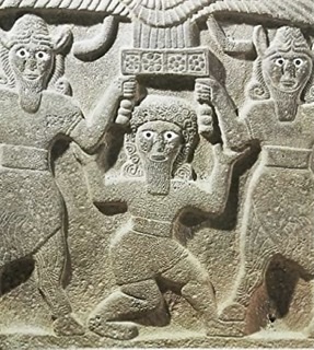